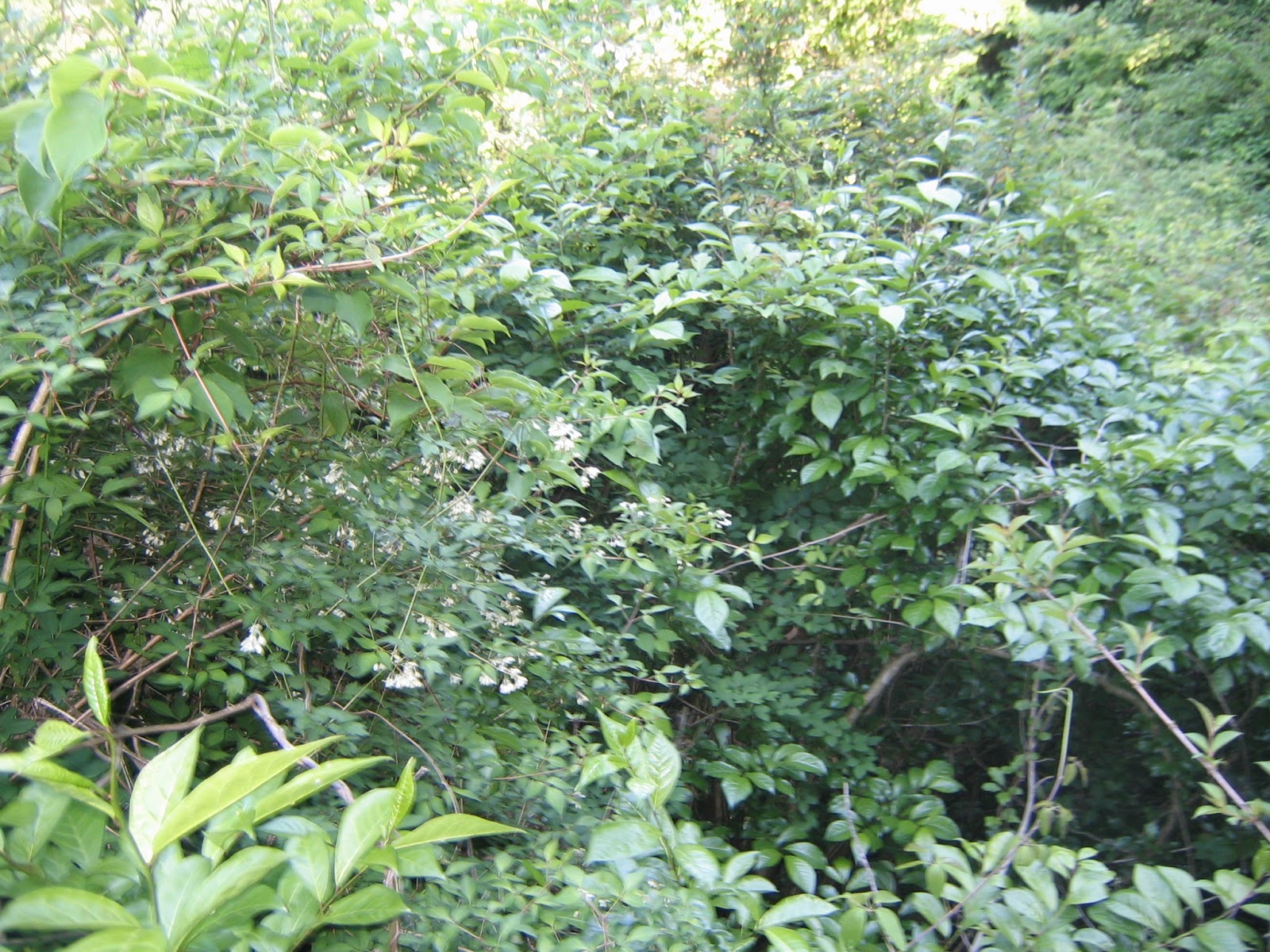
When you come to Odakyu Shin-Matsuda Station 新松田駅 in the morning, you soon notice there are lots of hikers. The place is the major entrance to Western Tanzawa Mountains 西丹沢, and Hakone Mountains. Last week, from Shin-Matsuda Station, we’ve been to one of the destinations in Hakone, the 21st Century Forest of Kanagawa 県立21世紀の森. This week, let’s go to Mt. Yagura 矢倉岳 (870m ASL) next to the 21st Century Forest. The mountain is sitting pretty in a triangular form seen from many places around Shin-Matsuda and JR Yamakita 山北 Stations. We Kanagawa Forest Instructor trainees have observed it every time we had training sessions in the area, and established a sort of affinity … We decided to call it “Omusubi-yama Mountain,” because it looks exactly like an appetizing rice ball neatly wrapped by nori seaweed that is actually an afforested area with coniferous trees over its slope. The mountain is not yet suffered much with deer. We don’t have to worry about land leeches even in summer. The view from the top is spectacular for Mt. Fuji and main peaks of Hakone Mountains, including Owakudani 大涌谷. The steepness to climb is not demanding as in Mt. Oyama 大山. A beginner hiker can spend a fun weekend there. The only thing to worry is, especially near the peak, there are lots of utility trails that can make visitors lose the way. So please bring a good map of Hakone with you. I recommend this one. Probably as Hakone is super-popular for foreign tourists, the latest version has some alphabetical indication for place names, if not in complete. It’s an improvement at least.
 |
| It looks like a rice ball. |
<A weekend hike to Mt. Yagura>
Odakyu Shin-Matsuda Station 新松田駅 =>
Hakone-tozan Bus Jizoh-doh Stop (400m ASL) 地蔵堂バス停 =>
Yamabushi-daira (720m ASL) 山伏平 =>
Mt. Yagura (870m ASL) 矢倉岳 =>
Ashigara Manyo Park entrance (730m ASL) 足柄万葉公園 =>
Jizoh-doh Stop 地蔵堂バス停 =>
Setting-Sun Waterfall (500m ASL) 夕日の滝 =>
Jizoh-doh Stop 地蔵堂バス停
An access from Tokyo to Mt. Yagura is almost the same as our last week’s visit to the 21st Century Forest. First you go to Odakyu Shin-Matsuda Station 小田急新松田駅, and take a commuter bus service to Sekimoto関本by Hakone-tozen Bus 箱根登山バスfrom #1 stop of Shin-Matsuda Station (time table, here). Sekimoto Bus Terminal locates literally next to Daiyuzan Station 大雄山駅 of Izu-Hakone Line 伊豆箱根鉄道. Change the service at Sekimoto to Jizoh-doh 地蔵堂 (time table, here). Ride a bus to the terminal stop, Jizoh-doh, which is the starting point of our hiking. For weekend mornings, they have direct services from Shin-Matsuda Station to Jizoh-doh. As of June 2017, the bus fare from Shin-Matsuda is more than 100 yen cheaper if you can catch the direct service. Please try, as for the last week. Jizoh-doh is an entrance for hikers to experience pre-Tokugawa era Hakone Routes called Ashigara Ancient Route 足柄古道, and to climb up to the eastern mountains in Hakone, such as Mt. Kintoki 金時山. Near the bus stop, there is a small restaurant, Manyo Udon 万葉うどん, whose specialty are freshly hand-made udon noodles and oden stews. I guarantee their taste at reasonable prices. 😋
 |
| Hakone-tozen Bus #1 stop of Shin-Matsuda Station |
 |
| Jizoh-doh bus terminal stop |
 |
| A
house with a clock seen from the bus top is, with some reason, a public toilet at Jizoh-doh stop. The time was accurate, FYI. It’s also a free parking space. |
 |
| Jizoh-doh
means “Small temple for Kṣitigarbha,” and inevitably the place has this small temple. |
 |
| Manyo Udon restaurant |
From the bus stop, please enter a small road running in front of Jizoh-doh and then Manyo Udon restaurant. We almost immediately meet with a paved road which is Prefectural Road #78, aka Ashigara Ancient Road 足柄古道. It is actually a very popular road for marathon runners, drivers, and bikers who want to run along the northern rim of Hakone Mountains. At the peak is Ashigara Pass (759m ASL) 足柄峠, where once the Barrier Station of Ashigara 足柄ノ関 and Ashigara Castle 足柄城 stood. Before the 17th century when Tokugawa Shogunate 徳川幕府 strategically located Hakone Barrier Station 箱根関所 on the south shore of Lake Ashinoko 芦ノ湖, the main route between Kyoto and Edo (Tokyo) went here. Ashigara Pass is on the border between Kanagawa and Shizuoka Prefecture 静岡県, and from there the Road #78 becomes Shizuoka Prefectural Road #365. The view of Mt. Fuji from #365 is spectacular when you drive. A snag is, Ashigara Pass is a typical tourism destination approachable with polished shoes and pin hells … i.e. a bit difficult place to enjoy meditative strolls. So, today, we don’t go there and keep ourselves within the forest. We simply cross Road #78 from Manyo Udon and walk a tiny bridge over Aino-kawa River 相ノ川 down there. A small trekking road in front of us meets with tea tree fields first, and then enters the forest. Within 5 minutes from the tea trees, there is a T crossing with a sign post. For today’s itinerary, we first go down to the right and coming back to this point from the left.
 |
| Cross
Road 78, and enter a trekking road from here. This gigantic maple tree is a guide. |
 |
| A bridge over Aino-kawa River |
 |
| Tea
tree field. Could you figure out fans situated around the place? A good quality tea grows in mountains where (1) the annual average temperate is 14-16°C, and (2) the annual rainfall is 1300mm+. In higher altitude, spring comes later and summer is not that hot. The first flushes grow slowly and will stock more “umami” before being harvested. The problem is late frosts that can destroy the product. So, farmers locate fans around the field. When there is a frost warning, they circulate the air to prevent moisture from staying one place to freeze. |
 |
| We go down to the right here ... |
 |
| And cross a small stream. |
From the stream after the T crossing, the route is one way up for a while. Later, we realized the road more or less went along the edge of afforested coniferous forest that is the ‘seaweed’ part of Omusubi-Yama Mountain. The forest floor is relatively dark due to tall cedars and cypresses. But we can find lots of Dioscorea japonica (mountain yam, recipes are here) naturally growing here and there. In late May, locals collect wild spring herbs in the forest. i.e., Deer problem is contained. Lots of signposts show the direction to the peak of Mt. Yagura, so climbing up is not much a problem. After one hour of gentle climb, we reach Yamabushi-daira 山伏平 and turn right to the forest of broad leaved trees. The road becomes steeper where within fresh greens from late spring to early summer several kinds of wild Deutzia crenata (Bridal wreath) are showing their neat flowers. We notice beautiful Mt. Fuji is watching us from openings between the tree canopies. Even though we can find some leaves bitten-off by deer, the place has lots of kinds of plants with many insects and small reptiles poking their heads to have a look of humans. After 20 minutes of going up, we arrive at the top of Mt. Yagura.
 |
| The trekking road after the stream |
 |
| Yams! Yams! |
 |
| Polygonatum odoratum! When younger, they are also spring delicacy. |
 |
| There are lots of signposts to the peak along the way. |
 |
| People constructed deer barriers, but guessing from their condition, the problem would not be that serious. |
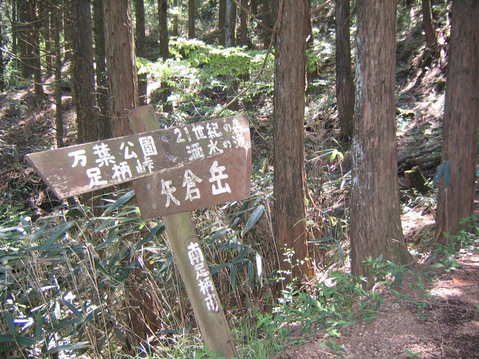 |
| The signpost at Yamabushi-daira. To Mt. Yagura, we turn right here. When we go straight for the continuation of afforested forest, we reach to Hama-kyojohruin 浜居城址 and the Central Open Space of the 21st Century Forest. |
 |
| Let’s go up! |
 |
| Hello, Mt. Fuji. |
 |
| We
decided to call Persicaria filiformis (Antenoron filiforme) “Batman plant.” |
The peak of Mt. Yagura is a comfortable open space. To the northwest in a fine day, we can admire almost the entire figure of Mt. Fuji from the peak to her elegant slope line. Directly to the west is Mt. Hakone (1438m ASL), and in front of us we observe actively smoking Owakudani (1044m ASL) 大涌谷. If you consider walking the length of eastern Hakone Mountains from Mt. Kintoki (1212m ASL) 金時山, Mt. Myojingatake (1169m ASL) 明神ヶ岳, Mt. Myojogatake (924m ASL) 明星ヶ岳, to Hakoneyumoto Town 箱根湯本, it is a good place to strategize your itinerary since the entire plan of yours is spreading in front of you. The atmosphere invites us to have a nap … Some bring kites … Geologically speaking, the eastern Hakone Mountains from Mt. Kintoki to around Shasui-no-taki Fall 洒水の滝 is separated from Mt. Hakone by a fault. The plate tectonics pushed up sedimentary rocks from the ocean bed and made these mountains. Mt. Yagura is basically a mass of pultonic rock protruded about 1 million years ago from the sediment. Since then it has been eroded to have a rice ball shape. “Yagura 矢倉” in Japanese means a watch tower. For whom? Well, we return to the story of Ashigara Barrier Station. The ancient travelers thought this mountain as a divine sentinel standing behind the real sentinels at the checkpoint. Within the open space, there is a small shrine paying a respect to this watchman god.
 |
| The top of the mountain! … Napping time |
 |
| We had a small banquet there. Cheers! |
 |
| A peak on the right is Mt. Kintoki. The left is Mt. Hakone. The whitish depression on the slope of Mt. Hakone is Owakudani. |
 |
| The point where the mountain goes down on the right is Hakoneyumoto. |
 |
| A pequeñito shrine |
 |
| Could you figure out Mt. Fuji above us? |
From the top of Mt. Yagura, when you take a trekking road to the east, you reach to Yagurasawa Community 矢倉沢 where Tokugawa Shogunate located a sub-checkpoint for Hakone Barrier Station, called Yagurasawa Barrier Station 矢倉沢関所. Yagurasawa is on our way of the bus service to Zizoh-doh so that you can start climbing Mt. Yagura from there. Today, we return to Yamabushi-daira from the peak, and take a route to the west to Ashigara Manyo Park 足柄万葉公園. This itinerary is easier. Your first graders could manage if you encourage them right. The tricky part of the plan is choosing the right road at Yamabushi-daira when we descend. We came down from the peak, and noticed the place was a 6-road (at least) junction with crossing points zig-zagiing. The safest bet is, return a bit to the direction we came from Zizoh-doh, and find a signpost saying “Ashigara Pass / Ashigara Manyo Park 足柄峠・足柄万葉公園.” Once you choose the right way, it’s a simple one-way road gently going down. The well-maintained coniferous forest around us is mainly afforested. The floors are not so dark. In less than 45 minutes, we meet with a signpost “Zizoh-doh this way: Manyo Family Course 万葉ファミリーコース.” Here, you have two choices: one is to go up 5 minutes or so to reach to the paved road that is an extension of Road #78. The road is running along a ridge whose peak is 776m ASL. It is Ashigara Manyo Park with a gazebo of a good view to Mt. Kintoki. In early spring the area is full of plum and cherry blossoms. Unless you return to the crossing of the signpost within the forest, the rest of your itinerary for this case is on a well-paved road for about 1 hour together with cars. Another choice is turning left to go down the trekking road which is the “family course” to Zizoh-doh. As its name “family” suggests, it’s not so difficult to walk this course. Although the road itself is sometimes confusing to be identified especially in the afforested coniferous area, fairly well-maintained forest floor allows us to figure out easily the next signposts “To Zizoh-doh” below us. Even when we notice we do not walk on the road, it’s just proceeding to the following signpost and making it sure the proper direction. Eventually, the road becomes obvious and wide enough for two people to stroll chatting. Soon, we return to the point at the edge of tea tree field. For about an hour from the signpost near Manyo Park, we return to the Zizoh-doh Bus Stop.
 |
| In Yamabushi-daira, please find this signpost to Ashigara Manyo Park. |
 |
| The road is like this. The vegetation is diverse, don’t you think? |
 |
| It continues … |
 |
| This caterpillar looks like coming out of the cypress … probably it’s a caterpillar of Coenobiodes granitalis ... Endoclita excrescens? |
 |
| In about half an hour from the peak, we can descend this much. From this direction, the seaweed for the rice ball is pasted along the side. |
 |
| The signpost shows us the direction of “Manyo Family Course.” |
 |
| Descending down in the coniferous forest. |
 |
| It soon becomes the forest of broad leaved trees. This part is afforested with Stewartia monadelpha (Tall Stewartia) which is ubiquitous in Hakone area. |
From Zizoh-doh Bus Stop, for about 15 minutes we walk a community road that is a continuation of a bus route. The scenery is Zizoh-doh community, a pastoral mountain village. This sleepy place has a place in Japanese history. Have you ever seen a doll or manga of an infant chubby Japanese boy? He has a mushroom hair, just like Ringo Starr circa 1965, and wears only a red belly band. His name is Kintaroh 金太郎 that is a baby name of Sakata Kintoki 坂田金時 born in 956 here, Zizoh-doh community. He grew up to be one of the important followers of Minamoto-no Yorimitsu 源頼光 who was the founding father of all the samurai clans. Kintaroh is particularly famous for his achievement to put down bandits who terrified Kyoto in the late 10th century. You see, that’s why the mountain over there is called Mt. Kintoki. And all Japanese kids know this song:
Broadax slung across his shoulder, Kintaro-oh!
He rides a bear just like a charger, practicing his horseback skills
Giddy-up, giddy-up, trot, trot, trot!
Giddy-up, giddy-up, trot, trot, trot!
High above Mount Ashigara, deep in the woods
He challenges each forest creature: practice sumo here with me!
Ready, set, go: fight, fight, fight!
Ready, set, go: fight, fight, fight!
* Translatedby Katsuei Yamagishi. I’m sorry to say for Mr. Yamagishi
… at least the first 2 lines of each section does not go well with the melody …
Hmmmmmmmmm, bears must be here. And, surely, we have seen drying of boar leathers in this community ...
 |
| To the Kintaroh place |
 |
| Kintaroh. Actually, he is the mascot of Kanagawa Prefecture. Cute. |
 |
| More Kintarooooooooh! |
 |
| The scenery around here was like this in May. |
 |
| Their
community garden is adorned with cute biscuit dolls. They look like siblings of Kintaroh. |
 |
| The birthplace of Kintaroh |
 |
| Oh, dear … |
At the end of the paved community road is a camping place called ezBBQ Country. They have a fairly good amenity, and at the end of their place is another hidden gem, Setting-Sun Waterfall 夕日の滝. We can just walk there going through the camping site to sit and watch the waterfall … forgetting any rat race in city. This waterfall is used for entry level trainings of under-waterfall meditation 滝行. It seems to me the program is very popular, and according to this calendar for the summer, many session dates are already full with reservations. (For the first timers, 9000 yen; from the second time, 6000 yen; standard wares for the process inclusive.) They do this even if it snows … I’m strongly tempted to make a reservation …
 |
| The
entrance of ezBBQ. They have bungalows and outdoor stone ovens for pizza. |
 |
| To the waterfall |
 |
| Setting-Sun
Waterfall. They call it as such since seeing from below in mid-winter the sun set at the beginning of the waterfall. Mid-winter is the New Year Day for the ancient lunar calendar in Japan. These days, lots of people are just sitting around the waterfall and watching it calmly year around … |
 |
| When
we see Mt. Yagura from the birth place of Kintaroh, it really looks like a rice ball wrapped by nori-seaweed … |
If you find environmental problems in Mt. Yagura, please make a contact to
Kanagawa Nature Conservation Center 神奈川県自然環境保全センター
657 Nanasawa, Atsugi City, 243-0121 〒243-0121 厚木市七沢657
Phone: 046-248-0323
You can send an enquiry to them by clicking the bottom line of their homepage at http://www.pref.kanagawa.jp/div/1644/
For more general enquiry about tourism in the area, the contact address is
Minamiashigara City, Commerce and Tourism Section 南足柄市商工観光課 商工観光班
Phone: 0465-73-8031 (During weekends, 0465-74-2111)
You can send an enquiry to them from here.


