Friday, October 16, 2015

Tomb Raider: Kajigaya Citizen Forest 鍛冶ヶ谷市民の森


Continuing the theme of ancient towns and shallow topsoil of the forests of Sakae Ward, we have another Forest, Kajigaya Citizen Forest. Kajigaya Forest itself is one of the toddler Citizen Forests that joined the family in April 2014, with 2.9 ha. However, it contains the oldest memory of people in Yokohama. It has more than 20 prehistoric tombs dated at least 1AD. Some say this is the most spectacular remains of prehistoric tombs in Yokohama.

To go to Kajigaya Forest, the easiest route would be from JR Hongodai Station 本郷台駅 of Keihin Tohoku Line. Leave the station, and turn left. There is a very peculiar building next to the Station. It is the Earth Plaza Kanagawa 地球市民かながわプラザ that is a public facility run by Kanagawa Prefecture for fostering international cultural communication among residents of Kanagawa. (It has a substantial library of Asian films, which we can watch, free of charge.) Just get across the campus of the Plaza to reach to the other side. Then, take the road running in front of Kajigaya CatholicChurch カトリック鍛冶ヶ谷教会 with kindergarten. Eventually we meet Kamakura Street 鎌倉街道, aka Prefectural Road #21. Turn left, and soon we find in front several so-called “Love Hotels” (; If you are interested in such facilities, just google with key words “Sakae Ward,” “Yokohama” and “Hotel”… yeah, love and death in Yokohama, really) on the other side of the Kamakura Street. Keep on going to the direction of these hotels, and pass Kajigaya Traffic Light 鍛冶ヶ谷交差点信号. Next to one of these “Hotels” is Gust Steak House. If you come along the left side of Kamakura Street so far, you are now in front of the entrance to Kajigaya Forest. It is about 10 minutes’ walk from the JR station.

Take this way along the Plaza
Kajigaya Catholic Church
A monument in front of the Church
commemorating war dead.
… She’s completely relaxed! 

Around Kajigaya Traffic Lights
Gust Steak House
At the opposite of Gust across Kamakura Street,
which is an entrance to Kajigaya Forest

As this is a quite new Citizen Forest, there is no official web-site for Kazigaya Forest. This is the map I can provide you at this moment. The entrance in front of Gust is at the southern tip of the Forest area. (Update Oct 21, 2015: wow! the City uploaded a new map for the Forest. The link, here.)

Map of Kajjigaya Forest

Entering from this point is like attacking the peak of Mount Yari 槍ヶ岳 or Oku-Hodaka 奥穂高岳 (though just for few minutes, ha ha). It is not a slope, but a precipice with carefully constructed long steps to climb. At the “top” there are a small bench to take a short break and a corridor of wooden decks pasted along the side of the cliff. This is the moment we recall the geological formation of this area … crush of tectonic plates, getting higher and steeper, shallow topsoil … Actually, around and within Kajigaya Forest, there are several notification of the City saying that they are pruning the trees because, unlike Iijima Forest 飯島市民の森, 2014 Typhoon #18 caused a devastating landslide from Kajigaya Forest which destroyed homes. Oh my … Soon we find a narrow trek runs on the surface of the steep slope where large trees are getting pruned here and there. Beyond, several caves are lining on the wall of the rock surface. They are called Miyanomae Cave Tombs 宮ノ前横穴墓群.
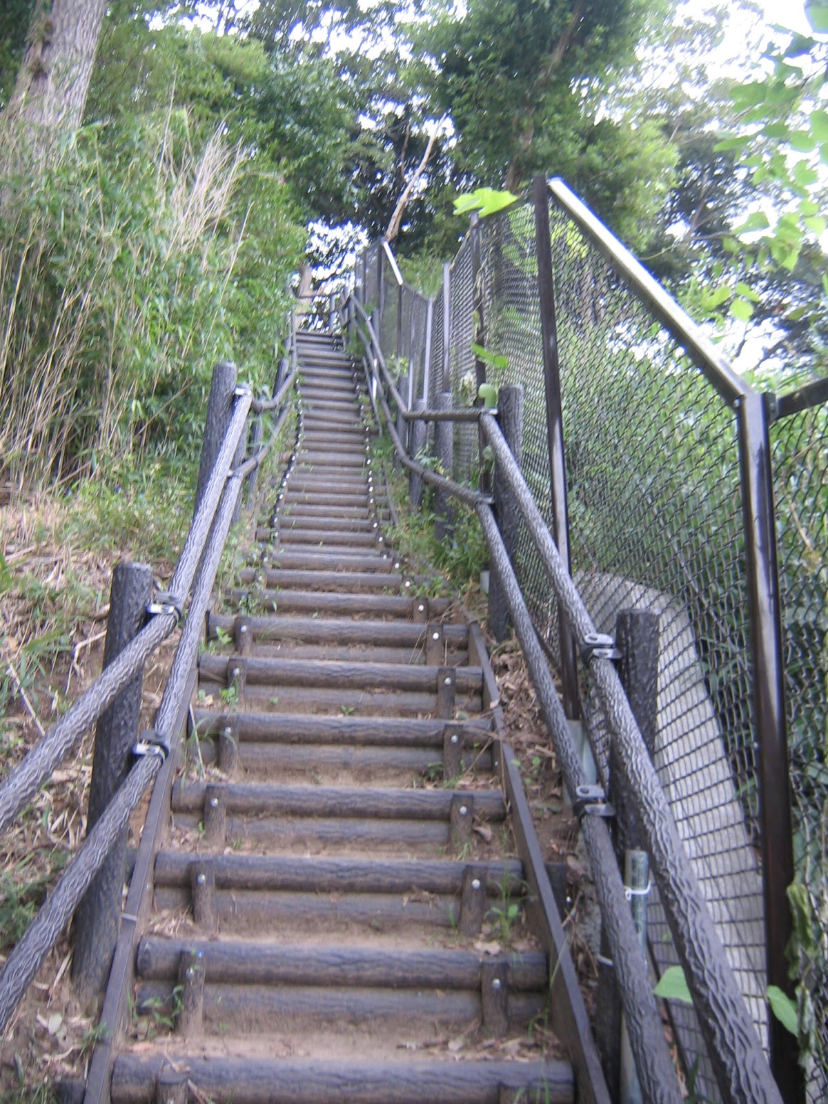
Welcome to Kajigaya Forest!
Take a break a bit here,
and enter the Air Corridor.

According to the Yokohama Buried Cultural Property Investigation Center 横浜市ふるさと歴史財団埋蔵文化財センター, the place is thought to be a graveyard for local powerful families who governed the area before the Emperor family expanded their territory from Nara Prefecture 奈良県 in the 7th Century. Until recently, the area had 5 more recognizable groups of cave tombs 4 of which were lost due to residential developments. Meanwhile the Japanese bubble burst, and the would-be developer of Kajigaya Forest bankrupted. The Forest and Miyanomae Cave Tombs were trusted to the City, and Kajigaya Citizen Forest was born. Miyanomae Tombs were studied at least partially in 1958 and 1959 by girls of Kugenuma Girls’ High School 鵠沼高校 (; the school was for girls only then), but no thorough excavation has been done yet. The blog of Investigation Center reports their preliminary professional sighting in 2010, with photos for the inside of the sarcophagus chambers (link, here). If you are interested in the 1958/59 report by Japanese Lara Crofts, it is now open for the public in the Library of Sakae Ward 栄区図書館.


At the moment, all the open tombs are protected by a wall of wire mesh with small windows for us to have a peek. As no professional study was completed for them, it is possible to find another chambers beneath the topsoil, the blog of the Investigation Center says. Fragile topsoil and substantial hardpan must have provided an ideal condition for prehistoric grave yards. Due to landslides, the trekking road surrounding the Tombs is only partially accessible now, but the road above the caves which is a ridge of the hill is open. The place is a naturalist version of Westminster Cathedral where visitors walk over the head of the dead buried beneath centuries ago …

Beneath my foot aresarcophagus chambers.

The ridge way of Kajigaya Forest goes with very gentle ups-and-downs to the north. The Forest this side ends with the North Open Space (Kita-Hiroba 北ひろば) where we have picnic tables and benches. The right next to the North Entrance of the Forest is new houses and condos. It was a close call to protect the prehistoric remains from the huge wave of development, I guess.


Kita Hiroba

The ridge way to the west is almost continuously going down. Several benches are provided along the road, until we reach to an extremely steep concrete steps falling down into a residential area that is the West Entrance of the Forest. It seems to me, Tombs have been well-known by the locals for generations and it was a talk of the town how the developers would deal with them. The 2000 years of Tombs are somehow preserved against a flash of the real-estate bubble. Anyway, cheers to the teenage Tomb Raiders of 55 years ago!

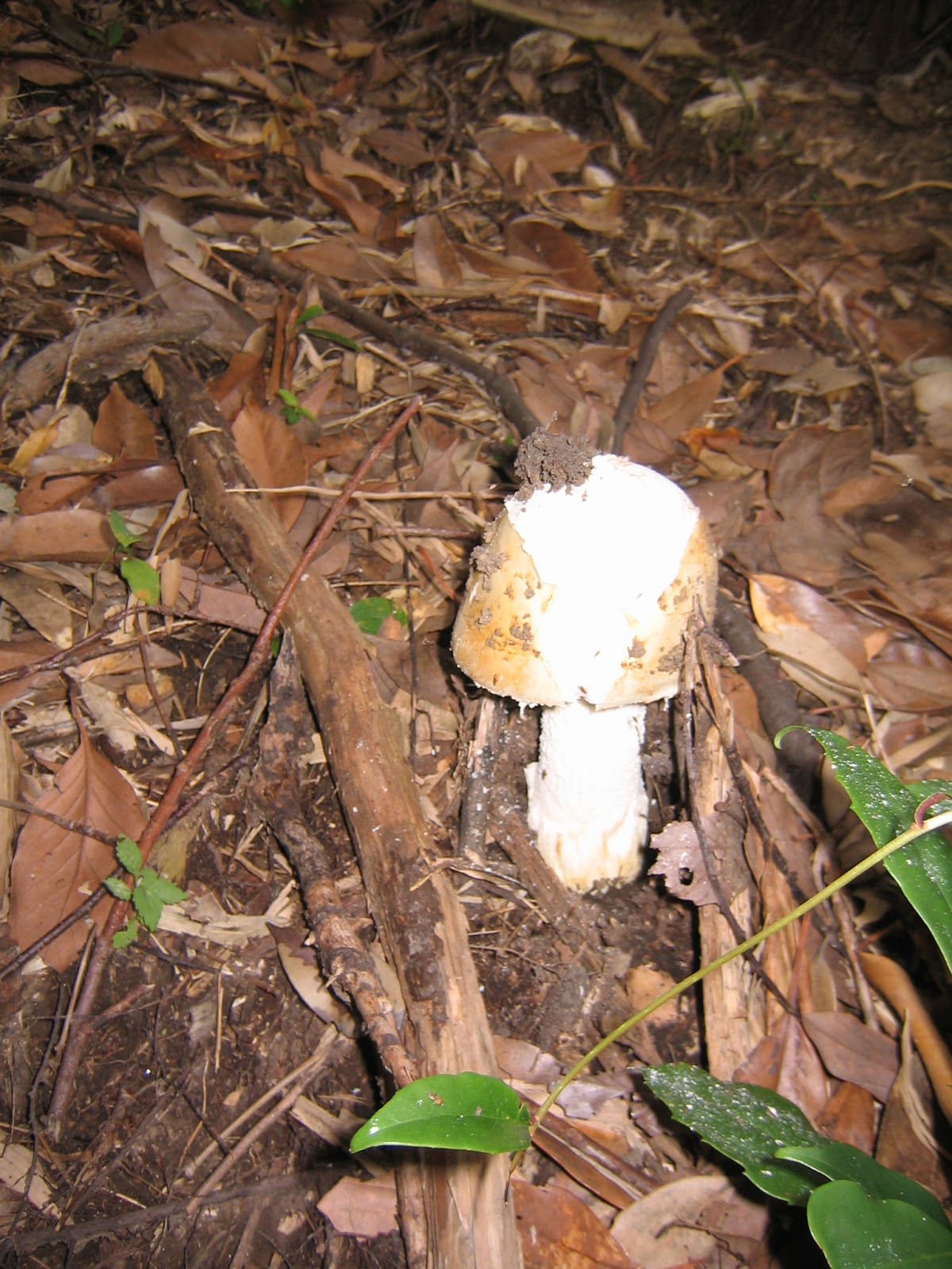


If you find a problem in the Park, please make a contact with

Office for the Park Greeneries in the South 南部公園緑地事務所
Yokohama Municipal Government Creative Environment Policy Bureau 横浜市環境創造局
Phone: 045-831-8484 (I guess in Japanese only)

FAX: 045-831-9389 (I hope there is somebody who can read English …)


Friday, October 9, 2015

Don’t underestimate the Seniors: 飯島市民の森


Very roughly speaking, the current city of Yokohama is made of 3 geographical areas. One is Tama Hills 多摩丘陵 with Gike Forest 寺家ふるさとの森 in the middle. Another is Sagamihara Plain 相模原台地 where Seya Forest 瀬谷市民の森 locates. Both of two areas are on Eurasian plate, so the structures deep down of these areas are similar somewhat. The third one is a part of Miura Peninsula 三浦半島. Miura Peninsula and Bosoh Peninsula 房総半島 (i.e. Chiba Prefecture) are pushed up from the bottom of the ocean by gigantic crushes of North American / Okhotsk Plate and Pacific Ocean Plate, and annexed to the edge of Eurasian Plate like Indian subcontinent pressed into Himalayas. Consequently, both of these peninsulas are currently getting taller and steeper. As such, the environment of Miura Peninsula area is a bit different from both Tama Hills and Sagamihara Plain.

Citizen Forests in Sakae 栄区 and Kanazawa Wards 金沢区 are located in this particular area. For the case of Citizen Forests in Sakae Ward, they are very precipitous hills where about 50 cm of topsoil covers a hardpan. Trees cannot establish their root deeper than the shallow topsoil. When humans neglected forests, the trees could grow too large to stand safely in a shallow soil of sheer hills. Moreover, the topsoil covered by large trees could not have vegetation beneath, and be compacted (like roads in Shishigaya Forest 獅子ヶ谷市民の森), i.e. not retain water.     

Last year in 2014, when Typhoon #18 (aka Typhoon Vonghong) hit Yokohama, there occurred many landslides in the city. Compacted grounds of hilly forests could not hold water as before. For the case of Sakae Ward, very large trees grew on the very very steep hills of shallow ground collapsed with washed-over top-soil with the typhoon. Luckily, honestly, no one was hurt in Sakae Ward, but some homes were damaged due to their proximity to the cliff.

“Under construction: please watch out above your head.”

IijimaCitizen Forest 飯島市民の森 in the west of Sakae Ward is the oldest Citizen Forest of Yokohama, with 5.7 ha and 1.7k trekking road opened in April 1972. (Map here.) As it is a Citizen Forest, it has escaped the calamity of neglect. The undergrowth of the Forest has been kept that helped retain the soil even with the record-breaking torrential rain. Still, its very steep treks and large trees gave us a sort of apprehension. It is a well-groomed Oldest Gentleman, but could be more menacing than the Hollywood-wild Miho Forest 三保市民の森. Hence, currently City of Yokohama is intensively pruning the Forest in order to prevent the landslides.


The access to Iijima Forest is either from JR Totsuka Station 戸塚駅 of Tokaido/Yokosuka Line, or from JR Hongodai Station 本郷台駅 of Keihin-Tohoku Line. From Totsuka Station, take the bus from #3 stop of Enoden Bus 江ノ電バス (timetable, here) to either Iijima Kami-cho Stop 飯島上町 or Shimin-no-Mori Stop 市民の森. From both stops, find a way to Iijima Seseragi-Ryokudoh Promenade 飯島せせらぎ緑道 that runs around Iijima Forest. The promenade has several entrances to the Forest. It takes less than 5 minutes of walk from the bus stops to the entrances. From Hongodai Station, the Forest is in the distance of 15 minutes’ walk. Leave the station, and turn right to the direction of Hongodai-Ekimae Post Office 本郷台駅前郵便局. Reach to the crossing at Hongodai-Eki-Iriguchi Traffic Light 本郷台駅入口交差点信号. Turn right again, and climb up Suzukake-Dori Street すずかけ通り passing in front of the City Water Recycling Center 栄第一水再生センター  and Hongodai Central Park 本郷台中央公園. Suzukake-Dori Street runs  through a quiet residential area. When you find a gas station of ENEOS over there, the bus stop just before the gas station is Shimin-no-Mori (= Citizen Forest) Stop. It is a testament for Iijima Forest as the granddaddy of the Yokohama Citizen Forest. The bus stop does not have the name “Iijima.” Phew.

Hongohdai Station
Hongodai-Eki-Iriguchi Traffic Light
Shimin-no-Mori Bus Stop
Entrance to Iijima Seseragi-Ryokudoh Promenade.
We can find it beyond the Gas Station on the left.

Iijima Seseragi-Ryokudoh Promenade surrounds Iijima Forest, and it is a really well-kept pedestrian (and occasional bikers’) road. Access to inside of the Forest is numerous, and often with tiny “bridges” of stepping stones in a small stream along the Promenade. The Forest is a steep hill climbing up from the flow. When we walk along the Promenade, we can know the work is in progress for pruning of the Forest. Even though, in the Forest the undergrowth is rich and roads are not compacted so that we know this old man is well-respected.

One of the entrances to the Forest
Ditto
Ditto
Under construction
Fujimaki Open Space ふじまき広場 of the Forest, next to the Promenade

The Forest gives us a very “deep” atmosphere with steep roads. It has 5 resting points for picnic and one toilet all of which are in the abundant rain forest. At the end of summer and early autumn, many kinds of mushrooms are sprouting here and there … It is the world of Brothers Grimm. 

“Hansel and Gretel” Road


At the top of the hill, there is an open space, called Sakuragaoka Open Space さくらがおか広場, with picnic benches and huge cherry trees. The place also has a tiny ancient-looking shrine. I guess this Forest has been loved for generations, and for cherry-blossom parties. Actually, Miura Peninsula area of Yokohama is next to the ancient Kamakura City. Before World War II, it was not a part of the City of Yokohama, but belonged to Kamakura. People lived here for a very long period … Iijima Forest is an old guy.

Sakuragaoka Open Space
Shrine

If you find a problem in the Park, please make a contact with

Office for the Park Greeneries in the South 南部公園緑地事務所
Yokohama Municipal Government Creative Environment Policy Bureau 横浜市環境創造局
Phone: 045-831-8484 (I guess in Japanese only)

FAX: 045-831-9389 (I hope there is somebody who can read English …)


Friday, October 2, 2015

Welcome, a City Baby Forest: Kashiwa-cho Citizen Forest 柏町市民の森


On September 1, 2015, one baby joined the Yokohama Citizen Forest Family. It is Kashiwa-cho Citizen Forest of 1.9 ha. The physical preparation was started late November 2014 for this forest to be a part of the Family … hmmmm it means the time of the groundwork is almost like a human baby to born. (ha, ha) To go to this Forest, we just simply get off the train at Minami-makigahara Station 南万騎が原駅 of Sotetsu Izumino Line. East side of the station is ordinary residential area where the numerous detached houses spread all over the hill. West side is Kashiwa-cho Forest. From the Station to the entrance of the Forest, it takes about 3 minutes. Easy.

Minami-makigahara Station
Turn left at the Station exit,
to find Minami-Makigahara Ekimae
南万騎が原駅前traffic light.
The entrance to the Forest is just over there.

The location of this Forest would be one reason why this place joined the Citizen Forest Family. Local newspapers reported that a dark forest surrounded by residential area without maintenance caused concern among locals. It could have been a damping ground of garbage, or worse, a crime scene. So residents’ associations around the Minami-makigahara Station were talking with the landlord and the City for solution, i.e. the conception of the baby Kashiwa-cho Forest. The volunteers to take care of the Forest come directly from the neighborhood associations. This Forest is a product of very urban concern of suburbanites.

The map of Kashiwa-cho Forest
(No web site or downloadable map
is available at the moment.)
The main gate

Kashiwa-cho Forest is just like Imajuku Forest, a ship floating in the middle of ocean of detached houses (and JR Tokaido Shinkansen Line in the north). Now the Forest has been treated by thinning, the bogs are controlled, the sturdy wire mesh surrounds the conservation area, and the cleaned up trekking road is covered by new wooden chips. The view over the forest becomes less obstructed, which would be good for the safety of the residents ...


A pond next to the Forest

A thinned forest

The Forest consists of two kinds of trees; one is the forest of planted coniferous trees (2/3), and another is a forest of broad-leaf trees (1/3). The accessible area of the Forest is 1/3 of 1.9 ha. It takes less than 10 minutes to conquer all the routes. Baby, baby … In the middle is an open space with a picnic bench and chairs where we can see a clear contrast between two kinds of forest. The route to the open space is barrier-free, i.e. accessible for the wheelchairs. The place will be a calm relaxing spot for locals, with lunch perhaps.

From the Gate to the open space

At the entrance, there are sign boards explaining the origin of the town’s and the Forest’s name: Kashiwa = oak. It says before the area was called the valley of oak leaves. So, the Forest would have been covered by large oak trees. The remnant of the valley is treated and dry now, covered by arrow root (aka kudzu). Granted kudzu is ferociously invasive plant that requires careful control in urban setting … do you know it has elegant flower with sweet scent? When it is allowed to flourish freely, the area could be filled with graceful smells ... One of the boards presents chronological satellite images of Yokohama. It shows relentless advancement of urbanization. It seems to me, in 1970 the 2/3 of the City was covered by greenery. In 2009, it is ¼ at most ... 


A remnant of valley at the gate


If you find a problem in the Park, please make a contact with

Office for the Park Greeneries in the North 北部公園緑地事務所
Yokohama Municipal Government Creative Environment Policy Bureau 横浜市環境創造局
Phone: 045-311-2016 (I guess in Japanese only)

FAX: 045-316-8420 (I hope there is somebody who can read English …)