Friday, March 30, 2018

Visiting the Republic of Tibet in Kanagawa Prefecture: hiking in Mt. Oonoyama 大野山

Deer!


So, on that morning, we met at Yaga Station 谷峨駅 of JR Tokai Gotemba Line 御殿場線. First, we go down a bit from the station, and turn right to cross a pedestrian overpass across National Route 246. In front of us, we can observe busy Tsuburano Tunnels 都夫良野トンネル for Tomei Express Way 東名高速. To the north of #246, there is an expansion of rice paddies that were dry during winter. Across the paddies, one paved way is going to a suspension bridge leading to the foot of the hills. Cross that, and turn left. Follow this commuter road for about 300m to turn right at the first corner. The paved way is serving the community on the foot of Mt. Oonoyama 大野山. We can either take this road to reach to the point of Yoritomo Cherry Tree 頼朝桜, or another trekking route for a shortcut to the tree. Needless to say, we take hikers’ course that was a quiet mountain road without much snow yet. For about one hour we went up slowly to the Cherry Tree point. 


Coming from Yaga Station, turn right here.
The long red bridge over there is Tomei Express Way.
The flyover comes down here.
We turn left to take the road beyond that pillar on the left.
It leads us to these steps to …
the paved straight road.
I guess from spring to fall, both sides are full of rice.
In the middle of the straight way,
there is this sign to Mt. Oonoyama.
Eventually,
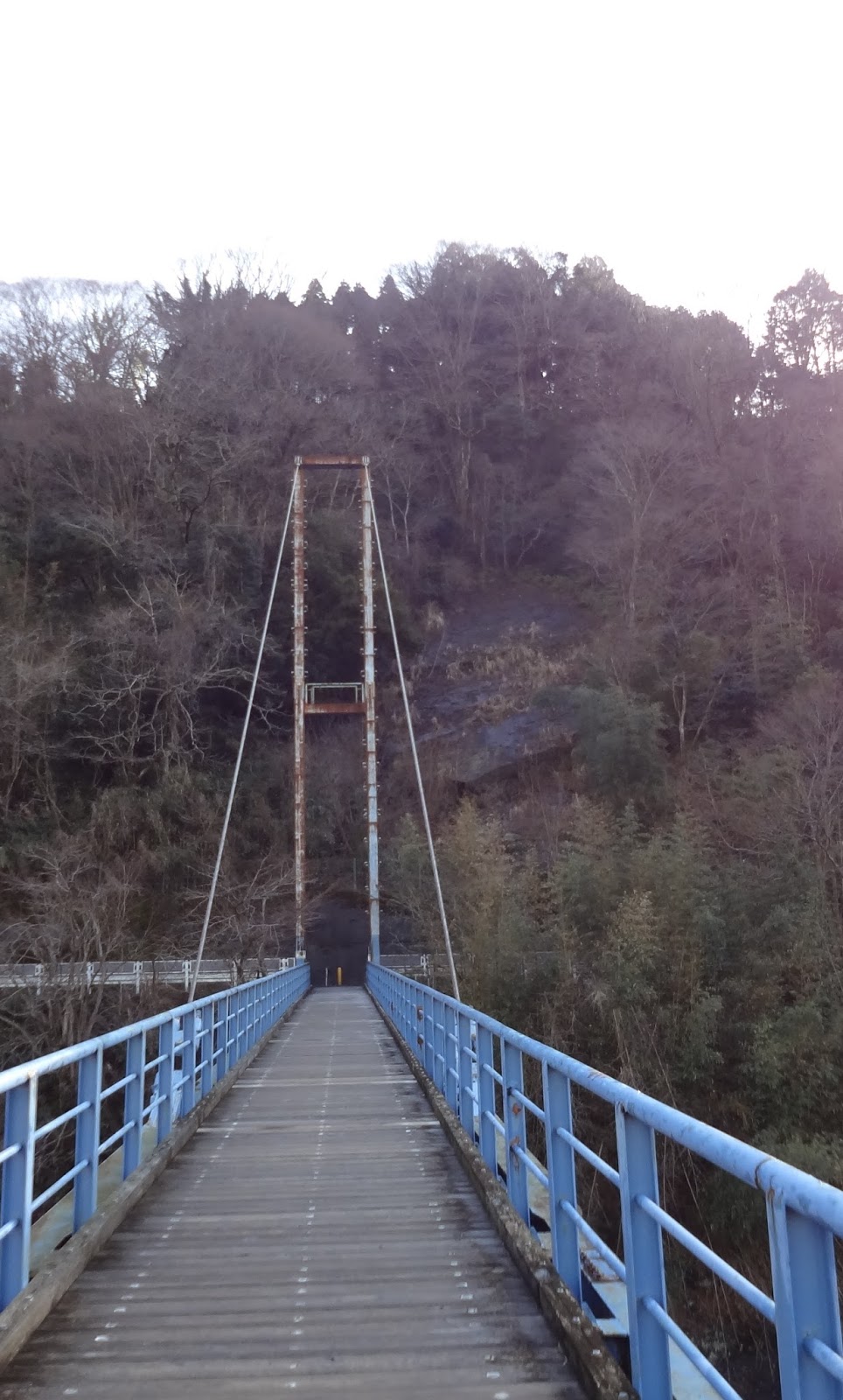
we meet with the suspension bridge.
Let’s cross it, and turn left over there.
The bridge is over Kawachi River 河内川 from Lake Tanzawa 丹沢湖.
The water reaches to Sakawa River
酒匂川,
and then to Yokohama …
The road from the bridge is a paved community road.
Proceed ahead … and …
we go to the right at this point with ...
This sign post saying “Turn right here to Mt. Oonoyama.”
The route gains the altitude rapidly from here.
It is a community road for residents and cars are running here.
Please be cautious.
By the way, that red girder over our head is Tomei Express Way.
Then, on our left, there is this narrow road
which is a short-cut to Yoritomo Cherry Tree.
Don’t miss
it!
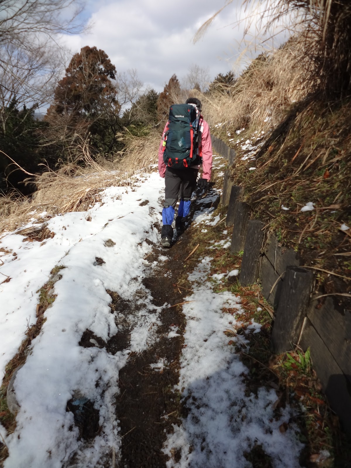
Yesterday’s snow …
As the ground was not trodden down,
the path was not much frozen. We were lucky.
Though, the road soon became like this.
As it was a fine day at the foothill of the mountain,
the snow piled up on the tree canopy melted
and showered down over our head.
That was a thrilling experience!
The final approach to Yoritomo Cherry Tree is steps
that can be slippery when it’s frozen. Careful!
The top of the steps is a junction
with the paved road for cars we separated below.
Yoritomo Cherry Tree.
The place also has a tourist map around Mt. Oonoyama.


Legend says when young Minamoto-no Yoritomo 源頼朝, the founder of Kamakura Shogunate Government 鎌倉幕府, came here to escape from the assassins, he took a rest and left his walking pole made of cherry tree. It’s believed the pole stroke roots into the soil, and in hundreds years’ time became a large tree. The “original” tree was hit by a thunder about 200 years ago, and the current one is from a tiller of the root. I guess now (at the end of March), the tree is blossoming profusely. When we went there, it was surrounded by fresh snow ... (which means it had a perfect preparation to flower coming spring). The trekking road became the real snow road. From Yoritomo Cherry Tree, we can observe the very gentle peak of Mt. Oonoyama. Let’s proceed with the paved road to the direction of the summit a bit. On your right, we can find a log cabin which is public toilets. From this toilet point, a road on the right is diverting from the paved way. It is another shortcut to the top of Mt. Oonoyama. Enter there, and the route slowly gains altitude within the forest. At that time, the sky was transparent blue with warm sun shine, and small snow bombs were coming down over our head. Snow on the canopy was melting. It seemed us not many took this route before us after the snow fall. The soft white pile was not deep thanks to the tree canopy. It was a relaxing walk. For about 15 minutes or so, we meet once again with the paved car road we departed at the toilet. This time there is a small gazebo where we can take a rest.


The toilet and an entrance to the trekking road.
Road with fresh snow.
I warn you, if it was not that fresh,
the place definitely demands crampons.
The crossing with a gazebo where …
the local landlord of Minami-ashigara City 南足柄市,
 Mr. Yamazaki (whom we forest instructors know),
opens a small unmanned shop to sell the produce from his farm.
They are actually delicious.
Please pay honestly if you purchase something here,
and help us to maintain our tradition of unmanned shop.


From here for about 30 minutes, the route is the steepest in today’s itinerary. After the gazebo, the route enters an area surrounded by protective mesh against deer. Inside is of still young afforested trees. As we proceed, the view from the slope becomes more and more spectacular. During our expedition, the clouds started to cover the sky at this point, and to the west we could only figure out relatively flat expansion beyond Tanzawa mountains. That was a foothill of Mt. Fuji. If the weather is fine, you must be able to admire the entire beauty of the highest peak of Japan, with sparkling Lake Yamanakako … Caution. As the view is wide-open, you might be tempted to deviate from the defined trekking road. Please, DON’T. (1) treading the non-road kills off the small ecosystem below your footsteps. The area is recovering from the munching of overpopulated deer, and thus ecologically unstable. Please help us to restore the fragile environment. (2) OK you deviate from the road in Tanzawa, and soon you could fall off from a steep cliff even if you are in gentle-looking Oonoyama, especially when the ground is covered with snow. Please be sensible, and save your life. About at ASL 700m, the hiking road becomes flat which means we have almost reached to the wide expanse over the top of Mt. Oonoyama. The route is now demarcated by well-constructed barriers which are separating trekking road from the ranch. About 10 minutes stroll along the flat, but freshly snow-covered way, we arrived at the peak of Mt. Oonoyama, ASL 722.8m. To the south, we can observe cities of Shonan Beach 湘南海岸, and Sagami Bay 相模湾. To the east, we could meet with the highest peaks of Tanzawa mountains 丹沢, including Mt. Hinokiboramaru 檜洞丸 (ASL 1601m) and Mt. Hirugatake 蛭ヶ岳 (ASL 1672m). To the west is Mt. Fuji. The place is one of the 100 best viewing spots for Mt. Fuji in Kanto Region 関東地方.


Entering in the protected area.
In Tanzawa, there are lots of such protected areas
secluded by wire meshes against deer.
When we enter,
the last person must close the gate for sure
to make facility the most effective.
Please help protect our delicate ecosystem.
It’s newly afforested area.
If weather had been fine, over there should have been Mt. Fuji …
There were lots of footsteps of animals on fresh snow.
I think they are of a fox.
In the middle of the route, there is a point saying
“The altitude here (ASL 634m) is
the same as at the top of the Tokyo Sky Tree.”
Hmmmmmmmmmm,
that’s very easy description to “feel the altitude.”
When you are surrounded by grass fields,
it’s a sign your climbing to Mt. Oonoyama is almost over.
The route becomes along the well-maintained barrier for the ranch.
This is to the direction of Hakone 箱根 from the ranch.

The top of Mt. Oonoyama!
From the top of Mt. Oonoyama.
Down there, we can find Lake Tanzawa.
Beyond that is supposed to be Mt. Fuji.
Ditto for Mt. Hirugatake …


The peak of Oonoyama has 2 toilets. When we proceed further to the east from the top of the mountain, the second toilet is in front of the parking lots, which are at a crossing of 4 roads. One road is where we come from, the second is obviously for cars, the third on the left is supposed to going down to Lake Tanzawa that is now closed due to landslides. The forth running to the same direction from where we came is the hiking route. First, it descends rapidly with long steps. Later at the foot of the mountain, we talked we may have used crampons there … at that time we didn’t, thanks to the fresh snow. We were simply lucky. Please be conservative for your safety and wear your gear if you come down from Oonoyama covered with snow. The steps go into the forest of afforested coniferous trees first, and then of broad leaved trees probably used for charcoal making before. In less than 1 hour of going down, there is a small sign showing on the right there is a small temple of Kṣitigarbha 地蔵岩. We did a bit of diversion (of less than 20m), and found a hut protecting a stone image of Kṣitigarbha. I learned it was a place to pray for miscarried babies … in such a deep mountain. I imagined mothers who came this far to cry. The mountain can swallow human torments and stand still for millions of years …


The beige structure on the left is the toilet
we first encounter at the top of the mountain.
To the left in this photo is the second toilet.
The crossing has lots of board explaining the route.
Let’s check them.
This way!
The long steps. Thank god, no one was hurt …
We proceeded along the snow-covered road in the coniferous forest.
When we entered in the forest of broad leaved trees,
the snow was almost gone.
The mini-temple of Kṣitigarbha


Walking further down from a mini-temple, we meet with a small paved community road, which means we have completed our hike in Mt. Oonoyama and arrived at Kyowa community 共和地区 of Yamakita Town 山北町. Kyowa in Japanese means “Republican.” Wow. Among locals, the place is called as “Tibet of Kanagawa,” but I think there are lots of other places that may deserve more the designation, like the area around Lake Tanzawa or Doshi River 道志川. With the name “Republican” and the academic past of Yamakita, it might be interesting to do a research about the local history of the area. Anyway, this is the community the young ranchers I mentioned last week moved in 2 years ago to revive the ranch at the top of the mountain. Further down, there is Kyowa Elementary School 共和小学校 which ended its 137 years of history in 2011. Now the place is HDQ of NPO Kyowa Forest 共和のもり. They engage in the revitalization of mountainous community. The NPO organizes tourism events, like kimchee making from local Chinese cabbages every December. If you are interested in what’s going on in Kyowa community, you can check it here.


Coming down from the mini-temple,
the final stretch is these steps which lead us to 
the community road.
As it is a community road,
it’s better to follow the direction indicating to Yamakita Station.
Otherwise, you could go around the village in circles.
Kyowa community has a unique festival called Omineiri 山北のお峰入り held once in every 5 years.
The ritual has the designation of
National Important Intangible Folk Cultural Propert 
国指定重要無形民俗文化財.
It is said that its origin was in the 14th century
and the village presided it for every 10 to 20 years before.
The current format was taken from the 1960s.
The most recent event was held in October last year.
(Huh, so we have to wait another 5 years!)
The festival has a heavy involvement of Yamabushi priests
山伏 who sing and dance several formalized program
together with the villagers for a whole day of the festival.
This is a warehouse near Kyowa Elementary to keep the tools for the festival.
Kyowa Elementary.
During summer, they open café here.
Kyowa community
At the mouth of Kyowa community,
there is a terminal bus stop named Oonoyama Tozan-guchi
 
大野山登山口 (“the entrance to Mt. Oonoyamaa hiking route”).
The service is only for weekends of spring and autumn
to Odakyu Shin-Matsuda Station
小田急新松田駅.
In any case, it’s just 30 minutes’ walk
from here to Yamakita Station.
Before arriving at the crossing with Route #246,
there is this Koshinto statue
庚申塔 dated for the 18th century.
This is an old community road.
Down there is Route 246.
To Yamakita Station, go to the left.


From Kyowa area it’s about half an hour walk within Yamakita Town to JR Yamakita Station 山北駅. Our last itinerary was Sakurano-yu Spa さくらの湯 that is in the 3rd floor of a pink building next to the Yamakita Station. This spa is popular among trail-runners for their weekend training between Yamakita Station and Ashigara Pass 足柄峠 in the Manyo Park 万葉公園 (; we visited there last year, remember?). The spa has nice Jacuzzis which strategically position jet-points for massaging muscles used for running, and hiking. J The place also has open-air spa area. The facility is run by Yamakita Town, and the price is fairly reasonable. I do recommend you to have a try. After drinking in freezing snow field, your body will surely be melted in Jacuzzi …


The entrance to Sakurano-yu Spa


If you find environmental problems in Mt. Oonoyama, please make a contact to

Kanagawa Nature Conservation Center 神奈川県自然環境保全センター
657 Nanasawa, Atsugi City, 243-0121 〒243-0121 厚木市七沢657
Phone: 046-248-0323 

You can send an enquiry to them by clicking the bottom line of their homepage at http://www.pref.kanagawa.jp/div/1644/

For more general enquiry about tourism in the area, the contact address is
Office of Policy Planning, Yamakita Town 山北町役場企画政策課 企画班
Phone: 0465-75-1122, FAX: 0465-75-3660

You can send an enquiry to them from here.


Friday, March 23, 2018

Snow Mountain 101: going to Mt. Oonoyama covered with snow 大野山


I don’t recommend wading in snow-capped Tanzawa area 丹沢 for those who don’t know the place. But, this winter, we happened to climb up Mt. Oonoyama (ASL 722.8m) 大野山 a day after heavy snow. It was gorgeous. So, in this post and the next, I tell you my adventure on that day. Come to think of it, if you try your first snow in Tanzawa, going up Oonoyama with virgin snow may be one of the safest bets. Actually, we can drive up very near to the peak, even with snow. When we had lunch there, we’ve met several kids who came to play in the snow with their daddies by car. Of course, tires for snow and ice are MUST for your family drive.


Mt. Oonoyama in March.
No snow already. You see? It’s a very gentle mountain.

When we look around from the shore of Lake Tanzawa 丹沢湖, to the south we can see a mountain of a flat summit with lots of towers which is Mt. Oonoyama. Until a couple of years ago, the top of Mt. Oonoyama was a ranch of Kanagawa Prefecture where prefectural researchers bred cattle for local milk industry. The place was closed in March 2016 and an exhibition cottage and public toilets in front of the parking lots went under the management of Kadoya Beef Co. 門屋. Then, in the late 2016, 27 years old girl, Kaoru Shimazaki 島崎薫 who studied organic cattle breeding in Iwate Prefecture 岩手県 moved in Yamakita Town 山北町 at the foothill of Mt. Oonoyama. She started to work for reviving the ranch, which invited to Yamakita several 20-and 30-somethings who sympathized with her. They are a kind of vanguard of Japanese rural revival these days. If you go there in a fine day (without snow, I mean), you might meet with them. Also, on one Sunday of every autumn, the Japan Mountain Guides Association 公益社団法人日本山岳ガイド協会 and the National Mountaineering Research Institute 国立登山研究所 hold Mt. Oonoyama Outdoor Festival which is secretly famous for grand bargain sale of gears of Patagonia, Montbell, Mammut, Mizuno, etc. etc. On that day many veterans climb Mt. Oonoyama with an empty rucksack and descend with their large shopping. It’s not yet announced the date for 2018 event, but you can check it from here. It’s really worthwhile to reserve your weekend for that. All in all, Mt. Oonoyama provides one of the best itineraries for novices to mountaineering in Japan. Spring is with fresh greens, summer with lots of flowers, gorgeous autumn leaves, and snow. Weather permitting, to the west from the top we will admire the entire shape of Mt. Fuji with Lake Yamanaka 山中湖. The place is one of the 100best viewing spots for Mt. Fuji from Kanto Region.


Mt. Oonoyama, seen from Lake Tanzawa

Having said that, needless to say, you have to prepare WELL for snow-covered Mt. Oonoyama. Crampons are the MUST. Also, bring light-weight blanket or the like. Snow in Tanzawa is often wet and heavy. Moreover, normally before dark temperature does not drop below zero when ASL is less than 1000m. So, there is no dry place to sit down in the mountain. Blanket is handy for this situation. Strategically layering your gear is also required. For the day we visited this winter, snow did not appear before ASL 300m. At the foot of the mountain, it was a walk of snowless country side, while the temperature dropped continuously to around 2°C at the peak. When we gain the altitude, it was a nice exercise of sweating, and then, the air rapidly turned damned cold as we proceeded. At the peak, we had a hot lunch of pork & vegetable miso soup + hard liquors. That was a bingo for our freezing body. Roads in Mt. Oonoyama are well-maintained, but be very careful. Do not deviate from the defined paths. You can easily be frozen to death by hypothermia if you lose your way in Tanzawa’s snow.


Cooking our lunch
in the pergola at the top of Mt. Oonoyama.
We, before climbing.
FYI, in addition to this, all of us wore warm head-gears.


This time, our route to Mt. Oonoyama followed the most standard itinerary.

<Visiting snow-covered Mt. Oonoyama (ASLs are approximate.)>

è Mountain Cherry Tree of Yoritomo 頼朝桜 (; there are toilets at this point. ASL 340m)
è Top of Mt. Oonoyama (ASL 723m)
è Jizo-Iwa 地蔵岩 (Rock of Kṣitigarbha, ASL 420m)
è Kyowa Elementary School (closed) 共和小学校(廃校)
è Sakurano-yu Spa さくらの湯 at JR Yamakita Station 山北駅 (ASL 110m)

Total time: 6 hours including 1.5 hour lunch at the top.


Caution: all the JR stations are of Gotemba Line of JR Tokai (JR東海御殿場線), and hence no PASMO is accepted. We have to buy a good-old train ticket and pass a manned ticket gate in their stations. Yaga Station is unstaffed and a conductor of the train checks and collects your ticket. The service of Gotemba Line here is limited (one service per half an hour at peak time) so that you’d better check the timetable of the train first and modify your plan accordingly. We could have only 1 hour at Sakurano-yu Spa to catch 17:34 train returning to the downtown. (er, too much drinking over there …)


Yaga Station.
This station “cottage” was built
by local volunteers in 2000.
Yamakita Station
Yamakita Station has the D52 locomotive that was resurrected for operation 3 years ago. Until the opening of Tan’na Tunnel 丹那トンネル in 1939, the place was a station of the most important artery train service of Japan, Tokaido Line. From here to Numazu Station 沼津駅, the locomotive had to climb steep mountains, which was uber-difficult during the 19th to the early 20th centuries. Yamakita town was the most fashionable place for the best and brightest Japanese mechanical engineers who made such difficult travel possible. In the 21st century, the service between Kohzu 国府津駅 to Numazu via Yamakita is a local Gotemba Line, and people do not think even Tokaido Line the artery. The title is for Shinkansen Bullet Train 東海道新幹線 … All glories must fade, but memories can remain just like D52. The machine welcomes tourists every October 14th. The super-popular ticket to ride is extremely difficult to have. You’d better ask Yamakita Tourism Association well in-advance. You can send them an enquiry from here.

Next week I tell you my adventure to Mt. Oonoyama. 😄 It’s unbelievable the snow was less than 2 months ago. Now, we are ready for cherry blossoms’ party …


At the top of Mt. Oonoyama.
Why is the half of this photo smoky?
That’s because I got drunk and dropped myself in snow with camera.
The “smoke” is snow covering the lens. Cheers!


If you find environmental problems in Mt. Oonoyama, please make a contact to

Kanagawa Nature Conservation Center 神奈川県自然環境保全センター
657 Nanasawa, Atsugi City, 243-0121 〒243-0121 厚木市七沢657
Phone: 046-248-0323

You can send an enquiry to them by clicking the bottom line of their homepage at http://www.pref.kanagawa.jp/div/1644/

For more general enquiry about tourism in the area, the contact address is
Office of Policy Planning, Yamakita Town 山北町役場企画政策課 企画班
Phone: 0465-75-1122, FAX: 0465-75-3660

You can send an enquiry to them from here.


Friday, March 16, 2018

Secret Garden: Ikebe Citizen Forest 池辺市民の森


The City of Yokohama opens one Citizen Forest per year recent days. In 2017, it was a turn of Ikebe Citizen Forest池辺市民の森 in the north of Yokohama. It locates near the Tsukidematsu Park 月出松公園 which is in front of the Yokohama office of Kyocera Co. Or, the Forest is in the north of a shopping Center, Lalaport Yokohama. It would be a kind of surrealistic experience if you go Ikebe Citizen Forest and Lalaport in one day. The shopping center is a completely artificial space for consumerism. Ikebe Forest is a remnant of old agricultural community in Yokohama. The combination is VERY 21st century Japan.


The slope near the entrance to Ikebe Forest.
The landscaping looks very new.


Unless you are ready to navigate through a mini-maze of detached houses around Tsukidematsu Park, the easiest way to go Ikebe Forest is from Prefectural Road #45, aka Nakahara Street 中原街道. It runs in the north of Lalaport Yokohama. (To Lalaport Yokohama, the access map is here.) You exit from Lalaport to the north, cross a narrow residential road, and go further 100m up to a road where commuter bus services run. To left, there is a police box, and in front of you is a kind of mixture of houses and a cemetery. It’s a ground of Kan’nonji Temple 観音寺. Please cross the bus road and take a narrow road on your right to the direction of the cemetery, and turn left at the first corner. From there keep going along the road for about 400m, and you’ll meet Nakahara Street. Over there in front of you, there is a green hill which is Ikebe Forest. On your left there is a 7/11 convenience store and the road starting from the opposite side of Nakahara Street is an entrance to Ikebe Forest. There is no traffic light around the point, so please find a traffic light to the right or left to cross the road safely. Nakahara Street is an industrial road where lots of trailer trucks run busily always. Don’t risk your life trying to take a short cut.


7/11 store is over there.
The photo is taken from the entrance
to the road to Ikebe Forest.
Nakahara Street seen from the road to the Ikebe Forest


Once you enter that road leading us to Ikebe Forest, the atmosphere changes from industrial commercialism to something different. The majority of the houses are probably for the (ex-) farmers of the place who could trace their ancestry for centuries. A rule of thumb in metropolitan Tokyo region is, when we find a large house with an ample front garden, that’s a place where a family of independent farmer has established themselves for at least 300 years. The neighborhood of the road to the Ikebe Forest looks exactly like this. Since nearby Tsukidematsu Park has remains of the New Stone Age, the locals of the place may have a very long history of their family … After approx. 300m rumbling along the road from Nakahara Street, please take the first road on the right , and soon on your right, there are steps going up in the Ikebe Citizen Forest. It is a south entrance of the Forest. Oh, an important notice: there is no place to park your car here.


The entrance of the Forest from Nakahara Street
looked like this in winter.

The map of Ikebe Citizen Forest


4ha of Ikebe Citizen Forest was opened on April 1st, 2017. The place has only one road going up from the entrance near Nakahara Street to the ridge of the hill that is a start of another housing area. Along the route it has 3 open spaces with picnic benches. When I’ve been there, I had a feeling the place was really “nestled-in.” The space defined as a citizen forest is a part of larger forest that surrounds the houses of farmers. I imagine Ikebe Forest was once a backyard of at least one of those families of the place. The Ikebe Citizen Forest has roughly 3 kinds of greenery. One is a bamboo forest. The other is a mixture of coniferous and broad-leaved trees. Bamboos are Phyllostachys edulis whose cultivation was promoted during Tokugawa Shogunate period in this region of Kanagawa as material for daily tools and for bamboo shoots. The cedars of 30-40cm diameter are cleanly standing, which indicates they were planted some 70 or 80 years ago. There are lots of Quercus serrata and occasional Prunus jamasakura (mountain cherry) that often have marks of coppicing also 70 or 80 years ago. Until that time, they must have been used for firewood and materials for daily tools. The third feature of the Forest is a small plot and citrus trees. i.e., the place was for a farming family. The new citizen forest has very neat walking path, picnic benches, and trimmed grasses. I’m sure the suburbanites who recently bought their home in the area love to visit the Forest for their morning walking. It’s a light-hearted urban garden where it preserves the smell of idyllic life of farmers.


From the south entrance,
the road climbs up to Temboh Hiroba.
The slope of this area is of broad-leaved trees,
probably of 70-80 years’ old.
The forest floor is fairly well mowed.
Temboh Hiroba 展望広場(“An open space with a good view”) of 
this view to the downtown Yokohama.
From Temboh Hiroba, the road is slowly descending to …
Sorin Hiroba 疎林広場 (“An open space in sparse trees”)
which locates almost in the middle of the strolling route.
This space has citruses and small plots.
A path from Sorin Hiroba to Rinkan Hinkan Hiroba
Rinkan Hiroba 林間広場 (“An open space between woods”)
that is near the north entrance to the Forest.
Rinkan Hiroba has a notice board for
Association of Lovers of Ikebe Citizen Forest.
“Volunteers Wanted!
Every second Sunday at 9:00,
let’s meet here at Rinkan Hiroba!”
The road to the north entrance. Phew, it’s neat.

And I found a place is an apparition for a resignation of traditional farming life in Yokohama. The place happens to be spared amid relentless advance of housing developments and constructions of industrial arterial roads. For tax reasons or else, the landlords decided to open their property, inherited for centuries from the ancestors, to the public use ... I’ll return to the issue, including 2022 problem, in my later post.


If you find a problem in the Ikebe Citizen Forest, please make a contact with

Office for the Park Greeneries in the North 北部公園緑地事務所
Yokohama Municipal Government Creative Environment Policy Bureau 横浜市環境創造局
Phone: 045-311-2016 (I guess in Japanese only)

FAX: 045-316-8420 (I hope there is somebody who can read English …)


Friday, March 9, 2018

Black Flowers: an interim report of my challenge to flower charcoal花炭


The Association of Niiharu Lovers 新治市民の森愛護会 has the Charcoal Baking Club. During winter, we cook charcoal 3 times from bamboos of Niiharu. I posted my first experience in the Charcoal Making Hut of Niiharu in February and March last year. Since then, I did a bit of research and found several variations that could be applied to our kilns for bamboo charcoal. This season I experimented with one of these alternatives in a fireplace. It is an interim report of my petit project to bake “different” charcoal, called Flower Charcoal, or in Japanese Hana-zumi 花炭. I don’t know if a fresh flower can turn into charcoal … what we call flower charcoal is made of acorns, burrs for chestnuts, torus of lotus flowers, … have you got the idea? They are not so substantial as trees or bamboos, but have a solid structure somehow. At times people call bamboo charcoals as flower charcoal when they are from bamboo trunks baked to be charcoal flower bases for a tea-ceremony room. (An example of charcoal flower base can be seen here.) Such as the flower bases of bamboo charcoal, flower charcoals are normally used for interior ornaments in tearooms. Since they are pitch-black, they are perfect for the color scheme of Japanese tea ceremony.


Niiharu’s hut for charcoal kilns


In theory, any vegetation will turn into charcoal, if enough heat is given for inducing self-combustion of the subject sealed in a space sans oxygen during a sustained period of time. For full-fledged daily use like cooking and heating, charcoal made of woods from broad leaved trees is the best. The finest quality charcoal in Japan, named Bincho-tan 備長炭, is made of Quercus phillyraeoides cooked for about 8 days by craftsmen who have accumulated traditional knowledge of Japanese forest life. In Japanese tea ceremony, charcoals made of Quercus acutissima in proper size is sliced and nicely put in a fireplace for teakettle. Tea masters demand meticulously defined forma and texture of charcoal for the “best tea ceremony.” In any case, charcoals of woods require several days of cooking, or industrial kiln with computerized temperature monitoring that is out of question for Niiharu Lovers. So, our kilns are for bamboo charcoals that demands less than 24 hour of firing-up before self-combustion. Comparing with charcoals of woods, bamboo charcoals do not have much energy when it is used for cooking or heating and will turn into ashes much sooner. Though, the bamboo charcoals have many tiny holes that can capture odor molecules, which is good for air and water purification. i.e. Bamboos have a structure with lots of holes bigger than woods. So I thought, if bamboos with lots of holes can turn into charcoal much sooner than woods, material-wise the more packed the texture is, the longer it is necessary for the time of baking charcoal. If the material is more fragile than bamboos, could it mean they are less dense than bamboos? If so, can we economize the time to bake flower charcoals? The answer for this question was, it seems to me, “NO.” Well, it’ll be easy for you to know from the photos how flower charcoals look like, and how my experiment went. I show you below how I cooked flower charcoals.


1. First, the material. I gathered cones of pines, cedars, cypresses, etc. from Kanagawa’s forests and put them in a can for paint. The size of this can was 1L, and the cones occupy about ¾ of it. Please remember the amount of cones I stored in the can. This is a wrong example.


2. I then located the loosely sealed can in a campfire which we made during charcoal baking session for the kilns.


3. Very quickly, steam came out from the gap between the can and the lid.


4. I left it for a while. Lots of steam gushed out. After 30 min. or so, the color of steam turned blue. It was a sign for the beginning of self-combustion.


5. At around 40 min. point, steam stopped.


6. I then took the can out from the fire and closed the lid completely. In theory, as long as the contents had enough heat it kept on self-combusting in oxygen-less chamber.


7. The can was left outside until it cooled wholly.


8. After cool-down, I opened the lid. The contents looked like this.


9. The product. They are flower charcoal, but this photo shows several problems of this approach.

The method I took above was a standard summer-camp procedure in Japan when kids make flower charcoal in campfires. Yeah, the charcoals made in this way are still pretty. BUT,

  • Could you see some cone charcoal had a collapsed shape? That’s because I became stingy and staffed too much materials in a can. In the cooking process, the steam pressured the crowded contents too much and the tops of cones collapsed. It’s bad.


  • Please look the inner side of the lid on the left in the final photo. It is coated completely by tar. After the water and other lighter elements came out, the heavier components of cones, such as phenol and lignin, evaporated as long as there was enough heat from campfire or self-combustion. However, unless the escape route was provided when the heavier components were cooled they turned into liquid, and then solid within the can which is the most visible on the inside of the lid. That’s the problem. The tar was left not only on the lid but dripped down on the flower charcoals themselves, which make the final product less than perfect. In a more close shot, they look like


this. It may be a matter of opinion … I found a kind of greasy texture in some parts of the charcoal. It’s surely not so perfect for OM of tea-ceremony room.

The senior Niiharu Lovers suggested 2 reasons for the result. First, I closed the lid completely when the visible steam stopped emitting. That’s because I feared leaving the can with a loosely closed lid in open fire could ignite the contents easily and turn them into ashes quickly. Though, it robbed the opportunity for the molecules to evaporate into the air after coming out during the self-combustion. The cooled tar-molecules coated the surface of the charcoal. So, I should have made the holes on the lid for letting the tar vapor escape even after tight closing. Second, I terminated the heating process too early. In order to get rid of volatile elements completely by evaporation, we need to sustain self-combustion in oxygen-less environment much longer while providing the exit for the tar vapors. The suggested solution was, it would be better cooking flower charcoal in the kiln. We could place paint cans with the lid with holes on the bamboos and close the kiln completely by cray. Then, let the standard baking process for bamboo charcoal work for the flower charcoals as well to turn them into a pure carbon while maintaining their pretty form. Hmmmmmmmmm. OK. That’s the homework I can try next winter. Come to think of it, although the cones or burrs feel fragile, at the molecule level they are similar to the woods. It can take time for the chemicals they contain to evaporate totally. 40 minutes of cooking could not do the job.


Though they are pretty, aren’t they?


Actually, there is another hurdle to clear to make this project better. I found collecting the material for flower charcoal took time. Say, we can place six 3L paint cans on the bamboos in a kiln. Let the cones and burrs occupy only 50% of a can, but it still is 9L. This year I have to be more strategic to gather the material for flower charcoal ... They might be a good product to raise fund for the activity of Niiharu Lovers …


Charcoal making is a task during the dead-winter.


When I did a research for flower charcoal, I encountered with articles from the research labo of Dr. Kazuo Akagi 赤木和夫 of Ritsumeikan University 立命館大学. Prof. Akagi refines the creation of solid polymer electrolyte fuel cell by expanding the mechanism of flower charcoal making. The successful way of creating flower charcoals preserves the forma of the material and transforms them into a pure carbon. Prof. Akagi wrote the methodology can be applied to create high-powered fuel cell. Wow. I now engage in the elementary procedure for fuel cell technology, don’t I. That’s … uber-cool.


If you find a problem in Niiharu Forest, please make a contact with

Office for the Park Greeneries in the North 北部公園緑地事務所
Yokohama Municipal Government Creative Environment Policy Bureau 横浜市環境創造局
Phone: 045-311-2016 (I guess in Japanese only)
FAX: 045-316-8420 (I hope there is somebody who can read English …)

Niiharu Administrative Office / Satoyama Exchange Center 新治管理事務所・里山交流センター
Phone: 045-931-4947
Fax: 045-937-0898