Friday, May 12, 2017

Sprawl (Mountains beyond Mountains): Higher Afuri Shrine 大山阿夫利神社上社


Yay! We’ve checked 3 routes to the peak of Mt. Oyama, and here come the shrines at the top of the mountain, 1252m above sea level. Enguishiki (927) 延喜式, one of the major documents for the students of the 1st millennium of Japan, has the mention of the shrine. Even earlier, the place could have been “sacred.” In 1959, a large academic excavation was done, and found artifacts of Jomon Era 縄文時代 (14000BC-300BC) at the peak. Whenever the scholars dig the ground, they find something very old to relatively new. The archeological findings from Mt. Oyama are now stored in the warehouses of Afuri Shrine and Kanagawa Prefectural Archaeological Artifacts Center 神奈川県埋蔵文化財センター. Before, Yamabushi did their rituals daily there. I think they would love to do it now as well, but given the popularity of the place, the religious activity at the top is limited for special festivals. (The calendar is here.) The other day, I met several groups of partying hikers at the top with “salad and spaghetti buffet,” or “BBQ for sizzling steaks.” I was amazed how resourceful we can be when we really want to do something ... My friends praised their preparedness. “Well, we can ride out a mega-earthquake. People can manage cooking pasta in tiny amount of water at the top of Mt. Oyama.” I simply hope they carried down their garbage after the melee. Come to think of it, we can recognize Mt. Oyama next to Mt. Fuji, from Tohoku Shinkansen 東北新幹線 beyond Kuroiso Station 黒磯駅. It really stands out even from that far. I can understand why many of our ancestors, and we, have thought the mountain something special …  So, at the tiny space of the summit we will be greeted by 4 shrines and a spectacular view.


Lots of hikers at the mountaintop of Oyama


Worshiping 4 shrines in turn at the top of Mt. Oyama has a special name, Ochudo お中道. It takes less than 10 minutes, your prayer time inclusive. The area is not large, and everything is a sort of standing very close in a Japanese way. The shrine we find when we come from Yabitsu Pass ヤビツ峠 and Omotesandoh 表参道 is Mae-yashiro 前社, a welcome shrine for the pilgrims. This is another house for the dragon deity, Takaokami-no-kami 高おかみの神 (; do you remember that “doll” things down there?) There are 20 or so stone steps from Mae-yashiro to climb further. We notice picnic benches and kiosk (open during summer and for major festival) at the landing, and a wooden house attached to the kiosk. Actually, the attached hut is the Main Shrine of Afuri Shrine 本社, for the god of Mt. Oyama, Oyamatsumi-no-Okami 大山祇大神. Comparing with the glittering Haiden 拝殿 in the Lower Afuri Shrine, it is a humble structure. The standard protocol for Shintoism is independent Haiden and Main Shrine. The theory is, Haiden is for mortal humans to pray for a god, and Main Shrine is a house for a deity. For Mt. Oyama pilgrimage, the god is the mountain itself, and Main Shrine could be something for human comprehension as a residence of supernatural. i.e., it doesn’t have to be uber as the mountain itself is here. On the other hand, Haiden is for stupid humans who can understand, er, well, things like glitter. Even though, thinking the condition to carry construction materials up here, I think the Main Shrine of Afuri Shrine is charming enough.


Mae-Yashiro.
It’s really a relief to see it after tackling
with scree-covered Omotesando …
The Main Shrine of the Afuri Shrine
During weekends in season,
the door of the Main Shrine could be opened …
inside is not bling.

There is a large round mirror which is
a symbol of deity in Shintoism.
But the god here is the mountain itself, isn’t it?
… we need to do some symbolism analysis.


The third shrine is something you can miss unless you know it. It is a kind of remnants that once stood next to the Main Shrine. We find a tree growing tall from the ground approx. 2m lower than the ground for the Main Shrine. It’s a sacred tree called Amefuri Tree 雨降木 (Raining Tree), as people found its branches drenched always with rain. The tree gave Mt. Oyama a nickname, Raining Mountain 雨降り山. The bank next to the tree is a stone wall that is according to the map of Afuri Shrine supposed to be leftovers of the third shrine, named Torinoiwakusufune-no-Kami-Yashiro 鳥之石楠船神社.  Torinoiwakusufune-no-Kami is a sacred ship who (yep, a person) could be the first ambassador of Japan dispatched to China, according to Japanese mythology. We can see Mt. Oyama from Kuroiso Station in the north. So, the mountain must be seen also far from the south in the Pacific Ocean. Seamen worship Mt. Oyama as a beacon recognizable from the sea, and here was their shrine. Shrines for Torinoiwakusufune-no-Kami are not many in Japan (huh, foreign affairs are not popular in any period of time). This place at the peak of Mt. Oyama was one of them. Finally, from the Main Shrine, 10 or so stone steps go up to the real peak of Mt. Oyama. The 4th shrine is there called Oku-Yashiro for O’oikazuchi-no-Okami, aka the thunder god. Being the god of Mt. Oyama is required to do multi-tasking forever …

Amefuri Tree
There is this stone wall right next to the tree.
The place should be the remnants of the shrine
for the first Japanese ambassador to China.
Oku-Yashiro.
Next to the structure, there is a shed with a bench
so that we can have a refuge there when it rains.


The view from the top of Mt. Oyama is something you should experience if you’re in Metropolitan Tokyo. On paper, we know there is nothing between Mt. Nasu 那須岳 that separates Kanto Plain from Tohoku Region, and Mt. Oyama. When we stand at the top of Oyama, we can actually feel this fact. Skyscrapers of Tokyo look like tiny prickles, but there is no obstruction between us. It would be a sad reality we can see not much green below us to the horizon … Whenever I’ve been there, I experience a drop or two of rain, even if it’s a fine day. Not for nothing we have a Raining Tree. I guess the moisture from the Pacific Ocean first crushes to the surface of Mt. Oyama, and becomes rain drops before going further into the Honshu Island. In my later post, I tell you a story of Tanzawa where 40 years ago Japanese for the first time noticed the effect of acid-rain. I think it is no surprise given the location of the area, especially for Mt. Oyama. This place is always facing directly to the vast Pacific Ocean and human activity. And it still preserves the lives from the Ice Ages, like Abies. The god of Mt. Oyama is very resilient … strong … Cool.


This direction must be to Kuroiso Station.
Yeah, there is nothing to block the view.
Mmmmmmmmmmmmmm!
Hello, Pacific Ocean!


Moreover, the top of Oyama has 360° view when we get behind the Shrine. We notice next to the peak, there stand towers of the 21st century. We can go near to them taking a small path from the back of the toilet next to the peak. From there, we enjoy a spectacular view of Tanzawa Mountains 丹沢山系, Chichibu Mountains 奥秩父山系, Mt. Fuji (of course), and if you are lucky, the South Japan Alps 南日本アルプス. A bonus is, there are not many people on this side as the shrine side of the peak. It’s possible for us to immerse ourselves quietly in the wide open sky of the top of the mountain. 😊 A path goes down from the towers, and meets with Omotesando at the point of the first Torii from Yabitsu Pass, 10m or so down from the Mae-yashiro. This route is far easier to walk, although it is not the official route for pilgrimage. Oh, by the way, from the back of the tower, there is an opening for a route going to the north. It is the entrance of the North Ridge Way of Mt. Oyama, eventually reaching to Miyagase Lake 宮ケ瀬湖. The ridge is very narrow and covered with bushes. On this road, it’s easy for hikers to tumbling down to death several hundred meters below. Unless you know really well the area, you should not go in there. Never underestimate Tanzawa.


The toilet was open in the middle of April.
It’ll be closed when water freezes early October.
Could you see the route at the back of it?
It’s the direction to the tower.
By the way, we should leave a donation in the box
at the entrance whenever we use the facility.
Maintaining it at the mountain peak is not at all cheap.
Some say, the owner of the facility is
intentionally obscured
in order to avoid terrorism,
but one of the doors has a logo of TEPCO,
and the wire fence facing to the west
of the facility says FM Yokohama.
A view of Tanzawa Mountains.
Unfortunately, we could not see Mt. Fuji on that day.
She is supposed to stand high in the north west of this photo.
Pro-only route to the North Ridge of Mt. Oyama
A wider road is coming from the modern structure
to the west …
It goes like this,
and this,
to Torii of Omotesando.


Next week we finally descend from Mt. Oyama via Omotesando / Urasando. To be continued!


Oyama Afuri Shrine 大山阿夫利神社社務局
355 Oyama, Isehara City, 259-1107 伊勢原市大山355
(phone) 0463-95-2006


If you find environmental problems in Mt. Oyama, please make a contact to
 
Kanagawa Nature Conservation Center 神奈川県自然環境保全センター
657 Nanasawa, Atsugi City, 243-0121 〒243-0121 厚木市七沢657
Phone: 046-248-0323

You can send an enquiry to them by clicking the bottom line of their homepage at http://www.pref.kanagawa.jp/div/1644/


Friday, May 5, 2017

Hello Ghosts! I’m going up to Mt. Oyama: Kotakuji Temple Route


The third route to climb up Mt. Oyama I tried is from Kotakuji Temple 広沢寺. Distance wise, it’s the longest walk to the peak (6.5K) compared to the routes from Hinata Yakushi Temple 日向薬師 (6K), Yabitsu Pass ヤビツ峠 (2K), or from the Oyama Cable Bus Stop via Lower Afuri Shrine 阿夫利神社下社 (3K). Though, I felt gaining altitude in Kotakuji Temple route is similar to the route from Yabitsu Pass, i.e. gentler, and we can enjoy a pleasant ridge walk along a well-maintained trekking road. When your objective in Mt. Oyama is to have a nice hiking weekend rather than experiencing historical pilgrimage, starting the day from Yabitsu Pass and going down to Kotakuji Temple could be the best option. The bonus of this itinerary is Gyokusui-Roh Spa 玉翠楼 next to the Kotakuji Temple. We can conclude our Oyama hiking in a quiet spa in forest. 😇


A view to Kanto Plain from the ridge way of Kotakuji Route


Even though, I repeat the thing I told you last week. Never try off-road, but keep the route clearly marked by the park rangers. Also, think the season and equipment when you go there. Checking the weather of your scheduled date should always be the starting point of your itinerary. If you plan to go there during cold spells, crampons are the MUST. It is definitely advisable to carry a good map of Tanzawa before your walk. For the most popular and reliable map, the info is here. The site of Japan Mountaineering Association aggregates the information of the mountains in Japan. Though they are mainly for the peaks of higher altitude, if something serious happens in Tanzawa they can cover. Consider leaving your plan in a written form at the entrance of the route; for this week’s schedule, a free parking space at the beginning of the route has a drop-in box. Tanzawa is the place where Japanese alpinists for Mt. Everest train themselves. Never underestimate the place.


The drop box for reporting your itinerary today.
The road beyond, especially around the tunnel we’ll go soon,
has ghost stories of lost souls ...
better be prepared anyway.


The commuter station we start for Kotakuji Temple route is Honatsugi station 本厚木駅 of Odakyu Odawara Line. We leave from the north exit of Honatsugi, and walk 5 minutes to the Atsugi Bus Center 厚木バスセンター next to the Atsugi City Central Library. Kanachu Bus connects Kotakuji Temple with downtown Atsugi City from #9 stop of the Bus Center by Atsu-38 (厚38) service (to Kotakuji Temple Spa stop 広沢寺温泉). As we can find the timetables to and from Kotakuji Temple, there are fairly limited services between the downtown and Kotakuji Temple. If you don’t mind prolonging hiking distance for about quarter an hour along the bus route, using Atsu-33, 34, or 39 (厚33, 34, 39) to/from Kotakuji Temple Spa Entrance stop 広沢寺温泉入口 could be an alternative. (Time Table from the Bus Center for them is here.) The bus runs through Nanasawa Hot Spring town 七沢温泉郷 via the campus of Kanagawa Nature Conservation Center 神奈川県自然環境保全センター, and Kanagawa Rehabilitation Hospital 神奈川リハビリテーション病院. The hospital is specialized for the people who suffer serious stroke, heart attack, etc. From the window of the bus, we understand why the Rehab Center for severe medical problem is there. We proceed through a peaceful countryside equipped with hot springs. When cherry blossoms are in full-bloom, the Nanasawa hills surrounding Mt. Oyama were so beautiful with various hues of green and polka dots of pale pink. I wish very good luck for those who are busy in their rehab schedule …


Atsugi Bus Center.
# 9 stop is in the middle of this photo where people gather.


Kotakuji Temple Spa is a part of Nanasawa Hot Spring which is clear and cold (23°C) mineral springs with ph9-10, i.e., strong alkaline. Bathing in strong alkaline spring yields smooth skin, and hence the springs in Nanasawa have a nickname, “Springs for Beauties.” 😍 The discovery of a spring next to Kotakuji Temple is in the 1930s. There is now a Japanese Inn, Gyokusui-Roh Spa. They have day-spa menus (usage of spa only, spa + soft drinks, spa + alcohol and tapas, spa + wild boar dishes, spa + …), or overnights options. Kotakuji Temple was a private temple for Uesugi clan 上杉氏, the lord of Nanasawa Castle that in the 15th century stood on the place where the current Rehab Hospital is. The clan was never be a major league player in Japanese history … I don’t think they wanted to be anyway. If you live in such a pastoral place, rat race of any kind could be nonsense ... Kotakuji Temple Spa bus stop is in front of the Gyokusui-Roh Spa and the steps going up to Kotakuji. To the route for Mt. Oyama, we go back 50m or so the bus route from the terminal stop. If you want to skip Gyokusui-roh and Kotakuji Temple, you can ask the bus driver beforehand to stop at the junction immediately before the road to Gyokusui-roh. Actually, between Kotakuji Temple Spa Entrance stop and Kotakuji Temple Spa stop we can get off the bus wherever we like, provided we ask the driver beforehand.


Gyokusui-roh Inn.
For a day-spa, they allow us to use open-air spas
(; male and female are separated).
Private spa is for overnight stay only.
Kotakuji Temple
Kotakuji Temple Spa Stop
We can get off the bus here without going to Kotakuji.
This is a free parking space with toilet.
The facility has western style toilets with wash basins,
and a drop box for reporting your itinerary today.


The Tanzawa-Oyama Quasi- National Park starts from the point where the free parking space is. Beyond, there is a paved 3.5K road proceeding further into the mountain. It’s a community road for local farmers and forestry. Especially at the beginning, the south side of the road is sealed off with electric wires that are to stop wild animals wondering into the ag land. (More to this in my later post.) Corollary: if you try to enter the mountain off road here, you’ll be electrocuted. A steep climb eventually begins after the last house on the way. Roughly 1.5K from the parking there is a gate that allows only the cars with official permit to enter. The road now runs along Yamano-kami Stream 山の神沢 (“Mountain God Stream”). 300m more walk from the gate, we reach to the mouth of a tunnel, Yamagami Zuido 山神隧道 (“Mountain God Tunnel”). Yamagami Zuido is something for “urban legend” as several TV stars insisted they have seen a male ghost inside. When I walked there … I could not feel any mysterious thing. It’s a long and narrow tunnel without light. The only light we can see is the other side. Rather than ghost, I found the road very good for walking meditation … I love the place, I tell you.


The road ahead from the parking
Please keep off from the fence.
Getting altitude …
This soil erosion controller became functional just last year.
Yamano-kami Stream.
We’ve entered forestry area …
From there no car without permit can enter.
Oh, by the way, before the gate,
there on the right is a small detour
that allows us to get a bit nearer to the watercourse.
At this point, we find an even smaller spurt
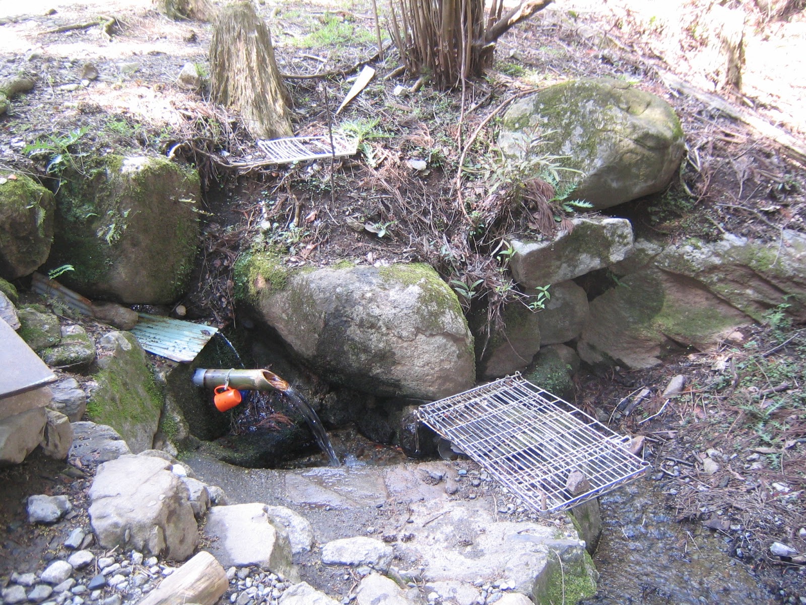
pouring to Yamano-kami Stream, with a plastic cup provided.
It seems to me locals come here to gather water for their tea.
I haven’t tried it, but could be sweet, as Gomayashiki Spring.
Beyond the gate is more and more a forestry road.
And over there is Yamagami Zuido, approx. 250m long.
The toilet on the left is the second from the last facility
we can use for today’s itinerary before the peak.
Oh so symbolic!


A paved road still continues beyond the tunnel. We find lots of small streams running down from the left slope of the road to Yamano-kami Stream. It’s an area with abundant water. “Nanasawa” means “7 streams” in Japanese. The name of the town must have logic. Thanks to these water-flows, we are able to observe the soil of Tanzawa mountain directly … very shallow top soil and the rocks underneath. About 20 min. walk from the tunnel, we reach to the end of the vehicle road. Beyond is a bridge crossing the Yamano-kami Stream. At the other side, there is the final toilet we can use for today’s itinerary. Please do not miss the opportunity! A paved road continues for a while after the toilet, but the surface is covered with screes and fallen trees. We have a feeling we are really entering deep into the mountain … Soon we meet a derelict concrete bridge without parapet crossing once again the Yamano-kami Stream. At the mouth of the bridge, there is a warning the structure is too fragile so that any wheeled device should avoid crossing it. Beyond the bridge is an open space, called Fudohjiri 不動尻 (453m ASL) that was once a camping site. This place also contains the legend of ghosts, this time a necrophilia eating roasted meat of baby girls … I could not feel any gruesome atmosphere there. Rather, I was welcomed by late blooming of Edgeworthia chrysantha adoring the beginning of the trekking road to the peak. If you don’t mind the legend, it’s a fairly good place to have a break and prep for a steep climb. 😜


The other side of the tunnel continues like this.
Along the way on the left there is a road leading us
to Kanegatake
鐘ヶ嶽 (an elevation of 561m) and then
to Kotakuji Temple Spa Entrance bus stop.
It’ll be 2 hours walk from here to the bus stop.
A huge rock along the route.
It looks like raised in a slanted way.
This feature is the key why the main pilgrimage
routes to the peak of Mt. Oyama,
Omotesando
表参道 and Urasando 裏参道,
are scree-covered.
I’ll tell you what they are when we go there.
One of the waterfalls
we can meet along the road.
The end of the paved road
Toilets!
The road beyond toilet
It will be beautiful in May here.
A bridge with a warning
A former camp, or crime, site
Edgeworthia chrysantha.
Now, let’s climb!


Almost immediately after Fudojiri, we meet a junction of 3 roads. To the left is to the peak of Mt. Oyama, and to the right is for about 5 hours hiking to Mt.Mitsumine 三峰山 (934.6m ASL) and Miyagase Lake 宮ケ瀬湖. (I hope you click the link to Mt. Mitsumine before you plan to go there. The route is not for uninitiated.) Today, we take Oyama direction. The road is sharply going up through the afforested area of Japanese cedars and cypresses. As we gain the altitude huge wild Pinus densifora start to appear as in Hinata-yakushi Route. It seems to me the City of Atsugi is doing the maintenance work for the forest, and there are lots of cordoned road with a notice “This route is not to the peak of Mt. Oyama, but for forest maintenance.” It’s a bit confusing arrangement, but as long as you follow the direction, signposts appears several times before we reach to the ridge. Please be patient. Climbing up further we begin to see the forest of Fagus crenata beyond the afforested area on the right. i.e., We are going beyond 800m above sea level. About an hour climb from Fudojiri, we reach to a small peak (844m ASL) with a sign post. Here we are already surrounded by natural beeches, Comus kousa, and Abies firma. I’ve come back to Mt. Oyama!


To the right is for Mt. Mitsumine.
To the left is for Mt. Oyama.
Gaining the altitude …
3.3K to go
This direction is off-limit for hikers.
In mid-April, the forest of Fagus crenata had so pale green of new leaves that
was a palpable contrast with dark green cypresses ...
By the way, have you noticed the trunk
of afforested trees wrapped by plastic mesh?
I’ll return the topic in my later post.
The sign post at 844m above the sea level


From here for about 1K, the route becomes fairly pleasant ridge road. We go down for 10 min. or so to Karasawa Pass 唐沢峠 where there is a pergola and picnic benches. There would be a strong temptation to have lunch now … but often the place is occupied by earlier visitors. If your stomach can accept 20 more minutes’ walk, there will be another good place ahead … After Karasawa Pass, the ridge way shows the feature of seriously precipitous rim of the mountain typical in Tanzawa. As this route is well-maintained, the route is clear with lots of wood decks and chains. So long as we are careful it would be OK. Though, I simply imagine the other routes that are assigned for “good walkers of Tanzawa.” The bushes cover the way, and there won’t be any help to pass rocks … No wonder many incidences occur in Tanzawa mountains. 0.5K from the Karasawa Pass, the ridge becomes somehow wider, and then suddenly the both sides of the road open up. On the left is the vast Kanto plain, and on the right are the North Ridge and the Peak of Mt. Oyama. You’ll soon find a picnic bench ahead. Some say this spot is better than Karasawa Pass for lunch.😋


A view from the ridge way to Oyama North Ridge.
Over there is a pro-only route.
Hello, dear firs!
Yellow cute flowers are Lidera praecox.
Karasawa Pass picnic place
A part of ridge way is like this,
or like this …
Very obvious ridge
The view ahead becomes wider …
This bench (908m ASL) is better for Picnic!


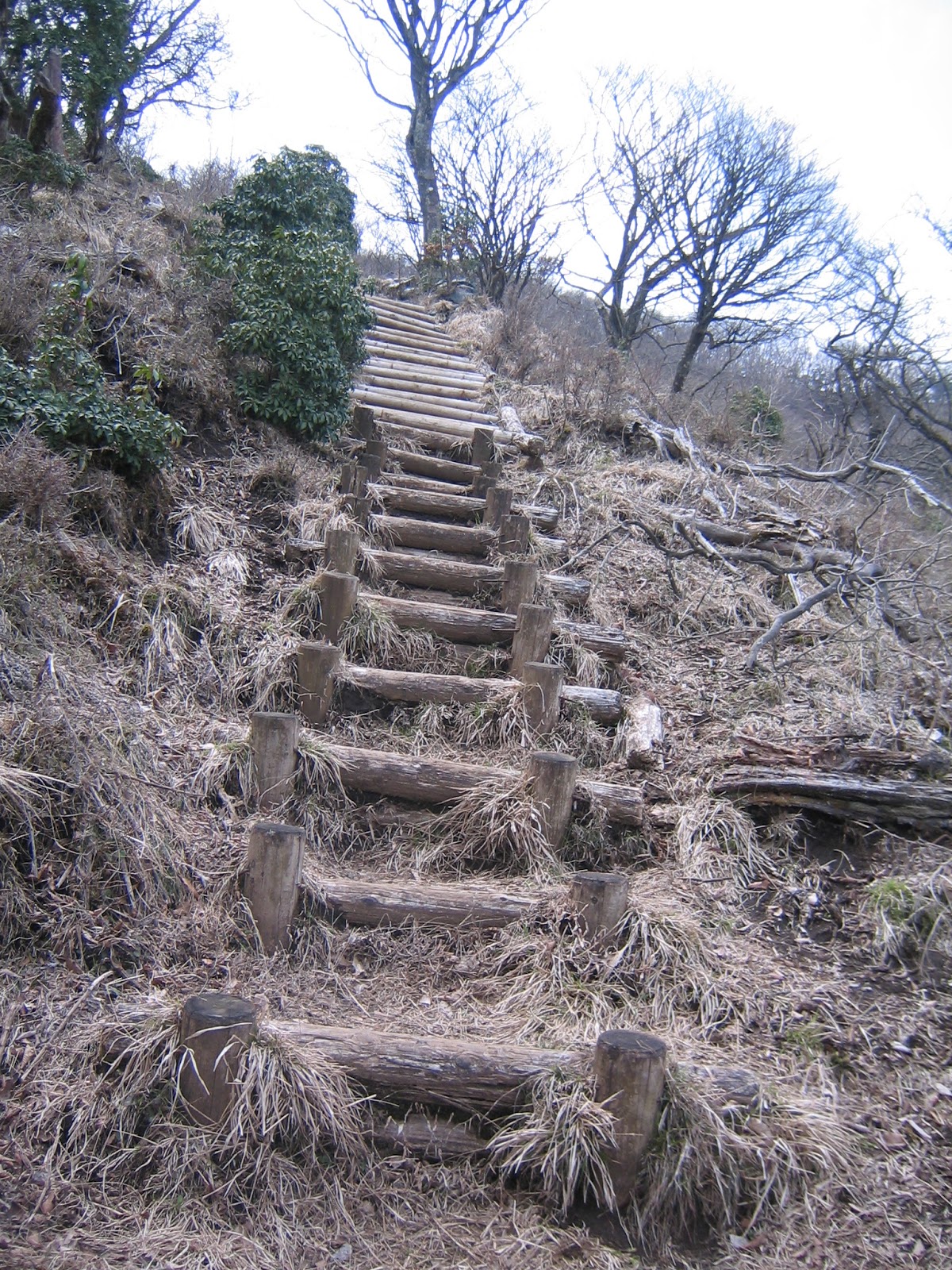
Soon after the bench with views, the road once again starts to gain altitude rapidly. The route is a continuation of steps of logs. It lasts for about 30 min. till Fudojiri-Bunki (不動尻分岐, Fudojiri Junction; 1148m ASL) where the Kotakuji Route meets with the end of Kaminari-no-mine O’ne (雷ノ峰尾根 The Ridgeway of Thunder-Peak) for the Hinata-yakushi Route. You may notice the vegetation around you is a bit limited …  natural beeches, ancient Abies firma, a bit of Acuba japonica, trimmed Boehmeria spicata, and large bushes of Pieris japonica. Admitted the flowers of Japanese andromeda are pretty, and they were in full-bloom in mid-April. But… they are poisonous. Why can they grow this vigorous here near the peak of Oyama? A hint appears at the next picnic bench situated before Fudojiri-Bunki. When you take a rest on it, to the west is a high-voltage power line going near the peak of Oyama. To the east is wire-fenced space where inside are baby trees covered by mesh. They are protected from being eaten ... I a sort of felt a pain. The situation is not yet settled in Mt. Oyama … I’ll return the issue next month … Any way! After a heart-pumping climb of 30 minutes, we meet the hikers who came from Hinata Yakushi at Fudojiri-Bunki. The top of the mountain is within 30 minutes’ walk now!


The long and winding and steep road
There is another picnic bench along the way.
Could you see the wired fence over there?
And next to us is a very 21-st century structure.
The way becomes more and more like this.
Yep, Japanese Andromeda are cuties, but …
Nearly there …
Fudojiri-Bunki


If you find environmental problems in Oyama, please make a contact to
 
Kanagawa Nature Conservation Center 神奈川県自然環境保全センター
657 Nanasawa, Atsugi City, 243-0121 〒243-0121 厚木市七沢657
Phone: 046-248-0323

You can send an enquiry to them by clicking the bottom line of their homepage at http://www.pref.kanagawa.jp/div/1644/