
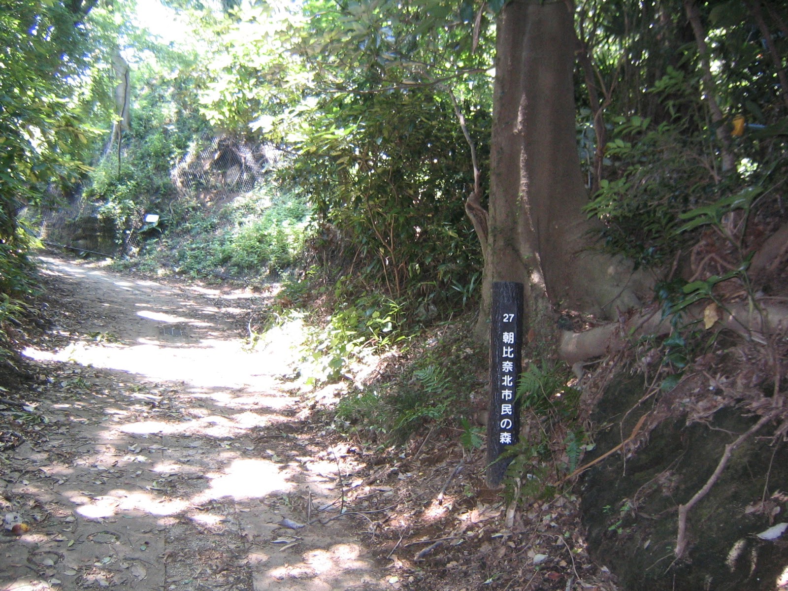
On April 1, this year a new member joined the family of Yokohama Citizen Forests. It is Asahina-Kita Citizen Forest. The above photo is currently only map available in the internet for the Forest. Actually, the City has not yet prepared the hard-copy version of it either. So, this info might be handy for some time if you plan to go there. The trekking routes within the Forest are the brown lines. It’s simple and every point has clearly shown signs with a number corresponding to the index in the map. (For example, this map is at point 26.) If you walk vigorously, or do a trail-run, the time you spend in the Forest could be less than 1 hour. But I think breezing past Asahina-kita Forest is a waste of occasion to experience remnants of Japanese history. The Forest is located at an interesting site for Japanese traditional civil engineering.
 |
| It’s point #17. |
The Forest is in the north of Asahina Bus Stop at the left edge in this map of Enkaisan Hiking Course. It is in the south of Kanto-Gakuin University Kanazawa Bunko Campus, practically separated from Yokohama Nature Sanctuary by (often very busy) Asahina IC of Yoko-Yoko Toll Road. Asahiha town is one of the oldest towns in Yokohama that is a gateway for more than 1000 years to Kamakura from the direction of Tokyo. Before the era of mechanized transportation, people of the town joined the festivals in Tsurugaoka Hachiman Shrine 鶴岡八幡宮 which is in less than 4 km from the town. They walked the ridge ways in Asahina-kita Forest joining to the Beetles Trail at the forest of Nature Sanctuary. According to one of the local elders, those ancient routes on the ridges were completely disrupted by Asahina IC. He didn’t say “there is no access,” but it seems to me the remaining hiking routes to Beetles Trail from the Forest must go into the private properties where landlords are not happy to have trespassers. So, let’s stick to the brown lines of the map.
 |
| The
Forest has lots of signs like this: “Beyond this line is not Citizen Forest. Visitors are asked to keep out.Office for the Park Greeneries in the South.” |
The Forest has 3 entrances. One is from the north, via the campus of Kanto-Gakuin University. We take Keikyu Bus Route Bun-2 文-2 from the West Exit of Keikyu Kanazawa Bunko Station 京急金沢文庫, and go to the terminal stop, Nomura-jutaku Minamiguchi 野村住宅南口. (Time table, here.) It is a bus ride of about 20 minutes. From the bus stop walk south along the campus, and on the left you’ll see steps going down. It is the entrance to Asahina-kita Forest with site number 1 in the map. From here to number 4 is a kind of park road within the campus, passing 2 college buildings. If you prefer more trekking style access, the other two points from the south of the Forest are yours. Both are from busy Prefectural Road 23, aka Kanjoh 4-go 環状4号 (Circular Road 4). One is to enter the Forest from #28 near Daido Chugakkoh Mae (Daido Middle School) Bus Stop 大同中学校前. You can also choose another, #24 from Asahina Bus Stop 朝比奈 next to Daido Chugakkoh Mae. From these 2 entrances we have to climb a steep slope to the point #11 that meets with the route from Kanto-Gakuin. There is no direct pedestrian road between #24 and #28 other than the Circular Road 4 with lots of cars. These two bus stops are reachable from Keikyu Kanazawa Hakkei Station 京急金沢八景 by Route Kama-24 鎌-24 to JR Kamakura Station. It’s the bus to go to the Nature Sanctuary from the Kanazawa Hakkei Stop in front of the Mitsui-Sumitomo Bank. (Time Table, here.) Next week, I report you a pedestrian short-cut to Kamakura from Asahina-kita Forest. I think entering from Daido Chugakkoh Mae would be wiser for our plan. So in this post I report my experience from the entrance #28.
 |
| Daido
Chugakkoh Mae (Daido Middle School) Bus Stop大同中学校前 |
 |
| If you
choose Asahina Stop, you first walk back a bit to 7/11 convenience store, and cross the road to enter a small way to the residential area. By the way, 7/11 has a public toilet. |
When we get off the bus at Daido Chugakkoh Mae, you’ll see at the other side a white cliff which looks like a left-over from a road construction. The place has a sign explaining Hana-kake Jizo (Lack Nose Jizo 鼻欠け地蔵 … somebody’s using this place for geocathing!). The white cliff is a remnant of a Buddha figure curved there ages ago. The road goes up next to Lack Nose Jizo is #28 entrance to Asahina-Kita Forest. From here to #26 where the photo of the top of this post is taken, the road is very wide. A horse can pass easily. This is a comparatively well-kept ancient arterial road connecting Kamakura and the northern cities around Tokyo Bay, including Edo (Tokyo). The degree of weathering of Lack Nose Jizo tells us the oldness of this place, and the width of the road indicates the road was important. From #26, the route becomes more of a trekking road. Within 5 minutes we’ll be welcomed by a new resting place. The map does not tell us the name of the place, and there is no sign other than “The rest place.” Anyway, there are 3 picnic tables facing the mountains of Kamakura-Zushi area. You can take a breath here, if you like. (Though, no toilet or water, here or anywhere in the Forest.)
 |
| Lack
Nose Jizo. The end of the rock surface was about the border between ancient Musashi Prefecture and Sagami Prefecture. Could you see a road on the right? It is the entrance to the Forest. |
 |
| Point #28 |
 |
| Go straight! |
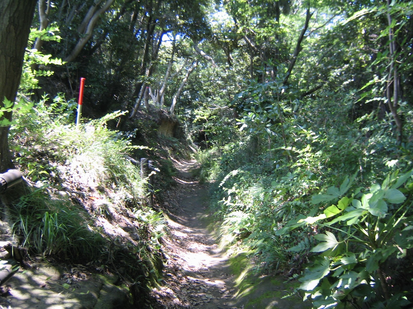 |
| After #26, the road is in a trekking spec. |
 |
| Soon
we’ll meet a new steps on the left, and |
 |
| A view
from the top of the steps. This open space is really new. |
Returning to the road from the rest place, we soon realize this is a curved route ages ago by people. The typical hardpan of the area is constructed here and there, though narrow. We also find lots of notice saying “Beyond this line is not Citizen Forest.” Peeping through the notice boards and trees, there are vegetable fields. I felt a kind of agony of landlords … “Well, we want to keep this land, but … OK make it open along the ancient road, but the rest is …” Between #13 and #11 is a road clinging to a cliff looking down the northeast which is a newly developed residential area, The other side of the cliff road is probably (as we cannot see) farm fields of landlords with ancestral land. The wave of urbanization towards the ancient forest is barely stopped thanks to the geography. From #11 point to Kanto-Gakuin Campus, it’s only 300 m or so with little ups and downs. We’ll be greeted by a long blue wire-mesh that was the same materials used for the entrance of Sekigaya Citizen Forest. Sekigaya Forest is located at the opposite side of the campus from Asahina-kita Forest. “Beyond the mesh is the property of the University.” OK, OK.
 |
| It is definitely man-made. |
 |
| An artificial mini-valley |
 |
| “Please keep out.” |
 |
| Beyond the cliff would be farmland. |
 |
| “The other side” |
 |
| The campus begins. |
From #11 point to the south, the trekking road first climbs up steeply, and then goes down rapidly to Circular Road 4. This part is similar to the standard roads in the other Citizen Forests. I guess, the road to Kanto-Gakuin University would be a part of old highway connecting to Beetles Trail, aka the Road of Iron-mongers, and to Ten’en of Rokkoku Toge. In contrast, the road from #11 to #24 was local utility route. Soon we find ourselves in a small clearing with lots of high grasses. Down there on the right is a bamboo forest which, with my eyes after bamboo-shoots harvesting in Niiharu, would need more human interventions … Soon we will be welcomed by another map for Asahina-kita Forest with number 12. The road goes down further, and when we see the roof of a temple on the right beyond the bamboos, the road becomes steps directly carved on the hardpan. The temple is an abandoned structure, next to a cemetery for locals. Its precinct has a magnificent cephalotaxus harringtonia with the sign saying “registered tree at Kanagawa Prefecture.” Please admire it from the direction of the cemetery. I loved it! Leaving the temple, we cross a small bridge whose handrail has the sign “#24 Asahina-kita Citizen Forest.” Well, it’s just one hour or so small walk up to here. We can proceed to the other side of Circular Road 4, actually as the people of 800 years ago did. I report you my adventure there next week. 😄
 |
| A brief steep climb, |
 |
| then tumbling down. |
 |
| Yeah, this scenery is more familiar. |
 |
| Small open space |
 |
| I
think they can make the bamboos fatten if they thin the space. |
 |
| #12 point |
 |
| Steps |
 |
| An abandoned temple |
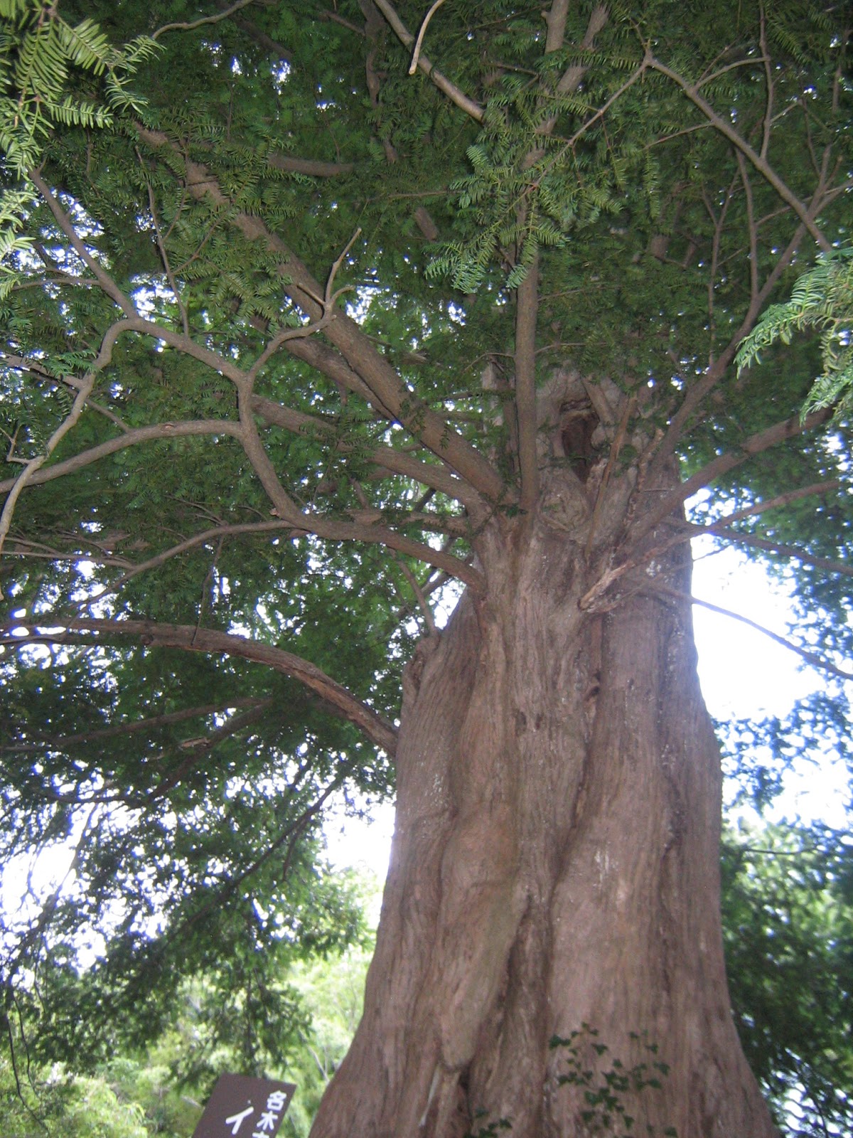 |
| The precinct was too small to capture the entire form of this huge tree with my simple camera … sorry. |
 |
| #24! |
 |
| From
#24, walk to the direction of Asahina IC. You’ll find Asahina Bus Stop (on the side going to Kanazawa Hakkei Station.) |
If you find a problem in Asahina-Kita Citizen Forest, please make a contact with
Office for the Park Greeneries in the South 南部公園緑地事務所
Yokohama Municipal Government Creative Environment Policy Bureau 横浜市環境創造局
Phone: 045-831-8484 (I guess in Japanese only) FAX: 045-831-9389 (I hope there is somebody who can read English …)

No comments:
Post a Comment