
Fall is getting deeper. Though the maple trees in downtown are currently having serious thought to dress-up, In Okuyama 奥山 of Kanagawa Prefecture the trees are fast changing into winter pjs. (“Oku” means “somewhere beyond the familiar environment. “Yama” = mountain.) Actually, middle of November is the best time to hike for autumn leaves in Tanzawa and Hakone. This time, I report you my recent visit around Yabitsu Pass in Tanzawa. That was gorgeous! (… it’s snowing there now. The colors must have gone …)

 |
| A map of Tanzawa at Yabitsu Pass |
An Autumn Day Hike in Tanzawa for beginners (8.5k)
Yabitsu Pass ヤビツ峠 (761 ASL) - Takenodai 岳ノ台 (899
ASL) – Bodai Pass 菩提峠 (759.5 ASL) – Gomayashiki Spring 護摩屋敷の水 – Kashiwagi Trail 柏木林道 - Minogue 蓑毛 (306
ASL)
<Equipment>
- Good walking shoes,
- Long-sleeved jackets with long pants and working gloves: i.e. serious hiking gears,
- Lunch and drinking water in a bag that does not constrain your hands,
- Towels, tissue papers, and any other personal hygiene products: when it is fine, wearing sun-screen is advisable,
- Map of Tanzawa Mountain: there are many versions including with Kindle. Of course you may print it out from whichever website, but I strongly recommend you to bring a full-version reference (Kindle would be OK). It is common knowledge within Japanese mountaineering community that Tanzawa is an epitome of Japanese mountains. The place is looked like small easier hills, but in reality all the standard dangers, including death, of mountain climbing can be waiting for you at every turn. It is better to be fully informed,
- and, a 500ml empty water bottle, well-cleaned.

First, we have to reach to Yabitsu Pass. It’s easy. Please take Kanachu bus Hada 秦21 service (time table, here) from #4 stop of Odakyu Hadano Station 秦野. Yabitsu Pass is the terminal stop, which takes 45 minutes to reach from the Station … er, yeah, it’s easy, but during a high season like November weekends, you’d better prepare yourself for a packed-bus ride at the level of JR Yamanote Line. Anyway, the bus takes Prefectural Road #70 first to Minogue Stop, then from there climbs up really mountainous (almost 1-lane) route. Yabitsu Pass is a kind of sacred place for cyclists and motor bikers who love to enter into the mountain via difficult P.Road #70. You can drive to the Pass by yourself, although the parking space is fairly limited. In our itinerary we come down to Minogue for the return trip (with Hada 秦 20 and 21 services to Hadano Station; the time table is here).
 |
| Within Hadano Station. They show you the way. |
 |
| I told
you. It’s congested in Hadano Station ... It means there would be somebody even if you had a problem in the mountain. |
 |
| Could
you see a winding road down there? It’s the bus route, Prefectural Road #70. It goes via Yabitsu Pass to Miyagase Lake 宮ケ瀬湖, then joins with P.Road #64 that will meet Chuo Express Way 中央高速道 via National Route #413/412 at near Sagami Lake 相模湖 and Mt.Takao 高尾山 of Tokyo. |
 |
| Parking
space at Yabitsu Pass. You’d better go there at 7:00 AM to park your car weekends. |
 |
| Yabitsu
Pass has a kiosk-cum-visitor center. You can collect info about Tanzawa here. Also, please leave a hiking registration at the booth before you start anything. When you have a problem, the information shall be vital for rescue operation. |
 |
| The
public toilet bldg. at Yabitsu Pass. The entrance of the structure also has a post to drop hiking registrations. |
 |
| Western
style! The water supply is limited, so be careful when you flush. Also, H2O from the faucets in the toilet is not potable. |
For our itinerary, first we climb about 1k to Takenodai from Yabitsu Pass. Oh, yes, for you visiting there during summer, the area hosts lots of haemadipsa zeylanica japonica. We must protect ourselves from Yabitsu Pass against those blood-suckers. (More to this in a post next year.) The entrance to the trekking route is first on the right when we start walking from the toilet along Route 70 to the direction we came by bus. For a while, the road is a typical Japanese mountain way where both sides are afforested with Japanese cedars and cypresses. Actually, the area is designated as “Kanagawa Water Source Forests” where there are the origins of the streams going down to Miyagase / Sagami / Tanzawa Lakes, and Sagami / Sakawa Rivers 相模川・酒匂川. All of them are the water sources to the cities in Kanagawa Prefecture, including Yokohama. You may notice there runs a fence along the route to Takenodai. It is because the place has a problem of overgrazing by wild deer. I’ll post later about this rather serious issue in Japan. Probably due to this, the undergrowth of the area outside the fence is mainly with Pleioblastus chino and Boenninghausenia albiflora var. japonica … I found it a bit poor comparing with the forest floors in Niiharu … Granted the place has a higher elevation, but the grasses we can find along the road are disliked by deer …
 |
| To Takenodai from Yabitsu Pass |
 |
| Cedars with deer fence |
 |
| The ground covered by Pleioblastus chino |
Even though, there appear several broad leaved trees some of which had leaves turned yellow or red (or both). We can also find dozens of formidable Pinus desiflora near or along the ridge way. In the lower bound world of Satoyama, they are almost gone due to deforestation during the World War II. It’s a relief we still have this tree in wild. Also, there are Euonymus hamiltonianus in 5+m high, with cute pink berries and yellow leaves. For the eyes accustomed to a garden-sized version, it’s a fresh delight. Soon we come to a field of Miscanthus sinensis spreading over the slopes both sides. Before, it was a place where the villagers living on the foot of Tanzawa Mountains harvested grasses as the material for roofthatch. We can also see many young Fagus crenata Blume within the grasses. They are planted by several volunteer groups to restore the ecosystem … it’s the connected thing with the deer and leeches. I’ll tell you about this next year. After the pampas field, the road runs almost on the ridge where both sides have several beautiful maples and other deciduous broad leaved trees. In Kanagawa, the climax forest is of evergreen broad leaved trees for Satoyama … we can see what difference in elevation can do. Eventually, we reach to Takenodai. It’s one of the spots we can admire beautiful Mt. Fuji J
 |
| Pinus desiflora |
 |
| Euonymus hamiltonianus |
 |
| The field of pampas grasses |
 |
| Fagus crenata Blume. The fences are against deer. |
 |
| A
fallen leaf of beech.The 3D
structure of Japanese beech with veins is not common among broad leaved trees, one of our seniors of Forest Instructor told us. |
 |
| Wow |
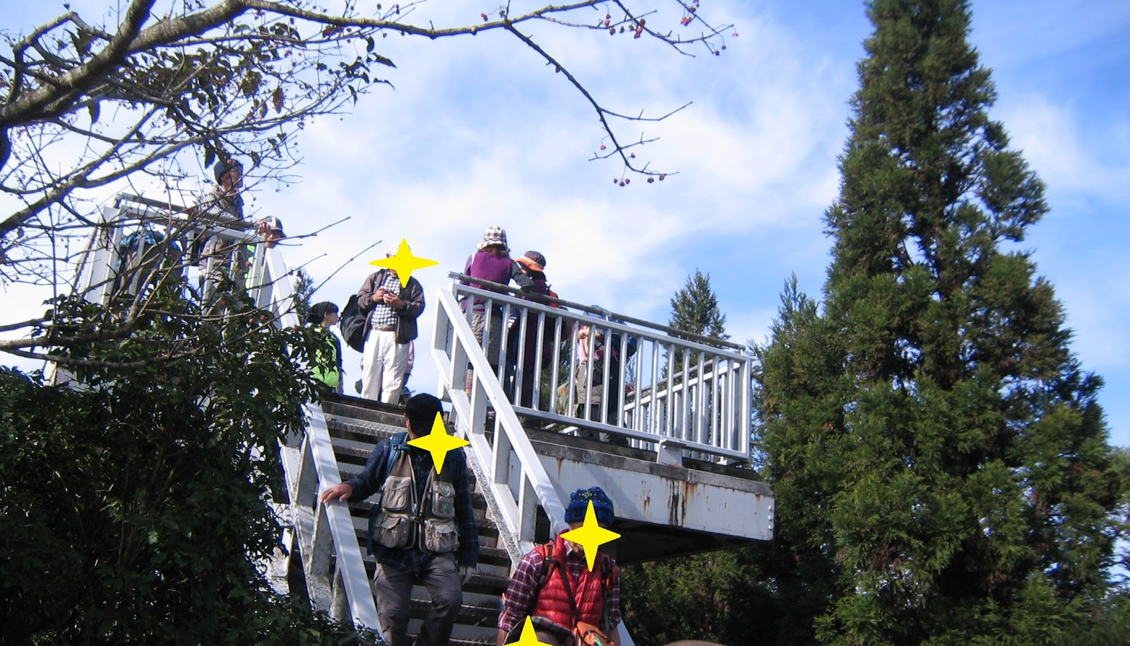 |
| Takenodai has an observation platform whose view is |
 |
| This! Hello, Mt. Fuji. |
 |
| Actually,
for almost all the way in our itinerary, we can observe Mt. Ohyama 大山 to the East. |
From Takenodai, it’s a steep slope going down. The opposite side before us is Nino-toh 二の塔 that is the beginning of Tanzawa Table Ridge 丹沢表尾根. The trails from Nino-toh to the main peaks of South Tanzawa (Sanno-toh 三の塔, Tohnotake 塔ノ岳, Nabewariyama 鍋割山 …) are training grounds for serious mountaineers in Japan. It is said especially during winter when the place is covered with snow, the area is ideal to learn snow mountaineering. When we reach to the bottom of the slope, there is a small shrine that worships the Wind God 風神. Meaning, this small valley is a kind of wind tunnel tucked between the ridges. From there, another small climb within the forest of maple trees will bring us to the place where 21st century humans play with the Wind God: 2 launch decks for paragliders. The people who jump from there will arrive at one of the rice paddies in Hadano down there. From the decks, we can see all the Hakone Mountains to Izu Peninsula, the eastern skirts of Mt. Fuji, Oiso Hill 大磯丘陵 whose southern edge has a house of Haruki Murakami, Hadano City, and spreading Odawara City. I found the spot is ideal to grasp the structure of Sogamae strategy 総構 represented by Odawara. If you are interested in historic war plan in Japan, this is the place you should visit once.

 |
| Nino-toh |
 |
| Baby Shrine for the Wind God :) |

 |
| Fly! Could you see Mt Fuji over there?If the Wind God is on holiday with lots of sunshine, the place is ideal for lunch. J |
 |
| The
ridge in front of us is Hakone Mountains. The hill below us is Oiso Hill. Could you figure out Odawara City between Hakone and Oiso Hill? Odawara was already well established at least in the 10th century, but in the 15th century it became famous as a prototype of Japanese cities with castles, whose plan is called Sogamae. The city is surrounded by steep mountains and hills from 3 directions and the only window is the sea. It is ideal to build an enclosed city around a castle of a warlord. Tokyo (Edo) was designed from the example of Odawara. |

From the launch decks, it is a steep decline to Bosatsu Pass. The route is of steps where both sides have Gentiana scabra var. buergeri f. stenophylla. If it is a fine fall day, they greet us with their elegant blue flowers open. Fingers-crossed (; they do not bloom when it rains). We can also see down there Bosatsu Pass Parking. From there to the north is Tanzawa Table Ridge hiking route. We take this time to the east for about 500m where we meet P.Route 70. Before returning to Yabitsu Pass to the right, let’s have a 100m detour along Route 70 to the left. Soon we will be greeted by several cars parking on the left. Many of their number plates are like “Omiya 大宮,” “Shinagawa 品川,” “Nerima 練馬,” … i.e. the cars are not from Kanagawa Prefecture. The place is called Gomayashiki Spring that is one of the water sources of Hadano City. It is also one of the Springs of Hadano Basin registered as a member of the 100 Best Water of Japan by the Ministry of Environment. Now, have you brought your clean water bottle? Store the water from the spring, and brew your green tea home. The water is not treated yet, of course, and the place has a warning from Hadano City, “Please boil the water before drinking.” Still, I guarantee your cup will have very soft, even sweet taste. It would be one of the best cups of green tea you’ve ever tasted ;)
 |
| Gentiana scabra var. buergeri f. stenophylla |
 |
| Bosatsu Pass parking |
 |
| To Tanzawa Table Ridge |
 |
| At the
corner with P.Route 70 from Bosatsu Pass, there is a structure for public toilet. |
 |
| To the
left, the entrance of Gomayashiki Spring. You can park your car only on the left of P.Route 70 to Miyagase Lake direction. |
 |
| The
Spring has 2 spots where we can collect the water. Please do not be greedy. Bringing a tank lorry is No-No-No (… I think it’s illegal if you do that). |
From the Spring, we take Route 70 to Yabitsu Pass for about 30 min and turn left after passing the Yabitsu Pass Bus Terminal. It’s the entrance to Kashiwagi Trail going down to Minogue town. The road was built as “Kinma-michi” 木馬道 in 1932 for the transportation of logs harvested along the way, so that it is a relatively new route. “Kinma” means wooden sledge pulled by human power on make-shift log rails. Japanese forestry in very steep mountains employed the method traditionally to carry the logs to the nearest stream, and let the product to swim down to a town. Kashiwagi Trail looks like a standard mountain road with 1m width at best. It is difficult to imagine people carried tons of logs on such road. The surface is graveled, probably intentionally in order to control the speed of the sledge. Moreover, the valley side of the route is almost 30º of steepness … It must have been a very dangerous job … I recalled my “Reducing BMI Exercises in Niiharu.” Ah-ha. The route was used until the 1980s, which implies how “remote” the Tanzawa Mountains were for city folks.
 |
| Looking
P.Route 70 from Kashiwagi Trail entrance |
 |
| The
entire surface of Kashiwagi Trail is like this. |
 |
| Of course, lots of cedars and cypresses both sides. |
 |
| And the beyond is supreme … |

Eventually, we meet Shungoku Sawa 春獄沢 that is baby Kaname River 金目川 reaching to the Hadano Station. The point is one of the sluice gates for Hadano City. From here, the route becomes a black top road with lesser inclination where vehicles could come in. We also find strangely flat spaces along the stream. Until 1923, Motojuku Village 本宿村 was there. Especially from the 17th century till 1945, Tanzawa and Hakone were the property of national powers, first of the Shogunate Government, and later of the Imperial Family. Harvesting anything from the forest without the permission of the Great was prohibited inevitably. The people who had a secluded community deep inside received special permissions to cultivate and hunt the forest bounty. Then, the Great Kanto Earthquake hit with the epicenter in Sagami Bay nearby. The entire Motojuku Village was swallowed by debris-avalanches and majority of the villagers died. The survivors moved to Minogue. The land along the Kaname River became human-less. It seems to me the families still hold the title of ancestral land though, as some BBQ business appears here and there. Soon, we pass Sengen-in Temple 千元院, and going down straight for about 100m we see the Minogue Bus Stop along P.Route 70. At the corner of Kashiwagi Trail and Route 70, there is a statue of Boy Scout with an inscription saying “The birth place of Tokyo Camping Club of Boys.” OK, OK.

The prefectural office who’s in charge of Tanzawa is Kanagawa Natural Environment Conservation Center 神奈川県自然環境保全センター. The contact address is
 |
| Shungoku Sawa |
 |
| A
waterfall seen from Shungoku Sawa. It is coming from Higesoh-no-Taki Fall 髭僧の滝 about 400m above. |
 |
| Don’t you think it is a bit spacious? |
 |
| Sengen-in Temple |
 |
| Boys for camping |
 |
| Minogue
Stop to the direction of Yabitsu Pass |

The prefectural office who’s in charge of Tanzawa is Kanagawa Natural Environment Conservation Center 神奈川県自然環境保全センター. The contact address is
657 Nanasawa, Atsugi City, 243-0121 〒243-0121 厚木市七沢657
Phone: 046-248-0323
You can send an enquiry to them by clicking the bottom line of their homepage at http://www.pref.kanagawa.jp/div/1644/
You can send an enquiry to them by clicking the bottom line of their homepage at http://www.pref.kanagawa.jp/div/1644/

No comments:
Post a Comment