
I’m sure there are lots of travel guide in many languages for going to the peak of Mt. Takao 高尾山. So in my post this week, I just tell you a rough sketch in this part of my adventure in Mt. Takao. First, the nearest train station for the peak is Keio 京王線 Takao-san Guchi Station 高尾山口駅 whose name literally means “the entrance to Mt. Takao.” There are lots of route to visit the peak, and the standard ones go through the precinct of Yakuoh-in Temple 薬王院 where we can have Buddhism vegetarian dishes (RSVP). If you plan to go there in your business shoes or high-heels, you must use chair lift or cable car services by Takao Tozan Railway 高尾登山鉄道 that can bring us to the stations at ASL 460m (chair-lift) or 480m (cable car). From there to the peak, the main roads via Yakuoh-in are either paved, or decked so that approach is not so difficult. Otherwise, it is strongly recommended to wear your hiking shoes for Mt. Takao. As Mt. Takao sounds too familiar, people could go there without preparation and end up in hospital with a help of mountain rescue teams. Besides, if we want to immerse ourselves in the amazing biodiversity of Mt. Takao, we must divert from the paved roads as much as possible. Actually, the mountainous roads are more popular than cable cars, and could be congested in Mt. Takao. Trekking Road #6 becomes one-way up during every April 29 – May 5 and November, in order to ease “traffic jam” of hikers.
 |
| Takao-san Guchi Station |
 |
| Kiyotaki
清滝 cable car station for Takao Tozan Railway that is the beginning of the cable car service. |
 |
| Just
before the cable car station, there is a junction between Omotesando 表参道 (meaning “the main approach”) to Yakuoh-in Temple, and two other hiking roads to the peak. This is actually the beginning of Tokai Shizen Hodoh (Tokai Nature Trail 東海自然歩道). More to this hiking road below. |
 |
| When
you get off the cable car from the foot of the mountain, you’ll be welcomed by this small open space where |
 |
| we
begin to enjoy spectacular views. This is to Sagami Bay 相模湾. |
 |
| But if
you don’t use public transportations from Takao-san Guchi Station, the roads are standard trekking paths of Japanese mountain. So, please be prepared. |
Yakuoh-in,
established in 744, is one of the training grounds for Yamabushi priests 山伏. The grand-masters of Yamabushi priests were often identified with
tengu 天狗 with magical powers and the precinct in Mt.
Takao has lots of tengu motifs. … After watching The Last Jedi, I felt the
training of Yamabushi is like to be a Jedi … yeah, I’m serious. There are two
water purification training 水行 spots for Yamabushi priests, or anybody who wants to do it (RSVP), in Mt. Takao … sounds
more and more like the Jedi Temple for Rey … One in Mt. Takao is Hebitaki Fall 蛇滝, and another is Biwataki Fall 琵琶滝.
Regrettably, just 20m underground of Biwataki Fall, there runs Takao-san Tunnel
高尾山トンネル of Kenoh-doh Express Way 圏央道 excavated by the technology for Eurotunnel. The
route was opened in 2014. People said the road construction may have cut off
the water vein of the area and could be a culprit for drying up of this sacred
waterfall these days. Let us see what would happen in 10 years’ time … Oh, by
the way, Biwataki Fall is along the most demanding trekking road of Mt. Takao.
You have to wear your hiking shoes to visit there for sure. Training to be a
Jedi is not at all easy, as all of us know.
 |
| All
the roads coming from Takao Town meet at the above open space in front of the cable car station. From there, the boulevard to Yakuoh-in Temple runs to … |
 |
| The main gate where |
 |
| Mischievous sculptures of Tengu (goblin? fairy?) welcome us. |
 |
| Yamabushi training spot at Biwataki Fall |
 |
| From
Oku-no-in of Yakuoh-in Temple, a wooden-deck road leads us … |
 |
| to the
peak of Mt. Takao where a visitor center 高尾山ビジターセンター is waiting for us. The place is equipped with a small theatre and many educational materials for science classes of grade schoolers. The facility is always visited by kids. |
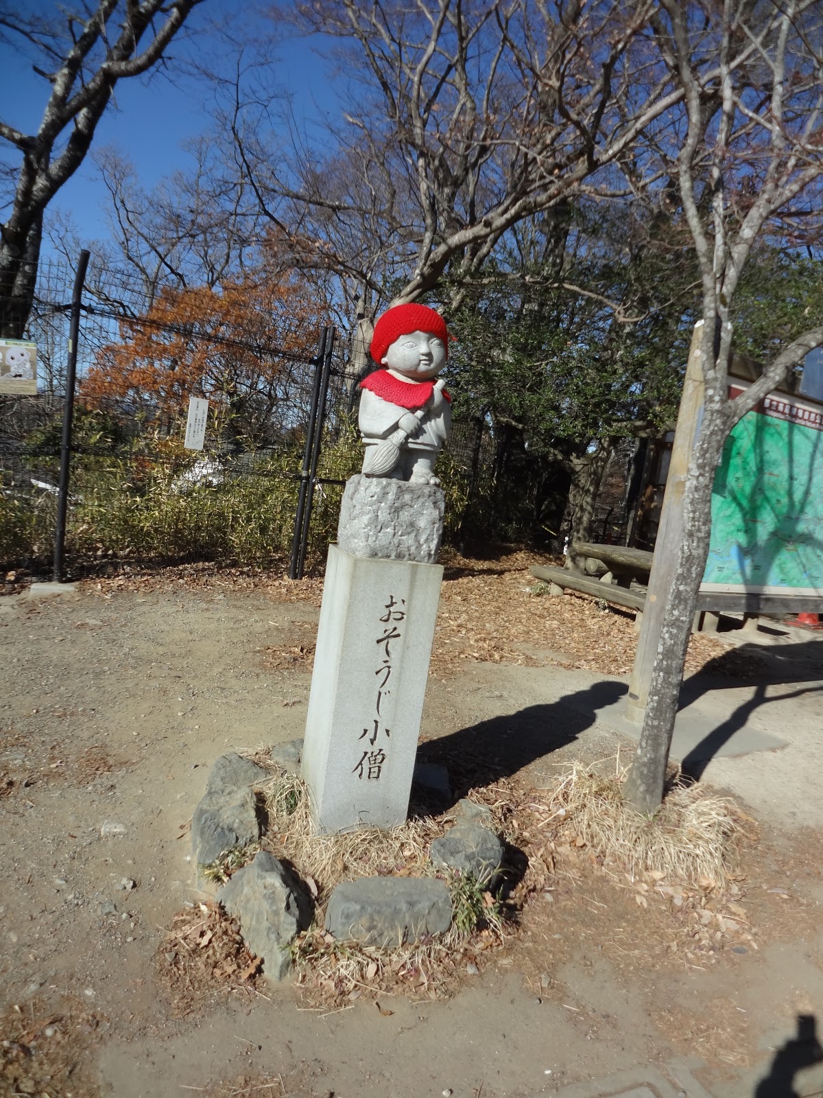 |
| Kstigarbha
image at the peak, calling for trash-free Mt. Takao. Cute. |
Now, let me start telling you my adventure in honest from here. The view from the top of Mt. Takao, ASL 599.3m, is spectacular. To the east in a fine winter day, we can see Tokyo Skytree, Mt. Tsukuba 筑波山 and beyond. To the south are Bosoh Peninsula 房総半島, Tokyo Bay 東京湾, Miura Peninsula 三浦半島 and Sagami Bay where Enoshima Island 江の島 and Eboshi-iwa Rock 烏帽子岩 are floating. To the west is the entire Tanzawa Mountains 丹沢 where their highest, Mt. Hiruga-take 蛭ヶ岳 (ASL 1672.6m), is clearly commanding her pole position. And Mt. Fuji, of course. We also should observe the extremely rich vegetation around the peak of Mt. Takao. The mountain is located on the border between the warm temperate and the boreal, which made its forest consists of plants for both climates. In Tanzawa, we can meet beeches in the area higher than ASL 800m. Here in Mt. Takao, Fagus crenata is thriving already around the top. No wonder this is the most visited mountain in Japan every year. And that might become the reason of its misfortune ... Often people are amazed by the well-prepared walking path forever in Mt. Takao … but do you think rain can seep slowly in there? Is it really “nature friendly”? I just advice you to hold your lunch for 20-60 minutes more from the peak for a less-congested, but with equally spectacular views …
 |
| The
view to Mt. Fuji from the top of Mt. Takao. The highish mountain to the left of Mt. Fuji is Mt. Omuroyama (ASL 1587.4m) 大室山. Further left is Tanzawa Mountains with the highest Mt. Hiruga-take. |
2 trekking roads are departing from the top of Mt. Takao to the west, which join again within 5 minutes at a 5 roads junction. They are going into Oku-Takao, or deep Takao, although the roads are still fairly wide and well-constructed. The north-most road is going down a bit, where it is famous for its beauty in spring and autumn leaves. The middle one among the three to the west is running along the ridge, and in fine days, we can constantly observe Mt. Fuji from this road. The routes also have lots of benches. So, at whichever point you can enjoy your lunch. In addition, after the first junction, they will unite once more in about 600m so that you can choose any way to go to the west. Actually, this is the route designated as a part of Tokai Shizen Hodoh (Tokai Nature Trail 東海自然歩道), starting from the beginning of Omotesandoh of Yakuoh-in Temple. It’s a recreational walking trail created in 1973 with an initiation by the Ministry of Health and Welfare of Japan 厚生省. At that time, Japanese economy grew at a break-neck speed and environmental pollutions were damaging the health of the nation. In 1969 promoting healthy living in nature, an officer for the Ministry, Michio Ohi 大井道夫 who was in the office for National Parks, presented his idea of walking path to connect Tokyo’s Mt. Takao located in the middle of Meiji Forest Takao Quasi-national Park 明治の森高尾国定公園 with Osaka’s Mt. Mino’o 箕面山 (ASL 355m) in Meiji Forest Mino’o Quasi-national Park 明治の森箕面国定公園. Along the 1697km between the two mountains, Mr. Ohi deliberately chose biodiverse spots which were not-so-famous but relatively near to the population centers. The plan gathered enthusiastic supports from all over, and 11 prefectures along the way collaborated to provide safe walking roads for the project. It made many designated parts of the Trail Quasi-national Parks quickly. Unlike with Kanto Friendship Roads 関東ふれあいの道 (首都圏自然歩道), conquering all the way of Tokai Nature Trail does not give us honoring badges or the like. Even though, it is a very popular walking route and one of the reasons for Mt. Takao attracting such a lot of visitors. The itinerary goes not only nature sanctuaries, but also historical monuments dating back millenia. If you plan to live in Tokyo metropolitan area for a while, walking all the way from Mt. Takao to Mt. Mino’o could be a project of your life time. Actually, it’s in my bucket list. 😁 A journey of a thousand miles begins with a single step, or with Mt. Takao.
 |
| The
junction with the 3 roads ahead from the top of Mt. Takao. The middle road going up is the ridge way. |
 |
| There are lots of signposts in the Mt. Takao Quasi-national Park. |
 |
| Even western
style toilets are provided. The facilities in this Quasi-national Park is so-called “eco-friendly toilets” where flushing toilet papers are HUGE NO-NO. After use, please throw them in a trash bin provided. Thank you for your cooperation. |
 |
| And the extremely well-constructed trekking road … |
Tokai Nature Trail meets with the next junction for 6 roads. This time, let’s choose either of the 2 northern roads to the west. (The third path to the left descends to O’otarumi Pass 大垂水峠 on National Route 20 which was chosen in 2012 by Toyota Motor Co. as “one of the 86 most exciting Japanese passes for sports cars TOYOTA86峠セレクション.”) They will see each other in about 500m at Ichho-Daira 一丁平 with another toilets and a wide wooden deck for the view to Tanzawa-cum-Mt. Fuji. After Iccho-Daira, follow the signpost saying “To Shiroyama 城山.” In total of about 1 hour walk from the top of Mt. Takao, we reach to the peak of Mt. Shiroyama (aka Kobotoke Shiroyama 小仏城山), ASL 670.4m, where a café and a relay-tower for mobile phones are situated. For today’s itinerary, this is the last spot where we can observe Mt. Fuji and Tokyo Skytree simultaneously. When I’ve been there, watching Tokyo down below a group of hikers became very philosophical … “Hey, all of these are houses and buildings.” “Yeah, and people occupy almost all of them.” “Above all, we don’t know 99.99999% of the inhabitants who they are.” “… Yeah.” Also we won’t meet a toilet after this peak until we go down to Lake Sagami 相模湖. Please use the occasion wisely. The top of Mt. Shiroyama is the border and watershed between Tokyo and Kanagawa. Very roughly speaking, from now on the rain drops on the west slope of the ridge are supposed to end up at taps in Kanagawa via Sagami Lake. Those drops on the east slope should eventually join with Tama River 多摩川 in Fuchu City 府中市 so that they will never have a chance to be a part of waterworks of Tokyo … or will they? Tokai Nature Trail goes down from here, the peak of Mt. Shiroyama, to Lake Sagami. But in order to ponder more the water ways for Tokyo and Kanagawa, let’s continue for 30 more minutes along the ridge way to Kobotoke Pass 小仏峠.
 |
| At
Iccho-daira just before Mt. Shiroyama, Mt. Fuji is always there. Hello! |
 |
| The
top of Mt. Shiroyama. In about 400 years ago, there was a mountain fortress, hence its name Shiroyama = a mountain for a castle. |
 |
| Seeing from Mt. Shiroyama, over there is the downtown Tokyo. |
 |
| The
Tokai Nature Trail goes down via the route starting next to the café. Instead, we take this road next to the tower for continuing the ridge way. |
Very interestingly, from Mt. Shiroyama to Kobotoke Pass the road becomes a familiar trekking road as we can find in Tanzawa. It’s indeed a border between Kanagawa and well-manicured Tokyo. After observing a bit Lake Sagami to the west, we arrive a viewing point with benches for Tanzawa / Mt. Fuji that is the last place for us today to admire the couple. About 100m from here, we reach to Kobotoke Pass 小仏峠, ASL 548m. The place now has a crumbling hut and a monument saying “Emperor Meiji visited here in 1880.” The reason why the place had a royal visit was, the road going through this pass from east to west was the original Koshu-kaido Road 旧甲州街道. Koshu-kaido Road was one of the 5 arterial roads 五街道 in Japan till Meiji Restoration 明治維新 of 1868, connecting Edo (Tokyo) and the middle of Honshu Island. For Tokugawa Shogunate Government 徳川幕府, Kobotoke Pass was an important checkpoint 小仏関所, just like Hakone Checkpoint 箱根関所, to defend Edo. Naturally, Kobotoke Pass is on the border between Edo (Tokyo) and Sagami (Kanagawa). Unfortunately, the way was too demanding for western style carriages, and later automobiles, so that in 1888 Meiji Government changed the route of Koshu-kaido Road to the current National Route 20. Inevitably, Kobotoke Pass was forgotten. Having said that, nowadays beneath the Pass, there run Kobotoke Tunnels 小仏トンネル for JR Chuoh Line 中央本線 and always congested Chuoh Expressway 中央自動車道 both of which trace almost the same route of the old Koshu-kaido Road. Hmmmmmm … at least in terms of a linear distance, ancient people really economized the way for connecting the Imperial Palace with the middle Japan.
 |
| A familiar mountain road in Kanagawa |
 |
| Telling
you the truth, the route to Kobotoke Pass is a part of Kanto Friendship Road. The photo point for badges is at the peak of Mt. Kagenobu-yama 景信山 (ASL 727.3m) about 40 minutes’ north from Kobotoke Pass. Unfortunately, we don’t go there today. |
 |
| The
last encounter with Mt Fuji today. Down there is Lake Sagami. |
 |
| Rapidly
going down to meet with the signpost saying “Kobotoke Pass.” |
 |
| The monument of royal visit, with an abandoned hut |
So, today, we turn left here at Kobotoke Pass to take the old Koshu-kaido Road to Lake Sagami. i.e. We bid farewell to Tokyo, and enter the water source forest of Kanagawa. But, by reaching this far from Mt. Takao, honestly I felt a kind of human opportunism dissecting the mountain to argue “the rain drops on this slope is Tokyo, and on the other side is for Kanagawa.” Who knows when we slice the land the waterway would be neatly organized for Tokyo and for Kanagawa. Whatever, when we enter the forests in Kanagawa, we meet the familiar notices saying “This forest is water source forest of Kanagawa Prefecture.” OK, OK, OK. Eventually, we start to hear the exhaust of cars busily running in and out of Kobotoke Tunnel, and then encounter frequent services of JR Chuo Line below. Just before meeting with train tracks, there is a beautiful mountain stream coming down from the north going to Sagami River. It has an impressive name, Bijo-zawa Stream 美女沢, aka the “Valley of a Beautiful Lady.” The area has a folklore as a birthplace of Lady Terute 照手姫, a gorgeous and faithful lover who became a heroine in the Story of Oguri Hangan 小栗判官 for Kabuki 歌舞伎 and Joruri puppet shows 浄瑠璃. As a person who drinks tap water in Yokohama, I felt the name of the origin for my glasses is not bad. … And such an egoistic feeling to call “this water is mine” … The way from Kobotoke Pass to Sagami Lake is almost constant going-down, and finally we meet with National Route 20 at Sokosawa 底沢 Junction. You can either catch a Kanachu Bus Services from Sokosawa Stop 底沢停留所 to Sagamiko JR Station (timetable, here), or walk to Sagamiko Station 相模湖駅 for about half an hour via Route 20. If you choose to walk, about 500m from the bus stop, there is Oharajuku Honjin 小原宿本陣, a museum preserving a hotel for Samurai Lords centuries ago 本陣. It is the only remaining historical structure in Kanagawa Prefecture as one of the most prestigious hotels under Tokugawa Government. In the 21st century, the admission for the museum is free even for us commoners. Thank you. 😏
 |
| From Kobotoke Pass, we take this road to Lake Sagami. |
 |
| Rain dropping over there is supposed to belong to Tokyo. |
 |
| And this side is for Kanagawa. |
 |
| We
understand why people of the 19th century decided to have a new route for Koshu-kaido Road … But, beautiful, isn’t it? |
 |
| Here it comes: “This forest is for Kanagawa’s water.” |
 |
| Chuo Freeway is over there. |
 |
| And JR Chuo Line. |
 |
| The stream of beautiful lady |
 |
| Sokosawa Bus Stop |
 |
| Oharajuku Honjin |

The
contact address for the office in charge of Meiji Forest Takao Quasi-national
Park 明治の森高尾国定公園 is
Bureau
of Environment, Tokyo Metropolitan Government 東京都環境局
2-8-1
Nishi-Shinjuku, Shinjuku-ku, Tokyo, 163-8001
Phone: 03-5388-3539, FAX: 03-5388-1379
S0000618@section.metro.tokyo.jp
The
contact address for the office in charge of Sagami Dam is
Enterprise
Bureau, Kanagawa Prefectural Government 神奈川県企業局
1045
Nihon-Odori, Naka-ku, Yokohama 231-8588
Phone: 210-1111
https://shinsei.e-kanagawa.lg.jp/kanagawa/uketsuke/dform.do?acs=SF3204

No comments:
Post a Comment