
Hm.
Telling you the truth, I have never had a result of my personality test
describing me as a “delicate, artistic type.” One afternoon, when 3 of us had a
girls’ talk in a forest, I was a sort of left alone in the discussion.
“Yeah, I
feel very ferocious spirits lurking in this space, now …”
I: “Oh
yeah? It’s maybe because of lots of pollens from ciders and cypresses this time
of the year! I know you had a severe hay fever.”
Pals: “………
Don’t you feel anything?”
Me: “??????????????????????”
My pals:
“Oh, it’s not that! Don’t you understand difference?”
I: “???????????????????????????”
So, this
spring I’m trying to learn ”difference” between the forests in two adjacent
areas. This week, I tell you my adventure to hike Mt. Shiroyama 城山 in Yugawara Town 湯河原 where I noticed the
distinctiveness. Forests in Yugawara are a part of Hakone Geo Park. We roughly
traced this suggested course by the Park, starting from Yugawara Station 湯河原駅 of JR Tokaido Line JR東海道線.
 |
| JR Yugawara Station 湯河原駅 |
 |
| In
front of Yugawara Station, they have hot spring faucets welcoming the visitors. The water is coming from the source of hot spring of this tourism town. You can stay Friday evening in Yugawara Spa that situates near the starting point of today’s itinerary. Next morning you trace the route of this post to Yugawara Station. Nice weekend! |
JR
Yugawara Station 湯河原駅
è Approx. 30 min. bus ride (Odakyu
Hakone Bus 箱根登山バス from #4 stop of Yugawara Station: time table
is here) to Shishidono-Iwaya Bus Stop ししどのいわや in Tsubaki-dai 椿台 (ASL 580m)
è 1.5 hour walk to the Top of
Mt. Shiroyama 城山土肥城址 (ASL 563m)
è 10 min. walk to lunch at
Picnic Ground (ASL 480m)
è 2 hour walk to Johganji
Temple 城願寺
è 15 min walk to JR Yugawara
Station
Total time:
5 hours of slow paced walk with lunch.
* You
can go to Shishidono-Iwaya from Tsubakidai first, and then returning to
Tsubakidai to follow today’s itinerary. In this case, it’s better to add 1.5 more
hours for your plan.
 |
| #4 bus stop in front of the JR Yugawara Station |
 |
| Let’s ride this bus. |
We get
off the bus at Tsubakidai with a view designated as one of the best 100 in
Kanagawa Prefecture. To the south is Sagami Bay 相模湾 looking Yugawara Town and
Hatsushima Island 初島. To the west is the valley of Yugawara Spa.
Geologists think Yugawara Volcano was there about 40-23 thousand years ago as a
somma of the original Mt. Hakone. Between 23-13 thousand years ago, Mt. Yugawara
exploded massively, and became a big caldera. The place was eroded further and
started to sprout hot springs that is the present-day Yugawara Spa. In today’s
route, we walk along the rim of the caldera to the south, ended around Joganji
Temple. Almost entire route is well-maintained, and half of the itinerary is
paved. There is a little bit of ups and downs from Tsubakidai to the Picnic
Ground, though no steep slope. Historically speaking, this is the area where
Minamotono Yoritomo 源頼朝, the founder of Kamakura Shogunate Government 鎌倉幕府, started his battle in 1180 to grab the power
of the nation. With helps of the local clan, Do’i Family 土肥実平,
Yoritomo’s troop used the forests as their hiding place. Mt. Shiroyama was once
the fortress of Do’i Clan. In today’s route, we can meet lots of rocks with legends
like “Yoritomo had a break here.” I thought geography of the area is
well-suited for the would-be ruler of the nation to ponder his strategy to win
the war. The forest is dense enough to prevent his enemies, but not so
precipitous as in Tanzawa. Yes, the forest in the somma of Hakone is more open,
even though it has rush greens.
 |
| Tsubakidai with the bus stop and a view of Mt. Shiroyama. |
 |
| From Tsubakidai, we can see Hatsushima Island. |
 |
| From
Tsubakidai, we can go either from a slope starting in front of the bus stop, or from steps next to the toilet. The 2 way meets at the back of the toilet, so don’t worry. In today’s itinerary, working toilets are at this point and at Johganji Temple. Don’t miss your chance! |
 |
| The
hiking course from the back of the toilet goes like this for quite some time. The wide road slowly repeats ups and downs. |
 |
| On our
way to the right is Yugawara Spa. It certainly has a feel of lucidity. |
 |
| At
about ASL 580m point, there is this small space to have a rest. In April, the place was adorned by flowers of very large Enkianthus perulatus. I’m sure in autumn they have spectacular leaves … |
 |
| The route goes through afforested area of cypresses … |
 |
| And a bit of climbing, which brings us to … |
 |
| the
top of Mt. Shiroyama. If you are lucky for a fine weather, from there you can observe Izu Ohshima Island 伊豆大島 and Toshima Island 利島 floating in the Pacific Ocean. |
 |
| From
Mt. Shiroyama, the road becomes a bit rustic, but the landscaping is done with lots of hydrangea. |
 |
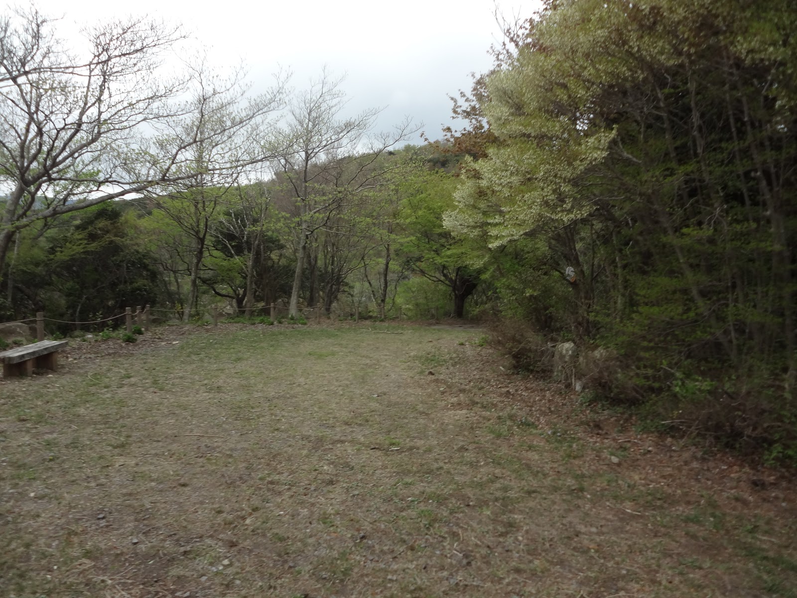
| The Picnic
Ground. Around here, there are 2 huts that were once toilets. As they are not functional now, be careful. |
 |
| From
here, we can see Manazuru Peninsula 真鶴半島 clearly. If it’s a fine day, Boso 房総, Miura 三浦, and Izu Peninsulas 伊豆半島 are also observable. Geologically speaking Manazuru Peninsula could be made of an eruption of another volcano about 15 thousand years ago. |
 |
| From
Picnic Ground, the route soon connects to a paved forestry road (for permit holders only to drive). |
 |
| The view from the forestry road is very free as well … |
From the
Picnic Ground to Johganji Temple, the road is simply descending. If you prefer,
you can go down to Johganji via the surfaced road only. The route can give us
open views of ocean to the south and a wide valley to the east of Shinsaki
River 新崎川 whose geographical features were created by
another ancient volcano erupted around 30 thousands years ago, i.e. older than
Mt. Yugawara. The magma exploded at that time was cooled rapidly and became
glass obsidian which made the area famous for the production of obsidian for centuries
to come. Although they are now almost all extracted, near the Temple where
orchards of mandarin oranges start to appear, the stone walls along the road
sometimes can sparkle depending on the direction of sunlight. That’s a
tell-tale sign of the contents of the rocks from the area. Also, in the middle
of the forestry road, there is a small short cut that goes through the forest via
a trekking road. In the middle of plunging, there is a large rock, called
Kabuto-Ishi 兜石, or Helmet Rock, with a legend as a helmet
holder for Yoritomo. Actually, in today’s course there are several of such
peculiar rocks of lores off the paved road. Scientifically speaking, they are
the remnants of ancient lava eroded to be interesting shapes in thousands of
years. The legends may or may not be true, but the surrounding forests for the stories
are not that intimidating and Yoritomo could relax here a bit even when the
enemy is attacking his troops …
 |
| The
road from picnic ground. Though permit holders only, cars can run here, so be careful. |
 |
| Entrance to the short-cut via Kabuto Ishi. |
 |
| Kabuto-Ishi. Hmmmmmm. The reason why we don’t feel closedness in this forest might be the rich vegetation that is surviving the attack of deer, unlike in Tanzawa. |
 |
| A beautiful country side with citrus trees in spring of Yugawara … |
Yugawara
village was once famous for their fishery and citrus farming. In a book “Oral
Record of Daily Meals in Kanagawa Prefecture 聞き書き神奈川の食事,” there
is a recollection of an old lady who lived in the early 20th century
Yugawara. Men went fishing for Japanese amberjack that fetched handsome price
in Tokyo’s fish markets. Women tended citrus orchards and vegetable patches
below the trees. Before, the area was the northern limit of Japan for citrus
growing so that their fruit tasted sour if consumed immediately. However, when
the farmers stored the crop in icehouse for 3 months, they became extremely
sweet. Such mandarin oranges were sold in high price after the main season of
citrus from the warmer western Japan. Yugawara has been, and is, a rich town.
The goal of today’s itinerary is Johganji Temple that was the family temple of
Do’i Clan. After helping Yoritomo, this family first became the high-ranking
officer for the government in Kamakura, and then changed their name to
Kobayakawa Clan 小早川氏 surviving to be one of the “noble class members
華族” surrounding the Emperor until 1945. This southern
part of the forests of Hakone was owned by celebrities. I noticed even in the
forest, we could here JR Tokaido Line running near the coast down there. The
reason why the forests of Yugawara give us an impression of openness is … such
proximity to prosperous human life? … My inner trickster then said “Huh, the
more the forest is near to the virgin, the more we feel menacing, don’t we?” Is
it?
 |
| Our route eventually enters the housing area. |
 |
| And
please turn right here. Over there is a gate of Johganji Temple. |
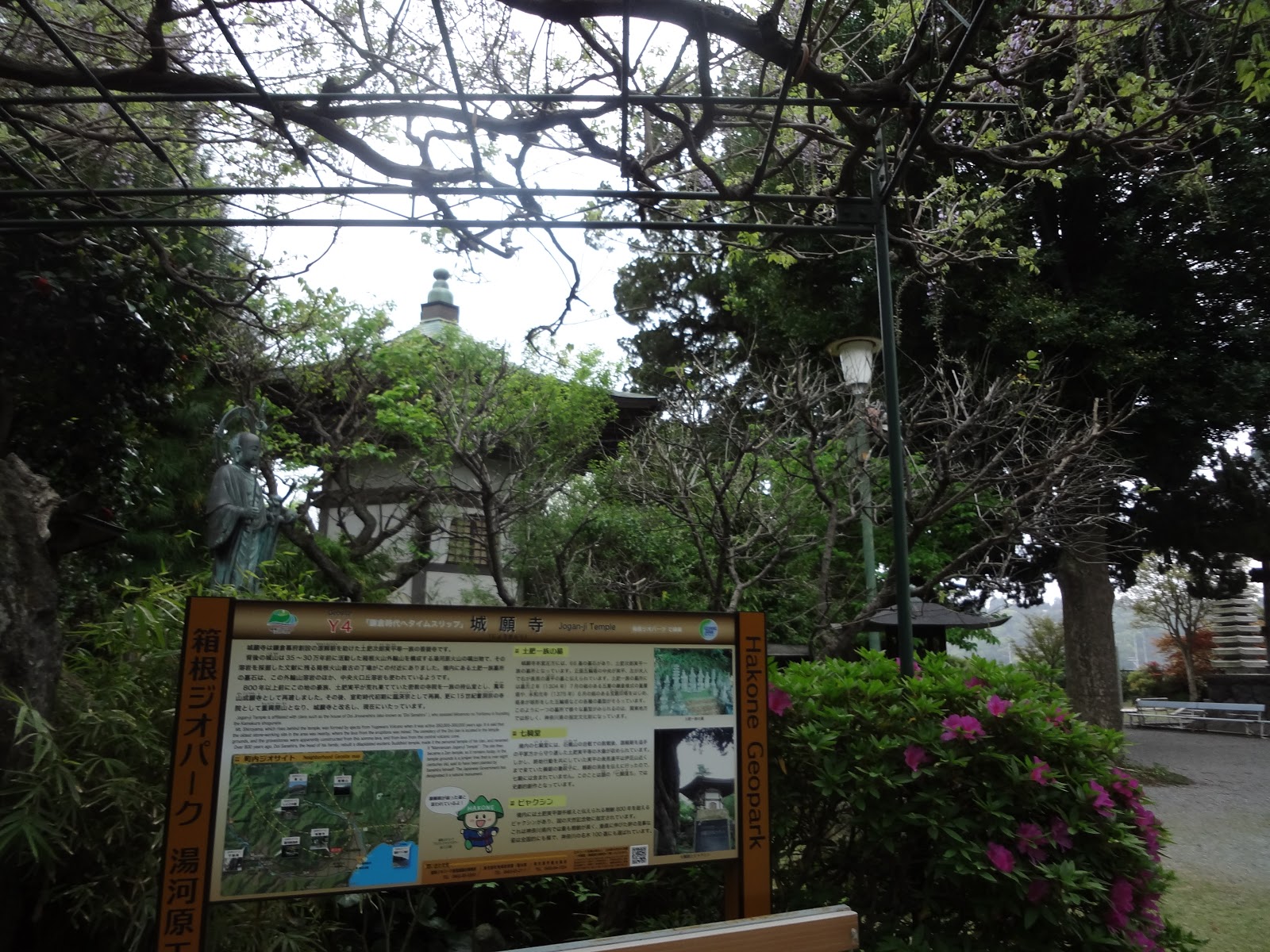 |
| Johganji Temple |
 |
| In the
sanctuary, there is this 800 years old Juniperus chinensis which is designated as a National Natural Monument of Japan. It was certainly planted by one of the Do’i clan members long ago. |
If you find problems in Mt. Shiroyama
of Yugawara area, please make a contact to
Yugawara Town Hall 湯河原町役場
Phone: 0465-63-2111, FAX: 0465-63-4194
For general enquiry about Hakone
Geo Park, the contact address is
Secretariat for the Promotion
Council for Hakone Geo Park 箱根ジオパーク推進協議会事務局
Phone: 0460-85-9560, FAX: 0460-85-7577
You can download the
introductory pamphlet of Hakone Geo Park in English, Chinese and Korean from
here.

No comments:
Post a Comment