Hm. This week, my post deviates a bit from the theme of this blog, “about forests in Yokohama and Kanagawa.” After writing last week’s post, I realized I may be of some help for you guys who happen to be in Megalopolis Tokyo, or in Japan, when natural disaster hits. Many people say especially casual visitors, or people who don’t understand Japanese, have difficulty to obtain vital info for typhoon, floods, tsunami, etc. Yeah. Earthquake is terrible, but it comes suddenly. The level of preparedness, at least mentally, for it would be the same between locals and visitors. In contrast, natural disasters with water, like storms and tsunamis, take some time to come. A monster tsunami took 10 minutes to gulp Manazuru Peninsula 真鶴半島 in 1923. Having good info as quickly as possible could be a matter of life or death. So, today, I tell you some sources for info issued by local and national pubic entities about natural disasters.

The first line of
defense of this matter in Japan is local offices. Say, you live in one of those
wards in Yokohama or Tokyo. Then, the ward office has many information for
disaster risk reduction. It includes
a.
Map for
the location of designated evacuation center near you,
b.
Map for
the location of delivery for water and any other emergency supplies by the
public office,
c.
Map of
medical services ready for opening the door whatever happens,
d.
Map of
the area where the office thinks it has a high possibility to suffer water
disaster, and earthquake; these two things can mean the same thing, i.e.
fragile land = landslides and flood-prone swamp,
e.
Nice
booklets for you to prepare for the disaster. The most famous one is by Tokyo,
called “Tokyo Bousai 東京防災“ which was distributed for Tokyoites.
This book keeps its #1 Best Seller position in this genre in Japan, and
downloadable as Kindle, free of charge, from here.
If you have any question you can ask to the desk they have in the local government office building. Actually, their HP has the above info so that you can go there first before physically visiting the place. They also have services for emergency alert system to the people who stay in their ward / city / town, like living there, or working in the area. You go to their HP, and register your email address, or SNS account. When an evacuation order is issued, they will notify via your contact addresses you’ve left in this page.
 |
| Inside Tokyo Bousai, showing the evacuation flow chart. |
But sometimes we need info for much larger geographical coverage. If a heavy rain causes trouble in upper stream, people in the region of lower down will have problems eventually. Or, knowing a super-typhoon is approaching from the east of the Philippines, we can have more time to prepare. About the weather forecast in general, there are several apps for your phone. You can choose whichever you like during your stay in Japan. We locals check NHK news in TV or, with their app, downloadable from any app store, free of charge. NHK has obtained the trust of us through decades of major disasters like last years’ super typhoons, Fukushima Nukes, or numerous earthquakes. They also have English app pages so that you don’t have to rely heavily on Google translation to know the latest info. Their info is not only for weather but also evacuation order or the like. In terms of detail, NHK is inevitably not so good as the info delivered from your registered ward. But, say, if you happen to be in the affected area which is away from your registration, you may know what is going on around you from the NHK site.
 |
| In Google Play, app for NHK news looks like this. |
These two places I mentioned above are a sort of info aggregators who receive the data from the public offices such as Japan Meteorological Agency, and Ministry of Land, Infrastructure, Transport, and Tourism. The primary sources also have their HP whose info is constantly updated, especially when the disaster is hitting. Needless to say, their info is the fastest, but we need finesse to navigate such pages as they are mainly for experts. Having said that, they have, er, well, a kind of, one-stop shop for the general public to obtain info directly from them. From the Meteorological Agency, you can go there, and your phone or PC’s GPS automatically sends your location data for the Agency to show the relevant disaster-related weather condition. I’ve found out they do not make this particular page in foreign language. That’s a pity. But if you find somebody who can tell you what’s on the page, it is the info for that translating someone would love to know urgently.
 |
| English version of Japanese
Met Agency HP starts from the general portal. You have to dig into from here. It’s cumbersome … |
About the condition
of dams, banks, and water flows for the river, bays, sea, … the primary info
comes from the Ministry. You go there, and click whatever info you need from
the icons. The same info is available from your smartphone from
and, hurrrrah, they
have an English version from
(er, yeah, it’s a bit abbreviated info.)
They contain live video streaming from ministerial
cameras situated at the strategic points for possible disaster. We can also
combine data such as the risk of tsunami, flood, volcano, and (known) active
faults to assess comprehensively a location, and to make a hazard map. Please
play around with the site for a while, and we can prepare before the next one
comes. Also, the Ministry has
this site of detailed hazard map. There, we can layer the risks of flood,
landslides, tsunami, road-related disasters on particular address within Japan.
Not only for preparing evacuation, but also in case you plan to purchase a real
estate in Japan, this info could be vital. Please check it. |
| Japanese portal for the
HP of River Info looks like this. We click any of these boxes and play around. |
Speaking of having fun to prepare for disaster, Tsurumi River has a nice facility by the Ministry. It’s Tsurumi River Watershed Center 鶴見川流域センター, next to the New Yokohama Sports Park 新横浜公園. Basically, the place is to offer info about Tsurumi River, including geological feature, history, biodiversity, the volunteers for the River, and advises for preparing possible flood, tsunami, and the other disasters caused by the River. It’s a family-friendly place with aquarium for water creatures living in Tsurumi River. They have a mini-library where we can borrow encyclopedia for nature, history and any other books about the area. The place also organizes public event such as workshops like I introduced you last week, concerts, movies, etc. They are often free of charge, or only for a nominal fee. The Center has a large display of hazard maps for towns in Machida, Kawasaki, and Yokohama that are along Tsurumi River. It covers the area of Kawasaki next to Tama River. It could be a vital info for your survival in the area. If you have any chance to visit the New Yokohama Sports Park, please consider visiting the Center. It’s fun there!
 |
| Tsurumi River Watershed
Center. Could you see a forest in their back? It’s Kozukue Citizen Forest. |
 |
| A photo when the Sports
Park was hit by the largest flood in 2014, shown in the Center. Yeah, it’s a scary photo, but the park did not reach to the max. Amazing. |
 |
| He’s from Tsurumi River. |
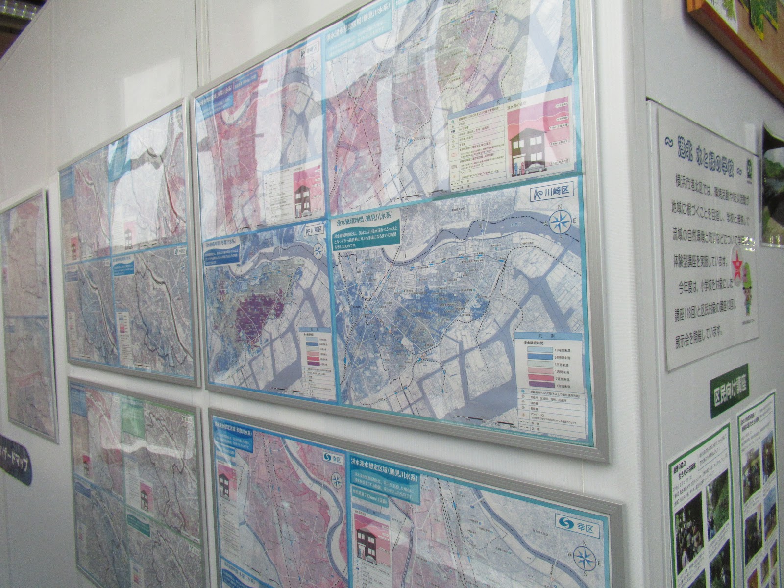 |
| Hazard maps shown for the cities along Tsurumi River. |
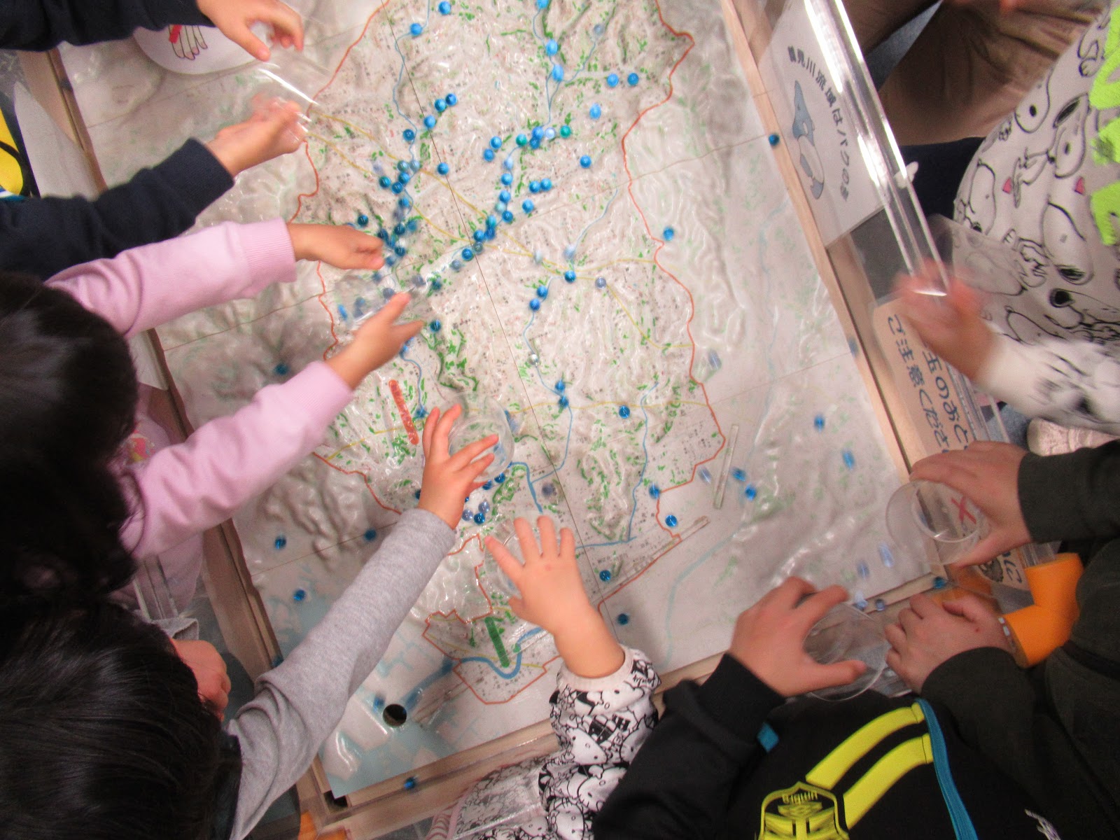 |
| Every Sunday at 13:00,
the Center has a fun event for kids to know how rainwater runs in Tsurumi River Basin, using diorama and marbles. It’s really an eye-opening experiment for adults as well. We can understand why the Sports Park and Nissan Stadium must be in that location to tame the damage of flood on population and industry center of Tokyo Bay. |
And finally, those
are the tree lingo for alert during the emergency. Yap, they are mouthful even
for locals (; they are legal terms, in the end), but it’s not useless to know
the meaning of it.
1.
Hinanjunbi-Koreisha-toh-Hinankaishi
避難準備・高齢者等避難開始 “Be ready to evacuate, and if you’re in a
certain condition, move to the evacuation center.” That is to say, you must be
ready to evacuate if this alert is issued, but do not have to move yet. Though,
if you are handicapped due to physical and /or mental condition, or you’re a senior
citizen, you should move to the evacuation shelter now.
2.
Hinankankoku
避難勧告 “Recommendation to evacuate.” Now is the time
for all of us to move to the evacuation shelter.
3.
Hinanshiji
(Kinkyu) 避難指示(緊急)”Immediate evacuation
order.” People say if the situation reaches to this point, your travel for evacuation
is very likely to be in Hollywood’s action movie. Better avoiding it, and act
while the level is still in Hinankankoku, I suppose.
 |
| My Time Line portal by the Ministry |
Tsurumi River
Watershed Center
Open: 10:00-17:00, Wed-Mon
2081 Kozukue-cho,
Kohoku-ku, Yokohama 222-0036
〒230-0051 神奈川県横浜市港北区2081
Phone: 045-475-1998
FAX: 045-475-1999
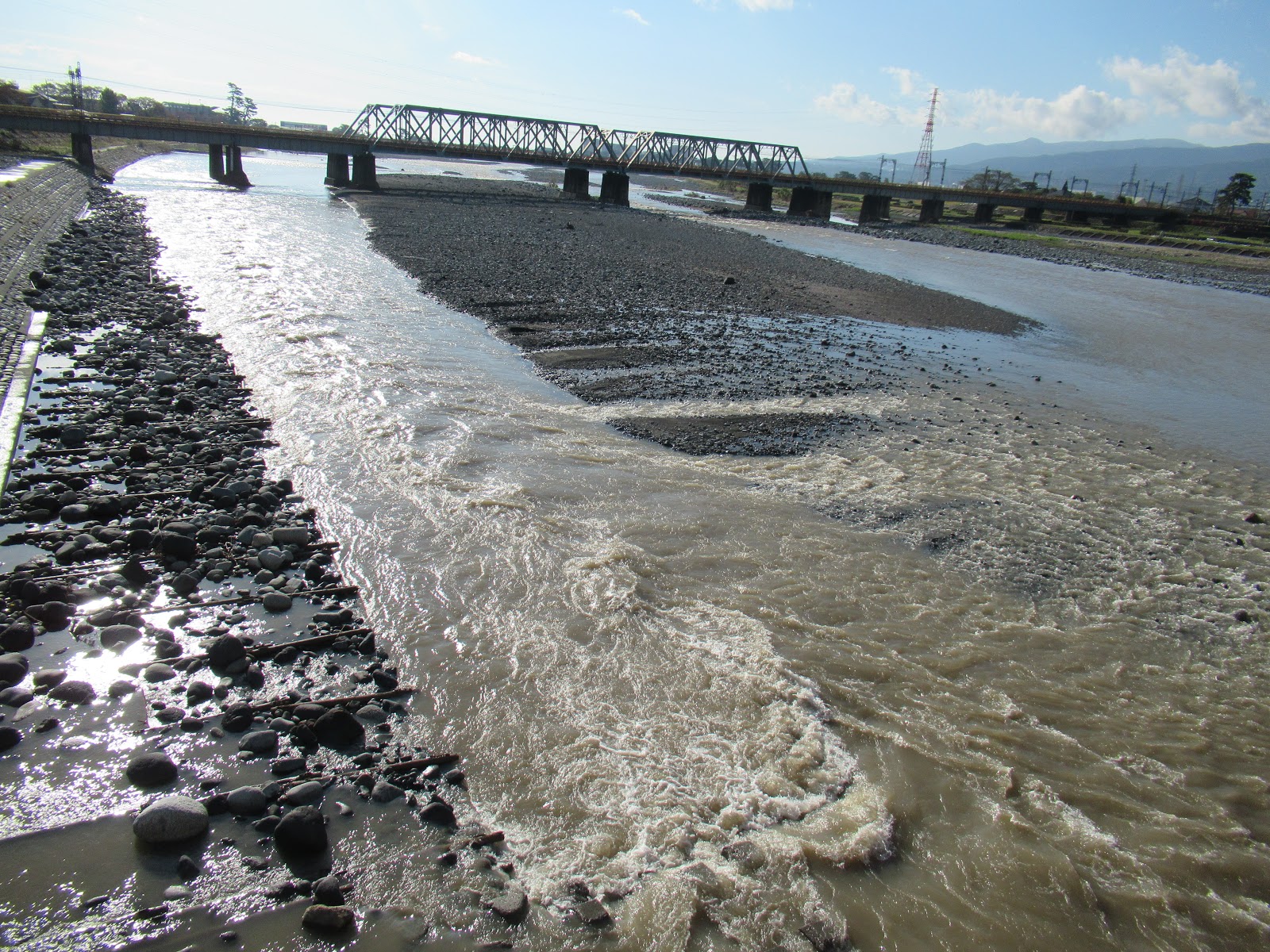
Also, Keihin River
Office of Kanto Development Bureau is asking people to send digital photos of
water disaster from Tsurumi/Tama/Sagami River. The picture will be used for PR
to inform general public about the risk of flood. (Copywrite will be of the Ministry.)
You can send a JPG file to
with you name, contact
address, the place and time you took the photo in your email, titled: Flood
photo of Tsurumi or Tama or Sagami River. If you prefer you can send CD-R or
DVD-R to
Keihin River Office,
Kanto Development Bureau
Ministry of Land,
Infrastructure and Transport of Japan
国土交通省 関東地方整備局 京浜河川事務所
2-18-1 Tsurumi-chuoh,
Tsurumi Ward, Yokohama, 230-0051
〒230-0051 神奈川県横浜市鶴見区鶴見中央2-18-1
Phone: 045-503-4000
No comments:
Post a Comment