Thursday, August 27, 2020

Resilience: Forests in Komayama Park 高麗山


From Shonandaira
湘南平, without using driving road or going back the same route we’ve taken so far, there are two routes to return to the beachside. Two roads divert after we check the highest point of Komayama Park 高麗山公園, Mt. Sengen 浅間山 of ASL 180.9m. So, let’s go to Mt. Sengen first by taking the ridge road to the east. This part of our itinerary could be the most well-prepared route in our adventure of Komayama Park. It is a wide road with several garden trees intentionally planted by humans. Local volunteers take care of such trees, including a row of hydrangea and a field of turf lilies. Also, the place is one of two secretly famous spots for Japanese bird watchers to observe migratory birds commuting between Southeast Asia and Eurasian Continent via Pacific Ocean. For those species spending their summer in Siberia, passing over Komayama Park to the south would be around the second week of September. There are not many obstacles for us on the ridgeway to see the creatures enjoying the final stopover before crossing the Ocean. If you have any chance to come here in September, please try which bird you could find! (Another mecca for Japanese bird watchers is Cape Irago in Aichi Prefecture 愛知県伊良湖崎. The season to go there is also in the second week of September.)


The road is wide.
In winter, the ridgeway of Komayama Park has
 several colonies of daffodils.
 Smells nice!
At the top of Mt. Sengen, in winter.


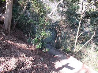
Roughly 300 or so meters after Mt. Sengen to the east, we come across a Y-crossing. One road directly going down is the route bringing us to Komashimizu Bus Stop 高麗清水. From there by Kanchu Bus Hira 33, 35, and 36 services we can return to JR Hiratsuka Station in 20 or so minutes. (Timetable is here.) Although the road is a narrow trekking route, it’s a one-way going down, and physically less demanding compared with another route. We can enjoy this road for its rich forest floor vegetation. If you prefer walking for leisurely nature observation from Shonandaira, I recommend this route.


The Y-crossing to the Bus Stop
Damnacanthus indicus in Komayama Park,
 typical bush tree for warm coast in Japan
Autumn leaves here will be its peak
 in late December.
Komashimizu Bus Stop
 to Hiratsuka Station


Another route from the Y-crossing is visiting Mt. Koma 高麗山, ASL 168m, then goes down to Oiso Town 大磯町 via Takaku-jinja Shrine 高来神社. Whenever you find the name of place “Koma 高麗” in Japan, it is a safe bet it’s a Japanese abbreviation of Goguryeo (高句麗), the ancient Korean Kingdom thrived between the 1st century and 7th century. Why is a Korean name for Japanese places? It’s because the kingdom had several political crises that created many political asylum seekers emigrated to Japan. For Mt. Koma of Oiso, the written historical document recorded such thing happened after Goguryeo was overthrown by Chinese Tang Dynasty in 668. According to Mr. Koichi Nakajima of Kanagawa Natural Environment Conservation Center 神奈川県自然環境保全センター, members of Goguryeo royal family flew from the Korean peninsula and settled here. As we’ve encountered Yokokuji-yato Tunnel Tomb 楊谷寺谷戸横穴群, and in the mythology for Mt. Hakone called Hakoneyama Engui 箱根山縁起 there are mentions about Goguryeo gods living in Oiso, the place may have been known by Korean nobles as some sort of spiritually desirable place … and some 1200 years later, a crown prince of their kingdom made Oiso his home (; my post on August 14, 2020) … The Koreans with advanced technology developed the area with iron manufacturing. It means, the forest of present day Komayama Park had a massive deforestation in the 7th century (; about steel making and deforestation, please see my post on January 15, 2016).


The ridgeway continues to the peak of Mt. Koma.
Before reaching to the top of Mt. Koma,
 we’ll meet this Y-crossing.
 Please cross the wooden bridge.
 For another road going down, I’ll mention it shortly.
To Mt. Koma


Then, in 717 famous monk Gyoki 行基 established Takaku Temple 高麗寺 around Mt. Koma, with Takaku Shrine. The temple grew bigger by the 10th century having tens of wooden temple buildings for hundreds of monks in this tiny area. So, people deforested the area further. From then till Tokugawa Shogunate 徳川幕府 was established in 1600, the area of Komayama Park was destroyed so many times for construction, or for the medieval civil wars. By the early 17th century, it was a bold mountain. Shogunate government decided to be a patron of the big temple-cum-Shintoism shrine, and aggressively afforested the seaside arid hill by black pines (Pinus thunbergii). Thanks to the strict control for forest management by Shogunate, Mr. Nagajima reported the vegetation of the area slowly recovered with pines from Shogun and oaks villagers around the hill planted for harvesting fuel logs. Those are the origin of present-day oaks here. At the time Oiso Town was becoming a celebrity town of the PMs, the forest was still of pines and deciduous broad-leaved oaks with lots of sunshine and humid winds from ocean reached to the forest floor. The place became the property of the prefecture who decided to keep the style of forest management as Shogun did. Though, the big temple at Mt. Koma was abolished and the buildings were destroyed. So, when we walk around the top of Mt. Koma now, we can find large afforested trees of 300-100 years old and a vacant space where once the temple structures stood.


The top of Mt. Koma where
 once the main temple building for Takaku Temple stood.
The steps of the temple remain.
To the Shrine from the remain of the Temple,
 it’s simply going down.


When Japan rushed into the World War II, many of the trees in Komayama Park were chopped as a part of resource mobilization for the total war. Yet, the Shogunate methodology of managing the forest of Komayama Park remained after the war till around the 1960. Then, petrol replaced the logs for energy and the forest was abandoned. Not much care was given. Around this time, massive die down occurred for 300 years old afforested pine trees due to pine wilt nematode. It gave chance for Machilus thunbergii, Castanopsis sieboldii, and Japanese camellia (Camellia japonica) to dominate the area with sasa bamboos covering the floor. The evergreens block the sunshine and sea breeze to penetrate in the forest. Now, remained or forgotten oaks have grown big enough to be a victim of Japanese oak wilt … So, it takes 400 years after the afforestation for the forest to be in the current form. The forest of Komayama Park is of old trees, but it certainly preserves the feeling of “man-made-ness.”


I think the feel here is a bit different from, say,
 the forests in Tanzawa mountains,
 in terms of “wildness.”
Still, it’s impressive forest, don’t you think?
Downtown Oiso is over there.


Although Takaku Temple was demolished, Takaku Shrine survived in the foot of Mt. Koma, which is the goal of our hiking in Komayama Park. The Shrine has two big annual festivals, whose photos and information are available in Oiso Municipal Museum 大磯郷土資料館 we visited. One festival is in summer with boats where fishermen ask good catch and prosperity for the town. Another is in spring for carrying a Mikoshi (portable shrine) from the Shrine to the top of Mt. Koma. From Takaku Shrine to the top of the mountain where once Takaku Temple situated, there are two routes. One is relatively smooth zig-zag trekking road, called On’na-zaka. Another, called Otoko-zaka, is definitely steeper and rocky way sometimes requiring rock-climbing. In spring festival, people carry Mikoshi to the hilltop intentionally using the steeper and more dangerous Otoko-zaka slope. The spring festival was originally for Takaku Temple, not for the Shrine, started in the early 17th century. Now the route proceeds in the dark evergreen broadleaved forest, but for the first 300 years, Mikoshi should have carried in a brightly sun-lit forest of early spring. There must have been some reason people chose that slope …


Do you remember another road
 we met before arriving the top of Mt. Koma?
 It comes down here,
 behind the main building of Takaku Shrine.
Takaku Shrine


From Takaku Shrine, we can return to JR Oiso Station via National Route 1. If you like, please take small detours here and there along the present-day Route 1. Oiso Town preserves ancient Tokaido Street as commuter road for residential area where several 400 years’ old black pines still stand. Considering the damage pine wilt disease did for Komayama Park, it may be miraculous we still see such old pines just outside ordinary residences … The festivals for Takaku Shirine were cancelled this year due to COVID-19, and no one knows if they’ll be held next year. Who knows what the slow destruction of COVID-19 would do for our culture? But, even if a mountain became completely bold, it eventually has some vegetation on it ... I hope in hundreds of years’ time, we’ll have some recovery, just like Komayama Park.


Route #1 running in front of Takaku Shrine.
A detour along Route #1, which was
 once for the Post Town of Oiso for Tokaido
東海道.
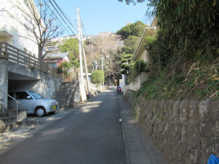
 Now it’s completely a residential area
 with descendants of original black pines.


If you find environmental issues in Kanagawa Prefecture, please make a contact with Kanagawa Natural Environment Conservation Center 神奈川県自然環境保全センター

657 Nanasawa, Atsugi City, 243-0121
〒243-0121 厚木市七沢657
Phone: 046-248-0323

You can send an enquiry to them by clicking the bottom line of their homepage at http://www.pref.kanagawa.jp/div/1644/

Friday, August 21, 2020

Wide View! Hiking to Shonandaira of Komayama Park 高麗山公園湘南平


Downtown of Oiso 大磯町 is elongated along the coast. Thanks to the crash between Philippines and North American plates, the flat downtown has little chance to be wider, but the Oiso Hill 大磯丘陵 immediately behind the coastal area is still growing taller. The hill itself expands to Shinseiko Lake 震生湖 in Hadano City 秦野市, with several hiking courses. The part of Oiso Hill back of downtown Oiso also has popular trekking roads in the forest, which are family friendly. The place has names; Komayama Park 高麗山公園, aka Shonandaira 湘南平, managed jointly by Oiso Town and the City of Hiratsuka 平塚市. This week and next, let’s visit this part of Oiso Town. The place is of natural forest, not the celebrity world of yesteryears, but it certainly has its history.


Actually, when you ask people of Kanagawa who are not so familiar with hiking, they will tell you Shonandaira is a dating spot with an ample parking space. The area called Shonandaira is a part of Komayama Park, with lots of amenities for tourists, including a restaurant, a shop, view spots, parking lots, and a TV tower. When you drive, you ask your car navigation system to Shonandaira, and you’re all set. Or, you take a Kanachu Bus Hira-35 35 service (; time table is here) from Bus Stop #3 in the north exit of JR Hiratsuka Station, and go to the terminal stop, Shonandaira. The bus ride is for about 15 minutes. To walk around Komayama Park, this is the easiest way to enter the park as the rest of your itinerary is almost descending only to the beachside area. But if you prefer more active way of visit, starting from JR Oiso Station would be the easiest in terms of the condition of trekking roads. So, I tell you first how to reach to Shonandaira from Oiso Station on foot. (The map of the park is downloadable from here.)


#3 Bus Stop in front of JR Hiratsuka Station
Shonandaira, the terminal stop
The parking space at Shonandaira


From Oiso Station please take a narrow road along JR Tokaido Line to the direction of Odawara 小田原. In 5 or so minutes, on our left is Oiso Elementary and on our right there is an underpass. Please cross the train track by this tunnel and go straight. In 5 or so more minutes, on our right is Myodaiji Temple 妙大寺 where in its cemetery Dr. Jun Matsumoto 松本順, a person who made Oiso a celebrity town, rests in peace (; please see my post last week). Next to the temple there is an ordinary house which was once a residence of Taka’aki Katoh 加藤高明 (the 24th PM of Japan). Let’s turn right here on this corner of former PM house. Soon the road in the residential area goes up a steep hill that is behind the Oiso Station. This is the beginning of hiking course. We can see almost entire expansion of seaside downtown of Oiso. In few minutes we reach to a small park, or garden, called Takada Park 高田公園 surrounded by ordinary houses. From there, we can enjoy the views of Sagami Bay 相模湾, Mt. Hakone 箱根, and Mt. Fuji 富士山. The place has a public toilet. The next toilet spot is Shonandaira so that you can utilize the chance here!


JR Oiso Station: we go to the left in this photo.
Follow this road along the JR Tokaido Line, then,
Take the tunnel in front of Oiso Elementary.
The other side of the tunnel is like this.
Myodaiji Temple
This is where Dr. Matsumoto was buried.
Please turn right here.
Go straight and along the way …
meet a zig-zagging steep slope climbing up.
Oiso downtown seen from the route
Eventually,
 the road folks into a standard paved way
 and this pedestrian road.
 Pedestrian route is the short-cut,
 and safer without fear of car traffic.
Then,
 in front of us is a park where Tamotsu Takada
高田保,
 who was a famous cultural commentator
 and an Oiso resident around 1950, is buried.
 He loved the view of the ocean from there.


From the north of Takada Park, there is only one road which is first paved for residents along the way, then turns into a trekking road surrounded by forest. It is a ridge way but the most of it is wide enough for 1st graders walking safely. You may find the vegetation here is a bit different from that of, say, inland Hadano City. The area has lots of Machilus thunbergii, Castanopsis sieboldii, and Japanese camellia (Camellia japonica). They are evergreen broadleaved trees that love warm and humid atmosphere of seaside. When I’ve been there in last winter, bright red camellias dotted deep evergreens here and there. That was a fun. Deciduous oaks are minority. They, like jolcham oak (Quercus serrata), are surrounded by the evergreens, and often infected by Japanese oak wilt so that they are under the treatment of “chopping down” by the municipality. The oaks here are famous home for larva of beautiful zephyrus, Favonius orientalis (East Palearctic species of hairstreak butterfly). If there is no oak, what would happen to them here? Oak wilt in Japan was in the end due to human negligence of forest. Sure, they are large in Komayama Park, with the signs of early coppicing. They were once cared for harvesting fuel logs, and abandoned in the 1960s. We must remember this ...


The road from Takada Park is first like this.
 Please keep on going straight.
 The detour could make you commit
 a criminal offence of trespassing into a private property.
The trees here are certainly old …
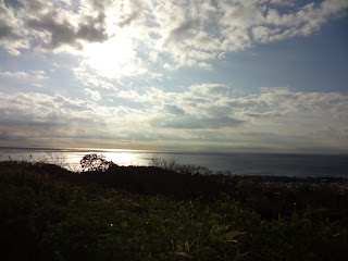
We can enjoy the view of Sagami Bay along the route.
The road finally becomes a trekking road,
 and in last February at the beginning
 there was this notice asking caution for hikers
 as the municipality treat the infected oaks
 by Japanese oak wilt.
The map is shown here.
The ridge way in February
The route has several crossings,
 which become one eventually
 (except for one; please see below).
 So please take whichever way you like.
Poor oaks …
Yes. We’re hiking!
Eventually, a TV Tower is found over there.
 That’s our destination.


In fact, the forest of Komayama Park has been under the heavy influence of human activities for more than a millennium. We’ll see the first evidence of such human activity along the road from Myodaiji Temple. About 1km from Takada park, we meet a signpost showing a detour to “Yokokuji-yato Tunnel Tomb 楊谷寺谷戸横穴群.” Let’s go to see this archeological graveyard. Oiso Town has more than 1000 such ancient tombs build during the 3rd - 6th centuries. The soil of Oiso Hill is not difficult for digging a hole to make a resting place. Yokokuji-yato Tunnel Tomb is one of such places with at least 48 holes made during the 6th century. The place was regarded with some spiritual value, for sure. We’ll see what’s the result of such image for the forest soon, next week.


When I’ve been there last February,
 they were building this brand-new signpost
 to the way to the archeological site.
The way to the Tunnel Tomb is like this,
 surrounded by afforested cedar trees.
It goes down a bit …
To see these Yokokuji-yato Tunnel Tomb.
The excavated grave goods are now stored
 in Oiso Municipal Museum
大磯郷土資料館
 we visited two weeks ago.


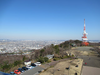
Returning to the original road, a bit of climbing brings us to the main ridge way of Komayama Park. On our left, we can see a TV Tower, a sign we’ve reached Shonandaira. This is the main tower for terrestrial broadcasting to the western part of Kanagawa Prefecture. The lower part of the tower has an observation platform that is accessible by steps. If you like, you will go up and see the Pacific Ocean to the south, Tanzawa mountains 丹沢 to the north, Mt. Hakone and Mt. Fuji to the west, and downtown Yokohama and Tokyo to the east. But without climbing up that high, Shonandaira has lots of view spots to admire this panoramic view of 360°. The night view for Megalopolis Tokyo from Shonandaira is designated by enthusiasts as one of the “Best 100 Night Views in Japan.” No wonder why this is the popular place for lovers to drive. If you prefer having lunch with views during your hiking of Komayama Park, Shonandaira is the place, with lots of tourist’s amenities at hand. Bon appetite!


We’re getting nearer to Shonandaira.
The signposts are located strategically here and there.
 Please don’t worry.
Shonandaira
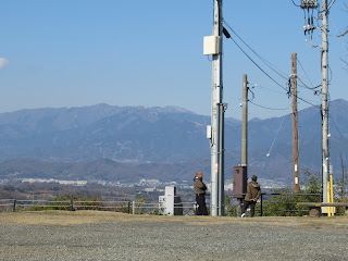
Tanzawa mountains from Shonandaira
Mt Fuji!
A restaurant and a shop are there.
Sagami Bay
To downtown area of Megalopolis Tokyo.
 Hmmmm.
 Yeah, it would be better admiring the view
 during night from here …


Next week, we’ll visit Mt. Koma 高麗山 of ASL 168m. The place is for lots of history. Please stay tuned!


If you find environmental issues in Kanagawa Prefecture, please make a contact with Kanagawa Natural Environment Conservation Center 神奈川県自然環境保全センター

657 Nanasawa, Atsugi City, 243-0121
〒243-0121 厚木市七沢657
Phone: 046-248-0323

You can send an enquiry to them by clicking the bottom line of their homepage at http://www.pref.kanagawa.jp/div/1644/