
First, yeah, you can start this ridge walk from Mt. Takao 高尾山. But, I have to tell you this. If you take Mt. Takao as your starting point, you’ll complete your hike descending from Mt. Jimba 陣馬山. The communities at the foot of Mt. Jimba have quite limited commuter bus service to the nearby train stations (all are for JR Chuo-honsen Line 中央本線). It is quite likely you complete your hike at dusk when you enjoy cherry blossoms. Say, from Wada bus stop 和田 (pls. see my post for Mt. Jimba) to JR Fujino Station 藤野, the last service is at 18:20. If you miss it, you have to either pay for taxi or walk to the station, for about 6km, on a mainly mountainous, street-light-shy winding car road. I don’t think it’s a fun itinerary after 8 hours’ ridge walk. In contrast, from Mt. Takao, although the last cable car departs at 18:00, even if you miss it the road to Takaosanguchi Station 高尾山口 of Keio Line 京王線 is more relaxed well-lit main approach to Yakuoin Temple 薬王院, which is roughly 1 hour walk from the cable car station. Of course, you can choose the short-cut of steep descend for Mt. Takao hiking course without any light. I don’t recommend it unless you’re an expert of the area ... The number of train service from Takaosanguchi to downtown Tokyo is far more than that for JR Fujino. It’s definitely a safer plan to end the hiking at Mt. Takao Ridge Way … Mmmmmmmmm … hotel-wise, if you don’t mind using taxi (with cost for about 100 USD or more), it may not be much different ending the hike at Mt. Takao or Mt. Jimba … There are lots of resort hotels around Lake Sagami 相模湖. Takaosanguchi Station has two hotels within 5 minutes walking distance. Hotels near Mt. Jimba has free pick up service from Fujino Station, RSVP of course. If you plan to spend 2 or more days in this area and you’re confident enough for your stamina to reach to a train station before sun set, ending your hike at Mt. Jimba could be an option, I guess. In any case, I tell you my adventure starting from Mt. Jimba side.
The beginning of today is from Takao Station either for JR or Keio Line. Please leave the station from the North Exit and find the Bus Stop #1 for Nishi-tokyo Bus 西東京バス. Ride a service to Jimbakogen-shita 陣馬高原下 to the terminal stop, Jimbakogen-shita (; time table is here). It’s about 40 minutes ride to ASL 300m. From there proceed along the road to the west. If you’re in doubt, find a sign around the bus stop saying “Mt. Jimba, this way.” There is a similar kind of road near the bus stop to the south along Okinatsurushi Stream オキナツルシ沢. If you take this road, you will go straight to Sokozawa Pass 底沢峠, economizing 30 minutes or so of your itinerary … but it’s a pity to take such short cut for this trekking fun, I think. Anyway, the paved road to the west is an old road called Jimba-kaido Avenue 陣馬街道 going around Mt. Jimba to Wada 和田 community we’ve visited before. As such, there are some car traffic, but it is a quiet forestry road. Actually, I liked a lot this road along Ange River 案下川, because it’s a wonderful humid way full of many kinds of moss, including several endangered ones! If you’re interested in these species, you can spend your whole day without climbing up to the ridge, I bet. About 20 minutes or so of walk from the bus stop, we’ll find a signpost telling us this is an entrance to the hiking road to Mt. Jimba.
 |
| Takao Station, North Exit |
 |
| I tell
you even it’s a weekday morning, the cue waiting for the bus to Takao Ridge Way can be LONG. |
 |
| Jimbakogen-shita, the terminal stop |
 |
| To Mt. Jimba, please go to the direction of a cherry tree. |
 |
| In
today’s itinerary, we also meet lots of wild azaleas. This is Rhododendron dilatatum, endemic species of Japan, which flowers before their leaves come out just like cherry blossoms. These days, they are suffering theft. Please protect them if you find their flowers. |
 |
| I think it is Brotherella henonii … |
The climb from this starting point to Mt. Jimba is the steepest ascend for today. The entrance to the trail is about ASL 540m, and Mt. Jimba is ASL 855m. The estimated time for standard hiker to reach to Mt. Jimba is within 1 hour. Gaining 300m in one hour … You’ve got an idea, hah? Please endure here: the rest of today’s itinerary is not this much tough. You can spend your time at the top of Mt. Jimba for toilet and morning snacks, but this is just the beginning of a long trail. Staying here not long may be a wiser move. Follow the sign telling us “Myo-oh Pass 明王峠, this way.” It’s the direction for the ridge way of Mt. Takao. Once you enter this route, it’s almost one way running along the prefectural border between Tokyo and Kanagawa. Simply keep on going the ridge. After 1 hour or so from Mt. Jimba, we reach to Myo-oh Pass.
 |
| The entrance to the trail to Mt. Jimba |
 |
| The beginning is relatively flat … |
 |
| The road then climbs up for about an hour … |
 |
| White paint and ropes indicate the route. |
 |
| Nearly, to Mt. Jimba |
 |
| The road coming down from the top of Mt. Jimba |
 |
| When
we are from the peak, there are lots of signpost like this showing the way to Myo-oh Pass. |
 |
| Here! Cherry blossoms! |
 |
| The
hiking road of the ridge is like this: wide and well-maintained. |
 |
| Myo-oh Pass |
The ridge way is really a well-maintained trekking route. Also, even during weekdays, you’ll find yourself with lots of companies. In this regard, this is a safe hiking course. The road goes with slight ups and downs in afforested conifers and broadleaved deciduous trees. Although today’s main attraction is cherry blossoms, you’ll be greeted by several kinds of spring wildflowers. For example, the area of Mt. Takao is famous for many kinds of violets. Please do not deviate from the hiking course. Those pretty violets can be stumped down easily by us without notice. + They are vulnerable for theft. Let’s protect rich biodiversity here … From Myo-oh Pass to Mt. Dodokoro 堂所山 ASL 731m, it’s about half an hour walk via Sokozawa Pass 底沢峠. There is a small detour around the peak of Mt. Dodokoro for proceeding the ridge way. Either you check the peak (but there is not much to see there), or go ahead straightforwardly the ridge, please follow the sign directing to Mt. Kagenobu 景信山.
 |
| This is a very well-behaved Viola grypoceras. |
 |
Sokozawa Pass. Please go to the direction of Mt. Kagenobu |
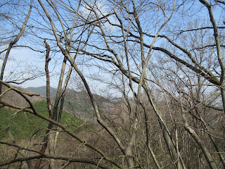
When we approach to the peak of Mt. Kagenobu ASL 727.3m, we started to see pink smokes within trees here and there along the ridge and beyond. They are Cerasusu jamasakura, the endemic wild cherry trees of Japan, and THE grandma of Japanese cultivated cherries. Although cherry trees in Ueno 上野 or Meguro River 目黒川 have less than 100 years of lifespan, these wild cherries in Takao can be hundreds of years old. Real grandmas. They are tall and big. And so, we can admire them from afar. On the ridge way, I recalled somebody’s advice: “Naomi, if you want to enjoy cherry blossoms, don’t go near a tree. View the entire slope of a hill. That’s the proper way of doing cherry blossoms party.” Yeah, we can enjoy such fun on this ridge way. Soon, we reach to the peak of Mt. Kagenobu. Next week, I tell you my adventure with more cherry blossoms. Please stay tuned!
 |
| High
above us is pink clouds of cherry blossoms … I think I was late last year. Probably just few days earlier, they were more splendid … |
 |
| Before
the peak of Mt. Kagenobu, there also is a large bush of Lidera praecox with pretty yellow flowers. |
 |
| This is Potentilla freyniana. |
 |
| Viola phalacrocarpa |
The contact address for the office in charge of Meiji Forest Takao Quasi-national Park 明治の森高尾国定公園 is
Bureau of Environment, Tokyo Metropolitan Government 東京都環境局
2-8-1 Nishi-Shinjuku, Shinjuku-ku, Tokyo, 163-8001
Phone: 03-5388-3539,
FAX: 03-5388-1379
S0000618@section.metro.tokyo.jp
No comments:
Post a Comment