One hundred years ago, September 1, 1923, at 11:58, Magnitude 7.9 earthquake occurred off the coast of Kanagawa Prefecture. The calamity is well-known as roughly 100 thousand Tokyoites died due to the mega-fire caused by the collapsed wood houses. The downtowners were busy preparing for lunch with cooking stoves. … Er, exactly speaking, the epicenter of the Great Kanto Earthquake 関東大震災 was along Sagami Trough which runs from the point where Hakone mountains 箱根 falling off to Sagami Bay 相模湾 to off-Bosoh Peninsula 房総半島. The megathrust has 340km long where Philippines Plate crawls in the bottom of Eurasian Plate. The line is (at least for human time scale) stable and causes Magnitude 8-class earthquakes once in 180-590 years ... In any case, compared with the effect for Tokyo, the number of victims directly by the Earthquake was larger in Kanagawa Prefecture. Our area was situated almost “on” the epicenter. Yokohama where lots of expats built brick houses turned into a field of rubble. Our ancestors rebuilt the city and used the tons of debris to reclaim the destroyed port and shore which is now Yamashita Park 山下公園 where lots of tourists stroll to enjoy the view of Tokyo Bay.
 |
| Basically, this part of the Port of Yokohama is made of rubble. |
Western Kanagawa was affected more seriously. Reason? Just check the map how the Trough runs in the above linked websites ... The water source area of Nakamura River 中村川 which pours into Sagami Bay in Ninomiya Town 二宮 (eastern neighbor of Odawara City 小田原市) was completely collapsed. The landslide from a hill of the area dammed the flow and created Shinseiko Lake 震生湖 (; my post on November 15, 2019). At least two school kids were buried deep down the crumbled earth. There were once lively communities along Nishiyama Forestry Road 西山林道 up to near Black Dragon Water Fall 黒竜の滝 at the end (; my post on November 17, 2017). They were all engulfed by avalanches of earth and rocks caused by the Earthquake, the before and the after torrential rains + aftershocks. Another river named Shiraito River 白糸川 also became a corridor of debris flow that washed away Nebukawa Station 根府川駅 of Tokaido Line 東海道本線 together with a train going to the west and happened to entering the station at 12:02. 289 Nebukawa villagers and 131passengers and staff of the steam engine were killed … Such stories are ubiquitous in Kanagawa Prefecture.
 |
| Shinseiko Lake. It’s made by the Great Kanto
Earthquake. Last year, it was registered as a National Disaster Ruins to be preserved. |
 |
| Nishiyama Forestry Road runs along Kuzuha River 葛葉川 (my post on May 26, 2023), and this river became a course for debris avalanche 100 years ago. |
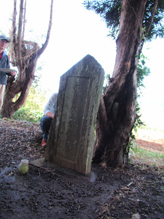
After March 11, 2011, the Great East Japan Earthquake, we Japanese noticed there were lots of old stone monuments on hills along the coast affected by the Tohoku Tsunami. They all say “At the time of year xyz earthquake, tsunami did not reach here and the villagers evacuated up to this point survived.” Sure enough, those who reached the monuments were able to escape from the 2011 Deluge. Now the communities, municipalities, and the national government are busy making a national database recording the address of these steles. Some of them record the survival of evacuees from Tsunami. The other is recording the casualties of a natural disaster and the subsequent recovery of the town. This type of stela can often be found in downtowns of cities of Japan. And the other are mourning the dead buried deep down the earth due to the debris avalanche. The stone monument at the entrance of Shinseiko Lake is one of these. One variant of the third type is found in Sagamihara City 相模原市.
 |
| The monument at the entrance of Shinsaiko Lake |
The variant? Yep. After the Great Kanto Earthquake, the community renamed the place for the monument Jishin Toge 地震峠, aka Earthquake Pass where casualties could be buried deep down. According to a panel built last year by the City next to the monument, this is the place where the debris of one entire hill buried the flow of Kushikawa River 串川, a tributary of Sagami River 相模川, and changed the course of the river. In the process, 9 houses were destroyed and 16 people dead, among whom found by the rescue clue was only 8. A family of 6 was annihilated and missing. This shocking incident was commemorated by the name of the place, Earthquake Pass, and 3 monuments. If you have any chance to go to Miyagase Lake 宮ケ瀬湖 from the downtown Sagamihara City, please drop by and visit the place. It’s along Prefectural Road 513 going to Toriihara Park 鳥居原ふれあいの館 on the Lake. The nearest commuter bus stop of Kanachu Bus is Maishibashi 馬石橋 for Hashi-07 service (; timetable from Hashimoto Station 橋本駅 is here). The kids of Tsukui High 県立津久井高校 are studying the place and send messages in manga from what they’ve learned. Yeah. Memories of this must be transmitted to the next generation … The next one will surely come. Will it be in 2103, or sooner or later?
 |
| 3 monuments at Jishin Toge. Among the missing were several kids. The central Buddhist statue is Ksitigarbha who is the guardian of kids. |
 |
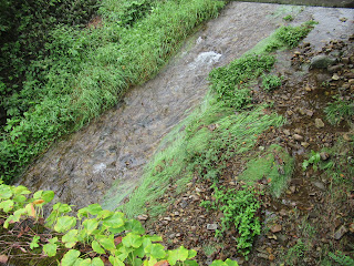
| Kushi River is not large. It’s like a trickle these days, especially for your eyes from the continents … |
 |
| Oh, one tourism info. The Earthquake Pass is on the cycling road which is a course for Tour of Japan race. So, many cyclists use this road, and these days the stores and cafes for tourists equip such parking facilities for the visitors. A part of the course for the Tour of Japan is exactly the same for the course of 2020 Tokyo Olympics Game. |
My next post is about 2023 Forest Lab Art Exhibition. Its opening is on September 17, the day after tomorrow. 😊
657 Nanasawa, Atsugi City, 243-0121
〒243-0121 厚木市七沢657
Phone: 046-248-0323
You can send an enquiry to them by clicking the bottom line of their homepage at http://www.pref.kanagawa.jp/div/1644/


No comments:
Post a Comment