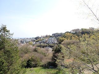
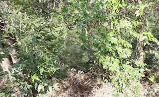
Sunday, June 15, 2025

What’s in a Name? Odawara Sogamae to defend Odawara Castle, V 小田原総構


The passage we’ve been through now was named (remember?) Komine-Okanenodai-O’horikiri-Higashibori 小峯御鐘ノ台大堀切東堀. “Komine-Okanenodai” is name of a hill, ASL 123.8m, directly continues from Hakone Mountains and ends more or less at the place where the Castle Tower stands now. “O’horikiri” means the “grand mort and wall system.” i.e. Komine-Okanenodai-O’horikiri was one of the most important defense lines for the Castle which was expected to fend off the advancement of enemies from the west. The last word, “Higashibori” means “East Mort.” This O’horikiri mort and wall system had three parts. One is the East Mort, and the others are Nakabori 中堀 = the Central Mort and Nishibori 西堀 = the West Mort. Actually, the present-day Castle Tower was defined as such in the 17th century, after the original builder of Odawara Castle and Sogame defense lines, (Go-)Hojoh Clan 後北条, was annihilated in 1590 by Toyotomi Hideyoshi 豊臣秀吉. The original was, needless to say, demolished completely by the winner and we can excavate the remnants in and around Sogame defense line. Such archeological research tells us the central part of Odawara Castle was developed in and around now-the campus of Odawara Highschool. The point we turned right after walking Higashibori was more or less the edge of the Third (= the outermost) Bailey of the original castle. With this finding, the archeologists for Odawara Castle concluded Higashibori was originally constructed to protect the Third Bailey. Then as they fortified the defense line, the other two parts, Nakabori and Nishibori, were built. These three morts configure as a team Odawara Sogamae defense line.

Higashibori.
Hmmmm … the entire scenery here looks warped …

From the T-crossing, we proceed the paved road to the north-east, where on our left is another steep slope with occasional terraces, and our right is peaceful rural scenery. The right side was where the original Odawara Castle building complex spread out towards the sea, so the name of township Shiroyama 城山 = Castle Hill. We soon meet with an entrance of Nishibori. A gigantic rock which is a remnant of defending wall was abandoned in a middle of small field on our left with exhibition panel provided by the City of Odawara. Our route on the paved road becomes more and more peaceful strolling path. The main field of Odawara Boy Scout Troop 2 comes in our view of the right. I noticed the naming of the place after entering this paved route becomes sporadic at best. The paved route runs through a wide ridge of a hill, which was probably constructed as such 500 years ago. The edge of a ridge is unnaturally piled up ground, afforested by taller cedars on the top. Then the inside near the road has lots of azaleas, cherries, et al of beautiful flowering trees. Though now we cannot call the land design “garden forest,” the feel of the area is definitely man-made.

Entrance to Nishibori.
The remnants here are not much as Higashibori.

On our right is where
the original Odawara Castle Complex was.

Former Odawara Castle is, now,

Summer grasses—
All that remains
Of warriors' dreams

Basho 芭蕉

(Haiku translation thanks to Chat GPT.)

We walked our route instructed by a well-learned guide for Sogame, and he said “Scholars could not find the name of this section. We simply call the place ‘greenery.’” The ridge here now faces to Ashigara Pass 足柄峠 direction from the foothills of Mt. Fuji. When Hojo Clan assumed another warlord of Takeda Clan 武田氏 in Kofu 甲府 coming in, I guess this was the place to be fortified. Before Toyotomi Hideyoshi, Takeda Clan was THE enemy #1 for Odawara’s Hojo for about a century … (; my post on July 28, 2017). No name here? … Perhaps, the place was one of the top-secret area. Maybe only those in-the-know understood the structure and everything of this point. Even the name of the place was secret …

Have you noticed this farmland sloping down to us,
and the end of it has
suspiciously intentional planting by somebody.
This place has no name.

It’s another remnant of mort and wall system,
called Yamanokami Horikiri.
Sogame structure has such smaller defense constructions
 in addition to the 3 main morts and walls.

On our left is another precipitous slope with terraces.
Natural mort and wall system modified by humans,
that was.

And over there to the direction of sea
begins with housings …

Such a mysterious forest soon becomes another ordinary suburbia of rows of houses. We leisurely go down to the crossing of Shiroyama Traffic Light 城山交差点. From there, we proceed to the Castle Tower which we can see over there. It’s about rapid descending of 15 or so minutes from the crossing to the wide overpass to JR Tokaido Line. When we stand at the Aohashi Traffic Light Crossing 青橋交差点 just before entering the Castle Park, please turn your head opposite the Castle Tower. We can see a small forest and rows of houses. This was the place where the main structure of the old Odawara Castle stood. I imagine the entire hill (and the place we stand now on the flyover above the railway system) was once a deep “strategically maintained” forest. Castle structures must have poked their roof out of forest canopy … Now it is houses of ordinary people, with a little bit of green. It should be a good thing we don’t have to think about defense matters, and can bulldoze forest freely for housing development …

We returned for a walk in a suburbia.

Shiroyama Crossing

Castle Tower is over there.

The opposite side of the Castle Tower …
too ordinary scenery now.

The current historical buildings of Odawara Castle was formulated in the 17th century when Tokugawa Shogunate started governing Japan. When Tokugawa Ieyasu entered Edo, aka Tokyo, after the demise of Hojo Clan in 1590, he was given a role to oversee the entire Kanto Region from Hideyoshi, then a far far far away rural place from the eyes of Kyoto and Osaka people. Ieyasu brought his loyal subordinate clan, Okubo Clan, from Nagoya to look after the former territory of Odawara Castle. During the 17th century, several court politics surrounded the occupiers of Odawara Castle. It made the governor of the place change several times. Okubo Clan finally returned to Odawara in 1686. The family governed the area until the Tokugawa Shogunate collapsed and the new Meiji Government introduced the current prefectural system in 1871. Daikyuji Temple 大久寺 we passed at the beginning of today’s walk is the family temple of Okubo Clan. The reason why the inhabitants of Odawara Castle got caught up in palace politics in Tokyo was its location of strategic importance. Odawara sits at the foot of Hakone Mountains and next to the foothill of Mt. Fuji. If an enemy force came up from the west to Edo, Odawara could be the last large defense line. So, the Shogunate Government appointed the family of Councilor class for Shogunate Government to administer the area. As it sits in the area for the epicenters of earthquakes and an eruption of Mt. Fuji, Odawara Castle Tower (of Tokugawa Era) was destroyed twice, 1703 and 1782, by natural disasters. Every time, Shogunate government did not spare a dime to rebuild it. This was the only castle tower in Japan with such privilege. Even the tower of Edo Castle was not rebuilt after it suffered the great Edo Fire of 1657.

Odawara Castle Tower

At the time when Aril 1868 Shogunate surrendered to Meiji Government, Odawara did nothing to stop the advancement of new forces from the west. That certainly made the job far easier for the new comer ... And it may tell something not only about the military importance of Odawara. When new Meiji Government introduced prefectural system in Japan, the role of any castle in Japan was ended, except for Edo Castle as a new residence for the Emperor, i.e. the Imperial Palace now. The Odawara Castle was first directly owned by Meiji Government. They destroyed in 1870 the castle tower which did not have any modern use for warfare but ate tons of money for maintenance. The former resident of Odawara Castle, now Viscount Okubo, was allowed to buy up the land for his former castle in 1890. Alas, he was not so rich anymore, and sold off his property to anybody with money. Among them was PM Yamagata (; my post on June 1, 2025). Forests were gone.

Inside the Castle Park contains a playpark for kids.

BUT. In 1960, people rebuilt the Castle Tower as it was remembered in Edo era for “treasuring history.” The place became one of the tourists’ attractions for Kanagawa Prefecture, but somehow overlooked. Once, I heard murmurs of people for the townhall of Odawara, like, “If they have time to stop by Odawara, they came to the Castle by taxi, visit there about an hour, and gone to Hakone.” In 2021, the people and the City of Odawara “renovated” Odawara Castle, because “The 1960 seismic resistance requirements are inadequate.” The result is this beautiful Odawara Castle we can visit today. The point is, the inside of the castle was NOT a replica of Tokugawa Era. People excavated records of Sogame Era castle, and reproduced the defense system of 500 years ago (sans lethal parts). To be sure, the crest of Odawara Castle (and the City of Odawara) is not of Okubo Clan, or of Tokugawa for that matter. It’s Tri-Scale 三つ鱗 of Hojo Clan, the family perished 500 years ago. People of Odawara remember them proudly with Sogame Forests of defense systems. Now cherry blossoms of Odawara Castle are called one of the 100 best cherry blossoms in Japan. May peace on earth.

The crest for Odawara Castle, and Hojo Clan


Everybody loves cherry blossoms.

For enquires about sightseeing in Odawara City,

General Incorporated Association, Odawara Tourism
一般社団法人 小田原市観光協会

250-0042 350-1, Hagikubo, Odawara City
〒250-0042 小田原市荻窪350番地の1 小田原合同庁舎内2階

TEL:0465-20-4192 
FAX:0465-20-4194

Sunday, June 8, 2025

Not many ghosts here: O’horikiri for Odawara Sogamae to defend Odawara Castle, IV 小田原総構大堀切


After entering the commuter road next to Shinkansen Railway, you may have noticed we’ve gone up all the way. It continues. We walk the ridge in the housing area where the roofs of houses on our left becoming one step down from the road. We are walking the top of a “wall,” and the place where the houses stand now is “mort.” Over there to the west, we can see Hakone outer rim spreading and ending into Sagami Bay. The nearest hill / mountain in our view is where Toyotomi Hideyoshi situated his troop headquarters, and finally in 1590 pried open Odawara Sogamae Fortress without destroying it (; my posts on December 6 and 13, 2019). i.e. We’re now walking the real frontline for Sogamae. At that time, the place must have been heavily guarded and covered by dense forests, which protected the movement of Odawara side … now it is a wide-open suburbia where we can see the place for the supreme commander of the enemy force. May peace on earth …

Roofs below us

The entire hill over there was
the HDQ of Toyotomi Hideyoshi.
We can observe fairly clearly from here.

As we’re approaching the end of the ridge way of a suburban scenery, real forests are appearing in front of us. The ridge road meets with a T-crossing with a bus stop Shiroyama 4-chome. On our right is the campus for Soyo High School, and in front of us is a forest which is the beginning of Shiroyama Park. For today’s itinerary, toilets are not so ubiquitous, but here a couple of minutes’ walk downward along the bus road, we can find the ones next to tennis courts. Please utilize the chance wisely. Also, the T-crossing point has a lawn field and a nice view to Hakone Mountains. For your tea or lunch, it’s a good place to spread your blanket.

Another T-crossing.
For toilets next to the tennis courts, please turn right here.

The point has
Guideposts to walk Sogamae remains.

A view of Sagami Bay
when we had lunch on the lawn at the T-crossing.

We cross the paved bus route and find a trekking road into the forest. This is a beginning of historical artifacts, the real remnants of wall and mort system of Odawara Sogamae, named Komine-Okanenodai-O’horikiri-Higashibori (phew!) 小峯御鐘ノ台大堀切東堀. Geographically, this defense system cut the ridge of Hachimanyama Hill 八幡山 that ends up at the central part of the Odawara Castle to the south, and the main mountain mass of Hakone mountains to the north. i.e. This is one of the crucial defense facilities, protecting the western part of the Castle complex. The design of Odawara Sogamae is a combo of (often) dry mort and steep mold acted as a wall. Here the hiking road for us has buried mort below our feet. For our eyes, it looks like a small dry valley, and we feel we walk at the bottom of it. On average this route had morts of 25-30m in width. Both sides of us are steep slopes on which even weeds have hard time invading. Those surviving greens on the slope cling to a wall-like soil. 600 years ago, the average gradient of the slope was 50-60°, and the height was 12-15m. The size of the system is the largest as the remaining mort and wall system of this kind in Japan. At the top of the slope are forests consisting of broadleaved trees. They are NOT neatly lined-up cedars. i.e. The randomness of vegetation pattern must have impeded invaders to work out their way …

The beginning of mort and wall system

No weed on the slope.

Actually, we’ve already visited a similar design of “forest” in Yokohama. Kozukue Citizen F.orest 小机市民の森 (; my post on July 3, 2015) was an archeological site for a branch castle of Odawara where subordinates of Odawara’s warlord protected the eastern border of Odawara domain. Inevitably, the plan of defense system was the same as its HDQ. The difference was its size. Now Odawara Sogamae structure is widely destroyed by housing and modern railway and road systems. We cannot feel the scale difference in mort and wall structure between Kozukue and Odawara. When the structure was really working, it surrounded 6 townships of Odawara City, approximately 9km in diameter. In comparison, Kozukue Castle is just a part of one township, Kozukue. The idea was, the fortress used steep natural hill covered by eye blocking forest when it is available. Otherwise, they dug the mort, piled up high the dirt from the digging and pounded the artificial mound firmly to be a wall. They constructed such structures multifold. The area became a maze for intruders. When it rains or after a rainy day, the dry mort becomes wet mort, and a wall-like slope of artificial hill denied easy escape from maze. When it was a working-defense system, the mort was not so straight as we stroll now, but many cranking, called Yoko-ya Ore 横矢折れ, meaning “attacks of arrow cannot reach the target due to the sudden wall ahead,” was prepared. When a heavily armed enemy force invaded, their advancement was thwarted by the design of landscaping. Of course, the Odawara side located many traps and attack facilities from the top of the artificial hill to destroy the enemy from above. I imagine breaking this fortress from the ground alone would be difficult even today. To begin with, what kind of tank can climb up to this point from Route 1 swiftly?

600 years later, the mort looks like a nice strolling path,
but the gradient of trees on the slope tells something.

The top of the “wall” is high …
Could you feel desperation
if an enemy force with heavy armory enters here?

But it is really a nice path now in the 21st century.

The City of Odawara prepares for visitors a site to experience virtual reality
when the system operated 600 years ago.
Please read QR code here, free of charge.

Surprising thing is, such an elaborate structure was built completely manually and expanded in just a couple of days if necessary. Ah-ha. That’s why there are lots of large sanctuaries around the Sogamae … Once crisis occurred, warlords mobilized town and village people. Large number of them were garrisoned in these temples and shrines to build the Sogamae perfect … Now all the remnants of war zone are peaceful strolling path in a forest where locals enjoy walk with their poochs. It’s a nice relaxing stroll in a forest … For Odawra’s Sogamae, there was no real final battle that could have made blood baths of mort. Probably, the lost souls of soldiers do not stay much here, and so the atmosphere is peaceful now. We only feel the seriousness of the former keeper of the forest for survival … The promenade of the mort and wall system is ended by another T-crossing with a paved road whose size is definitely smaller than the one for commuter bus route we departed. The paved way runs on another ridge whose north side is another precipitous cliff. The direction to the south is the Castle Tower. i.e., Again the Sogamae System is using the natural geography as mort-and-wall system. Let’s turn right here at the T-crossing. The relaxing semi-forest walk continues. For the continuation, please come next week again. There is a possible “intelligence” matter ahead of us.

We’ve reached another T-crossing.

The northern part of the paved road,
on our right in this photo, is almost a cliff.

Though they are not the same vegetation
as those in the 16th century,
the look of the “wall” of this part must have been
 more or less the same.

For enquires about sightseeing in Odawara City,

General Incorporated Association, Odawara Tourism
一般社団法人 小田原市観光協会

250-0042 350-1, Hagikubo, Odawara City
〒250-0042 小田原市荻窪350番地の1 小田原合同庁舎内2階

TEL:0465-20-4192 
FAX:0465-20-4194

Sunday, June 1, 2025

In search of lost forest: to defend Odawara Castle III


When I’ve been there, it was cherry blossoms’ time …

So, now we’ve returned Itabashi-mitsuke 板橋見付 traffic light from Odawara Castle Hayakawaguchi Park 小田原城早川口. “Mitsuke” is an old Japanese which meant the gate for a citadel. It was the west end of Odawara Sogamae 小田原総構え defense system. The mort and wall system spreading north-south crossed here with Tokaido 東海道, aka Route 1, running east-west. Standing at the crossing, the direction to JR Odawara Station is inside the citadel. The opposite direction of Route 1 to Hakone Mountains is outside. Till about 150 years ago, feudal lords of Odawara Castle had the observation post inside and outside of the gate for his subordinates to station 24/7. The office had well-staffed armouries preparing for the battle. Immediately inside the gate along Tokaido were rows of attached houses to the families of infantry of firearms. Their mission was to be the frontline immediately after the advancement of enemy forces to the citadel. The area around Itabashi-mitsuke also have large sanctuaries of Buddhist temples and Shintoism shrine. Immediately inside the mort system there are Igami Shrine 居神神社, Daikyuji Temple 大久寺, Koenji Temple 光円寺, Denjoji Temple 伝肇寺, and Gyokudenji Temple 玉伝寺. Outside of the gate are Hon’noji Temple 本応寺, Shofukuji Temple 生福寺, and Kotokuji Temple 興徳寺, etc. In the 21st century, they have sleepy open spaces surrounded by small forest and equip graveyards and playgrounds for pre-school babies. But before, they were allocated the role as garrisons for infantrymen called for duty from their neighboring villages … The sanctuaries inside the citadel have stories connected to the lords of the castle and the other yesteryear celebrities of Japanese history. They are now mentioned by Odawara’s tourists’ guide. If you’re interested in Japanese history to this level, they could be an interesting destination, I guess. But today, we stick to FORESTS!

Daikyuji Temple

Koenji Temple

Standing again at Itabashi-mitsuke crossing in front of the public toilet, please turn your back on Route 1. Could you see a not-so-wide community road in front of you cranking to the left? It’s the original Tokaido, Route 1. Do you notice we cannot see what’s there after the road winding? The design of the road is deliberate. It prohibits visitors from the west observing the situation inside the Gate. The mort-and-wall system was “constructed” from here to Hakone direction along Tokaido … er if you’re imagining Odawara’s old wall system looked like that for Avila or Samarkand, you’ve missed the point. Japanese citadel design fully utilizing geography and vegetation of that particular area. Odawara Sogamae was the role model.

Entering old Tokaido from Itabashi-mitsuke.
In this photo,
we even could not recognize the road is turning left.

When we walk the old Tokaido from Itabashi-mitsuke to Hakone direction, we are simply strolling peaceful housing area with occasional entrances for sanctuaries. But until recently the area was mansions district. The start was Yamagata Aritomo (1838-1922), the third and the ninth Prime Minister of Japan. In his very old age when he was still busy navigating Japanese politics, his health was deteriorating rapidly. He (and his family maybe) thought calm winds from Hakone Mountains and Sagami Bay would do nice for his body. He bought large acreage of farmlands to build a mansion on the slope of a hill spreading along Tokaido, near Hakone Itabashi Station. He died there in 1922. When Duke Yamagata moved his residence from Tokyo to Hakone Itabashi, many rich celebrities also bought lands, built manors and had their life of Japanese high society there. After 1945 this kind of privileged world ended, but the erection of mansions was simply taken over by the construction of houses for commoners, which created the current scenery there. The point is about the farmlands before PM Yamagata came. As now the old Tokaido runs in the private housing area, it’s a bit difficult to see the geography ... Please poke in the branch roads to the north from the Old Route. We can notice the roads have steep inclination. This is what the feudal lords wanted for their defense system. Before PM Yamagata, the area was farmland surrounded by forests and temples, cultivated on a very sharp slope. The arrangement of farmlands and forests prohibited a large troop from climbing up the hill at once. And the level of precipitation was not a laughing matter. Let‘s experience it.

The old Tokaido, 2025

A branch road goes up.

We enter Old Tokaido from Itabashi-mitsuke, follow the cranking, and go under the railway bridge of Tokaido Shinkansen. Immediately after the bridge, there is a commuter road climbing up along the railway. Let’s take this route. Soon the road is for pedestrians’ only with steps. Beyond the Shinkansen railway on our right, we can see another hill covered by a forest which is the sanctuary of Igami Shrine. When people constructed Shinkansen railway, they bulldozed a part of the forest and the hill continued from the sanctuary. The steps we take here are remnants of a forest road before-Shinkansen. The left of our steps is a sanctuary of Hon’noji Temple whose graveyards are situated on a terrace like spaces built on the slope. Imagine you’re a part of troops of intruders proceeding up this steep slope wearing heavy armory. You finish one task of going up to terrace-like structure. The end of a terrace was always another petit cliff to clamber. You repeat this exercise until the ridge. And the terrace was in a forest which obstructed the climbers’ sight. Finally, at the ridge you might think your travail to reach the main part of the castle was over. Fat chance.

Shinkansen track is fenced along the commuter road.

And the road climbs up …
A graveyard along the commuter road.
Could you notice a small cliff?

When the steep pedestrian road arrives at the top of the hill, we meet with a commuter road running through residential area. Please turn left. This direction goes the top of the outermost “wall“ for Odawara Sogamae defense system. We can immediately notice the route is still going up. Administerially speaking, on our right is Shiroyama township 城山, and on our left is Itabashi township 板橋. Itabashi side is a cliff where we can see between houses the panorama of Hakone Mountains. And these houses are built on terrace like terrain porched on the steep slope. Before it became the rows of houses, this slope was covered by forest hiding this ridgeway from the sight of visitors climbing the hill straight from Tokaido. I mentally imagine how it looked like before. Virutual reality gogle must be very handy now. Anybody developing it forthe present day visitors? On our right is Shiroyama township. “Shiroyama“ means “Castle Hill“ in Japanese. i.e. This side is within the defense system of Odawara Sogamae, and was equally covered by dense forest. As we proceed upwards, we meet a place where now a housing construction site. This point was once an armory for guns and bows+arrows.Odawara side worriers waited the enemy on the ridge way, and shoot them down using the weapon they stored here. Now it‘s a peaceful suburbia ... Eventually, we start to see forests on our right. There we can meet more preserved forest-aka-wall structure. Let‘s go there next week!

Ridge way goes up
along the sanctuary of Denjoji Temple.

Former armory, but as of April 2025
the place was waiting for carpenters to build a house.

Viewing Hakone Mountains from the ridge way.

Well, we go up …

A condo was built one step down from the ridge way.

A branch slope rapidly goes down to Route 1.
Could you see a forest in this photo?
It’s a remnant of defense system for the castle.

For enquires about sightseeing in Odawara City,

General Incorporated Association, Odawara Tourism
一般社団法人 小田原市観光協会
250-0042 350-1, Hagikubo, Odawara City
〒250-0042 小田原市荻窪350番地の1 小田原合同庁舎内2階

TEL:0465-20-4192 
FAX:0465-20-4194