After entering the commuter road next to Shinkansen Railway, you may have noticed we’ve gone up all the way. It continues. We walk the ridge in the housing area where the roofs of houses on our left becoming one step down from the road. We are walking the top of a “wall,” and the place where the houses stand now is “mort.” Over there to the west, we can see Hakone outer rim spreading and ending into Sagami Bay. The nearest hill / mountain in our view is where Toyotomi Hideyoshi situated his troop headquarters, and finally in 1590 pried open Odawara Sogamae Fortress without destroying it (; my posts on December 6 and 13, 2019). i.e. We’re now walking the real frontline for Sogamae. At that time, the place must have been heavily guarded and covered by dense forests, which protected the movement of Odawara side … now it is a wide-open suburbia where we can see the place for the supreme commander of the enemy force. May peace on earth …
 |
| Roofs below us |
 |
| The entire
hill over there was the HDQ of Toyotomi Hideyoshi. We can observe fairly clearly from here. |
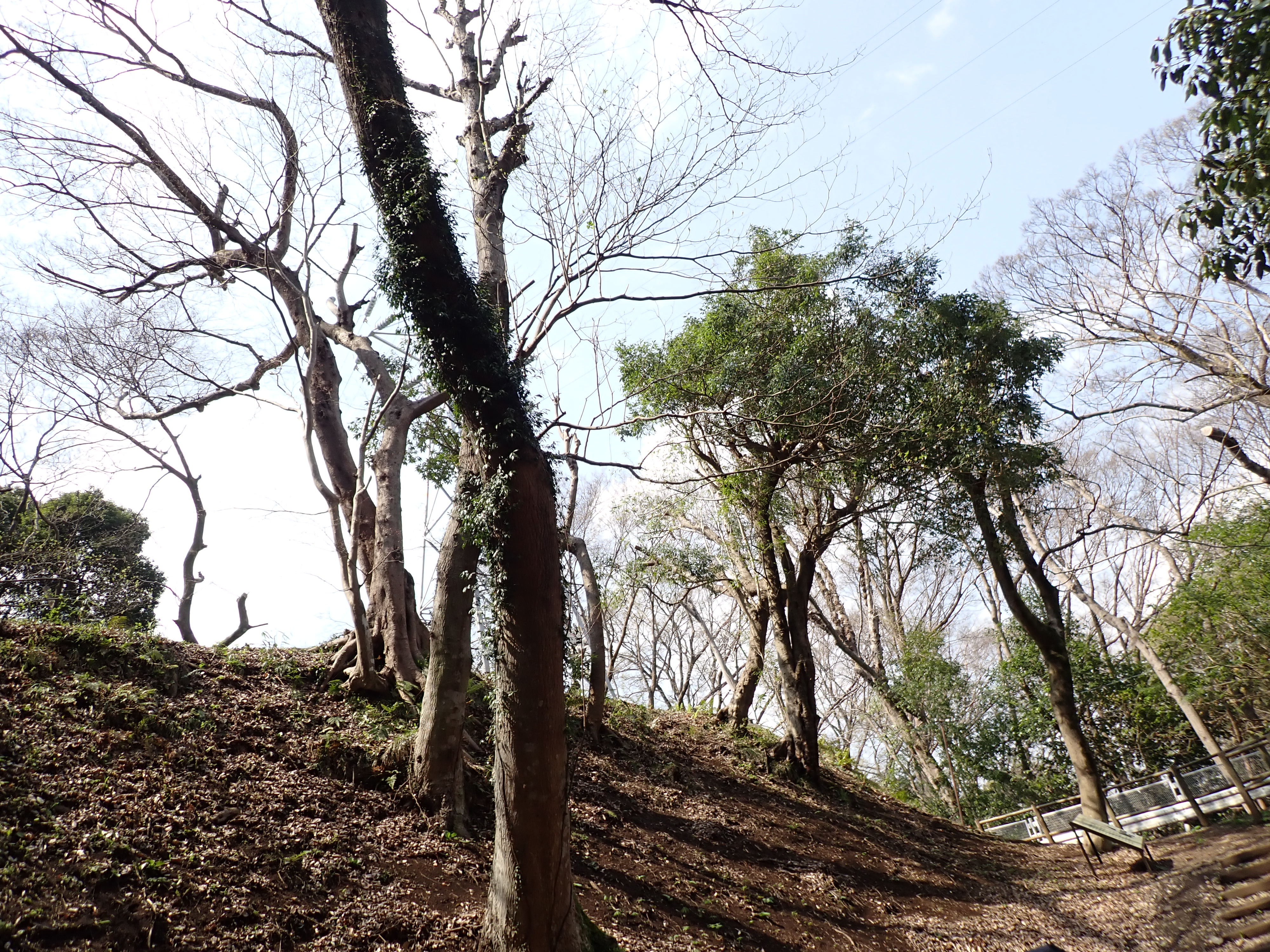
As we’re approaching the end of the ridge way of a suburban scenery, real forests are appearing in front of us. The ridge road meets with a T-crossing with a bus stop Shiroyama 4-chome. On our right is the campus for Soyo High School, and in front of us is a forest which is the beginning of Shiroyama Park. For today’s itinerary, toilets are not so ubiquitous, but here a couple of minutes’ walk downward along the bus road, we can find the ones next to tennis courts. Please utilize the chance wisely. Also, the T-crossing point has a lawn field and a nice view to Hakone Mountains. For your tea or lunch, it’s a good place to spread your blanket.
 |
| Another
T-crossing. For toilets next to the tennis courts, please turn right here. |
 |
| The
point has Guideposts to walk Sogamae remains. |
 |
| A view
of Sagami Bay when we had lunch on the lawn at the T-crossing. |
We cross the paved bus route and find a trekking road into the forest. This is a beginning of historical artifacts, the real remnants of wall and mort system of Odawara Sogamae, named Komine-Okanenodai-O’horikiri-Higashibori (phew!) 小峯御鐘ノ台大堀切東堀. Geographically, this defense system cut the ridge of Hachimanyama Hill 八幡山 that ends up at the central part of the Odawara Castle to the south, and the main mountain mass of Hakone mountains to the north. i.e. This is one of the crucial defense facilities, protecting the western part of the Castle complex. The design of Odawara Sogamae is a combo of (often) dry mort and steep mold acted as a wall. Here the hiking road for us has buried mort below our feet. For our eyes, it looks like a small dry valley, and we feel we walk at the bottom of it. On average this route had morts of 25-30m in width. Both sides of us are steep slopes on which even weeds have hard time invading. Those surviving greens on the slope cling to a wall-like soil. 600 years ago, the average gradient of the slope was 50-60°, and the height was 12-15m. The size of the system is the largest as the remaining mort and wall system of this kind in Japan. At the top of the slope are forests consisting of broadleaved trees. They are NOT neatly lined-up cedars. i.e. The randomness of vegetation pattern must have impeded invaders to work out their way …
 |
| The beginning of mort and wall system |
 |
| No weed on the slope. |
Actually, we’ve already visited a similar design of “forest” in Yokohama. Kozukue Citizen F.orest 小机市民の森 (; my post on July 3, 2015) was an archeological site for a branch castle of Odawara where subordinates of Odawara’s warlord protected the eastern border of Odawara domain. Inevitably, the plan of defense system was the same as its HDQ. The difference was its size. Now Odawara Sogamae structure is widely destroyed by housing and modern railway and road systems. We cannot feel the scale difference in mort and wall structure between Kozukue and Odawara. When the structure was really working, it surrounded 6 townships of Odawara City, approximately 9km in diameter. In comparison, Kozukue Castle is just a part of one township, Kozukue. The idea was, the fortress used steep natural hill covered by eye blocking forest when it is available. Otherwise, they dug the mort, piled up high the dirt from the digging and pounded the artificial mound firmly to be a wall. They constructed such structures multifold. The area became a maze for intruders. When it rains or after a rainy day, the dry mort becomes wet mort, and a wall-like slope of artificial hill denied easy escape from maze. When it was a working-defense system, the mort was not so straight as we stroll now, but many cranking, called Yoko-ya Ore 横矢折れ, meaning “attacks of arrow cannot reach the target due to the sudden wall ahead,” was prepared. When a heavily armed enemy force invaded, their advancement was thwarted by the design of landscaping. Of course, the Odawara side located many traps and attack facilities from the top of the artificial hill to destroy the enemy from above. I imagine breaking this fortress from the ground alone would be difficult even today. To begin with, what kind of tank can climb up to this point from Route 1 swiftly?
 |
| 600
years later, the mort looks like a nice strolling path, but the gradient of trees on the slope tells something. |
 |
| The
top of the “wall” is high … Could you feel desperation if an enemy force with heavy armory enters here? |
 |
| But it is really a nice path now in the 21st century. |
 |
| The City
of Odawara prepares for visitors a site to experience virtual reality when the system operated 600 years ago. Please read QR code here, free of charge. |
Surprising thing is, such an elaborate structure was built completely manually and expanded in just a couple of days if necessary. Ah-ha. That’s why there are lots of large sanctuaries around the Sogamae … Once crisis occurred, warlords mobilized town and village people. Large number of them were garrisoned in these temples and shrines to build the Sogamae perfect … Now all the remnants of war zone are peaceful strolling path in a forest where locals enjoy walk with their poochs. It’s a nice relaxing stroll in a forest … For Odawra’s Sogamae, there was no real final battle that could have made blood baths of mort. Probably, the lost souls of soldiers do not stay much here, and so the atmosphere is peaceful now. We only feel the seriousness of the former keeper of the forest for survival … The promenade of the mort and wall system is ended by another T-crossing with a paved road whose size is definitely smaller than the one for commuter bus route we departed. The paved way runs on another ridge whose north side is another precipitous cliff. The direction to the south is the Castle Tower. i.e., Again the Sogamae System is using the natural geography as mort-and-wall system. Let’s turn right here at the T-crossing. The relaxing semi-forest walk continues. For the continuation, please come next week again. There is a possible “intelligence” matter ahead of us.
 |
| We’ve reached another T-crossing. |
 |
| The
northern part of the paved road, on our right in this photo, is almost a cliff. |
 |
| Though
they are not the same vegetation as those in the 16th century, the look of the “wall” of this part must have been more or less the same. |
For enquires about sightseeing in Odawara City,
General Incorporated Association, Odawara Tourism
一般社団法人 小田原市観光協会
250-0042 350-1, Hagikubo, Odawara City
〒250-0042 小田原市荻窪350番地の1 小田原合同庁舎内2階
TEL:0465-20-4192
〒250-0042 小田原市荻窪350番地の1 小田原合同庁舎内2階
TEL:0465-20-4192
FAX:0465-20-4194
No comments:
Post a Comment