Returning the topic of planting cherry trees around Mt. Ogusu 大楠山, we have to check Kinugasa-yama Park 衣笠山公園. Last week, we started our hike from JR Kinugasa Station 衣笠駅. The area of Kinugasa was once the home ground of Miura Clan 三浦一族, who were the biggies of Miura Peninsula. The height of their power was in the 13th century until then the head of the Clan, Miura Yasumura 三浦泰村, lost the political and military power to his rival, Hojo Tokiyori 北条時頼, in Kamakura Shogunate 鎌倉幕府 in 1247. Yasumura was #2 in the Shogunate hierarchy. Tokiyori was #1 … a familiar story, don’t you think? At the time of clan destruction, Miura family did not live in Kinugasa area but in Kamakura. Still, their political power in Kamakura Shogunate secured the special status of the peninsula. In the first place, the reason Miura Clan gained the position in the government was a fierce battle in 1180 and the death of Miura Yoshiaki 三浦義明, then the head of the Clan, in Kinugasa Castle 衣笠城 for the victory of Minamoto-no Yoritomo 源頼朝, the founder of Kamakura Shogunate. So, the meaning of Miura Peninsula around Kinugasa was not so trivial for Kamakura. They began planting cherry trees, and the tradition continues till this day of the 21st century. Do you remember the previous Emperor and Empress planted cherry tree near the Radar Tower (; my post two weeks before)? The ordinary citizens also contribute to the growing number of cherry trees in the area. There is a notice board near the imperial cherry by NPO Ikuoukai 育桜会, which is promoting the planting of cherry trees in Japan and beyond.
 |
| The notice board by Ikuokai near the Radar Tower. |
The tradition of planting cherry trees around Mt. Ogusu also gave birth of one of the city parks of Yokosuka. It is Kinugasa-yama Park 衣笠山公園. The beginning of the Park was 1907 when the local governments (then, the city of Yokosuka and Kinugasa Village) built a memorial for war-dead during Russo-Japanese War and planted cherry trees on the Kinugasa-yama which was a continuation of old ruin of Kinugawa Castle. The place became the municipal park. Since then people keep planting the blossom trees, now counting more than 2000, and landscaping the slope of the park hill for citizens to stroll. In 1990, the place was designated one of the 100 best places for admiring cherry blossoms. Going there can be a part of Mt. Ogusu hiking. So, today I tell you the route to visit Kinugasa-yama Park. The easiest way to go there is by bus from Keikyu Yokosuka-Chuo Station and get off at Entrance to Kinugasa-yama Park stop 衣笠山公園入口 (; timetable is here and here). Though, going there on foot from JR Kinugasa Station can be an interesting adventure. I tell you how.
 |
| The
costume wore by actors who played Miura samurais in 2022 TV drama. They depicted the battle of Kinugasa Castle. People in Kinugasa still love Miura family so much. They displayed the outfit in one of the shopping windows next to the Kinugasa Station. |
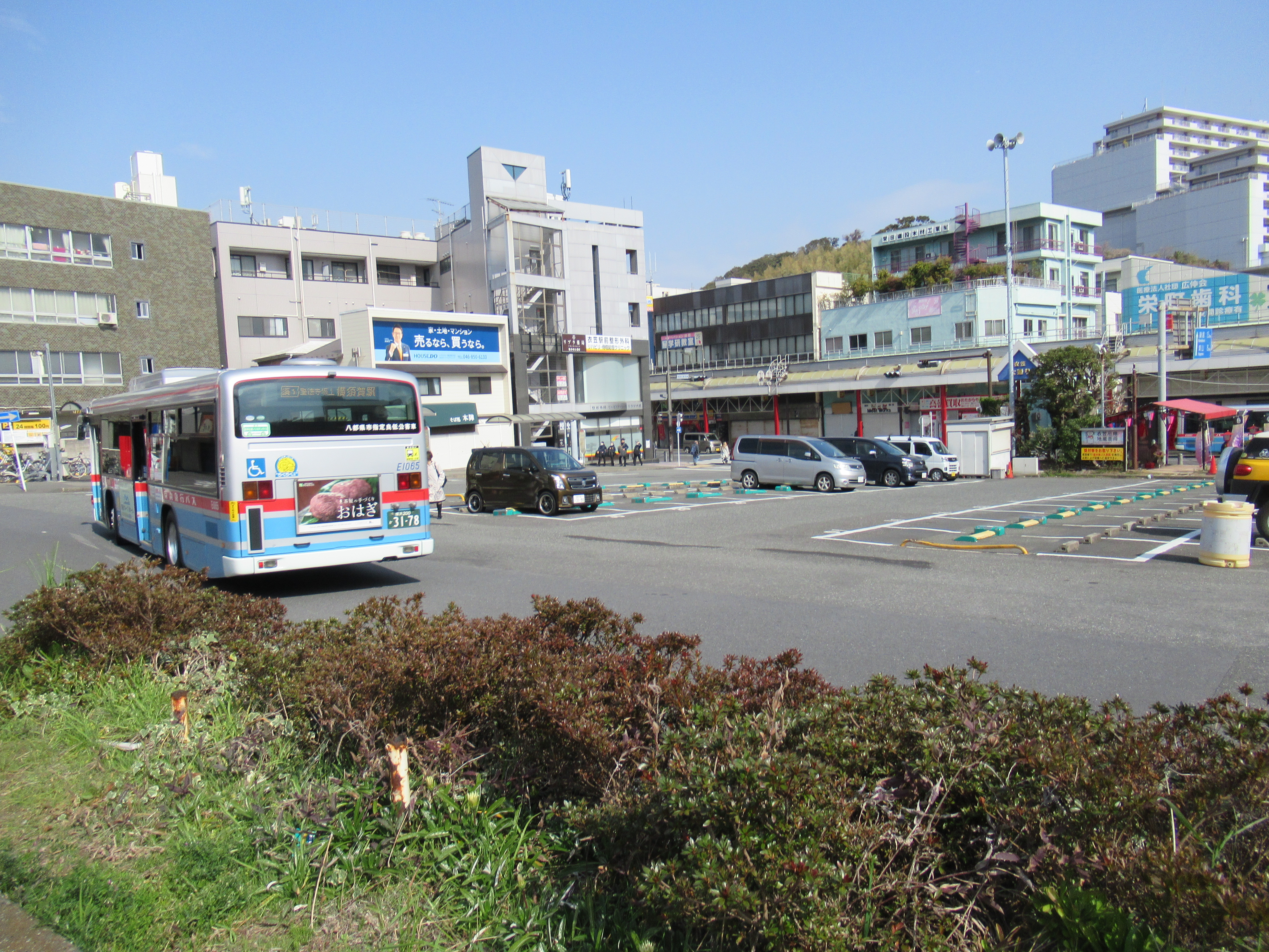
First, please check the map of Yokosuka City. JR Kinugasa Station has an exit of only one direction, to the north. And Kinugasa-yama Park is spreading south of the station. So, we have to find a way to go to the south of the station. We can take the long way around by following the car roads. Or, of course, there is a shortcut, only for pedestrians. From the station, please walk around the bus terminal and turn right at the corner of Mizuho Bank and Security. The street is of an old-fashioned shopping arcade with cars and buses running in the middle. Turn right again at the end of Mizuho premise for a narrow pedestrian road. It cranked to the left immediately, and in front of you is another shopping arcade running in parallel to the bus street. It keeps the atmosphere of the late 20th century Japan … Go a bit further down this shopping street to find a greengrocer on your right. Turn right here. You’ll enter a tunnel running beneath the JR Yokosuka Line. Voila! You’re in the south of Kinugasa Station. From the exit of the tunnel, we can find a residential road going up. In our sight, there is a church on your left and a hospital on your right over there at a small crossing. Please go there and take a way to the right along the hospital. You’ll find a condominium soon next to the hospital. Just pass the condo and the road is cranked to the right. Proceed the route and turn left at the third corner, go further, and turn left at the first. The end of this route is the beginning of a trekking road of Kinugasa-yama Park. All the routes so far are narrow residential commuter roads. Navigating up to here could be an adventure in itself!
 |
| The bus road running in front of Mizuho Premise. |
 |
| Please turn right here. |
 |
| Then
left. In front of you is this scenery of shopping arcade. |
 |
| Turn
right at the greengrocers. Could you see a tunnel over there? |
 |
| The
other side of the tunnel, i.e. the south of Kinugasa Station. |
 |
| There
is a map at the other end. But, it does not help much, I tell you. |
 |
| Turn
right here at the hospital, and walk along the hospital premises. |
 |
| After
turning the third corner. I’m sure you are getting nervous … |
 |
| Now,
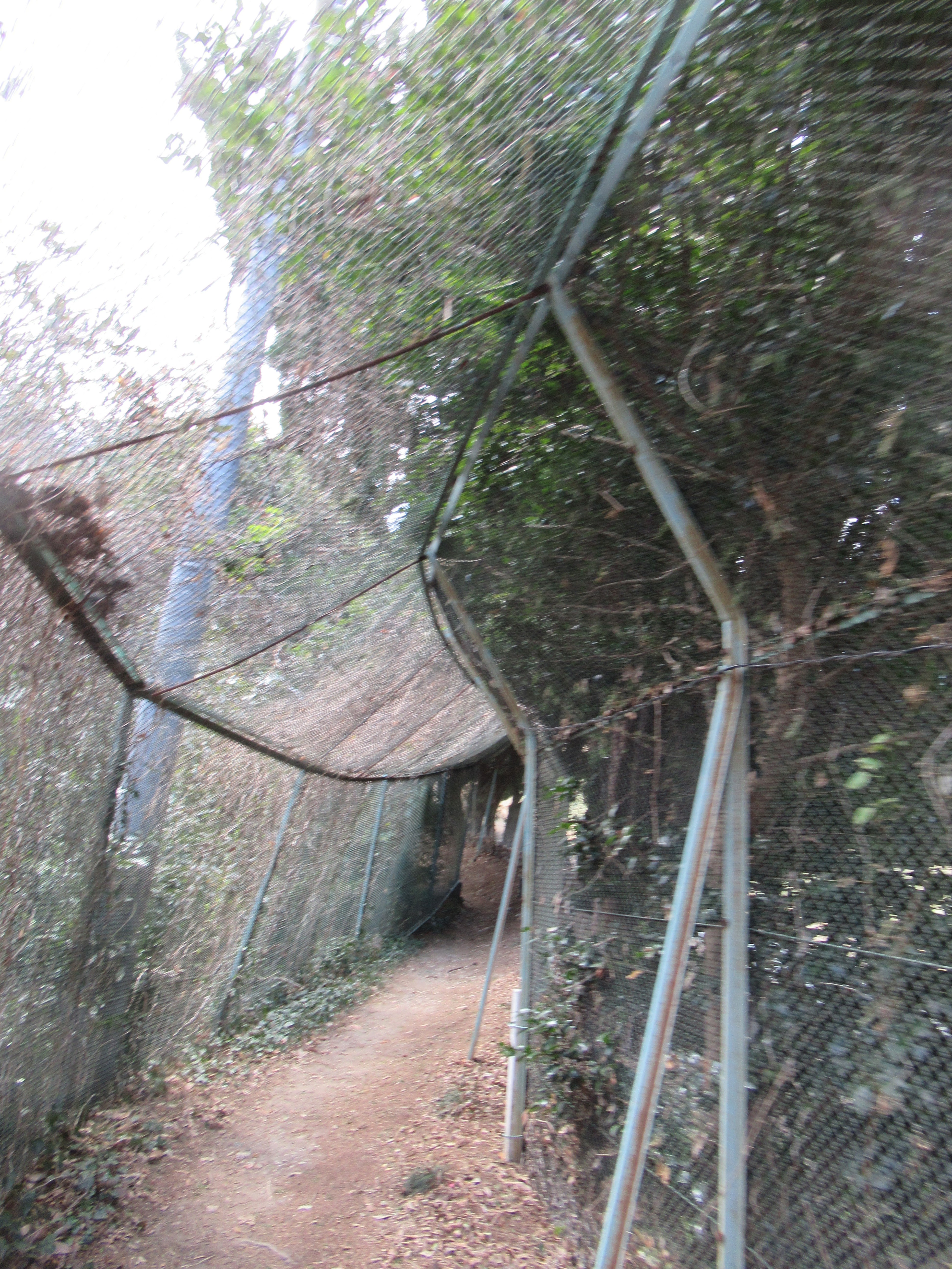
this is the adventure part! Please dive in this VERY narrow road. This is the final turn in the residential area. |
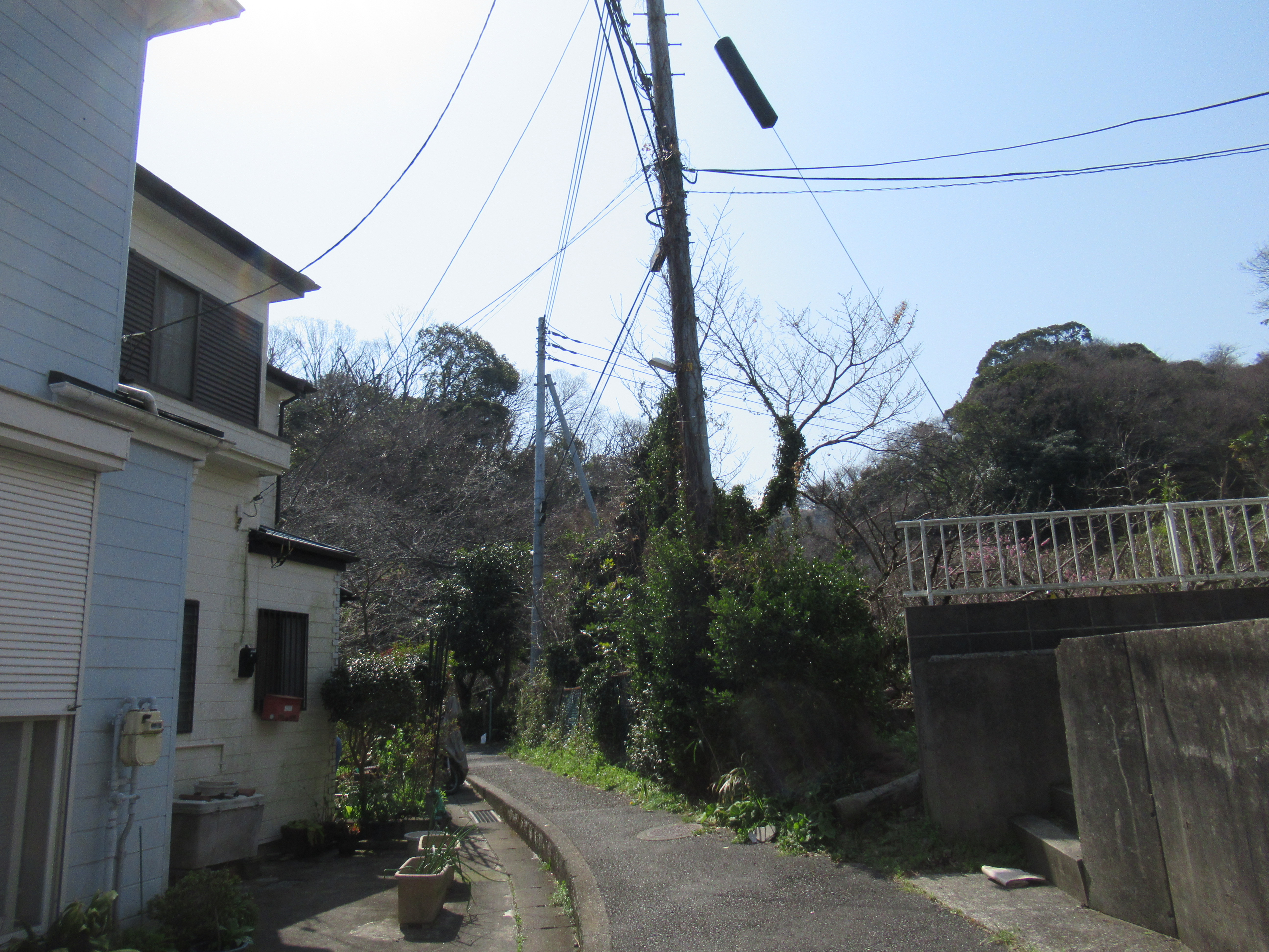 |
| The other
side of the alley. Could you see the greenery over there? That’s our destination. |
 |
| Going straight, and we come here. Please feel relieved … |
 |
| Phew! The entrance to the Park. |
The road starting from here is, I would say, at the bottom of the Park. Yokosuka is a port city with nice terrain suitable for an aircraft carrier of the US Navy to make the place home. Inevitably, it is very hilly, and so for Kinugasa-yama park. It is spreading a steep slope of Kinugasa-yama whose previous name was Mt. Kurakake, ASL 134m. We first go along a relatively flat road with a pond on our right over the fence. It was once the water source for the people of the area. (Now everybody in Yokosuka use waters from Sagami 相模川 and Sakawa 酒匂川 Rivers.) At the end of the pond, there begins a well-paved route of the Park. On our right is a marsh that is a water source of the pond we passed. In June, the place is adorned with the lights of fireflies. Firefly place ends with a colorful playground with slides. The route of the park becomes seriously steeper around the playpark, but it is perfectly paved. Here and there, the City of Yokosuka provides a map of the Park that shows our present location. As a city park, it has several toilets which are shown in the map. Please don’t worry in this regard. The paved slopes are lined with well-taken-care of trees, not only cherries, but also oaks, paulownia, camelia, etc. As you go up, eventually we see the ridge of Kinugasa-yama. People planted cherry trees intensively along the ridge way. The route becomes the main attraction when the City has Cherry Blossoms Festival.
 |
| The beginning of the Park Road. |
 |
| The pond appears in no time. |
 |
| The marsh begins. |
 |
| Such maps are shown here and there in the Park. |
 |
| The playpark |
 |
| The
slope in the Park is this much. The cabin at the end of the photo is another toilet. By the way, the stone wall on our left would be, I presume, the remnants of structure constructed by Miura Clan. |
 |
| As a
city park, the place has lots of detours. Our aim is to “go up higher.” |
 |
| In any
case, the end will be the top of the mountain, as long as we climb. |
 |
| When
I’ve been there, it was almost the end of the season for camelias … |
 |
| The detour for the ridge way. |
 |
| Do you
know Samurais don’t like camelias. Reason? Their flowers fall off from the tree as are. It has a connotation of decapitation … |
 |
| The
ridge way, aka the main street for Cherry Blossoms Festival. |
The ridge way has an open space full of cherry trees, and toilets. The place also has a wide view observing the City of Yokosuka. I guess during the festival the place is full of people admiring the view. From this open space there is a well-paved strolling path going northwest. Please follow this route, and in no time, we’ll be welcomed by a view tower of Kinugasa-yama Park. This is the peak of Kinugasa-yama at ASL 134 m. The tower also has a nice view of Yokosuka City. We can also find a white radio tower at Mt. Ogusu (my post on April 16) to the northwest from there. The road coming from the open space with cherry trees becomes narrower and going down. From this route, we can proceed to Mt. Ogusu, and there is a signpost on the foot of view tower saying “Mt. Ogusu, this way.” The road within the Park is well maintained till the end. It’s not a hiking road, but a strolling path of a city park. When we descend this route, we meet with the wide car road that we took from the Iris Garden bus stop last week. The green hill in front of us is where the ancient Kinugasa Castle once stood. To Mt. Ogusu, we turn right and walk along the car road. Eventually, we meet the traffic lights that shows the direction to the entrance of Mt. Ogusu hiking road we walked last week.
 |
| The open space along the ridge way. |
 |
| City of Yokosuka |
 |
| The path goes northwest, and we meet |
 |
| The View Tower. |
 |
| The signpost showing the way to Mt. Ogusu. |
 |
| Observing
Yokosuka City. We can figure out Nissan’s Oppama Factory in the left of the photo. |
 |
| The road to Mt. Ogusu. |
 |
| Cherries! |
 |
| The end of the Park Road. |
 |
| We
turn right here to Mt. Ogusu. The greenery in the other side of the car road is once Kinugasa Castle stood. |
 |
| To Mt. Ogusu, this way please. |
Miura Clan was destroyed 700 years ago, but their offsprings who branched out from the family are said to be many places of Japan. Above all, they are remembered by the locals. Cherries are precarious trees that sometimes could be difficult to take root. Yet, the continuous activity of planting cherry trees around Mt. Ogusu might be evidence of a long, very long, memory. And next year, another cherry blossoms’ season comes … Oh, I have to add this. Hiking in Miura Peninsula has relatively easy access from megalopolis Tokyo. Though, as it is in the southern part of Kanagawa Prefecture, we locals do not like to hike there during summer, especially in this age of global warming. It could be wiser not to visit there in July or August. Kinugasa-yama Park is also famous for their bush clover that will be in full-bloom in early autumn. Let’s wait. 😁

Kinugasa-yama Park 衣笠山公園
4 Koyabe, Yokosuka, Kanagawa Prefecture, 238-0026
〒238-0026 横須賀市小矢部4丁目
Phone: 046-853-8523