
There is a course climbing up to the summit of Mt. Ogusu 大楠山 from the side of Tokyo Bay. The City of Yokosuka is somehow reluctant to introduce this route actively. The course has several points with fallen trees due to typhoons or the like during the previous years. Well, because of such incidences, the course is more interesting to take. Though, I have to add this: Caution. Many broken trees mean the level of safety is lower than the courses I’ve introduced to you in my previous posts. Please be prepared for emergencies with proper gear and communication tools. Map, compass, and good hiking shoes are the MUST. Now, let’s start. The beginning is Kinugasa Station 衣笠駅 of JR Yokosuka Line. In front of the station, there is a terminal for commuter bus services. Find bus stop #3, and ride a bus Kinu-25 which is a circular service between Kinugasa Station and city’s Iris Garden. Take this line and get off at the Iris Garden (; timetable is here). It’s a short ride of about 10 minutes.
 |
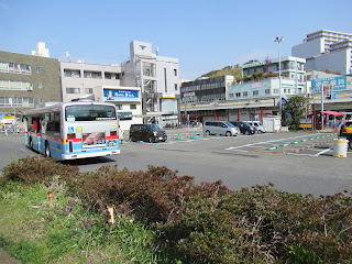
| Kinugasa Station |
 |
| The third crossing from the bus stop |
 |
| Turn right there and start going up this slope. |
 |
| Going straight and the road becomes narrower … |
 |
| to become like this. |
 |
| A hairpin curve |
 |
| A blockade |
 |
| Beyond the block is like this. |
 |
| The bridge is over there. |
 |
| Please cross it. |
 |
| And proceed further to |
 |
| meet this signpost. It says “Mt. Ogusu this way.” |
 |
| The road to ECOMIL. |
 |
| During
weekends, the gate is closed for cars. We pass it via the sidewalk. |
 |
| ECOMIL |
 |
| The toilet |
Behind the toilet of ECOMIL, there are steps going up. Please take it, and from there the road to the peak of Mt. Ogusu is almost one-way up. Compared with the course from Shonan Village, the road is … I would say, not so well-maintained, but at the level of standard hiking road. The steps constructed for the route are sometimes crumbling. The signposts are old with peeled paints. Still, the course is cleared. We don’t have to bushwhack. Climbing up for about 30 minutes, after passing a short narrow ridge way, we arrive at the corner of Hayama International Country Club 葉山国際カンツリー俱楽部. The golf course and the hiking roady are separated by vertical and horizontal net fence. I guess the fence over our head is to protect the hikers from out of bounds of hard golf balls. The fence is impressively long. Anyway, we’re protected, aren’t we? From the end of the fence, the hiking course becomes a bit wider. Eventually, on our right we find a small open space with a large camphor tree standing in the middle. Telling you the truth, this is the only camphor I’ve found along the hiking routes of Mt. Ogusu. “Ogusu” means “Large Camphor Tree” in Japanese. Maybe the mountain has the other camphors off the hiking road …
 |
| The hiking route starts from the toilet. |
 |
| Please go up these steps. |
 |
| Here! We’re in the trekking route. |
 |
| Not bad, huh? |
 |
| The signpost has character. |
 |
| The ridge way. |
 |
| At the corner of the Hayama International Country Club |
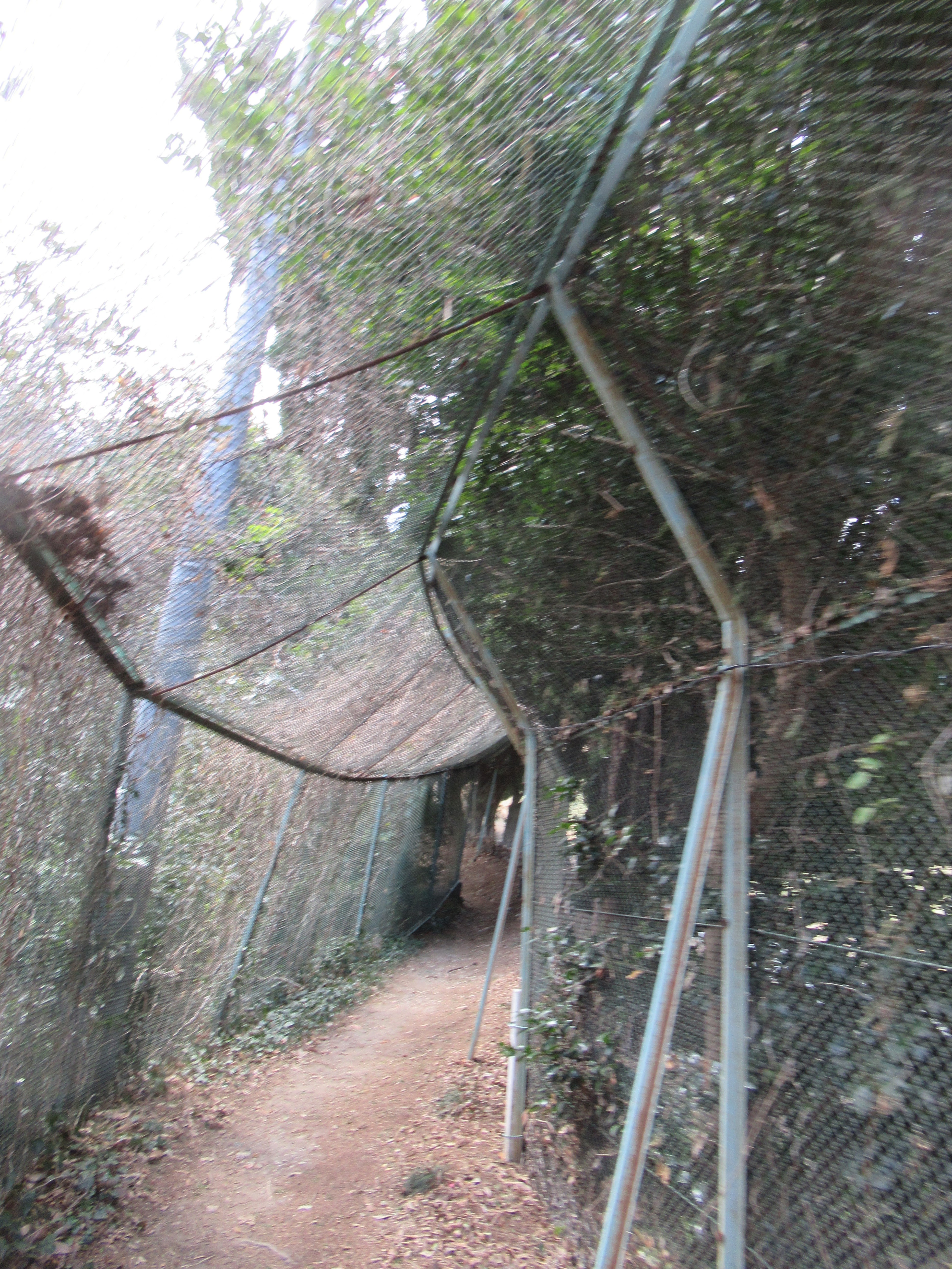 |
| The caged road |
 |
| The camphor tree |
After the Camphor Tree, soon we meet with another simple pavement which is the road we’ve descended from the peak last week. To go to the top of the mountain, we turn right here and find the steps that bring us to the open space at the summit. From the end of the net fence to the peak, it’s about 30 minutes’ one way up. Start from the Iris Garden, by slow pace it takes about 2 hours to the top. Not bad for having lunch with view around noon. To descend, let’s take another route, not a forestry road of the last week, but more standard hiking course. Last week, we returned from the radar tower to the blacktop. This time, enter a narrow hiking road from the end of forestry road in front of the Tower. This route is wide enough for one person to walk, and thus when cherry trees stand along the trekking route, they are nearer than those of the last week. We can recognize old cherry trees, of of Prunus speciosa and Cerasus jamasakura, here and there literally lined the course. Sometimes the road is a small cut-through of typical sedimentary rocks of Miura Peninsula. They can be slippery. Please be careful. Compared with the course of forestry road, the feel we’re nestled in the mountain of cherry trees is stronger here. After an hour or so descending, you may notice the vegetation along the hiking course becomes more of those loving humidity. Soon, rustle of stream is coming from the valley below. It’s small Maeda River 前田川 originated from Megurino Forest for Shonan Village 湘南国際村めぐりの森. When houses appear ahead of you, it’s the end of the hiking course.
 |
| We’ve met the road we took last week at this corner. |
 |
| And this time we go up to |
 |
| find the steps to the peak. |
 |
| a bit more to … |
 |
| The summit! |
 |
| Next
to the radio tower, there is this monument
saying the previous Emperor and Empress, Heisei, came here in 1992 for planting the cherry tree next to the monument. We pass this point to |
 |
| take this direction. |
 |
| In this
route, many spots are adorned with cherry trees. Above our head in early April this year, the buds are developing for full bloom. |
 |
| Another cherry street ahead of us. |
 |
| We
also find a small colony of wind flowers. They love humid soil. The valley is near. |
 |
| A bit going down, |
 |
| and we can see Maeda River down there. |
 |
| We rapidly go down |
 |
| and cross the bridge over |
 |
| Maeda River. |
Please cross small bridge over Maeda River and follow a paved commuter road. Several farming families situate unattended booths selling their product of the day. I tell you the quality of veggies from the venders here are very good, and the price is right. When you find another bridge in front of you crossing Maeda River, there is a small café before the bridge on your left. They make and sell original jams and preserves made of vegetables from their field. I found jam of broccoli (oh, yes) is unexpectedly good! Passing this shop, and cross the commuter road at the traffic light beyond the bridge, there is a bus stop, Maeda Bashi Stop, for Keikyu Bus. Keikyu has at least 4 services per hour to the stations from 8:00 to 10:00 every day from these bus stops. Two stops before Maeda Bashi Stop is Ogusu-Ashinaguchi Stop 大楠芦名口. So the return itinerary is exactly the same as the last week from here. Having said that, compared with the last week’s itinerary, this week’s descend is for more standard hiking. If you’re athletic, this week’s course is more interesting to Mt. Ogusu, I guess. Of course, it’s an easy hiking compared with those in, say, Tanzawa Mountains. Still, we can enjoy deep forest via easy access from the downtown. Especially when it’s a time of cherry blossoms, courses to Mt. Ogusu can provide us a relaxed stroll under fallen cherry petals. If you miss the timing this year, please try it next year. 😉
 |
| The
road after crossing the bridge is like this. Residents come and go by cars. Please be attentive. |
 |
| There is this public toilet along the road. |
 |
| Along
the route, a temple Seigyou-in 正行院 stands. The sanctuary has a grave for brave lady of the 12th century, named Tomoe-Gozen 巴御前. She was a lover of Minamoto-no Yoshinaka 源義仲 and had a superb skill of Japanese archery. She fought along with her lover till the end of his death against Minamoto-no Yoritomo 源頼朝. After the battle, she was picked up by Yoritomo and became wife of one of his senior vassals, Wada Yoshimori 和田義盛. After her death, Wada built Seigyo-in in 1199 on the coast for consoling her soul. Later in 1499, the temple moved to its current place, and in 1659 this main hall was rebuilt. |
 |
| One of the veggie stands |
 |
| Café and
jam place, Niikura Homemade Jam. Could you figure out a traffic light over there? |
 |
| Cross the traffic light, and on our left there is a bus stop. |

If you find environmental issues in Kanagawa Prefecture, please make a contact with Kanagawa Natural Environment Conservation Center 神奈川県自然環境保全センター
657 Nanasawa, Atsugi City, 243-0121
〒243-0121 厚木市七沢657
Phone: 046-248-0323
You can send an enquiry to them by clicking the bottom line of their homepage at http://www.pref.kanagawa.jp/div/1644/
No comments:
Post a Comment