
 |
| The beginning of ascending is like this. |
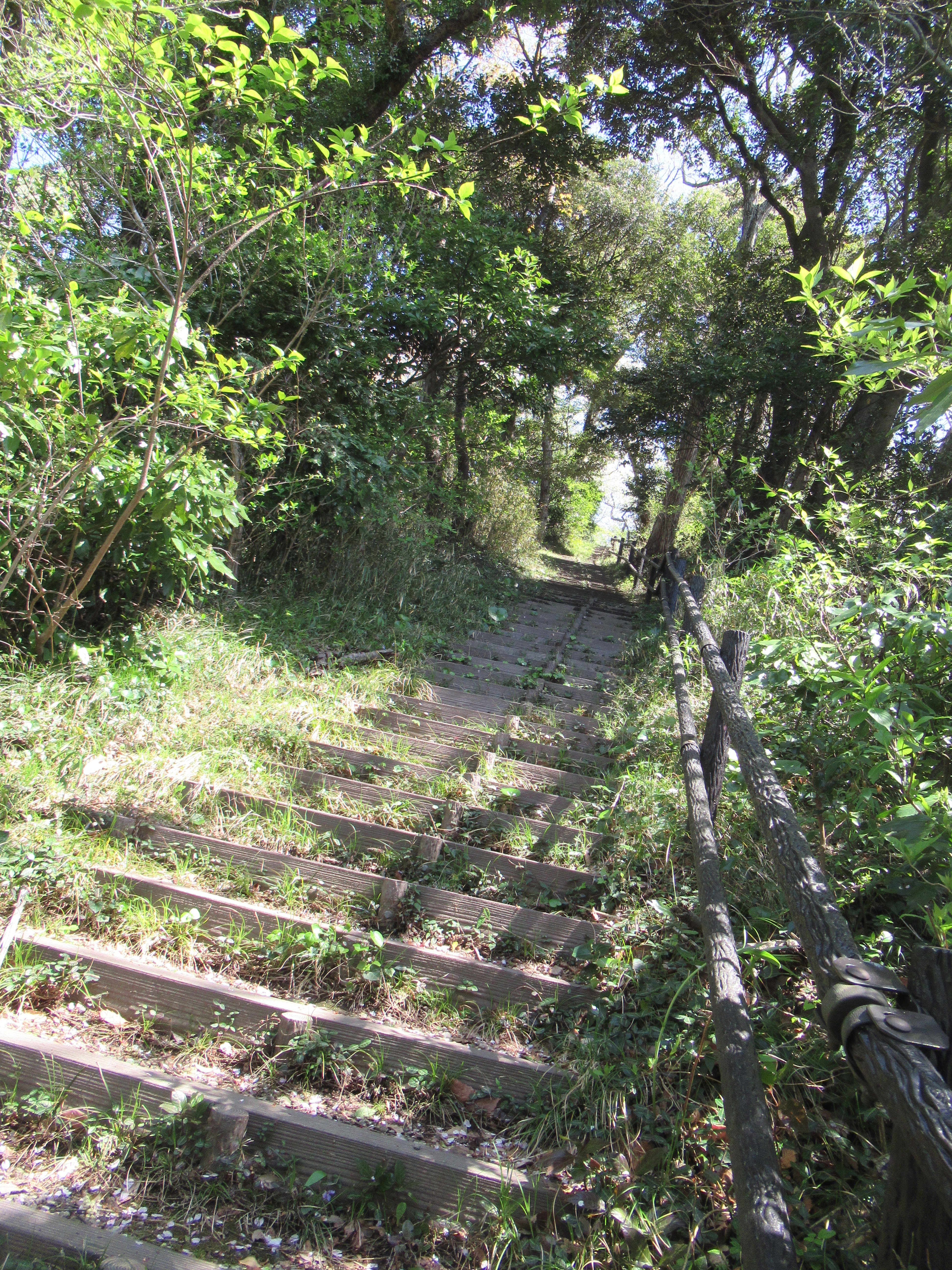 |
| Steep slope with sturdy steps |
 |
| Gentler parts are like here. |
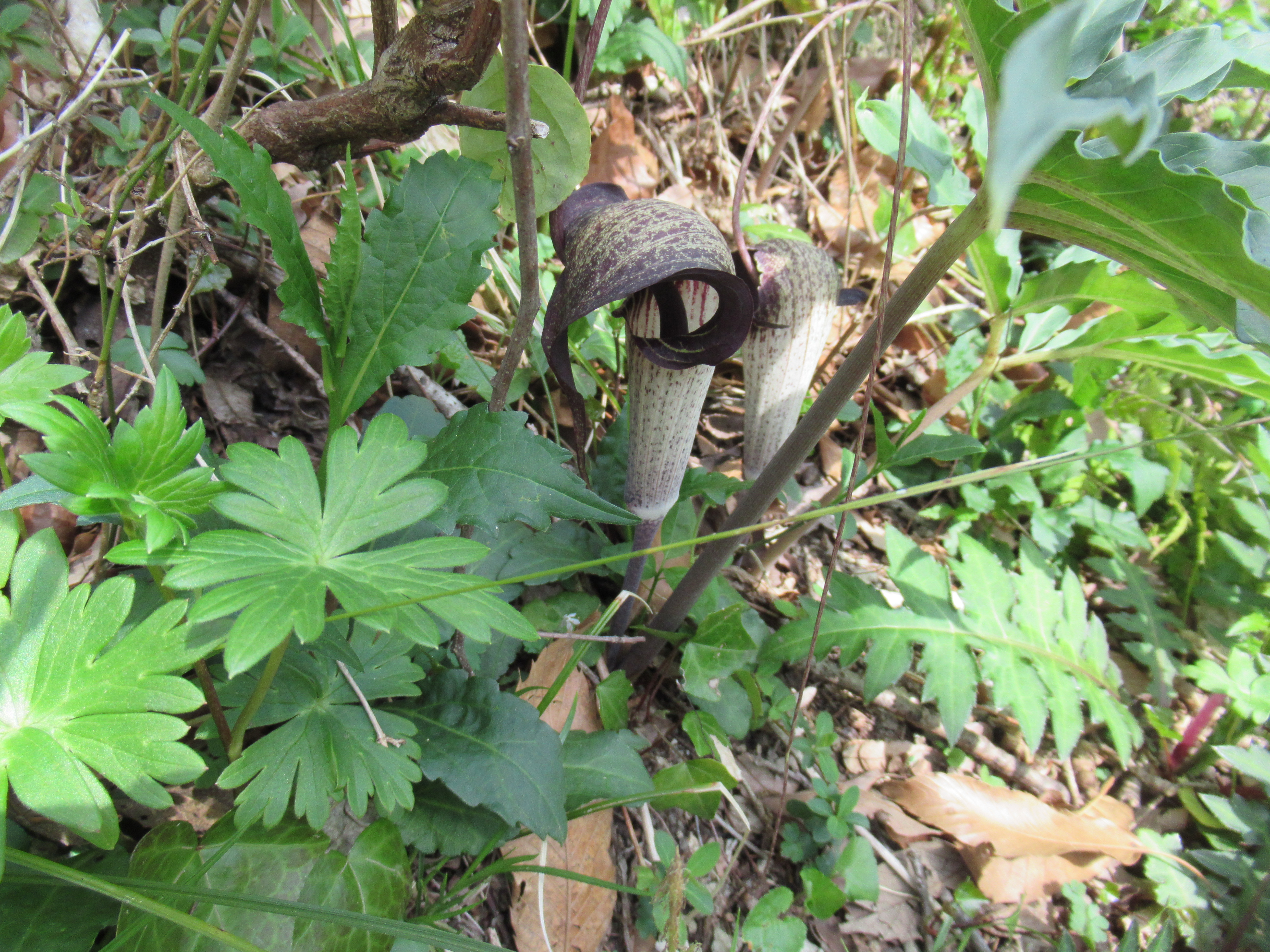 |
| Lots of Arisaema Urashima along the course |
 |
| The top of Mt. Ogusu |
 |
| To the
direction of Tokyo Bay. The ridge beyond the Bay is Boso Peninsula. We can hear whistles of mega container ships busily navigating Tokyo Bay. |
 |
| To the direction of Sagami Bay |
 |
| The rest house which is closed. |
 |
| We cannot go up this view tower. |
 |
| But
from the closed door of the rest house, we can see this beautiful cherry blossoms, Sagami Bay, and Mt. Fuji. |
 |
| To the
toilet, when we go down from the peak, there is this signpost. |
 |
| And we take the right road that goes up slightly for the toilet. |
Do you remember the white tower we noticed when we came from Shonan Village? Toilets we need stand right next to it. The tower has actually a very important mission for us living in megalopolis Tokyo. It’s a radar rain gauge constructed by the Ministry of Land, Infrastructure, Transport and Tourism. Admitting it’s an old gauge of short polarization radar that cannot precisely measure convective precipitation, aka sudden local squall becoming common in Japan by global warming. Yet, it covers the movement of clouds within 120km radius range from the top of Mt. Ogusu (; the range of its coverage can be checked here). So, if a typhoon approaches the megalopolis Tokyo the strength of the storm is first measured by this tower and the alert is issued to us for coming natural disaster. Japanese government is building a system for weather prediction with dual polarization radars, but the covering range of the newest technology is smaller. I guess people in the Meteorological Agency will keep the radar of Mt. Ogusu as such for some time to come. It’s at the ideal location and with wide coverage.
 |
| Cherry blossoms clouds and the tower |
 |
| Toilets at Ogusu Daira |
 |
| Inside is this traditional Japanese style. But its sewage system has an environmentally friendly circular structure. |
 |
| The tower for a radar rain gauge, next to the toilets |
When it is a fine spring day, the white tower is smiling under the sunshine and twinkling reflection from Tokyo Bay and Pacific Ocean. The facility also has a view tower attached next to the radar. Though the tall white structure blocks some view, it is still worth going up to feel “Mmmmmmmmmmmmmmmmmmmmm!” of spring warmth. Moreover, during cherry blossoms’ week we can observe the entire slopes of Mt. Ogusu dotted with white and pink clouds. I tell you, the cherry trees here are accumulation of 700 years of planting. Many of them are now huge trees, and it is more recognizable from above the forest canopy. The radar tower is an ideal location. I guess we can have two options for lunch: on the top of the mountain, or here in the view tower next to the radar.
 |
| To the inner Tokyo Bay from the Tower |
 |
| Could you figure out over there Minato Mirai area of Yokohama? |
 |
| Mt. Fuji is floating above the cherry blossoms … |
 |
| We can recognize Odawa Bay with Sajima Marina 佐島マリーナ. |
 |
| A floating something in the Ocean is Oshima Island 大島. |
 |
| And we are looking to the top of Mt. Ogusu. The radio tower there is for NTT’s mobile network. |
From the radar, descending Mt. Ogusu has two routes. Both are one-way-downs. Even when you’re meandering along the route admiring the living creatures with reference books (like me) and camera, in 90 minutes’ time we can arrive at the bus stop in residential area closer to the beach of Sagami Bay (not on the beach, I must add). From these bus stops, the easiest return trip is to JR Zushi Station or Keikyu Zushi-Hayama Station by Keikyu Bus. Keikyu has at least 4 services per hour to the stations from 8:00 to 10:00 every day from these bus stops. i.e. Relax! With the commuter bus, we first go to the route along the seaside to Hayama Town, and go a bit inland from the crossing in front of Hayama Imperial Villa. The vista of Sagami Bay along the bus route is superb, with Mt. Fuji over there a la Ukiyoe of Hokusai in fine day. With this closing in mind, let’s descend from the top of Mt. Ogusu, first to Ogusu-Ashinaguchi Stop 大楠芦名口.
 |
| A view from
the commuter bus to Zushi Stations. Could you figure out Enoshima Island 江の島 over there? |
 |
| To Ogusu-Ashinaguchi Stop, we first return a bit to the signpost for the top of Mt. Ogusu. |
Go to Ogusu-Ashinaguchi Stop from the peak is probably the easiest itinerary for Mt. Ogusu Hiking. We simply take a wide forestry route with blacktop. Basically, the road is for the maintenance of Radar Tower. Normally, the tower is an unmanned facility. The road to the place has lots of holes without regular maintenance. At least in theory, the road is for permit holding drivers only. So, when we hike there, we can enjoy leisurely going down along a wide (semi-)paved road to the very end at the bus stop. And cherry blossoms? Yup. Both sides of the road are natural forest of broad-leaved trees. The dominating figure here is evergreen Machilus thunbergia that loves warmer climate along the coast. That’s said, large cherry trees poking their canopy at the gap here and there. During cherry blossoms season, the forestry road is full of petals falling from high above. It is still early for leaves of cherries to be large enough to close the gaps of the forest canopy. Please look up and we can enjoy fresh lime green leaves of Prunus speciosa and Cerasus jamasakura, mingling with white flowers (Prunus speciosa) or pale pinks (Cerasus jamasakura). Janapese bush warblers are compete for their voice to attract healthy females to mate. In this day and age, it’s an incredibly peaceful stroll … The end of the forestry road has an organic café Shoku-yabo Noen open for lunch and dinner, and a small pond named Ashina-seki 芦名堰 on our right. A few minutes down from there on our left there are public toilets. Everything is well-equipped.
 |
| The road to Ogusu-Ashinaguchi Stop is like this. |
 |
| The route equips signposts as well. The gate at the bottom of this photo is to the NTT’s radio tower. |
 |
| At that gate, another road (the right one of this
photo) joining to the forestry road. More to this next week. |
 |
| Cherry blossoms smiling from above. |
 |
| Flowers for Quercus acutissima are also beautiful. |
 |
| In the middle of the route, there is a point where we can admire the beauty of slopes of Mt. Ogusu. |
 |
| Stachyurus praecox var. matsuzakii. It’s a variant for Stachyurus praecox. We can find it only along the coast of Kanagawa, Chiba, and Sizuoka Prefectures, and Izu Islands. The variant has definitely burlier boughs and leaves and longer and larger flowers than those found inland areas. |
 |
| Almost at the end of forestry road. On our right beyond the fence is the premise of the Café. |
 |
| Ashina-seki |
 |
| The toilets |
 |
| From the toilets above, simply proceed and we can find Somei-Yoshino’s over there. |
 |
| Reach there, and turn right to go to the traffic light ahead. |
 |
| It’s Ogusu-yama Iriguchi 大楠山入口 Traffic Light. Go to the other side of the crossing and turn right. |
 |
| The bus stop, Ogusu-Ashinaguchi Stop, is there. |
Well, so, if you need more adventure, today’s course could be a bit boring. Next week, I tell you another route for Mt. Ogusu Hiking. Please stay tuned!

657 Nanasawa, Atsugi City, 243-0121
〒243-0121 厚木市七沢657
Phone: 046-248-0323
You can send an enquiry to them by clicking the bottom line of their homepage at http://www.pref.kanagawa.jp/div/1644/
No comments:
Post a Comment