Friday, August 5, 2016

Civil Engineering of Soldiers, now and then: Asahina Kiridoshi 朝夷奈切通


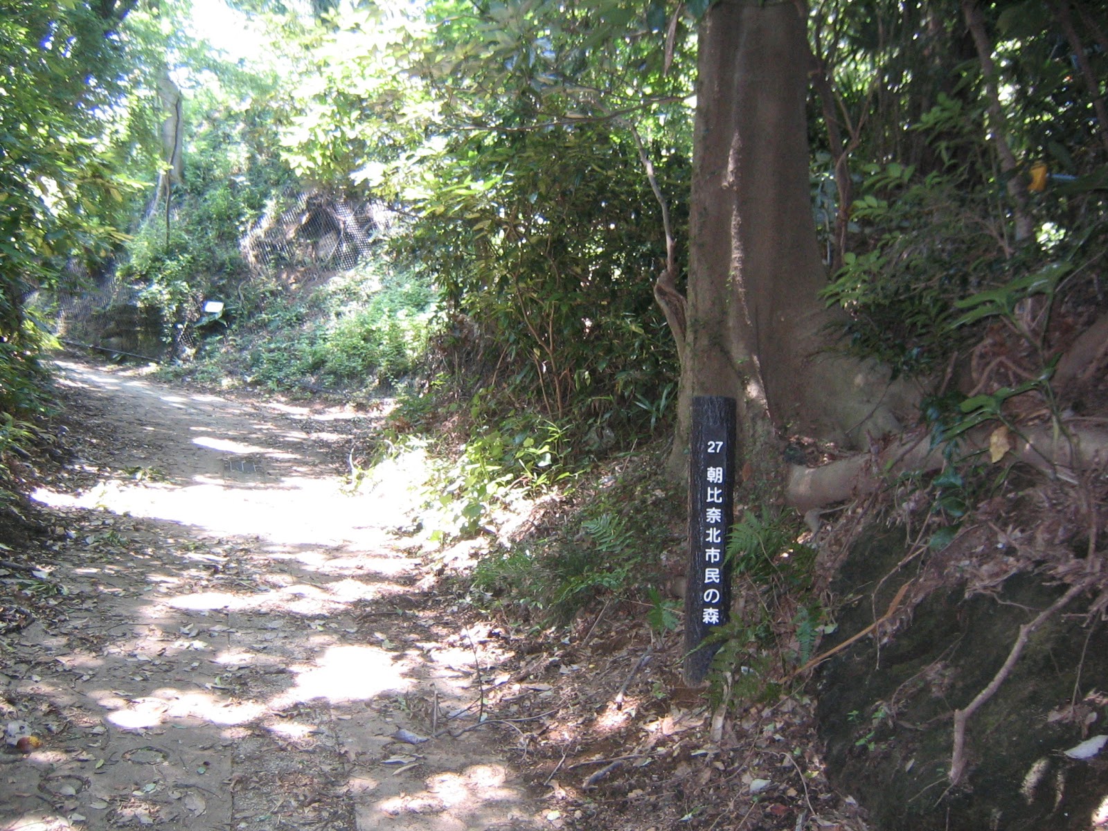
From Asahina-kita Citizen Forest 朝比奈北市民の森, we have returned to the busy Circular Road 4. Let’s cross it at a traffic light without name, next to Asahina Bus Stop of Keikyu Bus from Keikyu Kanazawa Hakkei Station by Route Kama-24 -24 (; this service is to JR Kamakura Station. Time table, here). When we look the direction of Asahina IC at the traffic light, there is a small road sign saying “Asahina Kiridoshi 奈切通” in about 2m high. Actually, that (comparatively) wide road at #28 of Asahina-kita Forest was connected to this point when samurais were governing the country. It is an entrance of the old arterial road to Kamakura, and from here within the mountain we can witness a larger version of Asahina-Kita Forest’s curved roads.

We cross here.
Oh, by the way, to the left from the traffic light
along Circular Road 4 there is a 7/11 Convenience Store
which is your last chance for toilet until
you reach to the residential area of Kamakura.

Look for this sign. Let’s turn to the left!

Simply proceeding forward after turning to the left at the sign post, soon we find Yoko-Yoko Road above. Below the bridge of Yoko-Yoko, there is a gold-plated noticeboard on the right. It tells us it is the beginning of Asahina Kiridoshi, one of the 7 ancient entryways to Kamakura, designated as a national historic site in 1969. Hm. It was a year before the construction of Asahina IC began. Next to the gold-plate, there is a large board explaining the historic significance of the road in Japanese, English, Korean, and Chinese. In summary, the route was an important route for the economy of Kamakura government as Mutsu’ura 六浦, now a town next to Asahina to the east, was an international port where goods from all over Japan and beyond arrived during 12-14th century. Now, Mutsu’ura is a sleepy residential town on a completely reclaimed land. Further in the east Nissan Oppama Factory in Yokosuka uses artificial ports for their business. It might be difficult to imagine the area 900 years ago … That’s that, anyway. We pass under the huge bridge of Yoko-Yoko Road. The road from here to Kamakura is wide. A horse, if not two of them in a line, could pass easily, but I’m not sure if off-roads can make it. The width is too small for a Jeep or a Landcruiser. (And no mechanized vehicle is allowed without permit.) We can enjoy hiking safely. J

A glod-plated sign
Entrance to Asahina Kiridoshi
Just below the Yoko-Yoko,
there is this site for Koshin-to
庚申塔.
There are 10 of them at least, meaning,
people are building these monuments for 600 years.
Yoko-Yoko won’t collapse, will it?

The City of Yokohama is showing several warnings for rockfalls along the route. Surely. Kiridoshi means “It was cut to go through (the stone walls).” As Kamakura was established by warriors in the 12th century, the first thing they thought was wars. They intentionally chose Kamakura that was surrounded in 3 directions by small but steep mountains and a shoal in the south, i.e. difficult to attack by a large number of medieval enemies. They built artificial entry ways all of which were cut-through ways of hard-pan wide enough for a horse, but not for ranks of armies. They could position their soldiers above the high “walls” of Kiridoshi roads to ambush the enemies. Among the 7 trunkroads, Asahina Kiridoshi is the largest in the difference of elevation. We can feel it certainly. The strangely wide road runs through the “walls” that preserve the traces of the chisels of workers whose latest work was done in 1250. I recalled the fact it was Mongolian army who brought gunpowder to Japan in 1274. This medieval civil engineering was done solely by hands. Woooow. The road alternates Kiridoshi and semi-stoned pavement in the forest of cryptomeria japonica. About 500m or so from the entrance, we reach to a Y-crossing. To the left brings us to Kumano Shrine 熊野神社 which was situated in the northeast of Kamakura. In I-Ching, northeast is the direction considered to be a gate for demons. The legend says in the 12th century when the first large construction work was done for Kiridoshi the founder of Kamakura government, Minamotono Yoritomo 源頼朝, established this shrine to protect his city. Though the road is somewhat narrower to Kumano Shrine, the route to the shrine has still a feel of “officially sacred” within a deep forest of cedars.  Kumano Shrine’s HDQ (UNESCO World Heritage) is in Wakayama Prefecture where forestry of large coniferous trees is one of the main industries for millennia. Wakayama people also provide “sacred timbers” for Ise Grand Shrine 伊勢神宮 at Shikinen-Sengu Festival 式年遷宮 for every 20 years. This old Kumano Shrine in Yokohama also carries such ominous atmosphere, standing quietly in the deep forest surrounded by formidable cedars and cypresses. The air is seriously meditative ... There are several seemingly passable trekking roads from the Shrine, but the locals say it is tricky to navigate the place as people these days seldom use these mountain roads. One elder STRONGLY recommended me not to wonder into them. The forest is deep here ... So, we return to the Y-crossing via the same road we took.

The road is going up.
Their achievement remains.
The medieval highway
Y-crossing.
To the left is to Kumano Shrine.
To the right is the main road to Kamakura.
The road to Asahina Kumano Shirne
Asahina Kumano Shrine

To the right from the Y-crossing is the ancient “highway” to Kamakura. We climb for a while between the old artificial cliffs on the both sides, then the road starts to go down. Around the pass, we are greeted by several “memorials” the travelers of ages ago left in the walls, including a Buddha figure. The smooth surface of the road looks like a river bed. Actually the area is one of the sources of Namekawa River 滑川 going to Yuigahama Beach 由比ガ浜 in Sagami Bay. Locals don’t like from here to further down that is almost a small stream. I guess when it rains the water gushes down over the road. Is it an intentional design to ward off the enemies, or the nature’s revenge against the military civil engineering? I personally enjoyed the walk as it was like a mini-gorge walking. The curved stone figures continue to appear here and there along the road-river. In the middle, I found mulberry trees high above. If a traveler was riding a horse, s/he could taste them ... Eventually the stream takes a shape of small river, and the road becomes dry. From some point around here, the noise of busy invisible cars begins from the right. It is a sound of Prefectural Road 204 coming from Asahina IC. When we drive to Kamakura using Metropolitan Express Way Bay Shore Route, this is the route we breeze down without thinking. I found it funny as we did not notice in cars such a rich forest just next to us.

The stones are worn out
thanks to the usage of millennia.
A Buddha figure curved on the hardpan ages ago.
Could you see the numerous traces of works in the wall?
Going down now.
And the road becomes a stream.
Mulberries … I cannot reach!
Now the stream becomes in definite.

Not before long, the road becomes flat and wider. The Kamakura exit of Asahina Kiridoshi is over there. At the exit, there are a small water fall, and the same explanation display in 4 languages for this historic road. Beyond the “gate” a graveled and then paved road goes into the residential area of Junisho town 十二所, the City of Kamakura. The small river continues on our right till it joins with the main stream of Namekawa. Before it reaches to the main river, there is a point with a board saying “Tachiarai Water 太刀洗水.” The legend says at this point an assassin named Kajiwara Kagetoki 梶原景時 washed his bloody sword after killing Chiba Hirotsune 千葉上総介広常 who was suspected of treason against Minamotono Yoritomo. This is a well-known episode in Japanese history as a part of Genpei War 源平合戦 depicted in Azuma Kagami 吾妻鏡, a (sort of) companion book of the Tale of Heike 平家物語. … Nowadays, Tachiarai is the name of a bus stop as Kamakura Reien Seimon-Mae Tachiarai (鎌倉霊園正門前太刀洗, Kamakura Cemetery Main Entrance at Tachiarai) for Route Kama-24 -24 … Impermanence of worldly things 諸行無常 … Oh, by the way, the water here and along Asahina Kiridoshi is NOT potable. Simply going forward, we bump into Route 204 with incessant stream of cars from Asahina IC. You can catch Kama-24 -24 bus coming from Kanazawa Hakkei Station, or walk to JR Kamakura Station from here via Myo-o-in Temple 明王院, Jomyoji Temple 浄妙寺, and Tsurugaoka Hachiman Shrine 鶴岡八幡宮.

The entrance of Asahina Kiridoshi, Kamakura side
The waterfall
It’s the same board as the Yokohama side.
Tachiarai Water 太刀洗水
The way to Route 204 …
eventually enters into a residential side,
… and let us walk along a promenade
along Namekawa River.
Route 204, near the Jesuit Convent.
Over there on the left, there is
a Mini-Stop Convenience Store
which has the first public toilet since the 7/11 Store.

All the way from the exit of Asahina Kiridoshi to Route 204, the direction to the southeast is a deep forest. It is actually the Forest of Ikego 池子の森 spreading between Yokohama and the City of Zushi 逗子市. The place was seizured by the US Navy in 1945, and till the early 1980s used as the munitions depot for the US Seventh Fleet stationing in Yokosuka, currently the homeport for USS Ronald Reagan. That would be the reason why Asahina locals told me the ancient local roads around Kiridoshi has not been used for decades … you lose your way in the forest, and could be shot by the US navy as trespassers. In 1983, the US government announced they were going to bulldoze the forest to make houses for US navy people. A huge uproar occurred not only in Zushi, but all over Japan. “Protect our ancient Forest!” Well, it is ironic (at best) as the place was off-limit due to the US Navy the Forest conserves its nature without becoming the sea of houses like neighboring Mutsu’ura town … The Navy’s plan was shrunk dramatically, and in February 2015, the Seventh Fleet and the City of Zushi opened jointly the Nature Park of Ikego Forest 池子の森自然公園 for weekends and holidays. At least in Google Map, there is no road shown from Tachiarai in Kamakura reaching to Ikego Forest Park. The place contains the area of US Navy’s facilities that is practically “beyond the international border.” Er … so, depending on who would be the next US President, the things about the forests around Asahina Kiridoshi may change dramatically. In the end, Asahina Kiridoshi has been a military installation from the very beginning.


If you find a problem in around Asahina Kiridoshi Forest, please make a contact with

Office for the Park Greeneries in the South 南部公園緑地事務所
Yokohama Municipal Government Creative Environment Policy Bureau 横浜市環境創造局
Phone: 045-831-8484 (I guess in Japanese only)
FAX: 045-831-9389 (I hope there is somebody who can read English …)


Friday, July 29, 2016

The Disrupted Highway: Asahina-Kita Citizen Forest 朝比奈北市民の森


On April 1, this year a new member joined the family of Yokohama Citizen Forests. It is Asahina-Kita Citizen Forest. The above photo is currently only map available in the internet for the Forest. Actually, the City has not yet prepared the hard-copy version of it either. So, this info might be handy for some time if you plan to go there. The trekking routes within the Forest are the brown lines. It’s simple and every point has clearly shown signs with a number corresponding to the index in the map. (For example, this map is at point 26.) If you walk vigorously, or do a trail-run, the time you spend in the Forest could be less than 1 hour. But I think breezing past Asahina-kita Forest is a waste of occasion to experience remnants of Japanese history. The Forest is located at an interesting site for Japanese traditional civil engineering.


It’s point #17.

The Forest is in the north of Asahina Bus Stop at the left edge in this map of Enkaisan Hiking Course. It is in the south of Kanto-Gakuin University Kanazawa Bunko Campus, practically separated from Yokohama Nature Sanctuary by (often very busy) Asahina IC of Yoko-Yoko Toll Road. Asahiha town is one of the oldest towns in Yokohama that is a gateway for more than 1000 years to Kamakura from the direction of Tokyo. Before the era of mechanized transportation, people of the town joined the festivals in Tsurugaoka Hachiman Shrine 鶴岡八幡宮 which is in less than 4 km from the town. They walked the ridge ways in Asahina-kita Forest joining to the Beetles Trail at the forest of Nature Sanctuary. According to one of the local elders, those ancient routes on the ridges were completely disrupted by Asahina IC. He didn’t say “there is no access,” but it seems to me the remaining hiking routes to Beetles Trail from the Forest must go into the private properties where landlords are not happy to have trespassers. So, let’s stick to the brown lines of the map.


The Forest has lots of signs like this:
“Beyond this line is not Citizen Forest.
Visitors are asked to keep out.
Office for the Park Greeneries in the South.”

The Forest has 3 entrances. One is from the north, via the campus of Kanto-Gakuin University. We take Keikyu Bus Route Bun-2 文-2 from the West Exit of Keikyu Kanazawa Bunko Station 京急金沢文庫, and go to the terminal stop, Nomura-jutaku Minamiguchi 野村住宅南口. (Time table, here.) It is a bus ride of about 20 minutes. From the bus stop walk south along the campus, and on the left you’ll see steps going down. It is the entrance to Asahina-kita Forest with site number 1 in the map. From here to number 4 is a kind of park road within the campus, passing 2 college buildings. If you prefer more trekking style access, the other two points from the south of the Forest are yours. Both are from busy Prefectural Road 23, aka Kanjoh 4-go 環状4号 (Circular Road 4). One is to enter the Forest from #28 near Daido Chugakkoh Mae (Daido Middle School) Bus Stop 大同中学校前. You can also choose another, #24 from Asahina Bus Stop 朝比奈 next to Daido Chugakkoh Mae. From these 2 entrances we have to climb a steep slope to the point #11 that meets with the route from Kanto-Gakuin. There is no direct pedestrian road between #24 and #28 other than the Circular Road 4 with lots of cars. These two bus stops are reachable from Keikyu Kanazawa Hakkei Station 京急金沢八景 by Route Kama-24 鎌-24 to JR Kamakura Station. It’s the bus to go to the Nature Sanctuary from the Kanazawa Hakkei Stop in front of the Mitsui-Sumitomo Bank. (Time Table, here.) Next week, I report you a pedestrian short-cut to Kamakura from Asahina-kita Forest. I think entering from Daido Chugakkoh Mae would be wiser for our plan. So in this post I report my experience from the entrance #28.


Daido Chugakkoh Mae
(Daido Middle School)
Bus Stop
大同中学校前
If you choose Asahina Stop,
you first walk back a bit to 7/11 convenience store, and
cross the road to enter a small way to the residential area.
By the way, 7/11 has a public toilet.

When we get off the bus at Daido Chugakkoh Mae, you’ll see at the other side a white cliff which looks like a left-over from a road construction. The place has a sign explaining Hana-kake Jizo (Lack Nose Jizo 鼻欠け地蔵 … somebody’s using this place for geocathing!). The white cliff is a remnant of a Buddha figure curved there ages ago. The road goes up next to Lack Nose Jizo is #28 entrance to Asahina-Kita Forest. From here to #26 where the photo of the top of this post is taken, the road is very wide. A horse can pass easily. This is a comparatively well-kept ancient arterial road connecting Kamakura and the northern cities around Tokyo Bay, including Edo (Tokyo). The degree of weathering of Lack Nose Jizo tells us the oldness of this place, and the width of the road indicates the road was important. From #26, the route becomes more of a trekking road. Within 5 minutes we’ll be welcomed by a new resting place. The map does not tell us the name of the place, and there is no sign other than “The rest place.” Anyway, there are 3 picnic tables facing the mountains of Kamakura-Zushi area. You can take a breath here, if you like. (Though, no toilet or water, here or anywhere in the Forest.)


Lack Nose Jizo.
The end of the rock surface was about the border
between ancient Musashi Prefecture and Sagami Prefecture.
Could you see a road on the right?
It is the entrance to the Forest.
Point #28
Go straight!
After #26, the road is in a trekking spec.
Soon we’ll meet a new steps on the left,
and
A view from the top of the steps.
This open space is really new.

Returning to the road from the rest place, we soon realize this is a curved route ages ago by people. The typical hardpan of the area is constructed here and there, though narrow. We also find lots of notice saying “Beyond this line is not Citizen Forest.” Peeping through the notice boards and trees, there are vegetable fields. I felt a kind of agony of landlords … “Well, we want to keep this land, but … OK make it open along the ancient road, but the rest is …” Between #13 and #11 is a road clinging to a cliff looking down the northeast which is a newly developed residential area, The other side of the cliff road is probably (as we cannot see) farm fields of landlords with ancestral land. The wave of urbanization towards the ancient forest is barely stopped thanks to the geography. From #11 point to Kanto-Gakuin Campus, it’s only 300 m or so with little ups and downs. We’ll be greeted by a long blue wire-mesh that was the same materials used for the entrance of Sekigaya Citizen Forest. Sekigaya Forest is located at the opposite side of the campus from Asahina-kita Forest. “Beyond the mesh is the property of the University.” OK, OK.

It is definitely man-made.
An artificial mini-valley
“Please keep out.”
Beyond the cliff would be farmland.
“The other side”
The campus begins.

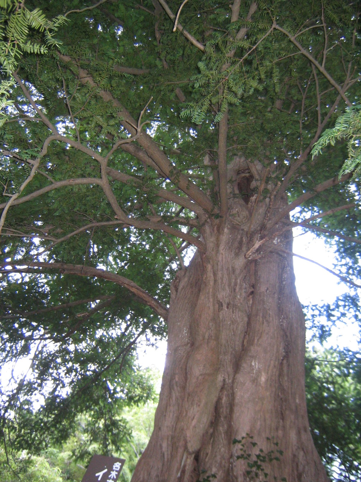
From #11 point to the south, the trekking road first climbs up steeply, and then goes down rapidly to Circular Road 4. This part is similar to the standard roads in the other Citizen Forests. I guess, the road to Kanto-Gakuin University would be a part of old highway connecting to Beetles Trail, aka the Road of Iron-mongers, and to Ten’en of Rokkoku Toge. In contrast, the road from #11 to #24 was local utility route. Soon we find ourselves in a small clearing with lots of high grasses. Down there on the right is a bamboo forest which, with my eyes after bamboo-shoots harvesting in Niiharu, would need more human interventions … Soon we will be welcomed by another map for Asahina-kita Forest with number 12. The road goes down further, and when we see the roof of a temple on the right beyond the bamboos, the road becomes steps directly carved on the hardpan. The temple is an abandoned structure, next to a cemetery for locals. Its precinct has a magnificent cephalotaxus harringtonia with the sign saying “registered tree at Kanagawa Prefecture.” Please admire it from the direction of the cemetery. I loved it! Leaving the temple, we cross a small bridge whose handrail has the sign “#24 Asahina-kita Citizen Forest.” Well, it’s just one hour or so small walk up to here. We can proceed to the other side of Circular Road 4, actually as the people of 800 years ago did. I report you my adventure there next week. 😄


A brief steep climb,
then tumbling down.
Yeah, this scenery is more familiar.
Small open space
I think they can make the bamboos fatten
if they thin the space.
#12 point
Steps
An abandoned temple
The precinct was too small to capture
the entire form of this huge tree
with my simple camera … sorry.
#24!
From #24, walk to the direction of Asahina IC.
You’ll find Asahina Bus Stop
(on the side going to Kanazawa Hakkei Station.)


If you find a problem in Asahina-Kita Citizen Forest, please make a contact with


Office for the Park Greeneries in the South 南部公園緑地事務所
Yokohama Municipal Government Creative Environment Policy Bureau 横浜市環境創造局
Phone: 045-831-8484 (I guess in Japanese only) FAX: 045-831-9389 (I hope there is somebody who can read English …)


Friday, July 22, 2016

Caution! Dangers in Forests of Yokohama: Wasps, or selfish humans


Wasps. The Lovers volunteers thinned the chamaecyparis obtusa and pisifera last March, near Zone C of Niiharu. In the process, we lopped off branches and simply piled them aside in the field in order to make logs easy to be trundled. The cut branches became a huge hedge that looked like a newly built wall from afar. Removing the logs and sweeping the field after the operation were not supposed to take 5 months. It did, in the end. (Er, volunteer work is once in a week, you know …) We completed the task this month, July, which means there was enough time for weeds to spread over the pile of branches. It became an ideal nesting ground for wasps. Woops. First, the neighboring landlord who’s doing farm work next to the pile complained that the spreading weeds started blocking the road he commuted every day. So one activity day in early July, aside from works to load the logs on a truck, the volunteers mowed the weeds invading the road a bit. Then, the menacing buzz came out. Wooooooow. “Get away!” A large tiger-stripe with wings appeared from a hole facing the road, and flying to sentinel around the pile. “Gee, we should have completed this job earlier …” “Anyway, stopgap measures! Return to the office hut to collect a spray insecticide.” July is in the early stage of nest building for wasps. Precaution could work. So, since then during the final phase of the operation, we treaded carefully around the pile of branches. Every time my seniors brought huge spray cans of insecticide whose label said “The range of emission: 10 m.” “10 m, really?” “Let’s do a trial.” “Ready, aim, spray!” “… 5 m, I guess.” “Is it effective?” “Well, better than nothing, I hope.”

An anti-wasp spray and a first-aid box are ready in the field.
Hm, this ad in a drug store says the spray will reach 11 m.
Anyway, we’ve moved all the logs, at last. Yayyyyy!

Basically, getting rid of wasps and other dangerous animals in private land is the job landlord must pay. The thinning operation was done in a private land next to the Citizen Forest, so that the City won’t pay for it. In addition, there is this huge pile of branches and boughs. The farmer who’s commuting every day to the field next to the pile thinks the “hedge” annoyance. The large pile must be disposed promptly as a trash produced in a private property, which could cost something. The amount is too large to be sneaked in household garbage for the City to collect. Disposing branches and other remnants after the forestry in metropolitan Tokyo area is becoming a huge problem. This Niiharu episode is not unique. The economizing landlord told the Lovers, “Please burn the pile.” “Hey, it’s very dangerous to set fire now. Did he ask it to our Chairman?” “Yeah.” “Wooooow.” Humid summer in Yokohama makes it difficult to watch if the fire is controlled. Besides, we are entering the months when the activity of wasps reaches to the max. Setting a fire could trigger “a wasp war.” The idea to deal with this problem became, (1) the Lovers will deal with the pile during winter when the activity of wasps are dormant, and the weeds can be controlled, and (2) the landlord of the thinned area must negotiate with his neighbor to wait until then; any possible cost during the waiting should be the responsibility of the landlord. A first-year newbie of me for Niiharu Lovers is holding my breath how the issue would be settled. The executive office of Lovers must mobilize intricate ability of diplomacy in the Niiharu community … civil-society based forestry has its own peculiar difficulty …

The weeds are approaching to the utility road …
An entrance to wasp nest

So, meanwhile, in this post I list the dangers you may encounter during summer in the forests of Yokohama. The first hazard I have to call your attention is, of course, wasps; in Japanese, Suzumebachi. They can kill you if you are bitten and have an anaphylaxis shock. On average 20 people died every year in Japan due to a wasp attack. Although we can find many “country hedges” made in situ in public and private forests these days, Niiharu Lovers seniors are now critical of this practice. The hedge made in this way is an ideal nesting place for wasps in Japan. “Now, how does the City think of this problem, huh?” The take-away in our episode is, please be careful when you find country hedges in the Forest of Yokohama. When unfortunately you meet one of them, never try to brush them off. Your movement shall be interpreted as a declaration of war for them. You stay calmly still while they are buzzing around you. Eventually, they conclude you are just passing by, and move on. When the coast becomes clear, you can start moving again. For precaution, we can purchase poison remover for about 1000 yen via internet, or in home centers, large drug stores, Tokyu Hands, and other places. This site explains how to use a kit available in Japan (in Japanese). When bitten, according to the advice of Wakayama Prefecture, (1) wash the affected area with running water. (2) Apply the remover to suck out the poison. (3) Apply anti-histamine. (4) See the doctor ASAP. If you are bitten once before, twice bitten could mean death within 15 minutes. Please be careful.

Poison Removers.
I found them in one of the special stores for mountaineering.

The next one which is easy to encounter is rhus javanica var. chinensis, Nurude in Japanese. It was used as poor peoples’ lacquer for wooden dishes. The similarity does not end here. Although it’s not as strong as sumac tree, many people can still react to them. If your toddler innocently touches them, you’d better wash their hand immediately with cold running water, and watch carefully for allergic reaction. If the situation worsens, go to see a doctor. Nurude is a pioneer plant so that harsh conditions of urban forest are a kind of their field. We can find them along a paved road in Yokohama Nature Sanctuary. Please be careful.


Rhus javanica var. chinensis.
The point to identify them is,
watch for the arrangement of leaves and the stems.
They have this orderly leaf-formation
with a kind of leafed stems.
They are very common in Yokohama Citizen Forests.

And of course, poison ivy. Japanese version has its own Latin name, toxicodendron orientale. They are also regulars in the forests of Yokohama. When they are climbing up trees, it is easy to recognize, but the distance can fool our eye. They often hide within the thick undergrowth. We are a sort of surprised to know how big their leaves are when we look at them close-by. It would be easy to touch them without recognizing. Better keeping the trekking road where the undergrowth is clear.


Young poison ivy in Niiharu
And they can hide within the vegetation under the tree.

I also have to mention artaxa subflava and euproctis pseudoconspersa. Actually, they are more common in urban small gardens and tree-lined streets in downtown Yokohama, especially when there are camellias. Their body, both caterpillars and adults, have small but numerous venomous hairs which can trigger allergic reaction for almost anybody. According to the advice from Health and Welfare Bureau of Yokohama, if you are stung by them, (1) wash the affected area with fresh running water, then (2) with the duct tape, try to remove the hairs from the body; never try to sweep them by anything other than strongly sticky tape. When you use your hand to remove them your hand will have reaction. Moreover, their hairs are tiny and light. They are easy to be blown away and inhaled, which could cause internal  allergic response.  (3) Wash the part again with running water. (4) Repeat (1)-(3), until the itches and swelling recede. (5) When the reaction continues or serious, visit the clinic.


Camellias are really common in all over Yokohama.
So, we must be careful for venomous euproctis,
especially during spring and summer.

And for anybody’s fear, there are poisonous snakes. In Japan there are 3 kinds of natives in this category: Japanese pit viper, rhabdophis tigrinus, and protobothrops flavoviridis. In Kanagawa Prefecture, we have the first 2 of them, but rhabdophis tigrinus are living in Tanzawa and Hakone. (Oh, by the way, Tanzawa and Hakone are called Okuyama, which means the mountains beyond Satoyama.) So, when you hike the area in Yokohama, Kamakura, or Miura Peninsula, the only snake business we have to be attentive is for Japanese pit viper. The first thing we must do is NEVER venture into the off–road. Yokohama’s forests have many damp grounds that can be covered by thick vegetation. Those are the places where Mamushi call home. Unless you know the ground really well, it is difficult to identify such sites just by looking. The locals who know the forest inside-out never dare to go inside the spots during spring and summer. Second, the vipers can also come out of their places to the trekking road. Our line of defense is noise. When we walk and make enough human noise in advance, such as sweeping noise by canes as we walk, timid vipers notice we are approaching and leave to avoid encounter. In case you are bitten, try to see the doctor ASAP. This newspaper article last year reported a research that found people running to the clinic for 18 minutes (average) after a viper encounter had a better result in treatment than those waited ambulance to see a doctor. Although running would hasten your heart beat and make the poison to circulate your body faster, laying in a mountain road waiting for emergency rescue makes the matter worse. It’s a matter of life and death, really.


Caution! Vipers are here!
In Niiharu, the left, viper, is dangerous.
But the right, Japanese rat snake, is harmless.
I’ve met rat snakes many times in Niiharu this July.

… But, really, no one knows if we encounter cobras or rattle snakes in the forests of Yokohama. It is an international port town. Currently, 40% of Yokohama’s vegetation is alien species. The poisonous foreign species could easily escape from the Container Terminals. In addition, this is the city more than 3 million urbanites live. Many commuting to overseas and could bring diseases such as Dengue or Zika. So mosquito and other insect repellent should be very useful in the forests of Yokohama. The traditional Japanese mosquito coil is the most popular. They are also effective to fend off common orthorrhapha whose bite can again cause allergic reaction.


An ignited mosquito coil can be portable within this container.
These are high tech version for mosquito coils.
With batteries, some can last 480 hours.
Lots of insect repellent in drug stores
But I think this organic peppermint oil is
the most effective among those repellents.
Caution, based on my experience:
NEVER apply it near your eyes.
I learned firsthand the reason
why it can ward off the insects …
its very minty vapor rapidly evaporates …
I cried, really. +.+
The peppermint oil spray is available
in sports gadget stores.
My peppermint spray. Inside the box is this tiny bottle.

Hmmmmmm … come to think of it, all of these cautions are for humans. Those “pests” must have their reason to cause problem on us … Do you know some temples in Kamakura do not equip mosquito coils or other equipment to kill pests. The monks think killing creatures is anti-Buddha. They use only organic repellents such as strong hot pepper water to be situated in a bottle at the corners. It is our responsibility for that huge pile of branches in Niiharu … In the end humans can be the most tricky to control in the forests in Yokohama, perhaps …


The City Office who’s in charge of execution of Green-up Plan is

Yokohama Municipal Government Creative Environment Policy Bureau 横浜市環境創造局
Phone: 045-671-2891
FAX: 045-641-3490
http://www.city.yokohama.lg.jp/kankyo/