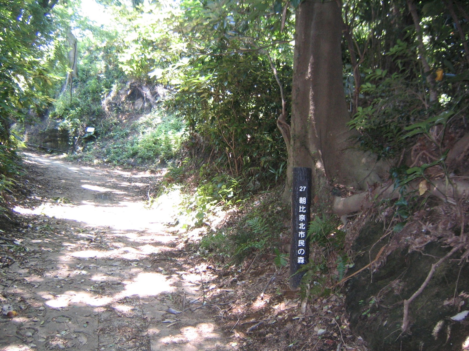
Miura Peninsula 三浦半島 that pokes out from
Honshu Island from around Segami 瀬上 – Hitorizawa 氷取沢Citizen Forest of
Yokohama into the Pacific Ocean has its own characters. Thanks to frequent
visits to Enkaisan Hiking Area 円海山 during this blog, I
became acquainted with its hard-pan with very shallow top soil created by tectonic
crashes between Eurasian, North American and Philippine Plates. From the tops
of Omaruyama 大丸山 and Ohirayama 大平山 Mountains, I also saw
lots of huge ships pass very near to the coast of Yokohama in Tokyo Bay. There is
a geographical reason for this. The natural structure of the eastern side of the Bay along Boso Peninsula 房総半島 is shoals so that
without massive human engineering it is difficult for large ships to sail along
that side. In contrast, the western bottom of Tokyo Bay is far deeper. During
the Ice Age, the Tokyo Bay was a land. In those days, Tone 利根川, Watarase 渡良瀬川, and Tama 多摩川 Rivers came from the
north and became one somewhere around Tokyo Disneyland. They went south-west further
to pour into the old sea near Miura Beach 三浦海岸. The former river bed makes the sea-lane narrow,
but deep enough for the 21st century huge cruise ships from China
and the US aircraft carriers coming in Tokyo Bay.
 |
| Ships,
ships, over there … |
For
somebody who chose Edo / Tokyo as the capital city of Japan, controlling the
traffic of natural sea highway in Tokyo Bay is the matter of national security.
When Tokugawa Ieyasu 徳川家康, the founder of Edo Shogunate that governed Japan from 1600 until1867, built Edo, he brought a
family of fishermen-cum-ninjas from Osaka to let them watch the sea-lane 24/7
at the innermost part of the Bay. In return the ninjas received the superior
right to catch fishes and established in the early 17th century the Edo
fish market to sell their catch. It is the origin of Tsukiji Fish Market 築地市場, the largest fish
market in the world (; and it will be closed this November … This book by Kyoko
Fukuchi 福地享子 tells the story of ninjas
with mouth-watering recipes. J) Tokugawa Government
also established at Uraga town 浦賀 facing the entry way to
the Bay a large checkpoint for inspecting ships. That’s one of the reasons why
Commodore Mathew Perry stopped at Uraga in 1853. After 1867, Japanese
government installed military facilities in Miura Peninsula where Yokosuka
served as the HDQ of Japanese Imperial Navy till 1945. Inevitably, the entrance
to Miura Peninsula, south of Yokohama and Kamakura, was strictly controlled for
these 350 years. Even villagers who fished and cultivated in and around the
peninsula for millennia had to carry ID to bring out their catches and
vegetables outside for commerce. (This book tells us how they managed their
daily life during pre-World War II.) Though, the story has another side.
Because of the sustained governmental traffic and development control until
recently, the Peninsula has several points where its original ecology is
preserved comparatively well. One of them is a hidden gem, Koajiro Forest 小網代の森, opened in July 2014. (Map,
here.)
 |
| A
long-legged fellow near Miyanomae Toge, Koajiro Forest |
Koajiro Forest is one of the National Trust Forests in Japan, managed jointly by
Kanagawa Green Trust かながわトラストみどり財団 and Kanagawa Prefecture.
The rough structure of the management for the National Trust greenery in Kanagawa Prefecture is similar to Yokohama’s Citizen Forest. Kanagawa
Prefecture collects the donation which is partially local tax deductible, and
pools it at Kanagawa Green Trust. With the money the Green Trust manages the
greenery owned by the Prefecture, or makes the contract with the private
landlords who agree with the environmental conservation in their property
managed by the Trust. Unlike the City of Yokohama there is no Green Tax, but
the way to fund the greenery management is National Trust system. Unlike Lovers
organizations for Yokohama Citizen Forest, the Green Trust manages both the public
fund and the forestry works. The field forestry jobs in Koajiro Forest are a
kind of subcontracted to volunteers of local communities and NPO Koajiro Field
Activity Coordination Conference 小網代野外活動調整会議,
just like the structure of Niiharu Council for Niiharu Citizen Forest. The
Koajiro people are studying the Forest since 2007, thinned far-too-large trees
on the steep cliff slopes that could trigger landslides, and controlled water
and invasive plants to stop aridification of wetlands along the small streams
running from near the hill-side entrance to the sea. The Forest preserves the
delicate environment of freshwater and seawater evolved along this water system.
And, the Forest is a home for very very very cute cheerleading troops, some of
which constantly welcome the visitors with happy dance. They are crabs.
 |
| Choreography |
The
only place we can safely park our car near Koajiro Forest is in Seabornia
Riviera Yacht Harbor シーボニア, 1 km west from the
seaside entrance to the Forest. You have to spend at least 2000 yen there to
leave the car free for 2 hours. The nearest train station for the Forest is
Misakiguchi Station 三崎口, the terminal station
of Keikyu. From the station, it is about 20 min. walk to the hill side entrance
of the Forest (which is on busy National Route 134, and hence parking is
illegal). We can use bus to go to Hikihashi Stop 引橋 for the hill-side entrance, or to Seabornia Iriguchi Stop シーボニア入口 for the sea-side
entrance. To Hikihashi Stop, go to Misakiguchi Bus Stop #1 for San-4 三-4 service (to
Aburatsubo Marine Park 油壺マリンパーク; time service, here) or
Stop #2 for San-5, 10, 11 ,24, 26三-5, 10, 11, 24, 26 (to
Misaki-Higashioka 三崎東岡 / Misaki Port 三崎港; time table, here) and
Su-6, 7 (to Misaki-Higashioka / Misaki Port; time table, here) services. It’s a
5 min. bus ride, and further 5 min. walk brings us to the entrance of the
Forest. If you prefer climbing up, Seabornia Iriguchi Stop is yours, which is in
a 15 min. bus ride with San-4 service. Between Seabornia Iriguchi Stop and the
sea-side entrance of the Forest, it is a 15 minutes’ walk mainly through alley
ways through the fishermen’s village (and hence, no parking space).
 |
Keikyu
Misakiguchi Station.
In front to the station is the bus terminal. |
 |
A
noodle café in the Station has a peculiar menu.
“Tuna Sashimi Buckwheat
Noodle,” “Tuna croquet,” etc. |
 |
A
kiosk in the Station also provides us
to see what’s in offer in this town.
In
addition to fresh turbo cornutus and other fishes,
this shelf is for various dried
seaweeds and
the variety of instant miso-soup
with several seafood stocks. |
 |
Hikihashi
Stop.
From here the route is the same as we walk from the station.
Please see
below.
En route on foot from the Station,
sign posts like in this photo on the
left lead us to the Forest.
It’s easy to follow. |
 |
| Seabornia
Iriguchi Stop |
 |
Walk
to this direction from the bus stop.
The blue billboard over they says “Turn
right here to Seabornia.” |
 |
Turning
right, it’s a slope.
We will eventually see those holiday condos ahead of us.
They are Seabornia Condos. |
 |
At the
bottom, in front of the entrance to Seabornia,
there is this public toilet.
This one, though not in western style,
is more permanent structure than the
other in the Forest. |
 |
We can
identify the forest over there in front of the toilet.
It’s Koajiro Forest.
Just go straight. |
 |
Koajiro
is a fishing town.
There are several parking spaces along the road,
but they
are for fishing business only.
At the end of the road is here,
and we take an
alley over there to the Forest. |
 |
| It’s
just one road … |
 |
… and
ends at Shirohige Shrine 白髭神社.
This shrine worhips
Shirohige Myojin 白髭明神,
aka Nakatsutsuno’o
Mikoto 中筒男命.
Generally, Shirohige
Myojin is alias for Sarutahikono Mikoto 猿田彦命,
who is very
large-nosed Caucasian lookalike god in Japanese mythology.
Nakatsutsuno’o
Mikoto appears in one of the early episodes of Japanese founding myth.
He is a
bit cursing deity of sea who demands proper respect,
otherwise becomes very
happy to sink ships and destroy fishermen’s community.
Why do Nakatsutsuno’o
and Sarutahiko share the same name here?
Anybody for mythological analysis?
Anyway, he stands here at the bottom of Koajiro fishermen village. |
 |
The
precinct of the shrine has a strange stone, called Can-can Stone かんかん石.
When we hit it with a
stone, it emits very metallic can-can sound.
Legend says it was a weight for an
anchor donated centuries ago by a fisherman in Osaka
as Shirohige Myojin of Koajiro
asked him to do so in his dream.
Koajiro was a port for ships coming from all
over Japan
before entering in the restricted area of Edo Bay,
and later it
became the port of refuge for Misaki Port.
The port has been known for
centuries. |
 |
Just
before the shrine, there is a graveled road on the right.
It is to Miyanomae Toge Entrance 宮の前峠入口,
the sea-side entrance
to Koajiro Forest. |
Though,
walking to the Forest is far easier, in the end. To reach to Hikibashi Entrance
at the hill-side, it’s simply along Route 134 to the south from the Station. At
the Misakiguchi Terminal, we can see Tokyo Bay on the left, and proceeding for
few minutes on the right is Sagami Bay. The sea breeze from whichever
the side is very comfortable (though it might be a bit too much of sunshine if
we visit there during high summer). Along the road there are several farmer’s
stores where they sell fresh veggies of the season at reasonable price. There
also is at least one wholeseller of tuna on the left where we can buy tuna. Among
Japanese ports Misaki Port boasts the 2nd largest catch of tuna from
pelagic fishery. (Stats for 2006 here. The biggest for tuna is Yaizu Port of
Shizuoka.) I’ve met a cheerful grandma at one of the vegetable stalls who told
me her proud teenage grandson is going to sit for an exam this summer to be a
crew for deep-sea fishing vessels. Counting the traffic lights from the
Misaki-guchi Ekimae Koban (Misagi-guchi Station Police Box 三崎口駅前交番), the second light is
at the corner of Family Mart Convenience Store which offers probably the best
toilet opportunity for this hiking unless you have your meal at the French
restaurant in Seabornia, or choose Alfonsinor Special at Higejii-no-Sumika Café ひげ爺の栖 of the hill-side
entrance. The road turning to the right at this traffic light with Family Mart could
bring us to Kita-o’ne Entrance (North-ridge way Entrance 北尾根口) of the Forest at which we will use later to
return to the Station. To Hikibashi Entrance, we proceed further to find
Hikibashi Bus Stop. With a bit of walk from the bus stop, we reach to the third
traffic light (without name) from the Station. Turn right here, and within 20 m
or so we are greeted by a 3-forked crossing. Take the left road which goes
down. Approx. 100 m from the forked crossing, there comes Higejii-no-Sumika Café on the right. In front of
the Café is the hill-side entrance of the Forest. The café has a fulfilling
menu with the morning catches from local fishermen and farmers. Yammy, yammy.
 |
A
veggie stall whose matron told me her 2 teenage grandsons built this structure.
Wow. Could you see Sagami Bay beyond? |
 |
| Family
Mart Convenience Store |
 |
| “Head
of a tuna, large, 600 yen, small, 400 yen” |
 |
Turn
right at this traffic light.
Unfortunately,
this parking space is only for the
employees of nearby business. |
 |
The
3-forked crossing.
The sign post for Koajiro Forest is in the middle. |
 |
The
entrance to Higejii-no-Sumika Café.
On the left of this photo is the hill-side
entrance to Koajiro Forest. |
Roughly
speaking, a walk in Koajiro Forest is mainly on superb wooden decks from the hill-side
entrance to Enoki Terrace (えのきテラス Celtis Sinensis Terrace,
as the place has a huge tree). The facility was provided by Keikyu as a part of
their CSR that makes the way from the Hikibashi Entrance to the edge of the
tideland a cake walk. You could even pass by a boy in drees of dating spec with
a high-heeled girl in makeup. Er, Japan is free country, so people can clothe
themselves in whatever way wherever … Koajiro Forest is not a shopping center,
so (at least for now) I can guarantee the road can often be silent enough where
the only sound you can hear is the sound of your steps, chirping of birds, and
silent bubbling of a tiny stream along which the wood deck runs. As the
protected area for nature conservation, we should not leave the decks during
our walk.
 |
From
Higejii-no-Sumika Café,
the road goes down and turns to the left, and |
 |
| we
will be greeted with this map and notice board of the Forest. |
 |
| The
decked road goes like this. |
The
decks from the hill-side entrance are called Central Valley. It was once a
Satoyama where locals harvested fire woods and cultivated rice in small rice
paddies next to the stream. They were all gone by 1970 when Keikyu planned to
bulldoze the place for a resort park and a residential area. The rest of the
story is similar to the Citizen Forests in Yokohama, like Maioka or Niiharu. We
could find several huge, but fallen quercus acutissima and others that may tell
us the place was once neglected. Now, in July the place is for many insects
including dragonflies, butterflies, moths, fireflies … The both sides of the
wooden deck is full of rush undergrowth for humidity loving plants. And … we
can find lots of holes on the slopes along the road. With high probability,
they are the houses for chiromantes
haematocheir.
 |
The
fallen trees.
They have their own beauty in the Forest, I think. |
 |
| Controlling
the stream to stop aridification |
 |
| Some
parts of the road are more like a park road. |
 |
One of
large colonies of pollia japonica
which we can find along the upper part of the
road
till around Yanagi Terrace (Willow Terrace やなぎテラス).
Hm, … I saw a lot of them in Oiwake Forest 追分市民の森.
That Forest is
supposed to be a marsh, then … |
 |
| Probably,
here was for rice paddies decades ago … |
 |
A
magnificent lilium auratum,
the prefectural flower for Kanagawa |
 |
| A
condos for chiromantes haematocheir |
 |
| Very
viable salix eriocarpa |
 |
From
around Yanagi Terrace, colonies pollia japonica changes
to the colonies of
saururus chinensis.
Beautiful variegated leaves … |
 |
| Hi, there! |
 |
Yanagi
Terrace.
It stands over the top of confluence
from several streams flowing down
to the point. |
 |
The
water below the terrace has thin film of iron oxide
that is created by bacteria
in the iron-heavy soil of Koajiro.
The minerals seep down to the tideland
and
provide rich nutrients for sea creatures. |
From
Yanagi Terrace to Enoki Terrace, the decked road goes almost flat, where both
sides are high typha latifolia and phragmites australis. Enoki Terrace has a
kind of wooden stage with steps. A good lunch spot. From Enoki Terrace, two routes are originating. One
is to the left leading us to Miyanomae Toge Iriguchi, the sea-side entrance of
the Forest from Seabornia. This direction is a continuation of decked route
with a viewing point (Choboh Terrace 眺望テラス) in the middle so that the dating couples with
high heels and makeup normally take this way. From Choboh Terrace, we can see
both the mountain and the sea parts of the Forest. After the Terrace, we climb
steps to reach to Miyanomae Toge (Miyanomae Pass). This place is not decked but
under a canopy of woods surrounded by small cliffs where water is seeping out
continuously. There are lots of holes “on the wall,” i.e. there would be chiromantes haematocheir somewhere here. Soon, the road
becomes graveled, and on the right there are portarloos, that are the only
toilet within the Forest. The route is on single road so that we arrive at the
mouth of Shirohige Shrine easily.
 |
| Flat
road to Enoki Terrace from Yanagi Terrace |
 |
L'homme
est un glosbe pensant …non, non, un roseau pensant.
It’s typha latifolia that
became baby powder
for a rabbit in another mythical story in Kojiki 古事記. J |
 |
| Celtis
Sinensis in Enoki Terrace |
 |
| Lunch! |
 |
| To the
left from the Terrace, the road continues to … |
 |
| A view
from Choboh (Viewing) Terrace |
 |
Before
Choboh Terrace, there is this spot where volunteers
are nurturing hemerocallis fulva var. littorea,
once ubiquitous in
the area, but now seldom seen.
They should have beautiful orange flower in high
summer. |
 |
From
Miyanomae Toge Entrance,
looking down to the tideland |
 |
| Miyanomae
Toge over there from Seabornia direction |
 |
| To
Shirohige Shrine |
 |
| Portaloo
on the right |
 |
| We
have arrived at the foot of Shirohige Shrine. |
From
Enoki Terrace to the right, the decked road soon ends and steps lead us to a single
sand bank running the northwest edge of the Koajiro tideland. The bank ends at
a bush: to the right brings us to Kita-o’ne Entrance. If the tide is high, this
point and a bit to the left along the bush on rocky shore is the limit for us
to go near the sea. A careless invasion into the tideland is huge NO-NO. The
reason? This tideland is one of a few remaining places around Tokyo Bay that provide
home for numerous sea creatures, such as crabs. Some say the spot hosts at
least 60 kinds of crabs including endangered uca
lactea lacteal (; of course, I have never seen them). During spring tides the
sea recedes almost to the north shore of Hirohige Shrine, and we can see many
crabs coming out from their burrows for meal. And, from April to September, of
course, they dance! (We can check the date and time of tide in Aburatsubo, a
southern next bay of Koajiro, here.) With a spring tide, we can walk a bit more
on the rocky shore, and observe the border of the rock which is sand with
numerous holes, i.e. the crabs have opened their door to come out of the
underground house. I noticed they are a sort of multitasking when they are on
the tideland. They stay alert for the moves of us intruders, search for food,
communicate with their fellow crabs, eat their lunch, and dance, all at once.
Their back is generally sandy grey that would protect themselves from the birdy
eyes above. But their belly side is colorful, and it is shown when they dance.
Scopimera globose has lovely reddish legs. Ilyoplax pusillas wear baby
blue shirts. Macrophtalminae boast their macho white claws … I did a bit of google
search to know why they dance, but it seems to me no human knows for sure what
the crabs are thinking. For mating? For territory? For communication? My sister
said they look like inviting tsunamis … my thought is more in line with Hello
Kitty. Cute! I uploaded my video of crab dance here. Actually, this tideland is one of the reasons why
Koajiro Forest is home for many chiromantes
haematocheir in the valley. From July to September evening, they go down from
the Forest to the sea to release their zoea, i.e. baby crabs, to let them grow
in sea for a while. Kanagawa Green Trust has guided nature observation sessions for general public (3rd
graders and up) to celebrate the departure party of chiromantes
haematocheir babies アカテガ二放仔観察会. The event is for 50
seats of reservation only, with fee. So sorry this year’s reservation was over
on July 10, 2016 ... People of Koajiro Field Activity Coordination Conference told me before July 10, there
were already more than 50 applications for each day, and the Trust shall hold a
lottery. No multiple date entry is allowed. No change of application be admitted
after the entry. If you plan to reserve seats, good luck!
 |
An
hour after ebbed spring tide at the mouth of Koajiro Bay.
This much tidal
difference creates … |
 |
| This
tideland. |
 |
The
decked road to the shore is ended around the point
where people are
congregating. |
 |
The
sandy bank.
On the left beyond the reeds is Koajiro Bay.
On the right is I
guess a marsh of brackish water.
We can find crabs on the right hand side too. |
 |
Rocky
shore under the ebbed spring tide.
From the sand bank to this shore,
there is a
bit large difference in height where
many senior citizens have problems.
Unfortunately, there is no warning sign there, so be careful. |
 |
| The
house of crabs |
 |
| Come
to think of it, ebbed tide is a perfect lunch time for birds. |
Turning
to the right at the end of sandy bank, the first thing we see is a cordoned
space 5 m ahead whose notice says “This is a biotope for chiromantes
haematocheir. No entry allowed without permission.” Many people are taken aback
with this and return to the sand bank. Don’t. Hidden behind the bush, there is
a trekking road turning to the right at the entrance for biotope. The road runs
around the circumference of the restricted space, and soon starts climbing
steeply. It goes to Kita-o’ne Entrance of the Forest. The first 100 m or from
the sandy bank has lots of holes on the slope that must be homes for chiromantes haematocheir. The continuing steep climbing
is surrounded by thick bamboo grasses where, it seems to me, lots of nightingales
make it home. Not before long, the bamboo grass way becomes a standard forest
road, and in less than 200 m, we come to a rudimental blacktop road for open
veggie fields which is Kita-o’ne Entrance for Koajiro Forest. To Misakiguchi
Station, simply follow this single road ahead until we meet a T-crossing to
turn to the left. The road is purely for utility for local farmers, so that the
paving is patchy here and there, but we can surely identify this is the road
their small trucks run. The T-crossing is with a somewhat larger, and
better-paved, road. The construction noise beyond the pumpkin fields on the
right is obvious here. Keikyu is developing probably residential properties.
Geographically, their site is just next to the area of Koajiro Forest … the
conservation effort was a kind of close call, phew. On the left, in contrast,
is very open space for vegetables. We can see Sabami Bay and Pacific Ocean
without obstacle or interruption from here until we bump with a bus route to
Hassemachi Town 初声町 / Mitohama Beach 三戸浜. The view is superb. I guess when it is a fine day, huge Mount Fuji
could be seen from there in front. When we arrive at another T-crossing with a
bus route, turn to the right, and about 5 minute walk, we return to the traffic
light where Family Mart Convenience Store stands. To the left is Misakiguchi
Station in less than 3 minutes.
 |
| The cordoned off biotope |
 |
| The biotope is surrounded by this road. |
 |
| A peek into biotope from the trekking road |
 |
A steep steps to Kita-o’ne.
The both sides of the route are dominated by
tall bamboo grass for a while. |
 |
This route is also rich in living creatures.
Hello, thank you for
welcoming me! |
 |
| The end of bamboo grass ushers us to a standard trekking route. |
 |
| Akebia quinata over there! |
 |
Before reaching to the paved road,
the route becomes somewhat
intimidating like this.
Don’t be discouraged, and proceed … |
 |
and proceed … well,
it means this route is not known for uber
popular Koajiro Forest. |
 |
| Hurrah! Sagami Bay on the left! |
 |
| This is how Kita-o’ne Entrance looks like. |
 |
| One way going through vegetable field |
 |
| The T-crossing |
 |
| We turn to the left for the Station. |
 |
| Open space … I love it! |
 |
Very well-tended fields.
Miura City is Ag City.
Over there is Hassemachi
Town. |
 |
| Another T-crossing viewed from the bus route |
 |
We go
to the east from the crossing to
Family Mart Convenience Store. |
If you find a problem in around
Asahina Kiridoshi Forest, please make a contact with
Kanagawa
Green Trust かながわトラストみどり財団
Phone: 045-412-2255
Email:
midori@ktm.or.jp
<Update, December
19, 2016>
Hi
there. One of my friends went to Koajiro Forest about 10 days ago, and could
not meet any crabs. We have concluded they are currently hibernating. To admire
their dance, you’d better visit there in spring and summer, I guess.