Showing posts with label Miura Peninsula. Show all posts

Sunday, November 23, 2025

Updating a Traditional Life: Miura Peninsula and Shiba Seaside Megumino-sato 柴シーサイド恵みの里


To Tenjin-jima Marine Biological Garden 天神島臨海自然教育園, we took bus sneaking through the edge of hills going down to Sagami Bay. Miura Peninsula is basically like this. Hills or petit mountains bear down on the seashore which is mainly rocky. The geography actually starts from Yokohama. Beyond the south border for Yokohama are 4 cities, Fujisawa, Kamakura, Zushi, and Yokosuka. Among them, Kamakura, Zushi, and Yokosuka are geologically a part of the Miura Peninsula, so is the communities in the south Yokohama. They do not have much flat land. Behind the touristic coast are hills where now mainly residential area covers the steep slopes and not so wide ridges. Sometimes, the original forests remain like Mt. Ogusu (; my posts for April 2024) and Hiromachi Ryokuchi (; my posts for March 2025). Before when Japanese economy was mainly of agriculture especially rice cultivation, such given condition of small space for rice paddies was not so enjoyable. Inevitably, old communities in Miura Peninsula traditionally have engaged in fishery and procured agricultural products with cash (Oral Record for Kanagawa’s Table 聞き書き神奈川の食事, in “Collected Works for Japanese Traditional Diet, vol. 14 日本の食生活全集 14,” Toda City, Nobunkyo 農文協, 1992, ISBN 978-4540920028).

Near Marine Biological Garden.
People establish themselves in
 a narrow street run between
the steep slope and seashore.

So there are the Sajima Fishing Port and the ethnographical exhibitions in the museum of Tenjin-jima Marine Biological Garden. This is true even for Yokohama. The City of Yokohama, of 3.8 urban people with a large container terminal for international trade, has a fisheries cooperative, proudly call themselves City of Yokohama Fisheries Cooperative. Guess where their office locates. Yep. At the beginning of geological Miura Peninsula. They are in Shiba Town 柴 of Kanazawa Ward 金沢区. Shiba Town is next to Kanazawa Town where Shomyoji Citizen Forest 称名寺市民の森 (; my post for December 4, 2015) and the remnants of the oldest libraries in Japan, Kanazawa Bunko 金沢文庫. Shiba Town is an old community. In the place we’re going to visit this week they have a Koshin-zuka 庚申塚 built during the 18th century. Koshin-zuka was constructed based on the belief for Taoism imported from China around the 15th century. Taoists said once in 60 days, there comes a day of Koshin when 3 bad worms in human body tattle the bad behavior of their landlord on a mighty god in heaven. To prevent the consequence of such snitch, on the day of Koshin people had a mini festival without sleep. When people had held such worship for 3 years of 60 Koshin days, the community built a monument called Koshin-zuka as a protective diety for the village, warding off the bad spirits to enter. Such folk religion was very common during the 17th and the 18th century, and lots of Koshin-zuka was constructed all over Japan. Now many are removed for development. But if a community is old and old families established themselves there centuries ago, we can find Koshin-zukas (yeah, plural) somewhere. Shiba Town is surely such place with Koshin Zuka.

The yesteryear’s way of life for Sajima Fishing Port

Koshin-zuka for Shiba Community

From the hill for Shomyoji Temple Citizen Forest, the slope rapidly goes down to Tokyo Bay where we can find a popular amusement park called Hakkeijima Sea Paradise 八景島シーパラダイス. In front of the Sea Paradise, there is Shiba Fishing Port with Fisheries Cooperative. People in Shiba has been fishermen for centuries. They also harvested veggies from small field on the ridge, in the forest continuing from Shomyoji Citizen Forest. The fishermen had difficulties to find a place for rice paddies, the most important ag product in Japan and once treated as money for centuries. Villagers of fishing community made do with vegetables for home consumption from the small veggie patches. Their farmland was only in the forest covering the ridge. Water was/is scarce. Industrial revolution gave the fishermen chances to earn cash nearby from office or factory jobs, but they still cannot cultivate rice. Life there was hard. Then, in the second half of the 20th century, the community had influx of new members from housing development. They were/are city rats. The new and old members of Shiba community did not have a contact. Meanwhile, the number of people who engaged in traditional fishery-farming was dwindling. This was Yokohama. If you like, there were/are lots of office and factory jobs. By the way, over there in front of the fishing port is the leading factory of Nissan. Why bother the old thing? The farmlands on the ridge in the forest were neglected, then abandoned.

Shiba Fishing Port

I don’t know what made them change their mind. But the historical fact is like this. The old community of Shiba thought such situation was not good. In 1988, they asked the Prefectural Office help for change. In 1990, the Prefecture designated the ridge area of abandoned farmland and the forest Land Improvement District for agriculture. The Office let the Shiba people form a committee to plan the land improvement project. Next year, actual implementation of the project started, and completed 15 years later in 2006. The work included the idea of minimum disturbance over the ecosystem of water-scarce area. The soil of the area was not moved. The precautionary design was applied for preventing landslides from steep slopes. The area has become a model case for the Prefecture and the City of Yokohama for agricultural development involving the old and new communities of the area. New community? You may think. That’s the point of this place, called Shiba Seaside Megumino-sato 柴シーサイド恵みの里, or Shiba Seaside Village of Blessings. Let’s go there next week😉

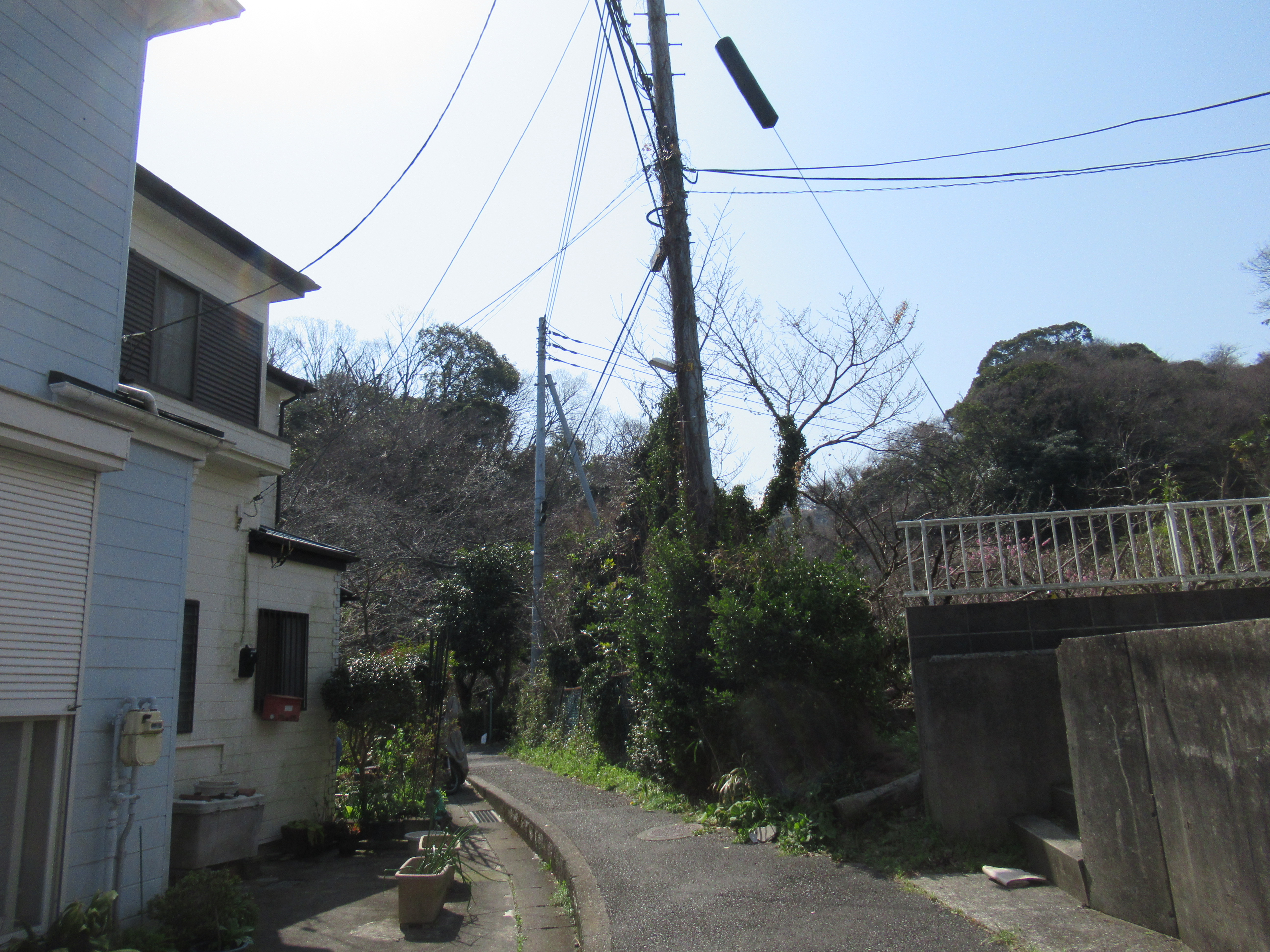
Shiba Town is pasted on a very steep hill.

If you have any questions about Yokohama’s Green Tax and Green Up Plan, please make a contact with

Strategic Planning Division, Green Environment Bureau, City of Yokohama
横浜市みどり環境局戦略企画課

Phone: 045-671-2712
FAX: 045-550-4093 

Sunday, November 16, 2025

Slanted: Tenjin-jima Marine Biological Garden for the Yokosuka City Museum 天神島臨海自然教育園


Keep on walking the road where the former imperial villa stands. It will end up at Sajima Marina, the port for pleasure boats established in 1965 with a hotel. Before reaching there, first we meet with the North Entrance for the Tenjin-jima Marine Biological Garden with the Admin Office. You can enter from here, or walk a few minutes more passing a Shintoism Shrine, which is a typical arrangement of pre-1945 Japanese high society. Soon on our right we are welcomed by South Entrance of the Garden with the visitor centre and parking spaces. To this point we are walking along a fenced forest. This is a curious forest of Tenjin-jima Marine Biological Garden. As it has a peculiar feature, we cannot enter inside the forest without permission. So, please enjoy it while you‘re walking to the Garden Gate. Oh, one important notice. The toilets are available in the buildings at North and South Gates, but no facility inside the garden itself. If you need it, please complete the necessary thing before venturing into the Garden.

The North Entrance for the Garden.
A cute house for admin purpose would be
 the remnant of Imperial summer cottage.
Shintoism shrine

The forest.
As this is the part along the road to the Marina,
comparatively speaking the area is relatively
well secluded from the direct sea winds and splashes.

The area of Tenjin-jima Marine Biological Garden is designated Natural Treasure of Yokosuka City and strictly protected as a nature reserve. We cannot beach-comb or take a petit crab home for souvenir. Instead, the visitor centre of the Garden has a good museum. It is small, but explains quite well the ecosystem of the Garden and the folkloric feature of the community around Sajima Fishing Port. According to the exhibitions, the sea in the Biological Garden has more than 100 species of sea slugs. The number species in the family of shellfish is also phenomenal. There are also baby sea creatures. Many of them found refuge in the nooks of rocky beach where the strong current of Pacific Ocean is moderated by the undersea geology. Many fishes of tropical area which reach this far north stay here during summer and even hatch eggs. The adults or babies of tropical species cannot survive cold water of winter and die. Come next spring, the new tropical creatures come ... the exhibition says marine biologists doubt if the number of such fishes are increasing in the Garden. They watch. It‘s the frontline to observe Global Warming.

The Visitor Centre at the South Gate

Many aquariums for creatures of the Garden
welcome us at the entrance.

The models of sea slugs living in the Garden.
They are so beautiful.
According to the exhibition,
they were once shell fishes but changed their mind
 and threw away the cumbersome shell.
In order to protect their body without shells,
they armed themselves with poison. Whoops.

They have colouring pictures of living things in the Garden,
 free of charge, for us to take as souvenirs.

Yesteryear’s artefacts of old fishing village

Outside, there is a how-to notice to enjoy the Garden.

Outside the Visitor Centre, there begins the strolling path of the Garden. Having said that, the path of the Garden is only one, circling the curious forest. On our right if we come from the Visitor Centre, there is a fence and a forest. On our left is rocky shore of Miura Peninsula. Provided watching your kids well and behaving carefully, you can venture into the places of tidal pools and complicated seashores around rocks. The geology of the Garden is also interesting as the strata created 5 or more million years ago below sea could be observed first hand. We can find volcanic ashes of probably gigantic eruption piled up in the bottom of the sea and pushed up by tectonic movement. Tiny fishes, crabs, barnacles ... all in the pool and quickly tried to make a distance from human shadows ... Hey, I don‘t harm you. I just only watch how you live there ... The crannies between volcanic strata are filled with conglomerates and fragments of shells. Beautiful unbroken shells of cowry can be found here and there. The living versions must live under sea here. Please do not take them home. Return the cowry to the beach. This is a protected area.

Outside the Visitor Centre.
The beginning for the strolling path
 and over there is an opening to the shore.
Many families enjoyed autumn sea.

I tried to photo the baby fishes ...


This vertical stratum tells us
the humongous power of tectonic movement.

Here, the volcanic conglomerates were
locked in the pile of ashes
 then received gigantic pressure
 to be a part of a rock ... 5 million years ago?


The place is actually an island connected to the Miura Peninsula only with the Tenjin Bridge. To the west of the Garden there is a tiny reef, Kasa-jima, which is prohibited to visit unless you have an official permit for scientific research. The intention of private life for the imperial family 80 years ago protected the area as a nature reserve. The forest in the middle of the island must have been a part of their intention. I guess when Prince and Princess were here, the Marina was not there. So, the forest was a bit larger and natural rocky shore surrounded entire island where the forest situated at the center and an imperial villa at the entrance. The vegetation of the forest was those strong ones which do not care much strong salty winds and water from sandy soil. Near the Visitor Centre, there is a patch in the forest where crinum lilies grow wild. Actually, this is the northern-most spot for them to live naturally in Japanese archipelago. Curiously, all the plants in the forest are slanted to the north as if they are parry sea winds. The person who‘s taking care of the place told me this summer the inside was affected by a long outbreak of tussock moths. Their caterpillars ate leaves bare for many camelias and large trees inside. Lots of withered trees over the fence, she said. Yeah, Miura Peninsula is warm, but too long summer, good for the moth, would be due to the global warming ...

Kasa-jima over there

The path for the Garden runs like this.

The patch for crinum lilies

Ampelopsis glandulosa var. heterophylla

Japanese cheesewood,
a typical coast plant for Kanagawa Prefecture.
They thrive on such a rocky and sandy soil ...

The plants inside the fence are growing
to the direction of the “mainland,”
away from the sea, it seems to me.

Lilium maculatum,
another typical coast plant for Kanagawa.
They still had flowers in late October.

Looking the forest from the seashore.
They are not tall trees, certainly.

Peeking in the forest. Hmmmmmmm …

Looks wild enough.

Moths-infested inside.


Many suggestions have been observed in the Botanical Garden for climate change. It would be a sign how fragile the ecosystem of the Garden. We should be attentive for this place to survive as a playing ground for tiny sea creatures. I imagine the vibrant sea life was one of the things the imperial couple loved ... I‘ve been there in a weekend of October and found many families enjoying sea creatures. I guess if it had been in the mid-summer, the place would be congested and the visitors sometimes have to wait for a parking space. If you go there during winter, the crowd should be smaller. For a sunny day without wind, the Garden is a therapeutic place. Please try, and experience imperial sitting in the winter sun. It is refreshing, I tell you.


Tenjin-jima Marine Biological Garden 天神島臨海自然教育園

3-7-3 Sashima, Yokosuka, 240-0103
〒240-0103  神奈川県横須賀市佐島3丁目7-3

Phone: 046-856-0717
Fax: 046-856-0717

Open
9:00 - 17:00 (April-September),  9:00 - 16:30 (October-March)

Closed
Every Monday (or if Monday is National Holiday, Tuesday) and December 29 -January 3

Admission Free

You can send an enquiry to m-bes@city.yokosuka.kanagawa.jp

Sunday, November 9, 2025

Keepsake of a Prince: Tenjin-jima Marine Biological Garden for the Yokosuka City Museum 天神島臨海自然教育園


The shores of Tokyo Bay are more or less concreted. Since Tokyo became the center of Japanese politics in 1600, people has continuosly engaged in massive civil engineering projects such as reclamation and changing the course of rivers. Now the look we have for the Bay is as such. Even though, there remains few spots where we can experience the remnants of original ecosystem. The previous Tone River and Arakawa River poured in the Bay from the east. The east shores of Tokyo Bay were a low land delta of these rivers. The remaining natural shores of the Bay for Chiba Prefecture are tidal flats of shallow sea. The west shores of the Bay, i.e. Kanagawa side, were the continuation of such flats until around Kan‘nai business district of Yokohama where in the 19th century many ships from overseas arrived. When Japan ended national isolation in 1854 and decided to have the Port of Yokohama in 1859, the first thing people thought was how to supply flesh water for longhaul ships. Yokohama at that time was a tiny village floating in a muddy swamp. Well water was/is salty. And so, there was the construction of the first modern water supply system in Japan for Yokohama, blah blah blah (; my post for January 12, 2018).

Concreted Port of Yokohama

The current Yokohama Chinatown is more or less the end of tidalflats. To the south from Yokohama Yamate (neighboring town to the Chinatown) to the tip of Miura Peninsula, the shores were created by plate techtonics. When the Philippine Plate crawled underneath the Eurasian Plate about 20 -15 million years ago, the earth‘s energy pushed up the deep sea sedimentary mass above water which is the origin of Miura Peninsula. Especially the south of the Miura Peninsula is coastal terraces where small but steep hills are tumbling down to the Tokyo and Sagami Bays, i.e. deep and rocky. That‘s the reason why the US 7th Fleet with an aircraft career uses the Port of Yokosuka. As its geological feature gives nice condition for humans to build ports, Miura Peninsula has lots of harbors, and so concreted. Even though, there are several natural seashores where we can enjoy the sea. One of such place is Tenjin-jima Marine Biological Garden 天神島臨海自然教育園 for the Yokosuka City Museum. It has a curious forest.

This is also Yokohama, 
in Nojima Island of Kanazawa Hakkei
 (; my post for September 2, 2022)
which is the south end of Yokohama.
Geologically,
this place shows one feature of coastal terrace.

The easiest access to the Garden is by car. It has an ample car park. You command your Car Navigation System to Tenjin-jima Marine Biological Garden, Yokosuka, and all set. I guess during summer, this parking MUST be very congested ... Using public transformation is another fun to go there. For this method, please go to the terminal station Zushi-Hayama of Keikyu Zushi Line. Leave the station from the South Exit and you immmeidately notice there is a Convini 7/11 over there and a bus stop in front of it. From there, please take Keikyu Bus Zu-71 逗-71 that brings us to Sajima Marina Entrance, the terminal stop. It‘s about 40 minutes bus ride, passing the gate of Imperial Summer House in Hayama, 葉山御用邸. I you remember our bus ride from the foot of Mt. Ogusu (; my post for April 24, 2024), this is the way we took from the opposite direction. Now we see Sagami Bay on our right from the bus. This time, the commuter service turn right before reaching the bus stop we used from Mt. Ogusu. The bus goes into Sajima housing area and reach the top of the hill, then descend down to Sajima Fishing Port. The final stop of this service, Sajima Marina Entrance, is next to the Fishing Port.

This is the bus which brings us to Sajima Marina Entrance,

and the terminal stop of Sajima Marina Entrance.

Get off at the terminal stop, and you‘ll find a cafe Portland‘s on your left. Take the road to the cafe‘s direction and turn left to a road in front of Portland‘s. Along the road, on your left is a Japanese restaurant Hikonoya, and on your right is a Italian restaurant AzzurrA Mare SAJIMA. I tell you both are at the high-end. There’s a reason for it. Passing AzzurrA Mare, there is a small bridge named Tenjin Bridge, and beyond of it on our right, there is an elegant white house with a large garden. It was a summer house of Prince Takeda … Explaining this princely house is a bit complicated … The Prince was a descendant of the 102nd Emperor Gohanazono (1419-1471). Emperor Meiji, Great-Great Grandfather of the current Emperor, had only one prince who came of age, i.e. Emperor Taisho, the Great Grandfather of the present Emperor. Japanese government at that time was afraid of the end of Imperial Family. Er, well, Meiji Emperor had 15 kids with 5 ladies (none the Empress). Among them 4 princesses survived and became adult enough to be a bride. So Meiji people did not have to worry if they were more female friendly. This way of thinking still continues for the current succession issues of Emperor in Japan … Anyway, the government at that time dug up the old documents to find a guy who had some blood relation to the Imperial family. They found and let him marry the 6th Princess of Emperor Meiji. In this way, the new Imperial family man became Prince Takeda and a younger brother of Emperor Taisho for the just-in-case scenario. Such thing did not happen, and the son of Emperor Taisho became Emperor Showa who met General McArther in 1945 after the defeat of the Pacific War. Prince Takeda returned to be a common man under the occupation by the US commander. Until that 1945 the graceful white house beyond Tenjin Bridge was the summer house of Prince and Princess Takeda. The princely family thought they should have such place near Hayama where their elder brother, Emperor Taisho, loved. Also, they secluded the place beyond the Tenjin Bridge as their private garden. That’s why now we had Tenjin-jima Marine Biological Garden, escaping concreat except the foundation of princely house. Next week, let‘s enter this nature reserve.

Portland‘s Cafe

Take the direction of the arrow.

Hikonoya

AzzurrA Mare SAJIMA

Tenjin Bridge. It‘s small.
Over there on the right is a former Imperial Summer House.
It is now a private property of a commoner.
Oh, by the way,
the place for Prince Takeda‘s principal residence is
 now Takanawa Prince Hotel in Tokyo.

Tenjin-jima Marine Biological Garden 天神島臨海自然教育園

3-7-3 Sajima, Yokosuka, 240-0103
〒240-0103  神奈川県横須賀市佐島3丁目7-3

Phone: 046-856-0717
Fax: 046-856-0717

Open 9:00 - 17:00 (April-September), 10月〜3月 9:00 - 16:30 (October-March)
Closed: Every Monday (or if Monday is National Holiday, Tuesday) and December 29 -January 3
Admission Free

You can send an enquiry to m-bes@city.yokosuka.kanagawa.jp

Sunday, May 5, 2024

For your next year cherry blossoms’ party: Kinugasa-yama Park of Yokosuka City 衣笠山公園


Returning the topic of planting cherry trees around Mt. Ogusu 大楠山, we have to check Kinugasa-yama Park 衣笠山公園. Last week, we started our hike from JR Kinugasa Station 衣笠駅. The area of Kinugasa was once the home ground of Miura Clan 三浦一族, who were the biggies of Miura Peninsula. The height of their power was in the 13th century until then the head of the Clan, Miura Yasumura 三浦泰村, lost the political and military power to his rival, Hojo Tokiyori 北条時頼, in Kamakura Shogunate 鎌倉幕府 in 1247. Yasumura was #2 in the Shogunate hierarchy. Tokiyori was #1 … a familiar story, don’t you think? At the time of clan destruction, Miura family did not live in Kinugasa area but in Kamakura. Still, their political power in Kamakura Shogunate secured the special status of the peninsula. In the first place, the reason Miura Clan gained the position in the government was a fierce battle in 1180 and the death of Miura Yoshiaki 三浦義明, then the head of the Clan, in Kinugasa Castle 衣笠城 for the victory of Minamoto-no Yoritomo 源頼朝, the founder of Kamakura Shogunate. So, the meaning of Miura Peninsula around Kinugasa was not so trivial for Kamakura. They began planting cherry trees, and the tradition continues till this day of the 21st century. Do you remember the previous Emperor and Empress planted cherry tree near the Radar Tower (; my post two weeks before)? The ordinary citizens also contribute to the growing number of cherry trees in the area. There is a notice board near the imperial cherry by NPO Ikuoukai 育桜会, which is promoting the planting of cherry trees in Japan and beyond.

The notice board by Ikuokai near the Radar Tower.

The tradition of planting cherry trees around Mt. Ogusu also gave birth of one of the city parks of Yokosuka. It is Kinugasa-yama Park 衣笠山公園. The beginning of the Park was 1907 when the local governments (then, the city of Yokosuka and Kinugasa Village) built a memorial for war-dead during Russo-Japanese War and planted cherry trees on the Kinugasa-yama which was a continuation of old ruin of Kinugawa Castle. The place became the municipal park. Since then people keep planting the blossom trees, now counting more than 2000, and landscaping the slope of the park hill for citizens to stroll. In 1990, the place was designated one of the 100 best places for admiring cherry blossoms. Going there can be a part of Mt. Ogusu hiking. So, today I tell you the route to visit Kinugasa-yama Park. The easiest way to go there is by bus from Keikyu Yokosuka-Chuo Station and get off at Entrance to Kinugasa-yama Park stop 衣笠山公園入口 (; timetable is here and here). Though, going there on foot from JR Kinugasa Station can be an interesting adventure. I tell you how.

The costume wore by actors
who played Miura samurais in 2022 TV drama.
 They depicted the battle of Kinugasa Castle.
People in Kinugasa still love Miura family so much.
They displayed the outfit in one of the shopping windows
 next to the Kinugasa Station.

First, please check the map of Yokosuka City. JR Kinugasa Station has an exit of only one direction, to the north. And Kinugasa-yama Park is spreading south of the station. So, we have to find a way to go to the south of the station. We can take the long way around by following the car roads. Or, of course, there is a shortcut, only for pedestrians. From the station, please walk around the bus terminal and turn right at the corner of Mizuho Bank and Security. The street is of an old-fashioned shopping arcade with cars and buses running in the middle. Turn right again at the end of Mizuho premise for a narrow pedestrian road. It cranked to the left immediately, and in front of you is another shopping arcade running in parallel to the bus street. It keeps the atmosphere of the late 20th century Japan … Go a bit further down this shopping street to find a greengrocer on your right. Turn right here. You’ll enter a tunnel running beneath the JR Yokosuka Line. Voila! You’re in the south of Kinugasa Station. From the exit of the tunnel, we can find a residential road going up. In our sight, there is a church on your left and a hospital on your right over there at a small crossing. Please go there and take a way to the right along the hospital. You’ll find a condominium soon next to the hospital. Just pass the condo and the road is cranked to the right. Proceed the route and turn left at the third corner, go further, and turn left at the first. The end of this route is the beginning of a trekking road of Kinugasa-yama Park. All the routes so far are narrow residential commuter roads. Navigating up to here could be an adventure in itself!

The bus road running in front of Mizuho Premise.

Please turn right here.

Then left.
In front of you is this scenery of shopping arcade.

Turn right at the greengrocers.
Could you see a tunnel over there?

The other side of the tunnel,
i.e. the south of Kinugasa Station.

There is a map at the other end.
But, it does not help much, I tell you.

Turn right here at the hospital,
and walk along the hospital premises.

After turning the third corner.
I’m sure you are getting nervous …

Now, this is the adventure part!
Please dive in this VERY narrow road.
This is the final turn in the residential area.

The other side of the alley.
Could you see the greenery over there?
That’s our destination.

Going straight, and we come here.
Please feel relieved …

Phew! The entrance to the Park.

The road starting from here is, I would say, at the bottom of the Park. Yokosuka is a port city with nice terrain suitable for an aircraft carrier of the US Navy to make the place home. Inevitably, it is very hilly, and so for Kinugasa-yama park. It is spreading a steep slope of Kinugasa-yama whose previous name was Mt. Kurakake, ASL 134m. We first go along a relatively flat road with a pond on our right over the fence. It was once the water source for the people of the area. (Now everybody in Yokosuka use waters from Sagami 相模川 and Sakawa 酒匂川 Rivers.) At the end of the pond, there begins a well-paved route of the Park. On our right is a marsh that is a water source of the pond we passed. In June, the place is adorned with the lights of fireflies. Firefly place ends with a colorful playground with slides. The route of the park becomes seriously steeper around the playpark, but it is perfectly paved. Here and there, the City of Yokosuka provides a map of the Park that shows our present location. As a city park, it has several toilets which are shown in the map. Please don’t worry in this regard. The paved slopes are lined with well-taken-care of trees, not only cherries, but also oaks, paulownia, camelia, etc. As you go up, eventually we see the ridge of Kinugasa-yama. People planted cherry trees intensively along the ridge way. The route becomes the main attraction when the City has Cherry Blossoms Festival.

The beginning of the Park Road.

The pond appears in no time.

The marsh begins.

Such maps are shown here and there in the Park.

The playpark

The slope in the Park is this much.
The cabin at the end of the photo is another toilet.
By the way, the stone wall on our left would be,
I presume,
the remnants of structure constructed by Miura Clan.

As a city park, the place has lots of detours.
Our aim is to “go up higher.”

In any case, the end will be the top of the mountain,
as long as we climb.

When I’ve been there,
it was almost the end of the season for camelias …

The detour for the ridge way.

Do you know Samurais don’t like camelias.
Reason?
Their flowers fall off from the tree as are.
It has a connotation of decapitation …

The ridge way,
aka the main street for Cherry Blossoms Festival.

The ridge way has an open space full of cherry trees, and toilets. The place also has a wide view observing the City of Yokosuka. I guess during the festival the place is full of people admiring the view. From this open space there is a well-paved strolling path going northwest. Please follow this route, and in no time, we’ll be welcomed by a view tower of Kinugasa-yama Park. This is the peak of Kinugasa-yama at ASL 134 m. The tower also has a nice view of Yokosuka City. We can also find a white radio tower at Mt. Ogusu (my post on April 16) to the northwest from there. The road coming from the open space with cherry trees becomes narrower and going down. From this route, we can proceed to Mt. Ogusu, and there is a signpost on the foot of view tower saying “Mt. Ogusu, this way.” The road within the Park is well maintained till the end. It’s not a hiking road, but a strolling path of a city park. When we descend this route, we meet with the wide car road that we took from the Iris Garden bus stop last week. The green hill in front of us is where the ancient Kinugasa Castle once stood. To Mt. Ogusu, we turn right and walk along the car road. Eventually, we meet the traffic lights that shows the direction to the entrance of Mt. Ogusu hiking road we walked last week.

The open space along the ridge way.

City of Yokosuka

The path goes northwest, and we meet

The View Tower.

The signpost showing the way to Mt. Ogusu.

Observing Yokosuka City.
We can figure out Nissan’s Oppama Factory
in the left of the photo.

The road to Mt. Ogusu.

Cherries!

The end of the Park Road.

We turn right here to Mt. Ogusu.
The greenery in the other side of the car road
is once Kinugasa Castle stood.

To Mt. Ogusu, this way please.

Miura Clan was destroyed 700 years ago, but their offsprings who branched out from the family are said to be many places of Japan. Above all, they are remembered by the locals. Cherries are precarious trees that sometimes could be difficult to take root. Yet, the continuous activity of planting cherry trees around Mt. Ogusu might be evidence of a long, very long, memory. And next year, another cherry blossoms’ season comes … Oh, I have to add this. Hiking in Miura Peninsula has relatively easy access from megalopolis Tokyo. Though, as it is in the southern part of Kanagawa Prefecture, we locals do not like to hike there during summer, especially in this age of global warming. It could be wiser not to visit there in July or August. Kinugasa-yama Park is also famous for their bush clover that will be in full-bloom in early autumn. Let’s wait. 😁


If you find environmental issues in Kinugasa-yama Park, please make a contact with the administrative office of the Park at

Kinugasa-yama Park 衣笠山公園
4 Koyabe, Yokosuka, Kanagawa Prefecture, 238-0026
〒238-0026 横須賀市小矢部4丁目

Phone: 046-853-8523