Showing posts with label Yukio Mishima. Show all posts

Friday, July 24, 2020

Beach front forests for celebrities: Visiting Oiso Town forests, introduction


Oiso Town


From this post I will tell you for several weeks the greenery of Oiso Town 大磯町, a municipality next to the Hiratsuka City 平塚市. I’ve been there early this year before COVID-19 dominates our conscience. Since then, there are some changes in Oiso due to the pandemic. I’m going to mention it, hoping the arrangement is only temporary. Anyway! The township faces to the Sagami Bay 相模湾 and has a unique meaning in Japanese history. Their forests show such feature. Part of them will be National Meiji Memorial Garden of Oiso 明治記念大磯邸園. It was planned to be partially open in July 2020. Now the inauguration is postponed. I’ll tell you more about it next week … Oiso Town is a nice place to live. Not for nothing Haruki Murakami 村上春樹 keeps his Japanese residence there. Yukio Mishima 三島由紀夫 was a party boy at Oiso Prince Hotel. There lived 8 Prime Ministers in the town. You may have an idea what kind of place, and forest, don’t you?


A morning in Oiso Fishing Harbor. 
They have a restaurant uber-popular,
 but no reservation accepted.
 Reason? They serve food of real fishermen!


First, geography. West of Kanagawa Prefecture was the epicenter for the 1923 Great Kanto Earthquake. It is the point where the Philippine Plate sinks under the North American Plate, after carrying the seabed from the Pacific Ocean. The tectonic crush continuously pushes up the seabed, creating numerous active fault lines, hills and volcanos such as mountains of Izu Peninsula 伊豆半島, Hakone 箱根, and Mt. Fuji 富士山. Shinseiko Lake 震生湖 (my post on November 15, 2019) is on this fault line. From the area of Shinseiko Lake, a hill is created to the south by the tectonic crash. It is called Oiso Hill 大磯丘陵. The Hill is sandwiched by alluvial fans of the City of Odawara 小田原市 by Sakawa River 酒匂川, and the City of Hiratsuka by Sagami 相模川 and Hanamizu Rivers 花水川. Unlike these two relatively flat areas, south slope of Oiso Hill is steeply tumbling down to the Sagami Bay. The top soil, er roughly 20m or so deep, of the hill is volcanic ashes spewed from the ancient Mt. Hakone that does not exist anymore due to the volcanic collapses. Especially between about 400 thousand to 60 thousand years ago, the debris from the volcano covered the tectonically crumpled-up seabed of Oiso. So, Oiso Hill is one of the most geologically unstable places in Japan. We’ll go there next month. 😉


Oiso Hill seen from JR Oiso Station


Even though, people have lived Oiso area for millennia. Do you remember we’ve been there once for Mt. Takatori 鷹取山 (; my post on December 1, 2017)? The hiking course to Mt. Takatori has shrines worshiped for centuries by Tokugawa Shogunate and the other historical dignitaries. Especially, the beachside to the Pacific Ocean has a long sandy shore along the main road, aka Tokaido, connecting Kyoto and Kamakura, and later Edo (Tokyo). The scenery of long beach with sharply rising hill behind (sans present-day suburban houses), with Mt. Fuji over there, must have been beautiful. Surely, it appeared often in Japanese classic literature as a gorgeous place of moderate climate. Many poets wrote their impression of the vista while they were travelling. The oldest appears in Manyoshu poetry anthology 万葉集 that was compiled in the 8th century. By the mid-19th century, the Oiso beachfront became of celebrity. After Meiji Restoration of 1868, the governmental biggies who led industrialization of Japan competed in the area to build their holiday mansions with private beach. Meanwhile, in 1885 a beach in Oiso spared from the “privatization” became the first Japanese bathing-resort for commoners.


The ancient Tokaido, now National Route 1,
 was lined with pine trees when it runs along the seashore.
 In Oiso, such design is preserved,
 and we can feel how it was in, say, 200 years ago.
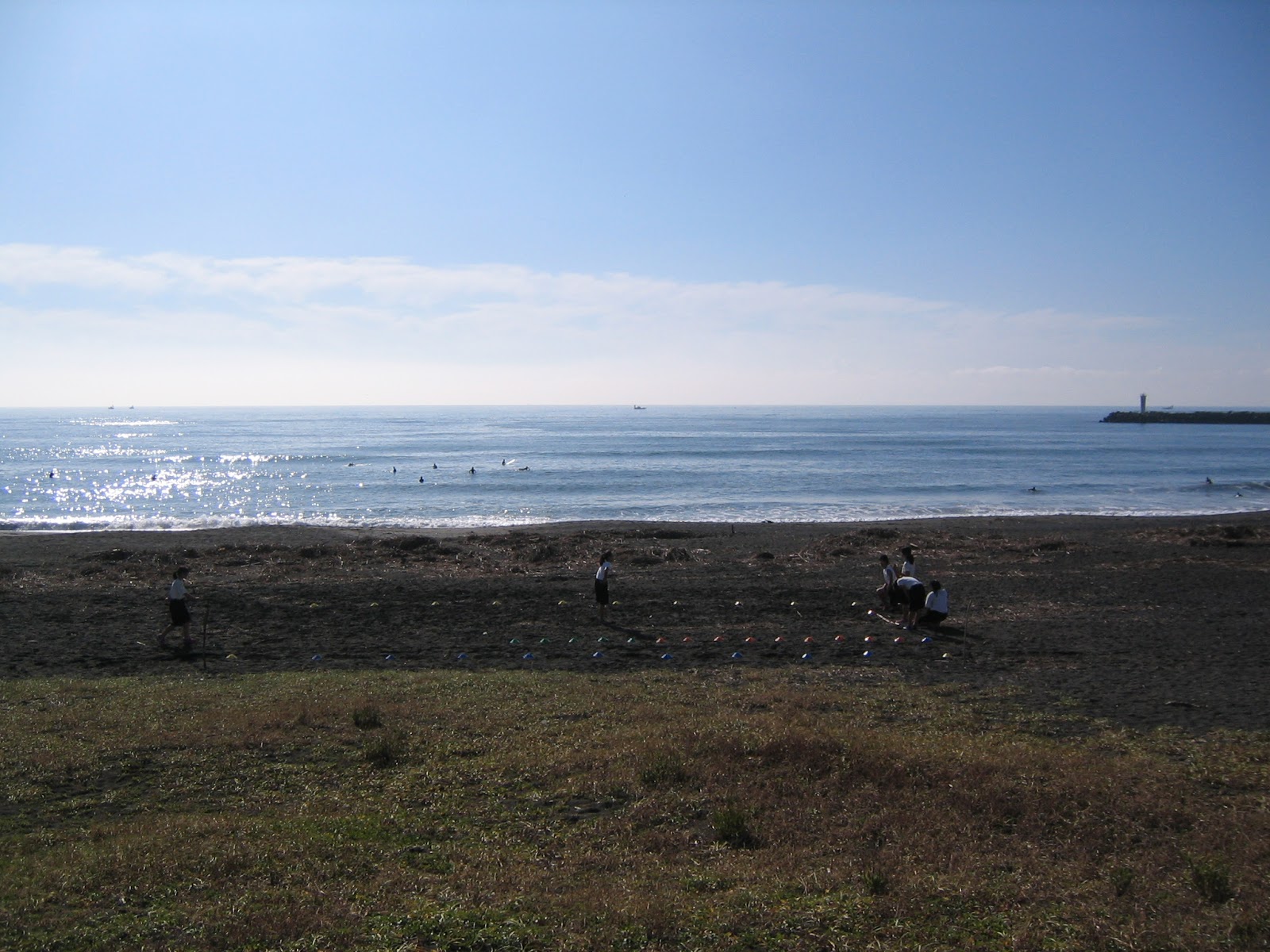
The Oiso Beach now.
 Surfers congregate all the year round including winter.
😄

When in 1945 Japan was defeated in the World War II, the GHQ of the Allied Forces ordered to dismantle the wealth of such stately homes. Since then, the owners of these real estates have been companies listed in the first section of Tokyo Stock Exchange. Now in the 21st century, the corporations could not find success to use the places as restaurant, banquet houses, or learning centers for their employees. Not many C-types could maintain their Oiso residence consists of historical buildings of the celebrities 100 years ago. When the area of historical value started to show apparent neglect, ordinary people of Oiso, together with the concerned citizens for history and art, negotiated with the local and national governments to preserve the area. The result is the 2017 cabinet decision to create National Meiji Memorial Garden of Oiso 明治記念大磯邸園. The place was planned to be partially open in July 2020 ...


Seibu Group tried to use the front building
 of the mansion owned by
 the first Japanese modern PM, Hirobumi Ito
伊藤博文,
 as a Chinese restaurant.
 Their business apparently failed …


Next week, I start to tell you my adventure with those “forests” of ex-PMs in Oiso. I found their idea is like that of Lord of Hikone and Prince Fushimi-no-miya who were the owner of the forest now in Hotel New Ohtani of Tokyo (; my post on September 20, 2019). But theirs in Oiso are certainly of the age of industrialization, and with the sad memory of Korea-Japan relationship … Please stay tuned.


If you find environmental issues in Kanagawa Prefecture, please make a contact with Kanagawa Natural Environment Conservation Center 神奈川県自然環境保全センター

657 Nanasawa, Atsugi City, 243-0121
〒243-0121 厚木市七沢657
Phone: 046-248-0323
You can send an enquiry to them by clicking the bottom line of their homepage at http://www.pref.kanagawa.jp/div/1644/

Friday, December 1, 2017

You can’t always get what you want: water and Oiso Hill 大磯丘陵


When we walk water source forests in Tanzawa 丹沢, it looks like Kanagawa Prefecture cannot have water shortage. Mountain torrents are here and there. Lots of rain washes the soil down when the afforested area has not had enough care … water is abundant. Hmmmmm … recently I noticed lots of rain does not necessarily guarantee water supply. One example we can find in our prefecture is communities in Oiso Hill 大磯丘陵. Let’s do a little hike there this week and next, to find historical ponds our ancestors dug to tackle water problem there.


It happened to be down-pouring in the morning
when we visited Oiso Hill the other day …
Believe me or not,
it’s a gigantic cinnamon tree
grew in the garden of local resident.


Oiso Town 大磯町 is more familiar with its seaside features. Oiso Beach 大磯海岸 is the first modern swimming beach in Japan, opened in 1883. In the 19th and early 20th centuries, the beachside was populated by villas of rich and powerful for Japanese national politics. Of this connection, the place was a playground for Yukio Mishima 三島由紀夫, a grandson of the third colonial minister for Sakhalin.  These days, Haruki Murakami 村上春樹 lives near Oiso Beach. All sound pretty much gorgeous, don’t they? When we look north of the JR Oiso Station 大磯駅, the hill is almost over us. Within 10 minutes’ walk from the station, we are on the seashore. A flat zone between Oiso Hill and the beach is quite limited. That’s the reason why the celebrities of the last centuries loved the scenery of the town, for sure. But geologically speaking, the place has a challenging feature especially for water. Nowadays, the town is receiving water from Sagami River so that the problem is solved. Before having modern water supply system, for ordinary folks who tilled the soil for living in Oiso, securing water was a critical issue. The area has lots of rain. So, the problem for commoners in Oiso was how to “safeguard” it.


Oiso Beach in winter.
Once it was a surfing place for Haruki Murakami.
A sunrise in Oiso Fishing Harbor
JR Tokaido Line 東海道本線 runs
along almost the edge of Oiso Hill,
where the south of the railroad is farmlands.


When we observe the southwest direction from Bodai Pass 菩提峠, about an hour walk from Yabitsu Pass ヤビツ峠, we notice there is a kind of land mass between a flat alluvial fan immediately below us, i.e. Hadano City 秦野市, and another urban expansion beyond, i.e. Odawara City 小田原市. The hilly area between 2 cities is Oiso Hill.  The hill itself is divided by an active fault line, Ikusawa Active Fault Line 生沢活断層, where currently Tokaido Shinkansen Bullet Train 東海道新幹線 is running. We can infer the birth of Oiso Hill from this scenery. Kanagawa Prefecture situates itself on the crush line between Eurasian and Philippine plates. About 5 million years ago, the tectonic squeeze pushes up the land mass on Eurasian Plates, and raised the sediments on the seafloor along the friction line of two plates. It created the base of Tanzawa Mountains and Oiso Hill 丹沢山地の衝突現象. This tectonic movement continues even now that is the Ikusawa Fault Line. The sediments from the sea continued to be raised till around 120 thousand years ago, which is now directly observable in the southeast side of the fault line called Shonan Daira 湘南平 of Oiso Hill where Komayama Park 高麗山公園 locates. Around 500 thousand years ago, Mt. Hakone and Mt. Fuji erupted and started to spew out tephra and lapilli. They piled up over the raised ground by plate tectonics, especially on the west side of the Ikusawa Fault Line. The push-up and volcanic tephra eventually created the peak of Oiso Hill, aka Mt. Takatori 鷹取山 at ASL 222m. Thus, the current soil of Oiso Hill is made of the raised seabed and volcanic projectiles whose date is relatively recent. That’s the reason why humans came here about 10 thousand years ago found the hold of local water tricky.


Observing Oiso Hill from near Bodai Pass.
The flat land below us is Hadano City,
then there is Oiso Hill separating
Hadano from Odawara over there.
Could you see
the Oiso Hill is divided by a small fissure on the left?
It’s the Ikusawa Active Fault Line.
The left of the fault line is Shonan Daira
which is very popular for family picnic.
The higher mountains at the background
of this photo is Hakone
箱根.
Observing Shonan Daira
from the estuary of Hanamizu River
花水川.
Hanamizu River originates from
Mt. To
塔ノ岳 and Mt. Oyama 大山 of Tanzawa,
and yet Oiso Town, the west of Hanamizu River,
had water problem thanks to Oiso Hill.
The point where Hanamizu River meets with
Sagami Bay
相模湾 is a peaceful place …

When farmers dug the ground for wells in Oiso Hill, they could easily be blocked by large lapilli. Although the highest altitude of the Hill is not much, the way its created is exactly the same as steep Tanzawa mountains, i.e. plate tectonics and volcanos. The slope of smallish Oiso Hill is sharp, and it’s very near to the sea. Unless the ground is extremely absorptive, rain drops reached to the ground can escape rapidly to the sea. Conglomerate of Oiso Hill is exactly the opposite of spongy soil. Frequent rain along the warm Oiso coast line can nurture a good forest for celebrities to admire, but it does not necessarily guarantee stable water supply.


To see how it actually is in Oiso Hill, we visit the peak of Mt. Takatori 鷹取山. There are several trekking routes one of which is introduced by the Oiso Town in the link above. Though, this time we start from Higashino-ike Pond 東の池, and descend to Hiratsuka City 平塚市 where we can actually observe a gigantic lapilli that prevents rain from becoming an underground reservoir. To go to Higashino-ike directly, we take a commuter bus service of Kancyu Bus Hira-31 or -32 (平‐31, 平‐32, time table here) from #2 bus stop in the north exit of JR Hiratsuka Station 平塚駅. After about 30 minutes ride, we get off the bus at Ikusawa Bus Stop 生沢, next to Higashino-ike Pond. To the south, we are greeted by frequent visits of Shinkansen Bullet Train, and Hiratsuka TV Relay Station Tower of Shonan Daira. Now, let’s continue next week our adventure to the forest that has difficulty to be a water source any way.😉


#2 bus stop
in the northern exit
of Hiratsuka Station
Ikusawa Bus Stop
A Bullet Train and the TV tower to the south of the bus stop
It was raining anyway.


The Oiso Hill covers Oiso Town, Hiratsuka City, and Ninomiya Town 二宮町. The Hill in Ninomiya Town is occupied mainly by private golf courses so that if you find problems during your hike, you’d better make a contact with either Oiso Town or Hiratsuka City. Their contact addresses are


Oiso Town Hall 大磯町役場

183 Higashi-koiso, Oiso-cho, Naka-gun, Kanagawa, 255-8555
255-8555 神奈川県中郡大磯町東小磯183
Phone 0463-61-4100 FAX 0463-61-1991

https://www.town.oiso.kanagawa.jp/ikkrwebBrowse/inquiryPC/Sec.do;jsessionid=AC09D1499780CCBD42365B009AB24F7A?mode=pc&inquiryId=53&ref=www.town.oiso.kanagawa.jp/isotabi/

Hiratsuka City Hall 平塚市役所

9-1 Sengen-cho Hiratsuka City, Kanagawa, 254-8686
254-8686 神奈川県平塚市浅間町91
Phone0463-23-1111 Fax0463-23-9467

https://hiratsuka.custhelp.com/app/ask/p/64/