
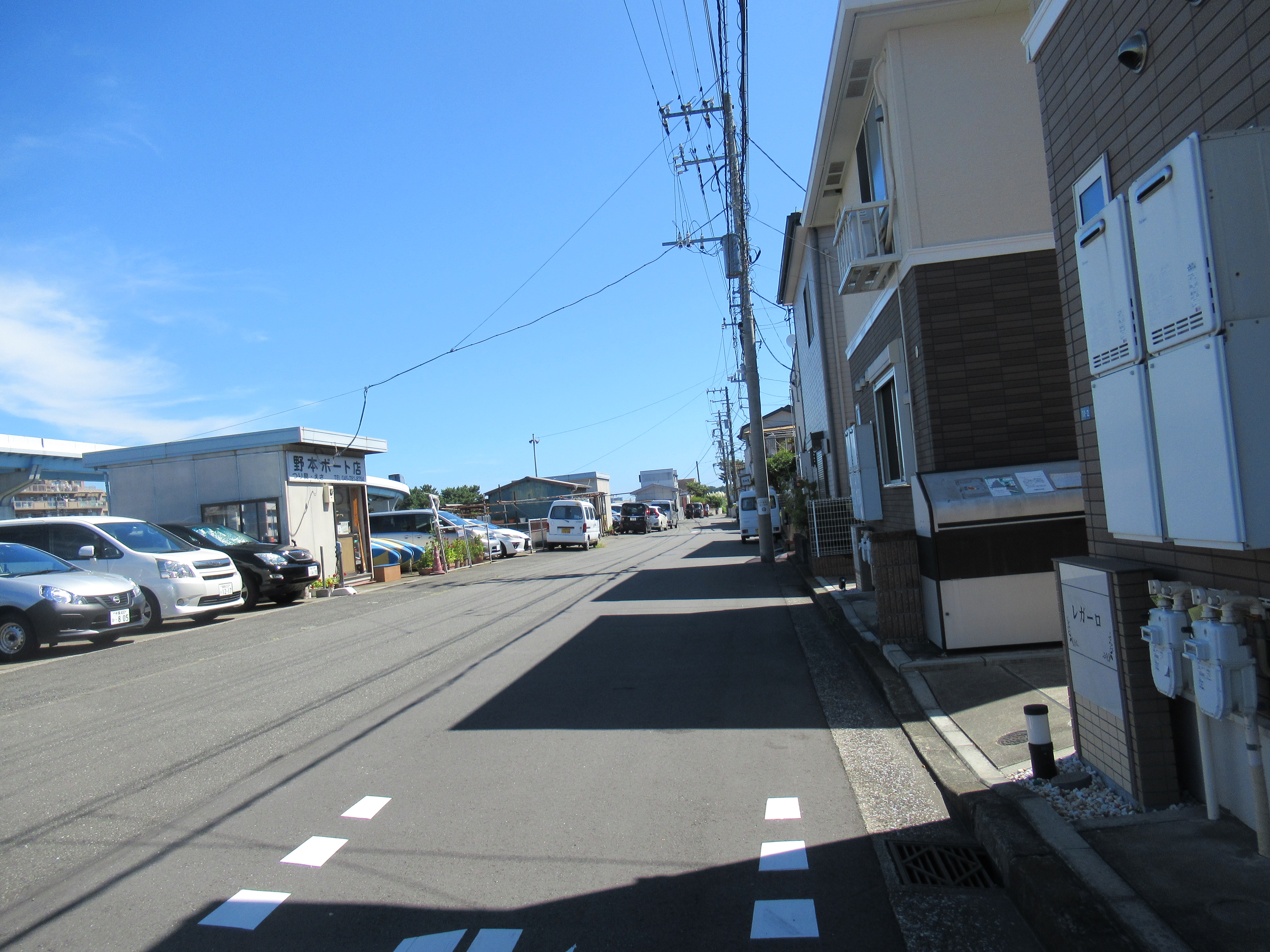
Let’s go to Nojima Park 野島公園. It’s easy. The nearest commuter railway station is Keikyu Kanazawa Hakkei 京急金沢八景. If you’re resident of Nojima Island, you take Yokohama Seaside Line monorail from Kanazawa Hakkei, and get off at the next station named Nojimakoen 野島公園. But today we should check several points before Nojimakoen Station. I recommend you walking for today’s itinerary, not taking commuter bus or monorail service. It’s to feel why Ottomo Beach 乙舳海岸 is bountiful. 😉 We find National Route 16 running in front of the Kanazawa Hakkei station. We can already see Hirakata Bay 平潟湾 on our left. Almost next to the station, there is a large shrine named Seto Shrine 瀬戸神社.
 |
| When we come out from the ticket gate of Keikyu Kanazawa Hakkei, we can find the station for Yokohama Seaside Line just there on our left. But today we don’t use the service, |
 |
| but go down these steps, |
 |
| to reach to the
ground. The road below the overpass of Seaside Line is National Route 16. Oh, by the way, if you plan to “watch” how ordinary Japanese do these days, the best way is to drive entire Route 16 that runs through almost all the suburbs of Tokyo. Demographers expect the area along Route 16 would not see population decrease at least until 2100. It’s something for this age and time of shrinking Japan. |
 |
| Turn left at the corner of the station and go along
Route 16, there is Seto Shrine. |
About 2000 years ago, the area along Route 16 from Kanazawa Hakkei Station to Kanazawa Bunko Station 金沢文庫 was an elongated inlet connected to Hirakata Bay in front of the Seto Shrine. There was difference in elevation for sea level between these two inlets that made rapids in a narrow joint by the ebb and flow of tide. Ancient people regarded such whirlpool of sea water as divine washing machine for everyday impurity. They built a shrine. At least archeological findings can be traced back to around AD 3C for the existence of Shrine. i.e. The seashore of ancient Tokyo Bay was at Route 16 more or less in front of Seto Shrine. As this is Japanese shrine, the forest around the old sanctuary has been kept intact for centuries (my post on May 22, 2015). So, today from the forest around Seto Shrine we can guess how the vegetation was along Tokyo Bay before the large reclamation.
 |
| In the sanctuary. Typical for Miura Peninsula 三浦半島, the ground for Kanazawa Hakkei area has porous geological features that tell us the place was once at the bottom of the sea, but pushed up by tectonic crash of Philippines and North American Plates. The forest of Seto Shrine stands on this very thin soil in the vegetables’ way once ubiquitous here. |
Another side of Route 16 from Seto Shrine, next to Lawson Convenience Store, there is a small way going to Biwajima Island 琵琶島 where in the middle there is a small shrine, called Biwajima Shrine 琵琶島神社. Before, there was a bridge that connected Seto Shrine and Biwajima Shrine. Those were the days Hirakata Bay was dotted by small green islands that attracted many artists to admire the scenery … Now the island has (probably concreted) permanent approach with pavement. But that’s not the point we should see here. Please go to the end of the island and check the sea at the tip of the island. We should find small planters lined under the water. It’s a nursery of common eelgrass (Zostera marina), or Amamo in Japanese.
 |
| The road to Biwajima Shrine |
 |
| Biwajima Shrine |
 |
| These stone walls indicate us the original form of the “island” that was lute (Biwa in Japanese) shaped. |
Common eelgrass was really ordinary seaweed found all over in beaches of Japan. It loves calm and shallow sandy sea floor with enough nutrition. It vigorously engages in photosynthesis, i.e. absorbs CO2 a lot. Meanwhile the underwater bushes of eelgrass become ideal homes for tiny sea creatures, planktons et al, and fishes. When it withers, it keeps absorbed CO2 in its dead body at the bottom of the sea. Here in Hirakata Bay once fishermen walked the seafloor almost bushwhacking the endless continuation of eelgrass … With rapid economic development and horrible water pollutions, many sea floors with common eelgrass, including for Hirakata Bay, had gone. However, now in Japan this plant is THE protagonist for national Blue Carbon policy. Around Nojima Island, volunteer divers of Amamo Revival Collaboration in Kanazawa-Hakkei 金沢八景-東京湾アマモ場再生会議 plant the common eelgrass strategically in order for recreating large undersea meadow funded by Toyo Construction. (They are a bit dated documents, but this and this pages – sorry in Japanese – neatly summarize volunteers’ activity.) The planter we can find at the tip of Biwajima Island is the nursery for this project. Last time they situated them on this underwater spot was in April 2019, before COVID, by lots of citizen volunteers. I guess they’ll have a similar ‘afforestation’ event in the sea near future. It could be worthwhile to check their facebook page to know the schedule.
 |
| … I could not recognize the ‘plant’ from the island.
The volunteers collect the seeds of eelgrass and sow them in the nursery. |
 |
| Seeing Nojima Island from the tip of Biwajima Island. |
Now we return to Route 16 and go north along the bottom of Hirakata Bay. Let’s turn right at the first corner which is of Seto Jinja-Mae 瀬戸神社前 (“In front of Seto Shrine”) traffic light. We immediately cross Seto Bridge 瀬戸橋 and enter a residential commuter road. Seto Bridge is to cross the former inlet which is now a river called 3km Miyakawa River 宮川 starting from the forest of Kanazawa Citizen Forest (my post on June 3, 2016) of Miura Alps (my post on April 29, 2016). This is important for today’s topic. Would you please remember that, wouldn’t you? In front of us is a green hill that is Nojima Island. About 300m or so from Seto Bridge, a small green garden named Suzaki Park 須崎公園 is waiting on our right. The place itself is nothing special. Green grass, all-weather pavement and a bench. What we should check here is the scenery we can find beyond Hirakata Bay from the garden. Over there is a continuation of green hills which is Miura Alps. This is important, I tell you.
 |
| Seto Jinja-Mae traffic light. Please turn right here. |
 |
| Miyakawa River and Seto Bridge. It is unbelievable the place was once sea. The structures on both sides of riverbank are on the reclaimed land. |
 |
| Seeing the other side of Hirakata Bay from Susaki Park. |
200m more ahead from Suzaki Park, there is one of the three bridges that connect Nojjima Island with the main island (oh, it sounds so strange … anyway, downtown Yokohama is on Honshu Island, for sure). We don’t take this bridge so let’s turn left and walk below the overhead monorail track. Ahead of us is the entrance to Nojima Island Station. Just before the entrance there is the second bridge, Nojima Bridge 野島橋, to the island. Let’s take this and enter the Island. After crossing the bridge, we turn left and go straight. Over there we see the end of the island and green lawned space with black pines. That’s the beginning of Nojima Park. Entering the park we soon find on our right the villa-museum of PM Itoh I introduced you last week. A strolling path along the beach begins in front of the PM’s villa. Basically, the beach front path is paved, wide, and the access for motorized vehicle is limited, i.e. very family friendly. Along the way, there is the area for camping tents, BBQ and baseball (all RSVP at here). Before the COVID, when they had fireworks in Tokyo Bay, people of Yokohama went there, eat BBQ, and enjoyed party with fireworks. (Oh, hand-held fireworks are prohibited inside the Park, I must add.) Although the firework festival since 1975 was proud of its history, COVID-19 nulled the expectation of citizens again this year … I’m sure it shall return!
 |
| Go straight from Susaki Park, we reach to this traffic
light. Let’s turn left there, and |
 |
| walk under the monorail. Nojima Island Station and Nojima Bridge are ahead of us. |
 |
| A scenery from Nojima Bridge. Basically, the area has lots of leisure service providers for sea fishing, in addition to professional fishery. |
 |
| Nojima Bridge at Nojima side. Let’s turn left here, to |
 |
| straight. |
 |
| The entrance to Nojima Park. |
 |
| PM Itoh’s villa is on our right. |
 |
| We’re a sort of trespassing the PM’s garden |
 |
| for arriving this point. |
 |
| For beachside walk, this way please. |
 |
| Such notice for clamming is posted here and there. |
 |
| Mmmmmmmmmmmm. Summer! |
 |
| Overnight tent needs reservation. |
 |
| BBQ place. It was before 11:00 AM, and already lots of people started their charcoal. |
 |
| Info booth for campers and BBQ. |
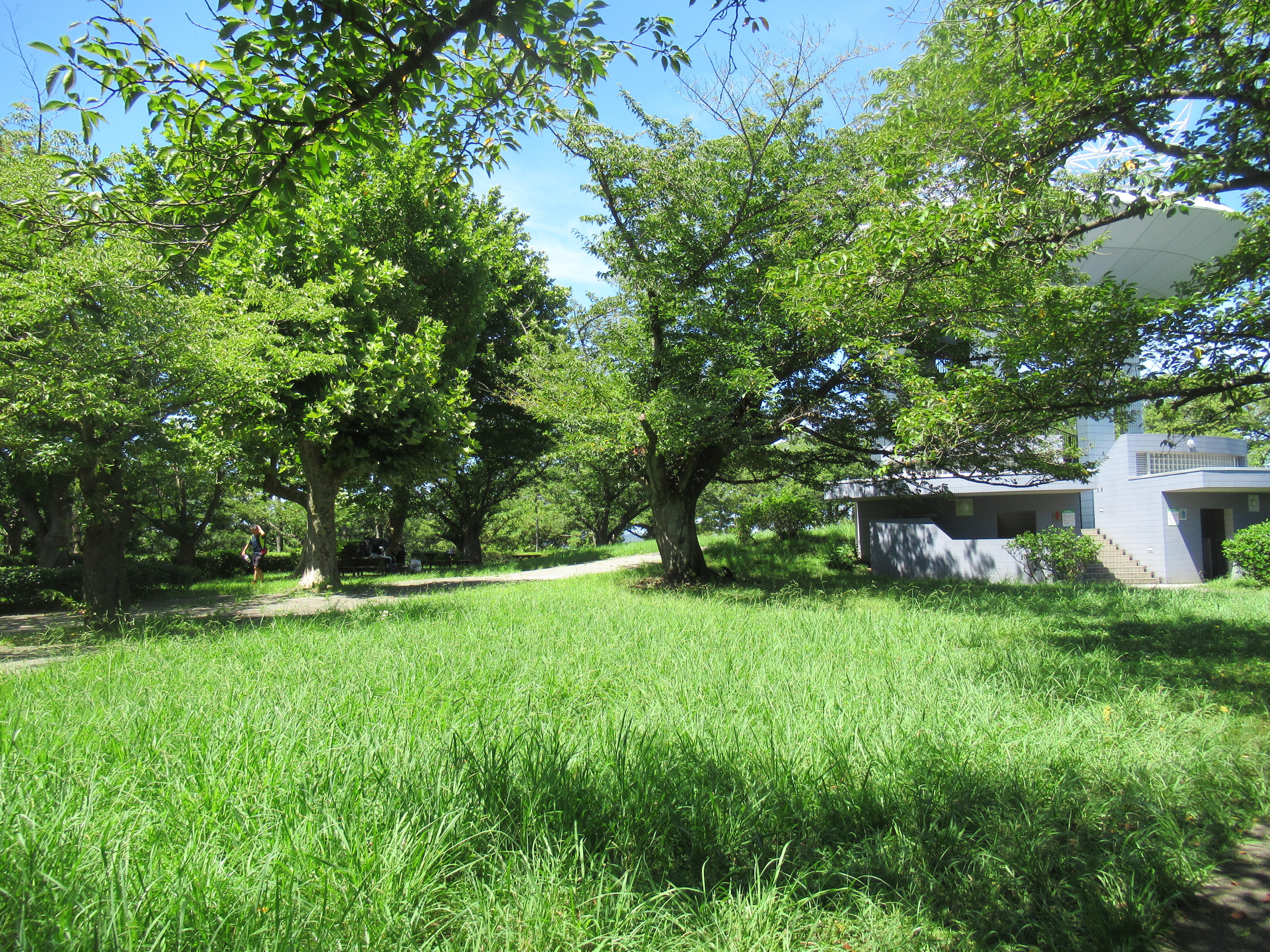
In any case, today we must go another part of the park that is an observation platform. From PM’s villa along the beach, check the first crossing we meet. On our left is the continuation of beach-side walk, on our right is to the residential area of the island and small parking lots for the Park. In front of us there is a road climbing steeply. This is the route to the observatory at ASL 57m. At the crossing by the sea we’re more or less at ASL 1-2m. So, be ready to go up rapidly to the top! The wide paved road spirals up. The atmosphere of the route soon becomes that for a forest. In addition to the black pines the vegetation has lots of broad-leaved evergreens, such as Lithocarpus edulis and Persea thunbergia, and deciduous trees such as cherry trees and Ficus erecta. Before the land were reclaimed, this part of Tokyo Bay was dotted with tiny islands covered with such trees … We then reach to the top where a large white structure invites us to climb. Let’s go up.
 |
| This is the beginning to the observation platform. |
 |
| Seaside forest |
 |
| Ficus erecta. Hm, it was not at all tasty, I tell you. |
 |
| The top of the hill with observation platform |
 |
| A part of the open space at the summit is an
archeological site where kitchen midden of 8000-7500 years ago was found in the 1940’s. This is the oldest known kitchen midden in Yokohama. |
The vista from the top of the observatory is good. To the bottom of Tokyo Bay, we can recognize congested structures of Ports of Yokohama, Tokyo, and Chiba. The direction to Nissan Oppama Factory has more open as it is nearer to the Pacific Ocean. To the west, when it is fine, we can observe Mt. Fuji, Tanzawa, Hakone, and mountains of Izu Peninsula. But nearer greenery is Miura Alps that starts from the end of suburban scenery surrounding the island. We can understand Nojima Island is enclosed by sea to the east, and the other three directions are by Miura Alps. That’s close, and it is the reason why Ottomo Beach and the area at the mouth of Hirakata Bay is so copious. Before talking more about it, let’s examine one more thing in today’s walk.
 |
| From the observatory to the direction of Tokyo. |
 |
| It’s to the Pacific Ocean. |
 |
| And the rest is there with Mt. Fuji, and |
 |
| there. The mountains / hills nearest to us is Miura Alps. |
Going down from the observatory, passing the BBQ site and Nojima Youth Learning Center 野島青少年研修センター for the City of Yokohama (where they have lots of on-the-sea programs for kid’s fun), we return to the residential area of Nojima Island. Take a road running along the west side of the island. We soon find a row of workshops of local seaweed farmers. I don’t know why but historically they are immigrants from sea-less Nagano prefecture 長野県, or around Lake Suwa 諏訪湖 to be exact, who came to Yokohama about 100 years ago and established themselves as gourmet seaweed supplier. Their product is secretly important for the menu of Sobayoshi of Nihonbashi 日本橋そばよし, the best standing noodle restaurant in the entire Tokyo area. If you’re lucky enough to encounter a retail shop open here, please just drop in for souvenir! Anyway, after the seaweed farmers’ place, there comes the third bridge for Nojima Island called Yusho Bridge 夕照橋. Now it is a concreted bridge of busy traffic, but this is the point where Hiroshigue painted “Sunset from Nojima Island.” Tourism office of the City recommends the place for couples to come at the sunset and take a photo for Instagram … OK, OK. We cross the bridge and walk along Hirakata Bay. Going straight is to the Kanazawa Hakkei Station of Keikyu where we started today. Almost immediately after Yusho Bridge, we cross another bridge, Hirakata Bridge 平潟橋 which is over Jiju River 侍従川 of 4km which is originated from Asahina Pass 朝比奈峠 (my post on August 5, 2016) of Miura Alps. Seeing from Hirakata Bridge the river looks like a canal with concreted banks for both sides.
 |
| To the exit of the Park. |
 |
| Outside is an ordinary residential area. |
 |
| The row of workshops for seaweed farmers. |
 |
| Tadahikomaru Shop. I think this is the largest retail vender of the street. |
 |
| Yusho Bridge can be seen from the workshop area. |
 |
| Crossing Yusho Bridge. … I cannot believe this is the same place Hiroshigue painted … |
 |
| Hirakata Bridge crossing Jiju River |
 |
| These yellow buoys are the sign for the mouth of Jiju River. |
 |
| Jiju River coming down from Asahina Pass. |
Today, we walked two bridges crossing rivers coming down from Miura Alps. Both Miyakawa and Jiju Rivers are short, which means the water contains lots of minerals from the forests of Miura Alps surrounding the Nojima Island. That’s another reason why the mouth of Hirakata Bay is a good place for common eelgrass. In general, fresh water discharged from forests contain large amount of CO2 and the other materials in the soil of forests it originates. If the river is short, such contents reach to the sea more directly. Common eelgrass does photosynthesis, which means lots of CO2 is good for their growth. They can also eat minerals from the forest more abundantly in Hirakata Bay. If eelgrass grows plentiful, it captures more carbon and provides homes for sea creatures that support biodiversity. The sea around Nojima Island of Hirakata Bay, Yokohama, has such potential thanks to its vicinity to Miura Alps and the forests there. It’s a site for small-scale replica of Kesen’numa Bay 気仙沼 and the Non-Profit Organization “Mori wa Umi no Koibito 森は海の恋人” in Miyage Prefecture (my post on June 17, 2022).
 |
| From Hirakata Bridge, a nice promenade is provided for strollers. |
 |
| And the end of this pedestrian way is Kanazawa Hakkei Station. |
It is said that the amount of CO2 Blue Carbon can store is 2 times more than that for Green Carbon (aka forest) on the ground. Yeah. It would be so, but the sea around Nojima Island cannot be like that without Miura Alps. Yokohama has about 141km of coastline. But beach we can go near is only 1300m = Ottomo Beach (500m) + artificial beach of Marine Park (800m). And this place has such potential for growing common eelgrass that can capture CO2 as Blue Carbon. It is amazing the remaining tiny beach collaborating with the forests has huge potential in such a way. Forest is longing for the sea, and plays a part for the sea to act, mate.

If you find a problem in the Nojima Park, please make a contact with
Office for the Park Greeneries in the South 南部公園緑地事務所
Yokohama Municipal Government Creative Environment Policy Bureau 横浜市環境創造局
Phone: 045-831-8484
FAX: 045-831-9389
No comments:
Post a Comment