Showing posts with label International Port. Show all posts

Friday, January 19, 2018

Amazing Grace: Yokohama’s waterworks and Doshi River 道志川


Being more exact, the first modern waterworks of Japan withdrew water from the confluence of Sagami 相模川 and Doshi Rivers 道志川, approx. ASL 200m in about 2.5K southwest from the peak of Mt. Takao 高尾山 (ASL 599.3m). In 1887, the system became operational and pumped up 5720m3 H2O per day for 70 thousand people in Yokohama. The water was then sent via the closed aqueduct to the first modern Japanese water purification plant in Nogeyama 野毛山, ASL 50m. Nogeyama, where we now have a zoo, is a small hill situated right behind the downtown of Yokohama named Kan’nai (関内 meaning “within the gate,” aka “a ghetto,” ASL 3m). The place was started during Tokugawa Shogunate period 江戸時代 as the “foreigners-only area.” By 1887 Japanese nationals were allowed to live there freely and to engage in international business. So, in terms of local politics, economic policy and diplomacy of the late 19th century, the location of the “water purification plant of the most advanced technology for the nation” was fitting.


In the northwestern part of Yokohama,
there runs the “
Waterworks Road 水道みち
which is now a pedestrian way over the underground aqueduct
coming from the north of the Prefecture.
If you find an old-looking brass post,
often with a head of lion,
sprouting from the road in Yokohama,
it’s a sign you are on or near the aqueduct.
They were imported and situated there
during the late 19th century
to make Japan “presentable” for Europeans.
And I found it very interesting the first pricing
of water from Yokohama’s waterworks.
Foreigners paid more than 10 times for one contract.
Er, well, those days,
ordinary Japanese lived in attached houses at best
and used communal water faucet
so that landlords collected tiny water fee from lots of tenants.
In contrast, foreigners lived in detached mansions
often surrounded by a large private garden
with lots of imported water-needy roses.
Progressive pricing made sense, huh?
The data is shown in
Yokohama Waterworks Commemoration Hall 
横浜水道記念館.


Though, the population of Yokohama kept growing. 5720m3 became quickly not-enough. In 1897, the city moved the water intake facility 3km upstream of Doshi River, and continued expanding the water network. When in 1915 the construction of Nishiya Water Purification Plant 西谷浄水場 was completed, the system was expecting to supply water for 800 thousand residents. In less than 20 years, the size of Yokohama literally exploded for more than 10 folds, and Doshi River alone carried the task to let them watered. After 1915 Yokohama experienced the 1923 GreatKanto Earthquake (関東大震災; Yokohama was nearer to the epicenter than Tokyo) and the 1945 carpet bombing by the US (横浜大空襲; do you know the US used 320 bombers for one night over Tokyo, in contrast to 517 bombers for 1 hour over Yokohama?). Yokohama’s population reached 1 million in 1942. Whatever happened, until 1947 when Sagami Dam became operational, Doshi River was the only water source for the city of Yokohama. Even today, the water intake from Doshi River is about 9% of Yokohama’s tap water. In addition, the water from Doshi River is now partially diverted to 2 underground aqueducts connected with Lake Miyagase whose water also comes to Yokohama. The abundance of Doshi River is amazing. Not only of its volume, we have to know the quality. For more than a century, people talk about Yokohama’s waterworks, “whose water is never rotten for ships to navigate to Europe via the equator.” Recalling Yokohama Village for cholera, this surely is the achievement of Doshi River, or Doshi Village Water Source Forest.


Water Source
How much Yokohama is allowed to take per day (in m3)
%
Doshi River
172800
8.8
Lake Sagami
394000
20.1
Lake Tsukui
284700
14.6
Lake Tanzawa
605200
30.9
Lake Miyagase
499000
25.5
We can check the percentage of storage at each water source, real-time, here.


Nishiya Water Purification Plant.
The place preserves several historical buildings
as working facility from its opening in 1915.
The plant in Nogeyama was destroyed completely
by the Great Kanto Earthquake.
It does not exist anymore.
Though, I imagine the scenery from Noge Purification Plant
could be similar to this vista
for Minatomirai Area
みなとみらい地区 seen from Nishiya Plant.


The question is, why Doshi River could have provided the high quantity and quality of water for more than a century. Between the Imperial Palace in Tokyo and the confluence of Sagami and Doshi Rivers, it’s about 55km distance, or in 1 hour drive. We have seen the ocean of houses of Tokyo below Mt. Takao. At least till the late 20th century, Japan has experienced impressive economic growth, while her population carried on expanding. I think British Colonel Palmer chose the first intake point for Yokohama only because of its geographical character to send water with gravitation. Without some reason, Doshi Village Forests could have been deforested rapidly for “economic development” and Doshi River would have had different characters. Yokohama, then, must have run for cover to satisfy its thirsty residents. Such things did not happen. Why?


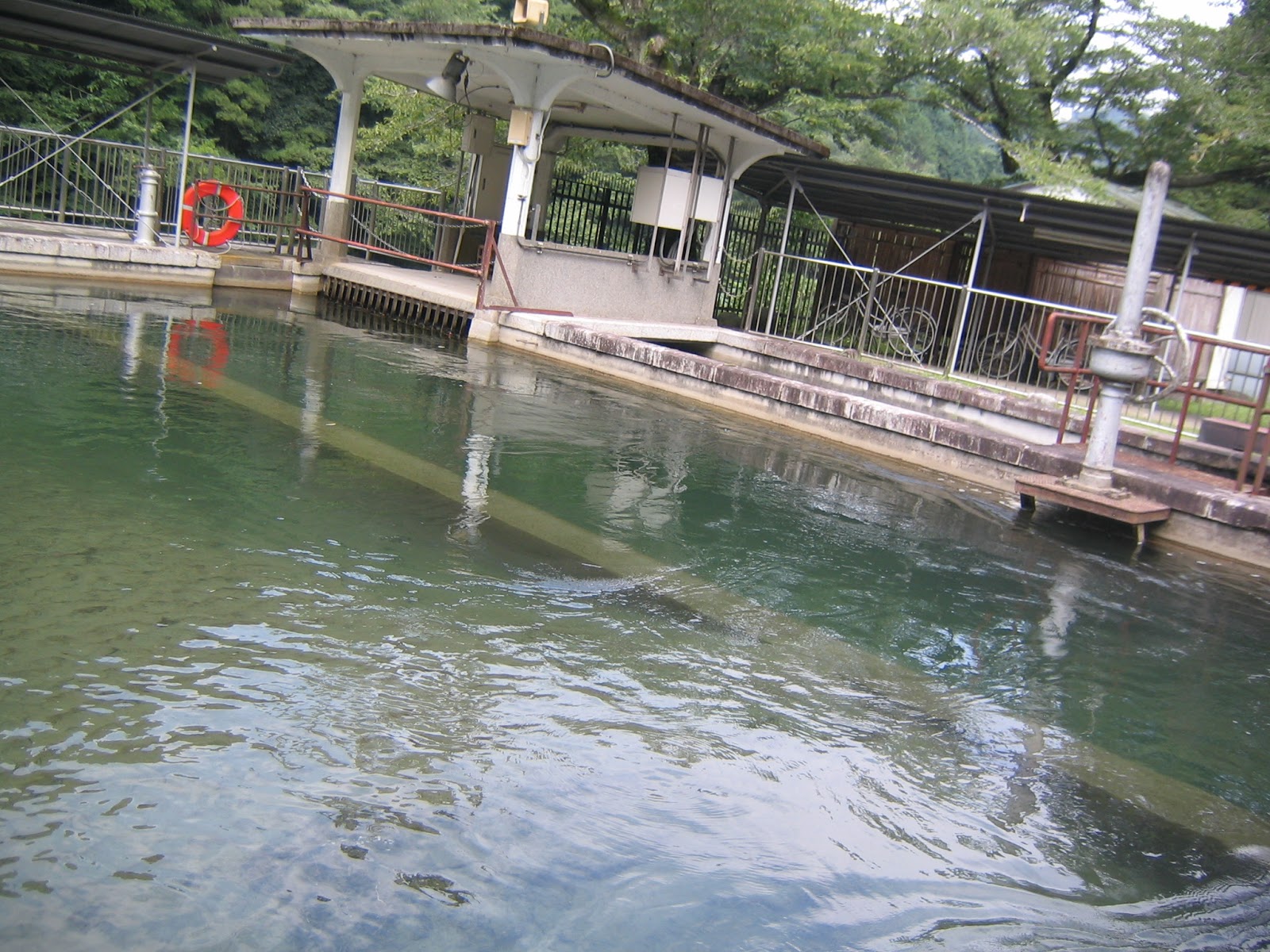
Last summer during waterworks’ festival, officers for Nishiya Plant showed me the difference in altitude among water sources in this way. Water from Doshi River comes from the highest place. Certainly.
Water of Doshi River is collected at Abiko Water Intake Facility 鮑子取水口,
and gravitationally conveyed to Aoyama Settling Basin
青山沈殿池 1K downstream.
This is the entrance for water from Abiko Facility to Aoyama Basin.
It’s built in 1913 and now a registered national monument.
The facility is still working for Yokohama’s waterworks.
At Aoyama Settling Basin, first,
large debris from the water source forests is filtered out in this pool.
According to Mr. Yagui for the Settling Basin,
sometimes even drowned wild boar piglets end up here …
Oh my …
The debris collected at the entrance of Aoyama Settling Basin.
When I’ve been there, no piglet was found.
A bit of disappointment …
The wheelbarrow is for debris gathering, of course.
When a storm hits the area and the water from Doshi River is really muddy,
polyaluminum chloride is added in this water corridor
to quicken the precipitation of impurities out of water.
The water flows simply by gravitation and
the design of the waterway facilitates the stirring with the chemical.
Mr. Yagui showed me a little experiment with polyaluminum chloride.
He added 5mg of chemical into 1L of muddy water,
stirred it, and …
here, the water becomes this transparent in less than 5 minutes.
Wow!
The debris condensed by polyaluminum or otherwise is settled here
in the basin while they slowly flow for 9 hours …
Oh, by the way, the chemical does not react with living creatures
so that this pool has lots of fishes and shrimps coming from Doshi River.
Inevitably, lots of herons use Aoyama Basin as their dinner table.
The menu for water birds cannot get through the final gate of the basin, where …
the water passes down to Shiroyama Tunnel 城山隧道that is connected in about 4.5K down with
an almost entirely underground aqueduct
running across the City of Sagamihara
相模原市.
The final destination of the watercourse is
the oldest (remaining) water purification plant in Yokohama,
Kawai Plant
川井浄水場.
Since its beginning in 1913,
no powered pump is used for sending water from Aoyama Basin to Kawai Plant.
And not a drop is shared with the people of Sagamihara.
I’ll return to this point later.
Kawai Water Purification Plant 川井浄水場.
In 2014, the plant introduced the most advanced technology
of water purification with ceramics,
and now supplies 172800m3 of tap water per day.
From here, the water from Doshi River is
distributed mainly to the western Yokohama.

Yokohama Waterworks Bureau 横浜市水道局
Phone: 045-847-6262
FAX: 045-848-4281


Friday, January 12, 2018

Magic wand to make stinky water clean: Japanese first modern waterworks


Before visiting the largest “Citizen” Forest of Yokohama, let’s talk again about 4 large water reservoirs for Kanagawa Prefecture. The line-up is

Name of the Dam
Accompanying Lake
Operational since
Water Storage Volume (million m3)
Catchment Area (km2)
Sagami Dam
Lake Sagami
1947
48.2
1200
Shiroyama Dam
Lake Tsukui
1965
51.2
Miho Dam
Lake Tanzawa
1979
54.5
159
Miyagase Dam
Lake Miyagase
2002
183
100


These dams (plus one more that I tell you next week) provide 90% of tap water in Kanagawa. The remaining 10% is for Hadano City 秦野市 and the surrounding area who uses underground water system of Mizunashi River 水無川 from Tanzawa. Unlike Tokyo, Kanagawa Prefecture procures all the water within its border. Water source forests in western Kanagawa receive lots of rain so that Kanagawa seldom has water shortage. Moreover, Kanagawa Water Source Authority神奈川県内広域水道企業団 and Waterworks Bureaus of cities have an impressive network to smooth out water supply for the entire prefecture. The dams except Miyagase have the western Tanzawa 丹沢山系 and Okutama 奥多摩山系 mountains as the catchment area where it rains a lot. Miyagase Dam 宮ケ瀬ダム asks the eastern Tanzawa only as its catchment area, but its capacity is the largest. The water offices connect Sagami 相模ダム and Shiroyama 城山ダム dams with Miyagase Dam by 2 large underground aqueducts to store water. In addition to this, the underground aqueducts also connect Iizumi 飯泉取水堰, Sagami 相模大堰 and Samukawa 寒川取水堰 waterintake facilities. Iizumi facility collects water from Sakawa River 酒匂川 stored at Miho Dam 三保ダム. Sagami and Samukawa facilities withdraw H2O from Sagami River 相模川 stored in Sagami, Tsukui, and Miyagase Dams. The connection among water facilities stabilizes water supply from these 2 rivers and distribute it to the population centers of the prefecture, including Yokohama. 


Lake Sagami created by Sagami Dam
Lake Tsukui created by Shiroyama Dam
Lake Tanzawa created by Miho Dam
Lake Miyagase, created by Miyagase Dam
Samukawa water intake facility on Sagami River


A prefecture where 1/3 of it is in the megalopolis Tokyo area, i.e. Yokohama, Kawasaki, Fujisawa, and Sagamihara, rarity of drought is an achievement. I understand the pride of officers for the prefectural government or the city halls in Kanagawa when they describe the arrangement from their wise water policy making and execution with a long-term view. Er, well, BUT, these days I felt the very beginning of the foresight would be thanks to the coincidence of the history. The lucky chance happened some 150 years ago from the now-largest “citizen” forest of Yokohama. And that was because Japan closed itself to the outer world between 1639 and 1854. In those days, I don’t think there was anybody who cleverly expected the 21st century waterworks system of Kanagawa. Taking a credit of drought-less Kanagawa should require some modesty. Now I explain you why I think so.


When Commodore Matthew Perry of the US prised open the Japanese door for westerners in 1854, Edo (Tokyo) government 徳川幕府 did not want to be physically near to the white-faced people at all. They first let the foreigners have their consulate in Shimoda of Izu Peninsula 伊豆下田, some 110K south from Tokyo, and Hakodate in Hokkaido 函館, about 800K north from Tokyo. Soon Imperialists’ gun diplomacy forced the Shogun to tolerate them nearer. In 1858, the Port of Yokohama, 20K south from the Edo Castle (now, the Imperial Palace), was opened. Even though, until 1899 Japan did not allow non-nationals to move around in the country. The concentration camp of foreigners in Yokohama was enforced for about 40 years. The port Europeans (; then, Americans became busy with their Civil War) had to stay that long was not so comfortable at the beginning. Before 1858, this part of the beach of Edo (Tokyo) Bay was salty swamps with occasional sandbanks for a small impoverished village of fishermen’s huts, called Yokohama Village. Inevitably for sandy places surrounded by salty swamps, the water quality was extremely poor. Before 1858, the area was frequently hit by the outbreaks of cholera. Do you remember in August 2015 we visited Yasaka Shrine 戸塚八坂神社 near Masakarigafuchi Citizen Forest まさかりが淵市民の森? The Shintoism Shrine is famous for the transgender festival every 14th of July. The carnival is said to be started in the 17th century to “pacify” demon of cholera. The shrine is about 8K inland from the newly established port.


Yasaka Shrine against cholera epidemic


In 1868, Edo Shogunate was replaced by Meiji Government 明治政府 who was eager to industrialize and imperialize Japan. Meanwhile, the new international port attracted lots of people from all over Japan who needed water too. The population of Yokohama exploded. In 1868, Yokohama already had 28589 residents including 1070 foreigners. By 1876, the population became 56048. For a while, the government let Yokohama to follow Tokyo about water. Some 300 years earlier, the place around Edo Castle 江戸城 was also a swamp. For centuries the Shogunate government reclaimed land, and built waterworks in ditch such as Tamagawa Josui Waterworks 玉川上水. In 1871, the mandarins for Yokohama made private entrepreneurs build ditches and carry water in wooden pipe from Tama River 多摩川, just like for Edo. According to Prof. Keiko Izumiof Iwate Prefectural University, the volume of H2O reaching to the new port in this way could not keep pace with the increasing number of residents. Worse, open-air ditches with hastily connected wooden pipes contaminated the contents at once. Outbreaks of cholera, again and again. In addition, rashly constructed new town was prone to large fire, and lack of water created the serious fire incidents. Water sellers with wooden buckets for exorbitant price did thriving business in Yokohama. On the other hand, luckily for westerners they had superior weaponry to Japan. They went like “OK, we stay at the place you designated for us. But, hey, you have to make our place nicer for our life in Japan. Otherwise, we’re gonna push you trade treaties that would extract silver, silk, and any Japanese goodies as much as possible while we are completely immune to Japanese law. By the way, our gun can kill Yokohama people easily whenever we want to.” The new government hated the international trade treaties concluded during the Shogunate. They had to provide good deals to invite westerners to the renegotiation table. i.e., Japan needed better infrastructure for Yokohama ghetto of foreigners. They realized private water business in old Edo style did not work.


A remnant of old wooden pipe
used for the private water business in Yokohama.
A water seller in early days of the port of Yokohama.
We can find these historical artifacts in
Yokohama Waterworks Commemoration Hall
横浜水道記念館.
It’s a fun museum with lots of exhibits
about mechanics of waterworks in Yokohama,
old and new.


So, in 1883, the Meiji government invited British Army Engineer Brigade Colonel H. S. Palmer to create project information documents to build a modern waterworks system for Yokohama. In his proposal, Palmer presented 2 water sources for Yokohama; Tama River and Sagami River. Kanagawa Prefectural government chose Sagami River since all the suggested water intake facilities from Sagami River was in Kanagawa Prefecture. (Ah-ha, so Kanagawa is historically stingy about water towards Tokyo!) The construction started in 1885 and the system for Yokohama became operational in 1887. It was the first modern waterworks in Japan, earlier than for Tokyo. For more than 150 years, the system continue withdrawing water from near Tsukui Lake, or, to be more exact, from a tributary of Sagami River called Doshi River 道志川. It sends water to Yokohama only by the gravitational pull created by the difference of elevation between the water source and Yokohama’s water purification plants some 53km apart; no pumping is used at all. From the beginning the network goes through the closed and sometimes underground pipes, which made it possible to convey the water to the destinations “as-is” at the intake facility. As Prof. Izumi pointed out, the design made the water quality at the source all the more important. All sound very difficult for a mega national project of the late 19th century. Why, then, could the endeavor be completed in only 4 years from the inception? Well, it’s because of the water source forest surrounding the water intake facility in Palmer’s design. It’s Doshi Village Water Source Forest 道志村水源林, owned by the city of Yokohama, but situated in Yamanashi Prefecture. That’s my topic next week. It’s a story possibly similar to the international relation along Mekong River, or for Rogun Dam of Tajikistan.


Doshi River along the Aoyama Settling Basin 青山沈でん池


Kanagawa Water Source Authority 神奈川県内広域水道企業団
1194 Yasashi-cho, Asahi-ku, Yokohama, 241-8525
Phone: 045-363-1111

Yokohama Waterworks Bureau 横浜市水道局
Phone: 045-847-6262
FAX: 045-848-4281