Showing posts with label The first Japanese modern waterworks. Show all posts

Friday, February 2, 2018

Arrested Development: a brief history of Doshi River, Part 2


Doshi 道志 is an elongated area along Doshi River道志川. 2/3 of it is Doshi Village 道志村 in Yamanashi Prefecture, and 1/3 is Aone 青根 and other townships in Kanagawa. According to Izumi (2004), 1903 data says people lived along the river and created arable land around their houses. The agricultural field was surrounded by private forests, then by the property of the village, and finally by the Emperors’ forests to the peaks and beyond of the mountains in both sides of the river. Doshi Village had 4179ha of forests of which only 15.5% was privately owned. The rest was Emperor’s property where villagers as a group were traditionally allowed to enter for their charcoal making business or wood-crafting for kitchen and other supplies, up to a point. Such products were popular as “Made-in Doshi” for centuries in markets of (present-day) Tokyo and Kanagawa. Though, in 1868 the time when Doshi Village could expect some income of forestry from Shogun was gone. It made the rule of forest non-existent. Moreover, the rapid industrialization was sweeping the entire Japan. People in Doshi started to plan joining the modern economy by using their resources for industrial production of charcoal and kitchen supplies, underground minerals, hydro-electric power generation, paper mills and expansion of commercial ag-land. In contrast, the political upheaval in the middle of the century messed up the cycle of planting, nurturing, harvesting, and replanting of trees. After the Meiji Restoration, bold mountains were spreading rapidly again in Doshi Village. In 1903, 40% of Emperor’s land did not have a tree to speak of. By then, the area had frequent floods and landslips, to be sure.


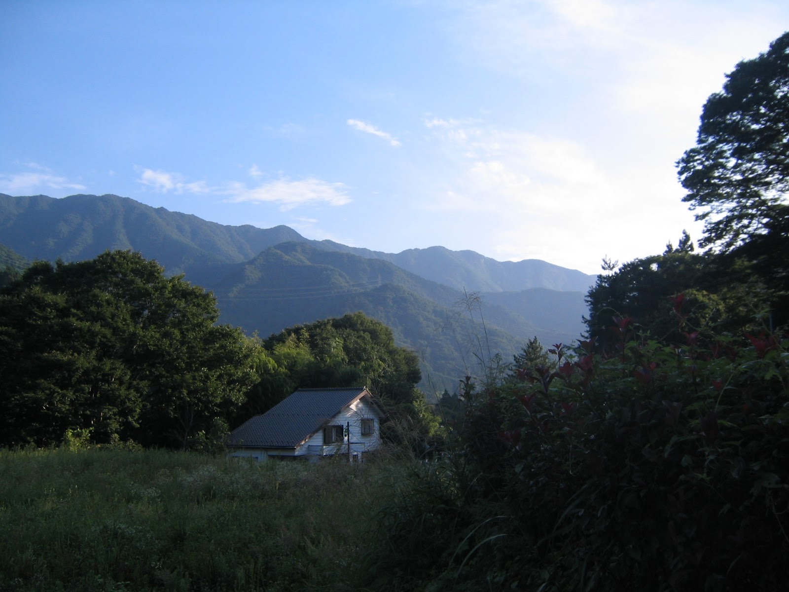
In Aone community, there is this monument
where it had a sentry to warn cities in Kanto Plane
during the World War II when B-29 of the US
approached from the west for carpet bombing.
The thing I want to say with this photo is,
if we clear the woods in Doshi area,
the vegetation could be like this.


Meanwhile, in 1887 the firstmodern waterworks of Japan became operational for Yokohama, but it soon became inadequate to serve for the rapid development of the city. The city moved the water intake from the confluence of Sagami 相模川 and Doshi Rivers to Doshi River alone and built up the system further. For the endeavor, Japanese national government gave awfully generous grants to the City of Yokohama. By 1901, the first project cycle of network expansion was completed and Yokohama achieved a balanced budget for the waterworks, which is now the tradition of Yokohama’s water. (“Thank you for your majesty in Tokyo!”) From the very beginning the system uses entirely closed ditch between the water intake facility and purification plants. The quality and quantity taken from Doshi River directly affects the water for Yokohama. The city became very watchful and demanding for the condition of Doshi River, or to be exact, of the environment of water source in Doshi Village. At that time, villagers of Doshi were busy destroying the water source forests. In 1903 Yokohama organized a preliminary survey about the situation of the forests covering the entire Doshi area. The civil engineers found if villagers cut the trees in this pace for charcoal or other industrial usage, the forests in Doshi would have been gone within 5-10 years. The city with her big brother in Tokyo became aggressive. With a help of friends in the national government, Yokohama blocked the plan to develop copper mines in Doshi, and in 1897 paid 5000 yen, or USD 51000 in 2018 (cheap, huh?), for the holder of prospecting rights as compensation. The blueprints for hydro power plants and paper mills in Lower Doshi were crushed by the hands of the Governor of Kanagawa, and several ministers of the national government. Kanagawa also made a tag team with Yamanashi Prefecture and devised a grant scheme for afforestation by the villagers of Doshi. Though, it was not enough to compensate the cash flow people received from manufacturing charcoal and the other products through deforestation. Villagers of course ignored it. Soon, residents of Doshi became more and more suspicious of and hostile to Yokohama. Then there came the final nail in the coffin.


The mountain under the cloud is Mt. Fuji, seen from Lower Doshi.
The place is this near to Mt. Fuji area.


Upper Doshi, aka Doshi Village, was / is under the administrative jurisdiction of Yamanashi Prefecture 山梨県. The lord of Yamanashi was traditionally a close relative of Shogun in Edo 徳川将軍家 during Tokugawa Shogunate 徳川幕府 so that after the Meiji Restoration 明治維新 the place had lots of Emperor’s forests. Needless to say, the prefecture and the Imperial Household who was in charge of Emperor’s property wanted to maximize the profit out of their “public” forest. Regarding Doshi forests, they haggled with Yokohama and Kanagawa for about two decades, and reached a deal in 1915 when Yokohama completed the second project cycle for the expansion to supply water for 800 thousand residents. The mayor of Yokohama and the governor of Yamanashi agreed on October 12, 2015 “To celebrate the coronation of Emperor Yoshihito (嘉仁 the father of Emperor Hirohito), 2800 ha of Emperor’s forests in Doshi is to be sold to the City of Yokohama by 130 thousand yen (about USD 2.6 million for 2018).” On October 22, i.e. 10 days later, the Ministry of Interior, who could talk with the Imperial Household, completed the paper works for the real estate deal. Have you noticed there was no player from Doshi Village in this very swift business? Yap. After October 22nd, the village received a letter from the prefectural government curtly notifying 40% of their village had changed the ownership from the Emperor to the City of Yokohama. People were astounded. They had an emergency village assembly and on October 29, delivered a petition to the Governor of Yamanashi, politicians, any possibly influential offices … either to nullify the deal, or to guarantee the continuation of their charcoal and other manufacturing business as with the forests of the Emperor. No one in high offices listened.


From Upper Doshi
looking to the direction of the downtown Sagamihara
相模原opposite direction to Mt. Fuji.
Hmmm. Looks same. Just mountains …

Thus, the Yokohama’s largest Citizen Forest was born as the Water Source Forests of Doshi Village. In Doshi, the episode has been passed on from generation to generation as “The day when our village was sold off to Yokohama.” From that time onwards, like it or not people of Doshi Village has been asked … er, well, forced … to engage in the business of water source forests for Yokohama. Cutting trees for charcoal baking business, or developing copper mine, paper mill, etc. are No-No-No. The demand from their largest landlord, aka Yokohama, dictates so. Reading Prof. Izumi’s story and the exhibitions in Yokohama Waterworks Commemoration Hall 横浜水道記念館, I felt it was very opportunistic for Yokohama to take advantage of Doshi River. Prof. Izumi, who was born in Yamanashi, wrote that the prefectural government of Yamanashi regarded Doshi Village so peripheral to allocate their forest management budget adequately. Sitting in their downtown office more than 50km far from the forests, Yokohama and the national government jumped at the opening from neglect to grab water. Looking south from the village, just over the ridge of Tanzawa mountains, there ran rivers now for Lakes of Miyagase 宮ケ瀬湖 and Tanzawa 丹沢湖 where former-guards of Shogun’s treasure trees built hydroelectric plants, forestry companies, river sand pits for construction, etc., etc. to join with the industrializing Tokyo. Yes, 100 years later, they too become the water source for Yokohama just like Doshi River. Probably, Doshi Village was different only because of their convenient location to build the first Japanese modern waterworks … It must have been looked really unfair for the Doshi villagers at that time ... And now? 


The present-day campus of Doshi Junior High.
The place now is peaceful … thank Buddha, honestly.


I made this post based on the information given at Yokohama Waterworks Commemoration Hall 横浜水道記念館 and the books below:

522 Kawashimacho, Hodogaya-ku, Yokohama, 240-0045 横浜市保土ケ谷区川島町522

Phone: 045-371-1621

Seiji Maekawa 前川 清治. The Story of Doshi 22km: a village of greenery, clear stream, and history 道志七里物語―緑と清流と歴史の郷. Yamanashi Nichinichi Shimbun 山梨日日新聞社, 2006. ISBN-10: 4897106141, ISBN-13: 978-4897106144.

Keiko Izumi 桂子. The Origin of Modern WaterResource Conservation Forests: an ecological history of forests and cities 近代水源林の誕生とその軌跡―森林(もり)と都市の環境史. University of Tokyo Press 東京大学出版会, 2004. ISBN-10: 4130760262, ISBN-13: 978-4130760263.

In case you need a contact in Doshi Village, the address of their village office is
Doshi Village Office 道志村役場
6181-1 Doshi Village, Minamitsuru-gun, Yamanashi, 402-0209 402-0209 山梨県南都留郡道志村6181-1
Phone: 0554-52-2111
FAX: 0554-52-2572

http://www.vill.doshi.lg.jp/

Friday, January 26, 2018

War and Peace: a brief history of Doshi River, part 1 道志川


The blessing from Doshi River 道志川 to Yokohama comes from Water Source Forests in Doshi Village 道志村. 21.7km Doshi River is a tributary for Sagami River 相模川. It starts from the east of Yamabushi Pass 山伏峠 whose western side is Lake Yamanakako 山中湖, and joins with Sagami River at the point west of Lake Tsukui 津久井湖. Approx. 10km of the river from Sagami River runs through Sagamihara City of Kanagawa, and further upstream is in Doshi Village of Yamanashi Prefecture. Kanagawa side was called Lower Doshi 下道志, and the area along the river in Yamanashi was named Upper Doshi 上道志. Going Upper Doshi by public transportation is tricky. The nearest train station would be Tsurushi Station 都留市駅 of Fujikyu Line 富士急行 on the foot of Mt. Fuji 富士山. From there, an hour bus ride could bring us there twice daily (time table, here). From JR Shinjuku Station of Tokyo, it’s about 4 hour journey of 3200-4500 yen (Approx. USD40) for one-way. If we go there fromYokohama, we first go to JR Gotemba Station 御殿場駅 by whatever way, and from there take a 1.5 hour bus by Fujikyu Bus 富士急バス, changing the service once at Asahigaoka Bus Stop 旭が丘バス停 on the shore of Lake Yamanaka. The expected duration of your journey is about 4.5 to 5 hours with 3800-4200 yen (USD ditto!) for one way. So, normally, we go there by car which is cheaper and quicker. When we drive to Doshi River from wherever, we have to enter National Route 413, aka Doshi Road. It’s a venerable road existing since Japanese Neolithic age, connecting Mt. Fuji with Kanto Plane 関東平野. There is no other road linking up Upper Doshi with the outer world. When we proceed in Route 413 from Lake Tsukui to Upper Doshi, we are always surrounded by mountain forests that get deeper as we approach to Doshi Village of Yamanashi Prefecture. As a rule of thumb, rich forest can withhold rain as underground water, while they simultaneously play as soil retainers. If forests are gone, the underground water system would disappear sooner or later. The scenery of Doshi Road is a very good testimony that abundant water of Doshi River is sustained by the mass of trees. Why then could Doshi Village preserve rich forests for more than a century? Actually, they are keeping the forests for at least 400 years thanks early to Japanese civil war + geopolitics, and later to international relation. Let me start first from the civil war.


Aone Community 青根 of Lower Doshi.
The road below is the Route 413,
and the blue roofs further down on the foot of
right mountains (Doshi Mountains) are
for camping lodges near the riverbank of Doshi River.
Looking south on our way to Upper Doshi.
It’s actually the northern slopes of Tanzawa Mountains.


During the 15th to 16th centuries of the civil war, Japanese cut trees a lot. Slowly growing forests were useless for rapid destruction in wars. Moreover, deforestation did not stop at the end of the civil war. After the establishment of Tokugawa Shogunate 徳川幕府 in 1603, increasing population of peace time promoted slash-and-burn agriculture for food, which put enormous pressure on the forests. Obliteration of virgin forest that was started during the 7th century in Kyoto and Nara, as Totman (1989) said, expanded all over Japan. Saving grace was, it was before the industrial revolution so that the speed of demolition did not create a collapse of environment. Rather, according to Suga, Okamoto and Ushimaru (2012), they were converting the archipelago from forests-dominating to grassland-covering with rich but different biodiversity. When a British diplomat, Sir Ernest Mason Satow, hiked around Japanese mountains in the late 19th century, he encountered here and there lots of vast flower beds in grassland. Japanese farmers cut trees, converted some into farmlands, the others to grasslands for their livestock and materials for construction and daily tools (e.g. thatched roofs and tatami mats). But, villagers in Doshi Village did not have such ordinary rural life of Japan.


This is Niiharu’s farmland nested in the Niiharu Citizen Forest of Yokohama.
The senior forest volunteers for Niiharu told me
this part of the area has been cultivated for centuries,
and the background forests are new additions in the late 20th century.
Before World War II, the majority of the scenery here was for agricultural field.
Hmmmmmmm.
A traditional house gate remaining in
Toriya community
鳥屋 near Lake Miyagase 宮ケ瀬湖.
For having this size of thatched roof,
we need rather substantial acreage of grassland.
The architecture also requires rethatching once in every 15-20 years
so that maintaining the place for construction material
(i.e. grass) for long-term was very important.
It means once deforested,
villagers had to maintain diligently the grassland
through regular mowing every fall to avoid reforestation.


Do you remember Tsukui Lake and Shiroyama Park 津久井城山公園 we’ve visited last fall? A booklet provided by the Park Office (in Japanese, downloadable from here) said Shiroyama Hill was a bald mountain when it was a fortress. The place was a battle ground, where trees were simply obstruction for the business. Samurais must have cut vegetation vigorously. From Shiroyama Park to Aoyama Settling Basin 青山沈殿池 on Doshi River, it’s only 6K. From Mt. Fuji and Kofu City 甲府市, the routes along Sagami River and Doshi River were important passage to Kanto Plane for millennia. Not for nothing National Route 20, aka Koshu-kaido Route 甲州街道 and Chuo Express Way 中央高速 run through the area. Lots of warlords from Central Japan wanted to control the territory of Doshi Village and the northern Kanagawa Prefecture. Deforestation was inevitable. However, after conquering Tsukui Castle on Shiroyama Hill in 1590, Tokugawa Ieyasu 徳川家康, the founder of Edo Shogunate, grabbed the land and ordered to afforest the entire area massively in order to create a buffer zone, in case another enemy approached to Edo (Tokyo) from the west. Later, this defense policy was transformed to industrial policy of timber and fuel (i.e., charcoal) production whose main customer was his city, Edo. Almost entire forests of Tama Region of Tokyo, and Tanzawa / Hakone of Kanagawa were the property of Shogunate Government from 1590 till 1868. There, cutting trees without governmental permission was considered as high treason with death penalty.


Afforested cypresses in Shiroyama Hill.
They were planted in the middle of the 19th century
by a local mandarin, Egawa Tarozaemon Hidetatsu
江川太郎左衛門秀龍.
The Shogunate Government must have planned
to harvest them in hundreds years later as construction materials.
Now they are registered historical monuments for Kanagawa Prefecture.
Kobotoke Pass 小仏峠 on the former Koshu-kaido Route.
There are only ruins in the 21st century,
but until about 150 years ago
there was a checkpoint of Shogunate Government,
stopping invaders to Edo (Tokyo) from the west.


Early this month, we’ve been to Lake Tanzawa 丹沢湖 to meet with a Treasure Tree 箒杉, haven’t we? The people lived in the region of Lake Tanzawa was the assigned guardian of the forests of Treasure Trees for Shogun. Villagers of Doshi also protected the afforested mountain for Edo. They could not cut trees for rice paddies or farmlands as ordinary farmers did elsewhere in Japan. Instead, they engaged in forestry for Edo government. They were also given several permissions, such as holding arms to fish in the river, or to hunt deer and the other wild animals. That was a real privilege where disarmament among non-worriers was the foundation of the Shogunate politics. The life would have been not bad in Doshi Village. There is a book, “Oral Record of Traditional Meal in Kanagawa Prefecture 聞き書 神奈川の食事 日本の食生活全集(14 published in 1992. There, the grannies lived near present-day Lake Tanzawa said even in the late 19th century their community had “traditional” regular meal with deer steak and freshly BBQed fishes. That’s something if we consider the rest of the nation of that time had mainly vegetarian diet, not by choice but due to subsistence farming. I imagine villagers of Doshi enjoyed similar life back then. Doshi Village, 14km long and narrow human settlement along the river in deep mountains, has several temples holding elaborate Buddha statues dating back to Shogunate Period, or Shintoism shrines that preside over lively traditional seasonal festivals, including amateur Kabuki theatre (Maekawa 2007). Starving people could not have such things, couldn’t they? When Ernest M. Satow visited Doshi Village in January 1872, the rush forests around Doshi River were frozen-green with nice houses dotted here and there with open-air private spa to enjoy relaxation under moonlight. Though, the life style in Doshi changed dramatically with the Port of Yokohama.


The present-day forests near Lake Tanzawa,
which was once owned by Shogun.
“Treasure Tree” in Lake Tanzawa Area.
Water source forests in Doshi Village last fall.
The greenery is thanks to
the traditional guardian of the trees in the Village.


According to Izumi (2004), when Shogunate Government collapsed and Meiji Restoration Government 明治維新政府 took over, the entire forests owned by the previous government became the property of the Emperor 御領林. Shogunate had lots of forests all over Japan, and the Government of Emperor cashed in quite many of them during the 19th century, by selling them to their supporters (with preferential price, of course). Meanwhile, at the time of societal chaos during 1868-1890, people of Doshi who lost the Shogun as the main client of their forestry tried to do the same as the rest of Japan: cutting trees to expand their field for food production to avoid starvation. On the other hand, when the Meiji Government was mulling over the treatment of their newly inherited “Treasure Trees,” Yokohama’s water problem became large. The new government took over not only the land of Shogun, but also one-sided treaties with Europeans and Americans. The deal was rapidly vacuuming Japanese silver to the coffers of imperialists in London or else, which caused hyperinflation in Japan. In addition, Japanese knew rather well similar agreements for Qing Dynasty after the Opium War were devastating the glory of China. The new government had to deal with this international issue ASAP. Sitting at the negotiation table with the imperialists as “equal” was the first thing to do. But, Yokohama where the foreigners stayed had horrible water often with viruses of epidemics. “Oh, how barbarous!” was the last evaluation Meiji Government wanted to receive during the complicated diplomacy. They hired British Engineer Colonel Palmer and built for Yokohama one of the most technically advanced waterworks of the world, earlier than for Hamburg in Germany. Furthermore, the government needed the forest guaranteeing high quality water for the international city and port. It happened to be one of the water intake facilities Palmer suggested was located in the middle of Emperor’s forests that traditionally engaged in governmental forestry. No land negotiation was necessary to secure the water source forests. Doshi was an easy place for the mandarins in Tokyo. The people in Doshi were chosen again to serve, this time, for Yokohama. They were imposed new restrictions over their life by Tokyo, and Yokohama.


The international port of Yokohama was not built in one day,
or alone, …
but with the help of these plants.


* Here is the list of books that gave me the info for this post.

Conrad D. Totman. The Green Archipelago: Forestry in Preindustrial Japan. University of California Press, 1989. ISBN-10: 0520063120, ISBN-13: 978-0520063129.

Takeshi Suka 須賀 ; Atsushi Ushimaru丑丸 敦史; Toru Okamoto 岡本 . Grassland and Japanese: ten thousand years’ journey through the grassland of Japanese Archipelago 草地と日本人―日本列島草原1万年の旅. Tsukij-Shokan 築地書館, 2012. ISBN-10: 4806714348, ISBN-13: 978-4806714347.

Ernest Mason Satow. A Handbook for Travellers in Central and Northern Japan: Being a Guide to Tokio, Kioto, Ozaka, and Other Cities; The Most Interesting Parts of the Main Island Between Kobe and Awomori, with Ascents of the Principal Mountains, and Descriptions of Temples. Forgotten Books, 2017. ISBN-10: 0282568409, ISBN-13: 978-0282568405.

The Editorial Committee for Recording Japanese Regional Diets, Kanagawa Chapter 日本の食生活全集神奈川編集委員会. Oral Record of Traditional Meal in Kanagawa Prefecture, Japanese Regional Diets volume 14 聞き書 神奈川の食事 日本の食生活全集. Rural Culture Association Japan 農山漁村文化協会, 1992. ISBN-10: 4540920022, ISBN-13: 978-4540920028.

Seiji Maekawa 前川 清治. The Story of Doshi 22km: a village of greenery, clear stream, and history 道志七里物語―緑と清流と歴史の郷. Yamanashi Nichinichi Shimbun 山梨日日新聞社, 2006. ISBN-10: 4897106141, ISBN-13: 978-4897106144.


Keiko Izumi 桂子. The Origin of Modern Water Resource Conservation Forests: an ecological history of forests and cities 近代水源林の誕生とその軌跡―森林(もり)と都市の環境史. University of Tokyo Press 東京大学出版会, 2004. ISBN-10: 4130760262, ISBN-13: 978-4130760263.


In case you need a contact in Doshi Village, the address of their village office is

Doshi Village Office 道志村役場

6181-1 Doshi Village, Minamitsuru-gun, Yamanashi, 402-0209
402-0209 山梨県南都留郡道志村6181-1

Phone: 0554-52-2111
FAX: 0554-52-2572

http://www.vill.doshi.lg.jp/

Friday, January 19, 2018

Amazing Grace: Yokohama’s waterworks and Doshi River 道志川


Being more exact, the first modern waterworks of Japan withdrew water from the confluence of Sagami 相模川 and Doshi Rivers 道志川, approx. ASL 200m in about 2.5K southwest from the peak of Mt. Takao 高尾山 (ASL 599.3m). In 1887, the system became operational and pumped up 5720m3 H2O per day for 70 thousand people in Yokohama. The water was then sent via the closed aqueduct to the first modern Japanese water purification plant in Nogeyama 野毛山, ASL 50m. Nogeyama, where we now have a zoo, is a small hill situated right behind the downtown of Yokohama named Kan’nai (関内 meaning “within the gate,” aka “a ghetto,” ASL 3m). The place was started during Tokugawa Shogunate period 江戸時代 as the “foreigners-only area.” By 1887 Japanese nationals were allowed to live there freely and to engage in international business. So, in terms of local politics, economic policy and diplomacy of the late 19th century, the location of the “water purification plant of the most advanced technology for the nation” was fitting.


In the northwestern part of Yokohama,
there runs the “
Waterworks Road 水道みち
which is now a pedestrian way over the underground aqueduct
coming from the north of the Prefecture.
If you find an old-looking brass post,
often with a head of lion,
sprouting from the road in Yokohama,
it’s a sign you are on or near the aqueduct.
They were imported and situated there
during the late 19th century
to make Japan “presentable” for Europeans.
And I found it very interesting the first pricing
of water from Yokohama’s waterworks.
Foreigners paid more than 10 times for one contract.
Er, well, those days,
ordinary Japanese lived in attached houses at best
and used communal water faucet
so that landlords collected tiny water fee from lots of tenants.
In contrast, foreigners lived in detached mansions
often surrounded by a large private garden
with lots of imported water-needy roses.
Progressive pricing made sense, huh?
The data is shown in
Yokohama Waterworks Commemoration Hall 
横浜水道記念館.


Though, the population of Yokohama kept growing. 5720m3 became quickly not-enough. In 1897, the city moved the water intake facility 3km upstream of Doshi River, and continued expanding the water network. When in 1915 the construction of Nishiya Water Purification Plant 西谷浄水場 was completed, the system was expecting to supply water for 800 thousand residents. In less than 20 years, the size of Yokohama literally exploded for more than 10 folds, and Doshi River alone carried the task to let them watered. After 1915 Yokohama experienced the 1923 GreatKanto Earthquake (関東大震災; Yokohama was nearer to the epicenter than Tokyo) and the 1945 carpet bombing by the US (横浜大空襲; do you know the US used 320 bombers for one night over Tokyo, in contrast to 517 bombers for 1 hour over Yokohama?). Yokohama’s population reached 1 million in 1942. Whatever happened, until 1947 when Sagami Dam became operational, Doshi River was the only water source for the city of Yokohama. Even today, the water intake from Doshi River is about 9% of Yokohama’s tap water. In addition, the water from Doshi River is now partially diverted to 2 underground aqueducts connected with Lake Miyagase whose water also comes to Yokohama. The abundance of Doshi River is amazing. Not only of its volume, we have to know the quality. For more than a century, people talk about Yokohama’s waterworks, “whose water is never rotten for ships to navigate to Europe via the equator.” Recalling Yokohama Village for cholera, this surely is the achievement of Doshi River, or Doshi Village Water Source Forest.


Water Source
How much Yokohama is allowed to take per day (in m3)
%
Doshi River
172800
8.8
Lake Sagami
394000
20.1
Lake Tsukui
284700
14.6
Lake Tanzawa
605200
30.9
Lake Miyagase
499000
25.5
We can check the percentage of storage at each water source, real-time, here.


Nishiya Water Purification Plant.
The place preserves several historical buildings
as working facility from its opening in 1915.
The plant in Nogeyama was destroyed completely
by the Great Kanto Earthquake.
It does not exist anymore.
Though, I imagine the scenery from Noge Purification Plant
could be similar to this vista
for Minatomirai Area
みなとみらい地区 seen from Nishiya Plant.


The question is, why Doshi River could have provided the high quantity and quality of water for more than a century. Between the Imperial Palace in Tokyo and the confluence of Sagami and Doshi Rivers, it’s about 55km distance, or in 1 hour drive. We have seen the ocean of houses of Tokyo below Mt. Takao. At least till the late 20th century, Japan has experienced impressive economic growth, while her population carried on expanding. I think British Colonel Palmer chose the first intake point for Yokohama only because of its geographical character to send water with gravitation. Without some reason, Doshi Village Forests could have been deforested rapidly for “economic development” and Doshi River would have had different characters. Yokohama, then, must have run for cover to satisfy its thirsty residents. Such things did not happen. Why?


Last summer during waterworks’ festival, officers for Nishiya Plant showed me the difference in altitude among water sources in this way. Water from Doshi River comes from the highest place. Certainly.
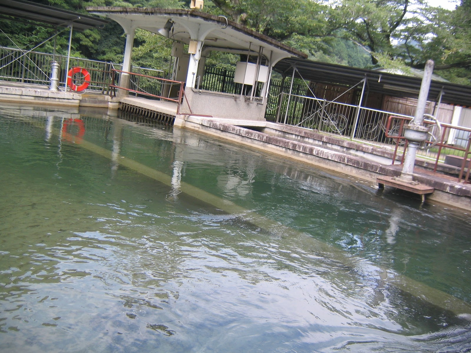
Water of Doshi River is collected at Abiko Water Intake Facility 鮑子取水口,
and gravitationally conveyed to Aoyama Settling Basin
青山沈殿池 1K downstream.
This is the entrance for water from Abiko Facility to Aoyama Basin.
It’s built in 1913 and now a registered national monument.
The facility is still working for Yokohama’s waterworks.
At Aoyama Settling Basin, first,
large debris from the water source forests is filtered out in this pool.
According to Mr. Yagui for the Settling Basin,
sometimes even drowned wild boar piglets end up here …
Oh my …
The debris collected at the entrance of Aoyama Settling Basin.
When I’ve been there, no piglet was found.
A bit of disappointment …
The wheelbarrow is for debris gathering, of course.
When a storm hits the area and the water from Doshi River is really muddy,
polyaluminum chloride is added in this water corridor
to quicken the precipitation of impurities out of water.
The water flows simply by gravitation and
the design of the waterway facilitates the stirring with the chemical.
Mr. Yagui showed me a little experiment with polyaluminum chloride.
He added 5mg of chemical into 1L of muddy water,
stirred it, and …
here, the water becomes this transparent in less than 5 minutes.
Wow!
The debris condensed by polyaluminum or otherwise is settled here
in the basin while they slowly flow for 9 hours …
Oh, by the way, the chemical does not react with living creatures
so that this pool has lots of fishes and shrimps coming from Doshi River.
Inevitably, lots of herons use Aoyama Basin as their dinner table.
The menu for water birds cannot get through the final gate of the basin, where …
the water passes down to Shiroyama Tunnel 城山隧道that is connected in about 4.5K down with
an almost entirely underground aqueduct
running across the City of Sagamihara
相模原市.
The final destination of the watercourse is
the oldest (remaining) water purification plant in Yokohama,
Kawai Plant
川井浄水場.
Since its beginning in 1913,
no powered pump is used for sending water from Aoyama Basin to Kawai Plant.
And not a drop is shared with the people of Sagamihara.
I’ll return to this point later.
Kawai Water Purification Plant 川井浄水場.
In 2014, the plant introduced the most advanced technology
of water purification with ceramics,
and now supplies 172800m3 of tap water per day.
From here, the water from Doshi River is
distributed mainly to the western Yokohama.

Yokohama Waterworks Bureau 横浜市水道局
Phone: 045-847-6262
FAX: 045-848-4281