
The forest we saw on the left when we came out of Asahina Kiridoshi 朝夷奈切通 consists of 1.7 ha of Hisagi Oike Park 久木大池公園 of Zushi City 逗子市, and 288 ha of the Forest o Ikego 池子の森 spreading between Yokohama and Zushi. Until 1937, there was two-millennia years old Ikego Village where people had maintained Satoyama life of rice cultivation. Imperial Navy of Japan seizured the area for their munitions depot, and forced the villagers to emigrate. When Japan unconditionally surrendered to the Allied Forces in 1945, the place was simply transferred to the jurisdiction of the US Navy. In 1983, the US government announced their plan to bulldoze the forest for a large American style housing development to their sailors. A huge protest occurred all over Japan. The Navy’s plan was shrunk dramatically. The expected sprawl of American town with detached houses became 68 apartments for 854 families of the US Navy personnel, built in a compact area of 85 ha within the Forest. Now, at least Google Earth shows the Forest maintains its integrity as a mass of greenery. (Hey, it’s the power of grass-roots diplomacy!) In any case, Ikego Forest is under extraterritoriality, and we certainly are not allowed to hike there, except for one part. In March 2016, U.S. Fleet Activities Yokosuka FAC3099 and the City of Zushi opened jointly 1/5 of Ikego Forest as the weekend Nature Parkof Ikego Forest 池子の森自然公園. (A map of the Nature Park, not the entire Ikego Forest, here.) 80 years of “off-limits” national security policy has kept the Forest from the ferocious attack of urbanization in the metropolitan Tokyo. Now, in order to maintain the ecology of Ikego Forest, 90% of the newly granted area remains inaccessible. (Their zoning concept is shown here.) Even though, we can still weekly walk the allowed roads in the 10% area and watch how the nature can transit without human intervention for about a century in this part of Japan.

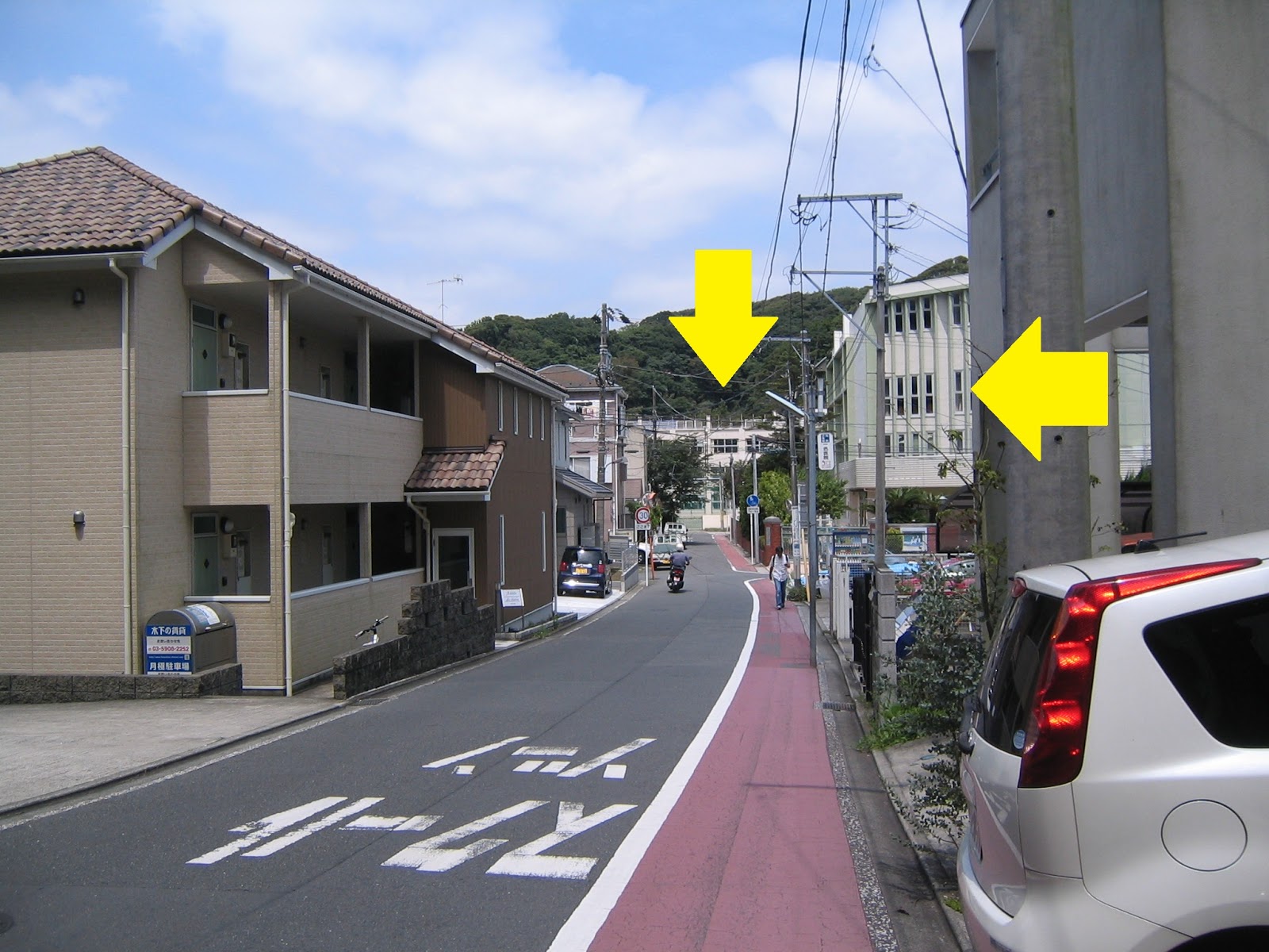
As such, Ikego Forest has two “official” entries. One is in Hisagi town, 久木 located about 20 minutes on foot from JR Zushi Station. I personally think entering from this side and leave from the other side (the US camp exit) of the Forest is the smartest. We leave from the West Exit of Zushi Station, which is in the opposite of the Beach Side Exit, with the stairs that say “To Yamano-ne, Ikego, Zushi Cultural Gymnasium.” Let’s walk for about 100m along the JR Yokosuka Line to the east. Turn left at the corner before the railroad crossing. There is a utility pole in that corner with a sign, “Seiwa Gakuin, this way.” Simply follow this direction to find first Seiwa Gakuin Girls’ Jr.-Sr. High School, beyond a tunnel. After Seiwa Gakuin High, go straight to the T-crossing at Hisagi Elementary, turn right to walk a cranked way between Seiwa Gakuin and Hisagi Elementary, then right again at another T-crossing at Hisagi Shrine. From this position, we can see Ikego Forest in the northeast direction. Go straight to the forest along the road from Hisagi Shrine, and soon we’ll be greeted by a small sign saying “Ikego Forest, this way.” The end of the alley is a private parking lot (which you cannot park your car unless you have a contract) with an even narrower alley running along the wired fence to the forest. Soon a sign greets us, “Off Limit Area as the facility of the US Forces, Japan. Trespassers shall be penalized by the Japanese National Law. The Commander of the US Navy Camp Yokosuka, and The Chief for Yokohama Defense Facility Bureau.” Yokohama blah-blah is the old name for South Kanto Defense Bureau of Ministry of Defense of Japan. i.e. Welcome to Ikego! Soon we meet with rather heavily guarded Hisagi Entrance of the Forest. From the entrance there is a gravel road that leads us to a well-paved road which runs in a kind of American style park area. We reach to Area 1 and 2 in the map from Hisagi Entrance.
 |
| West Exit of Zushi Station |
 |
| Railroad
crossing on the right, the direction to Seiwa Gakuin on the left |
 |
| Turning
to the left, we soon find Y-crossing. Take the left, and proceed along the road. |
 |
| We find a tunnel eventually ahead. |
 |
| At the
exit of the tunnel: on the right is Seiwa Gakuin High, and over there is Hisagi Elementary. |
 |
| Hisagi Shrine for Summer Festival … |
 |
| Could
you figure out the sign for Ikego Forest on the left of this photo? |
 |
| Nearly there. |
 |
| Welcome! |
 |
| Hisagi Entrance of Ikego Forest |
 |
| The
opposite side of Hisagi Entrance is the ground for Hisagi Elementary and Middle-High which is for school kids only. Between the Forest entrance and the Ground, there is a stream the water is gushing from the Forest. The small water system is home for fireflies. It seems to me Americans living in Ikego also have a fun-club for this tiny but lovely creature. |
 |
| We can park our bikes inside the gate. |
 |
| Proceeding
along the gravel road … I found the forests of Phyllostachys bambusoides both sides show not much human intervention. They are too congested for a bamboo forest of Satoyama, and many dead trees are hooked by the crowded neighbors. |
 |
| When we enter from
Hisagi town, we reach to this point of the Forest. |
Another entrance to the Park is from Keikyu Zimmuji Station 京急神武寺駅. This station is right next to the housing complex for the US Navy, and equips a special entry for them. Unless you have a valid US Navy ID, you cannot use that gate. So, for us, the station has only one gate. We leave the station and go to a T-crossing of Zimmuji Station Entrance Traffic Light 神武寺駅入口. Turn right there and walk for about 400 m, passing old Ikego Shrine 池子神明社 and Toshoji Temple 東昌寺. On the right, there will be a railroad crossing that leads us to the main entrance to Ikego Heights Family Housing of the US 7th Fleet. We walk the road running in front of the heavily guarded gate. The opposite of the gate is 400 m track field, two baseball grounds and tennis courts. These are the facility constructed by the US, and now open for Japanese public during weekends. As such, all the score boards and other notices are written in English, and Japanese are pasted over or below the original. This area is important for us because it has many toilets that are non-existent in the other parts of the Nature Park. We have to utilize whatever the chance fully in Ikego! Also, in front of the tennis court, there is an admin building for the Park. The ground floor of the building has large toilets and a visitor center where you can receive a hardcopy map of the Park. If you plan to reserve the usage of the sports facility, you can consult with them. (Zushi City has a web-based reservation system, but you have to register first. The staff for the visitor center could help you how.) The second and third floors of the admin are for Ikego Artifacts Museum 池子遺跡群資料館. When we turn right at the road from the Hisagi Entrance, we first find another tennis courts on the right, then a 150 m long New Hisagi Tunnel. At the exit of the tunnel from Hisagi Entrance, we can find the admin building on the right.
 |
| Zimmuji Station Traffic Light |
 |
| Ikego Forest seen from Jimmuji Station |
 |
| Ikego
Shrine that has a history of community shrine of Ikego Village, said to be established in 1177 by Minamoto-no Yoritomo 源頼朝. |
 |
| Toshoji
Temple. Its principal object of worship is Mahavairocana 大日如来 that was saved by a monk who escaped from the destruction of Kamakura in 1333 and re-established his temple in Ikego with the statue. |
 |
| The railroad crossing |
 |
| Wow |
 |
| The Park starts here. |
 |
| 400 m
track field. Oh by the way, we can park our car along the road for the sports facilities. … So American … |
 |
| Hmmmm,
unless you play American football, some of the entries do not mean much in Japan. |
 |
| The
beginning of toilets … the size of TOTO here is Japanese, not that large American. |
 |
| The
admin building. The structure next to the building is the last toilet! We can walk the 2-lane road from here freely, though occasionally US personnel drive through here with max 10 mph. |
 |
| The
tunnel to the admin building from Hisagi side. Zushi locals use the tunnel for weekend training of kids to learn how to ride a bike without the fear of cars. |
 |
| It’s
funny to find the name plate of the tunnel written only in English, in Japan. |
When Americans settled to have a smaller development for housing, there still remained a problem. The area included 12 ha of possible archeological site. So before the construction, during 1989-1994 archeologists of Kanagawa Prefecture excavated the area and found lots of interesting artifacts, together with the evidence of tectonic crashes among Pacific, Philippine, North American and Eurasian Plates. The result of their study is currently stored here in the admin building of Ikego Park. The third floor has a small museum that exhibits some treasures. To know the evolution of Ikego area, this is the place worth visiting. The characteristics of Ikego archeological site is, the place preserved organic materials such as ancient clothes and wooden tools fairly well. It is because excavation site was in the ancient river beds where the artifacts were buried deep under the wet soil. The tools and “dresses” were in effect vacuum-packed by the cray which stopped their decay. I was impressed by the ancient wooden handles for axes and swords with holes to fit stone blades. Although they are not gorgeous as we could find in the National Museum in Ueno, the things in Ikego Museum can show us a bit how the ordinary people lived in Ikego from 2500 years ago till 1937. The museum also has an exhibition explaining the fossils of (a type of) calyptogena soyoae lived 300 million years ago. This large bivalve thrives in deep sea where methane and other poisonous gases jet out from the core of the planet. The Pacific side of Japanese archipelago is along the (literally) abysmal fissure of the plates with lots of gases, which is ideal for calyptogena soyoae. But Ikego does not have a record of being a sea floor 2,000 m deep. The fossils were formed down there and pushed up to Ikego by the tectonic crashes during the formation of Miura Peninsula. In the Museum, the detail of the process is explained, together with a silicon-covered surface of the stratum with fossils. Later we’ll encounter a large unearthed stratum for calyptogena soyoae so that receiving a briefing here is handy.
 |
| Entrance to Ikego Museum |
 |
| Inside |
 |
| The wooden artifacts in Ikego |
 |
| The fossils of calyptogena soyoae |
 |
| It
seems to me the second floor of the Admin Building is still dominated by the crates of retrieved artifacts. |
You’ll find a sign between the admin building and a baseball field, saying “Trekking road this way.” Simply follow the direction along the tennis courts. At the end of the paved road there is an American style portable metal picnic table (which is ubiquitous in Ikego). Next to the table is another “Trekking road this way.” Turn right there. The road goes along the tennis courts, and at the end on the right there is a large bolder that is actually the mass of fossils of calyptogena soyoae dug out from the site of baseball fields. Wow. This part is fenced with wire mesh that has one opening. It is an entrance to a trekking road runs almost along the New Hisagi Tunnel. This is the only hiking road allowed in Ikego Nature Park. From the admin building side, the way first climbs up steeply until a resting place with a (permanent, and probably Japanese) picnic bench, and tumbles down to the small forest of phyllostachys bambusoides next to Hisagi side of the mouth of the Tunnel. For adults, it takes about 15 minutes from the sports facilities to Hisagi side with this way. If we take the Tunnel, it’s about less than 5 minutes of distance … an achievement of civil engineering, perhaps. The entire trekking route here is well-equipped with steps and handrails (of Yokohama Citizen Forests’ grade) although the slope is very steep. I guess this was the route the villagers of Ikego used for their Satoyama. Along the route, there are many over-grown coppiced trees. 3 or 4 gigantic trunks of acorn trees and others start with the same one base. They were supposed to be cut for household usages when they were 10 or 15 years old. They never had the chance for that. Some of the trees have collapsed from the bottom, hanging precariously over the neighboring boughs. Wisteria and the other large vine trees are twining around the large deciduous trees. We can feel this place is wet: the floor of the forest is covered with large moisture loving vegetation including ferns and aucuba japonica.
 |
| “Trekking road this way” 1 |
 |
| “Trekking road this way” 2 |
 |
| The road along the tennis courts |
 |
| The fossils of calyptogena soyoae |
 |
| The entrance to the trekking road |
 |
| The
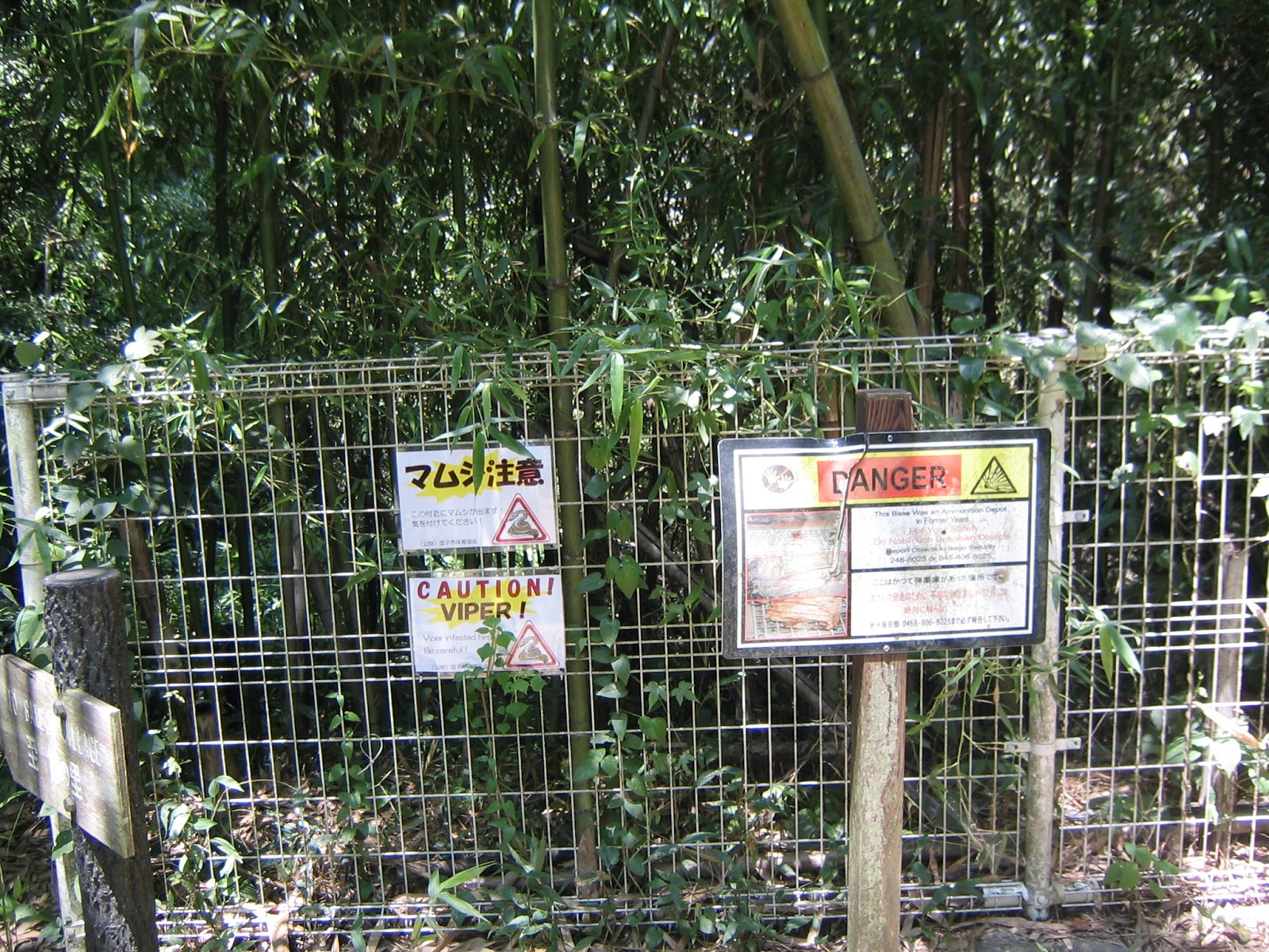
warning signs at the entrance. One is for viper, another is for unexploded ordnance … Very Ikego. |
 |
| The
bottom of both entrances to the trekking route is small forests of phyllostachys bambusoides … it’s surely not managed by humans for a long time … lots of fallen bamboos within a very congested forest … |
 |
| Steep climb |
 |
| The picnic bench is taken. Ah, yes, this one is not of portable metal, but the permanent facility ... could be the only permanent picnic bench in Ikego Forest at the moment. |
 |
| Overgrown coppiced trees |
 |
| Fungi are working for forest transition … |

 |
| Wow |
 |
| Hisagi side of entrance |
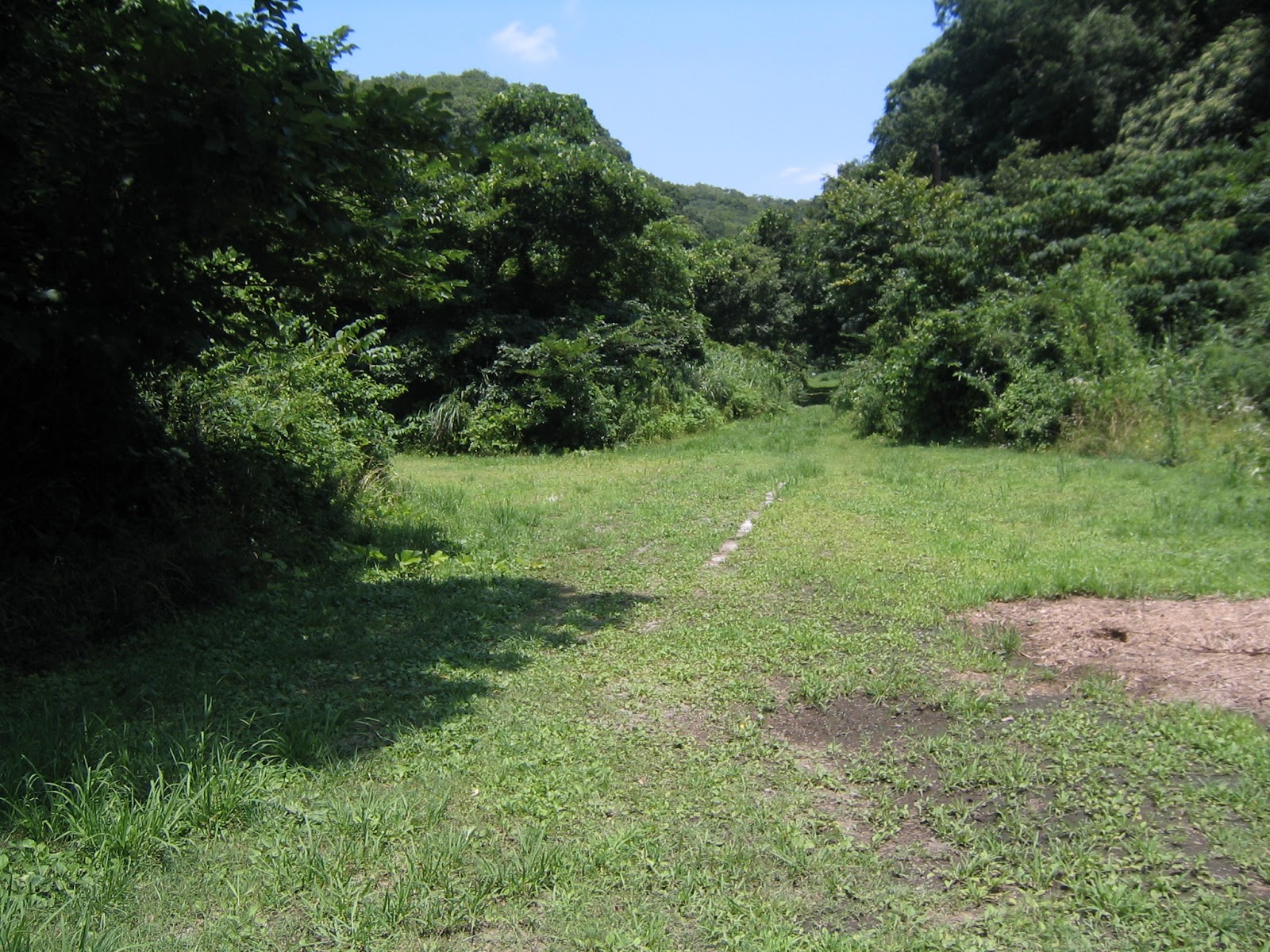
In the opposite of the Hisagi side exit of the trekking road, there is a kind of clearing that is flat. It is an entrance to an elongated area #4 in the map. At the end of this part has a sign saying it is off-limit for nature conservation. I guess this was the remnant of a road and a lot for some military facility. The middle of the clearing has two tracks almost buried by grasses. The end of Area 4 must have had something heavy that required railroad for transportation. Otherwise, this is a calm and quiet area where papilio xuthus are dancing with songs of birds. Don’t they plan to situate a picnic table here? (Or, can’t they? Bombs?)
 |
| The beginning of Area 4 |
 |
| The forgotten tracks |
 |
| The bottom of #4. Over there is the beginning of off-limits |
 |
| Cayratia japonica is in full-bloom in July in Ikego. |
From the Hisagi when we turn left, instead of right to the admin building, we walk along a stream whose downstream was found right next to the Hisagi Entrance. The road ends with another guarded gate with “US Navy Personnel Only” sign. This part of the Forest is designed for very American style “Park”; the corner of the space has a name plate, “Hayashi Friendship Park,” written only in English. I guess Americans first thought they could have a lawn field here, and found Japanese temperate rain forest is not the place for their plan, at least budget-wise. The field is now completely occupied by grasses with occasional molehills we can commonly find in the open spaces of Yokohama Citizen Forest. No bike or pet is allowed to this direction from the entrances. I a kind of understand the restriction. In the middle of the “Park,” there is a pond where no foreign species lives, according to the environmental study done by Zushi City during 2014-15. It is a phenomenal feat in the metropolitan Tokyo. … And funny to think those Americans who tried to create an American field park along the stream have not brought any of their kinds during 70 years of occupation. The pond is surrounded by rush phragmites australis which also is one of the few sceneries we can encounter these days, although it was the dominant landscape of the Tokyo area 1000 years ago. In English and Japanese, warning signs are here and there in the phragmites australis. “Human interventions are prohibited for nature conservation.” Yeah, dogs or kids on bike can disturb the place easily. Better playing it safe.
 |
| I’m
not sure the name Hayashi Friendship Park is still in use … anyway, this is the direction of the “Park.” |
 |
| And
the end of the Park. The toilet over there is not open for the general public. |
 |
| It is not an American Park, for sure, vegetation wise. |
 |
| A pure Japanese pond within the US Navy’s property. |
 |
| “If
you find a violator of the regulation, please call the US Navy” … the supreme deterrence. |
 |
| A stream from the pond |
Soon after turning left from Hisagi Entrance, there is a sign on the left saying “Yagura” which means cemetery during 12-16 century around Kamakura. The “Park” is actually surrounded by steep hills typical of Miura Peninsula whose cliff surface can be easily drilled for a cave. The people of Medieval Japan used the characteristics of hardpan for burial sites. Basically these are the site off-limit unless you have a permit for study, but we can see their mouth from the edge of the “Park.” In addition, there are 5 openings along the paved road, seemingly going into the Forest proper. Without fail, all the entrances to the openings are wet, which means they were the valleys whose water coming from the hill to the pond and the stream. The roads to the openings are all wide enough for a car to enter, and the insides are probably for some facilities before. Now the spaces are dominated by common Japanese grasses that love damp ground. All the spaces have American metallic picnic benches ... I thought the places could be ideal nesting for Japanese vipers, but if Americans who use the place during weekdays for picnic, the sites would be OK … God willing, yeah. Otherwise, each pocket is surrounded by calm deep forest with rush green, chirping birds, dancing butterflies + dragonflies + … We can often spot magnificent Japanese maples at the circumference of an open space. Japanese maples love damp ground so that they could be wild, not a tame horticultural staff … The space will be ideal for early winter picnic with gorgeous maple leaves, sans viper, I guess.
 |
| Yagura in Ikego Forest |
 |
| An entrance for one of the opening spaces |
 |
| Let’s have a lunch (preferably in autumn). |
 |
| The ground is covered. |
 |
| The end of one of the clearings |
It’s very strange … although a top-notch paved road for cars runs through in the middle of Ikego Park, walking in the space we can feel the forest is really full of nature. I have met so many kinds of butterflies, fireflies, flowers, trees … I doubt whether 2006 Biodiversity Study for Kanagawa Prefecture done by Ministry of Environment included Ikego … in the end the place is still in extraterritoriality for Japan. If the forest was included in the research, and Niiharu were still in the 3rd place for biodiversity in Kanagawa, that’s amazing … Returned to Japanese sovereignty or not, it may be better to open this place only for weekends. The Forest is special. I felt so. The City of Zushi has a kind of neighborhood watch approach to protect the nature of Ikego. You visit Green Policy Office of Zushi City, and tell them you are a regular for weekend Ikego so that you want to be a Supporter of Ikego Forest. They then explain the characteristics and the rules of the Forest, and give you Supporter ID. You can wear your ID when you walk in Ikego Forest. The idea is, your ID could stop somebody trashing and destroying the place, i.e., the demonstration theory of deterrence. (Oh, so Ikego …) The address of the city office and the link to the map is here.


If you find a
problem in the Ikego Forest, please make a contact with
Phone: 046-873-1111 (I strongly think they can manage English enquiries.)
5-2-16 Zushi, Zushi City 249-8686 〒249-8686 神奈川県逗子市逗子5-2-16
http://www.city.zushi.kanagawa.jp/syokan/ryokusei/


