
Recently after Typhoon Hagibis, I had a chance to go a bit further into Yadoriki Stream 寄沢. This week, I tell you how the forest is as of early November 2019. It seems to me the situation is somehow stabilized. But … anyway, I show you photos.

From the main gate of Yadoriki Water Source Forest やどりき水源林, there runs a forestry road to the beginning of a mountain trail to Mt. Nabewari 鍋割山 (ASL 1272.4m). Hagibis destroyed it in the middle with a cave-in and lots of landslides. The above photo was taken a week after Hagibis for the point where the subsidence occurred. An emergency plate was precariously put above a large hole. The place was/is strictly off-limit.

In early November, the Prefecture has completed a detour for hikers to go beyond the hole. This is a beginning of it. Please go straight the forestry road from the gate. Beyond the toilet on our left, there is this point on the right.

The new road is going up as such.

From the route, we can see what happened with the cave-in. At least, a repair work is going on.

This is a photo of 2018 where the subsidence happened. It was a family-friendly route …

Hagibis created, probably, a flash flood and landslides along the road. Now the place is not for kids but more for Indy Jones. I was really impressed by the scenery … It is a confirmation Tanzawa Mountains 丹沢 are fragile gravel layers pushed up from the bottom of Pacific Ocean by a tectonic crash of Philippines and North American Plates. Thin and sandy Hoei Scoria from Mt. Fuji, covering the area, could be easily washed away with a torrential rain of super-typhoons. Humans made earth retainers for kids to run along the road. They are all gone, completely destructed by the power of nature ... Awesome.

Near the end of the forestry road, there was a bridge crossing a small stream joining Yadoriki Stream. After Hagibis, the under-bridge was completely filled with gravel and large rocks down from higher altitude. Now the bridge is a part of river.

Just off the above “bridge” on the riverbed, there was an astonishing stock of Cirsium pupuratum, big-bloomed thistle which is Japanese-endemic and characteristically found around Mt. Fuji. (Its Japanese name is Fuji Thistle.) I took this photo in the middle of this September, just before super typhoons came … It’s all gone. I really hope we can meet them again along Yadoriki Stream in few years’ time …

Beyond the end of forestry road within Yadoriki Water Source Forest, it is a beginning of a mountain trail to the peak of Mt. Nabewari. In this route, we have to cross Yadoriki Stream numerous times before reaching to the ridge way. Already this August, the point has changed its face drastically due to a peculiarly long monsoon season. The river was too wide and deep to cross with standard climbing shoes. One of the senior forest instructors who knows the place for more than 30 years told me he has never seen the place this much of water …

Sure enough, super-typhoons brought more water and gravels/rocks from higher altitude. By the beginning of dry season this November, the valley is buried. The river runs completely different routes.

So, the vegetation of this riverbed has drastically changed. Before as in this photo taken in 2018, the shown point was adorned with large Caprinus Japonica, Staphylea bumalda, Lindera praecox, Caprinus laxiflora, Japanese Maple, etc.

Now, I could recognize only this ring-cup oak (Quercus glance) without acorns. I’ve heard nation-wide this is a “miss” year for acorns so that bears and wild animals are starving. Some of the bears have come to human settlements and learned how to open refrigerators … It’s a sad story for bears and humans.
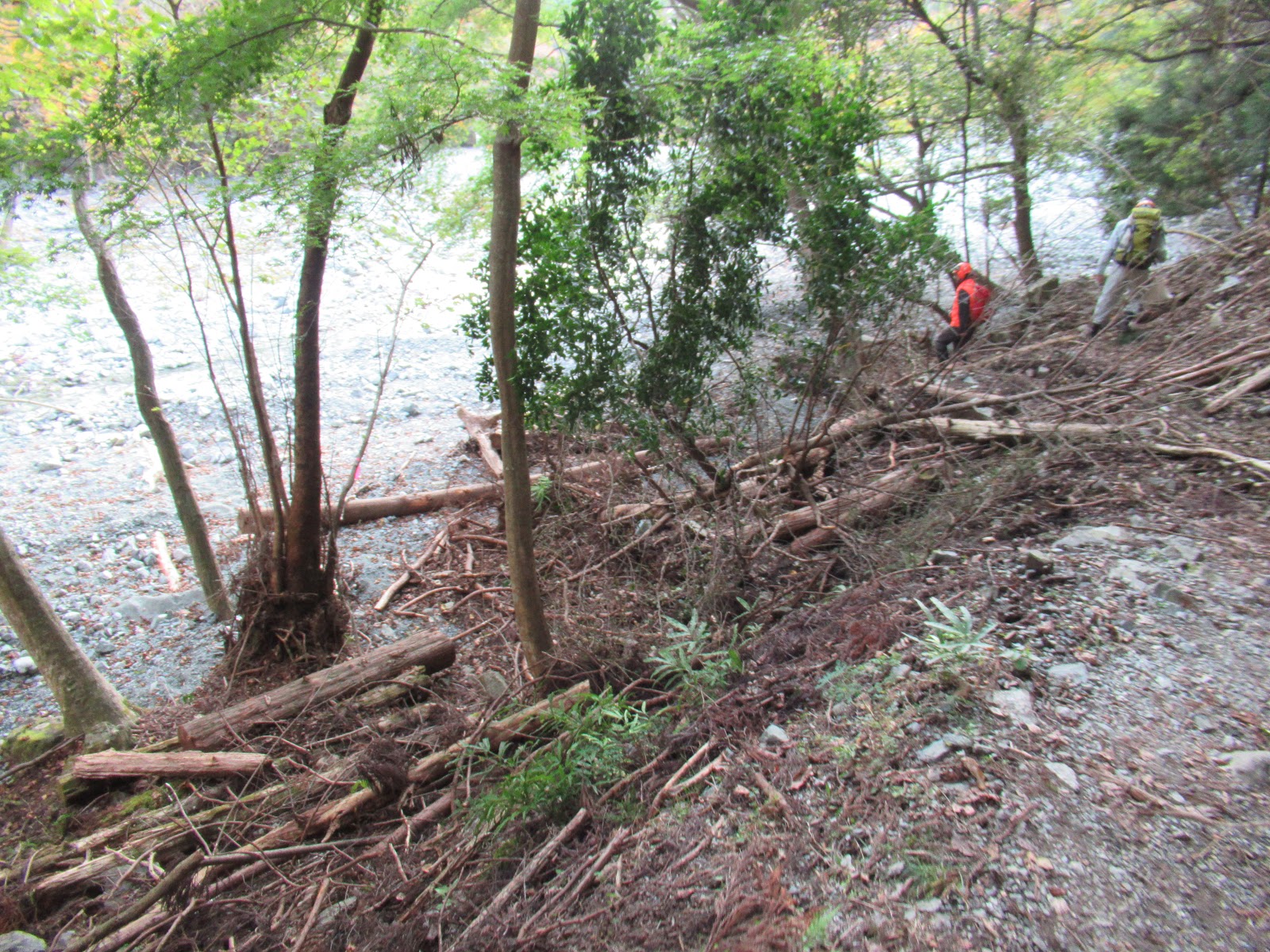
Actually, many slopes down to Yadoriki Stream are strewn with debris tumbled down from the surrounding forests. How was it here during Hagibis?
At the moment, the scenes of deep Yadoriki Water Source Forest are for witnessing the power of natural disturbance. Strangely, right next to a havoc by typhoons there remains another slope unaffected ... I felt humble in front of such forest I’ve never seen. It’s Inshallah moment …

If you find environmental
issues in Kanagawa Prefecture, please make a contact with Kanagawa
Natural Environment Conservation Center 神奈川県自然環境保全センター
657 Nanasawa, Atsugi
City, 243-0121
〒243-0121 厚木市七沢657Phone: 046-248-0323
You can send an
enquiry to them by clicking the bottom line of their homepage at http://www.pref.kanagawa.jp/div/1644/
No comments:
Post a Comment