Showing posts with label Mt. Takao. Show all posts

Sunday, February 23, 2025

Pounding: making mochi cake at the top of Mt. Kobotoke-Shiroyama 小仏城山


Rice cake, mochi in Japanese, is popular in Japanese cuisine. It’s made of steamed sticky rice pounded enough to be the rice gummy. It takes a certain effort to make it. In yesteryears, it was a regular menu for village festivals and served each community member as a token of celebration. The time when Japanese consume mochi most must be for New Year Celebration. It can carry symbolism of the tradition, like Hot Cross Bun for England. Having said this, now in the 21st century we can purchase it all year round from supermarkets, neatly wrapped and ready to be popped in a toaster. Traditional meaning aside, making mochi is a fun group activity. So, please try Aotengu mountain café 青天狗 at the top of Mt. Kobotoke-Shiroyama 小仏城山. This week I tell you my adventure of mochi-making there.

That day, Mt. Fuji was beautiful ...

First, where is Mt. Kobotoke-Shiroyama? It’s the next peak from uber-popular Mt. Takao 高尾山. How to go Mt. Takao must be explained a lot in the travel guides for Japan or Tokyo. I omitted the itinerary today. Between Mt. Takao and Mt. Kobotoke-Shiroyama, I posted travelogue several times in this series, including the route for enjoying the “most beautiful cherry blossoms in Tokyo (; my posts for February 25, March 4, March 11, 2022). Please check these if you like. In any case, although there are several branch trekking ways between Mt. Takao and Mt. Kobotoke-Shiroyama, it‘s a simple one way direction. The majority of branch roads meet soon several times, or join at the top of the mountain at the end of the day. + It‘s uber popular hiking course. You simply join the crowd, and Mt. Kobotoke-Shiroyama is just there. As long as you wear good shoes + hiking gear and carry enough water, don‘t worry ... er, it‘s becoming problem these days accidents are happening too often especially among overseas visitors who are not at all prepared for hiking. Although it‘s not Mt. Everest, the mountain is a mountain, and we must get ready for walking such environment even if it is for Mt. Takao. There are of course the other routes reaching to Mt. Kobotoke-Shiroyama skipping Mt. Takao. It’s a bit complicated operation, including finding bus stops or entrance to hiking course, etc. So, I skip these today: main topic is POUNDING MOCHI!

Along the route,
there are many maps showing the routes around Mt.Takao.
 Follow these directions together with your fellow hikers.

Actually, the most important thing for having rice-cake fun at Kobotoke-Shiroyama is Making Reservation. From their HP of this, there is a reservation link. The café Aotengu 青天狗 moved from the neighboring peak of Mt. Kagenobu 景信山 last March, and with this they transfered mochi-making service to the top of Mt. Kobotoke-Shiroyama. When you make reservation, please tell Mr. Aoki, the owner of the café, the date and expected arriving time of your party. In order to make mochi it is needed one overnight soaking of rice before steaming them, and so RSVP. Also, you need to confirm your mochi-making by 15:00 of the day before of your fun. Oh, I have to add this: you cannot make mochi alone. At least two people are needed, and Aotengu does not offer variety of portion: 3kg of sticky rice only. We’ve been there 6 people, 5 males and me, ate mochi enough, and could prepare souvenir for 7 families. You see? Mochi-making is the thing of festivals!

Aotengu Café

Aotengu Café prepares the tool for mochi pounding (mochi-tsuki in Japanese), i.e. a set of pestle and mortar, and 3kg of steamed sticky rice, for around 9000 yen. As these days the price of rice in Japan is super volatile, please ask café how much it is now. The Aotengu also can lend us a portable stove, a deep pan, and a ladle, all of which are in separate charge. We brought by ourselves these tools + lots of H2O, hand sanitizer and plastic gloves for serving food. Mr. Aoki said OK for this. H2O is very important as there is no water source at the top of the mountain, you know. However, if you bring in alcohol drink by yourselves, Mr. Aoki will charge 1000 yen per person, as his café sells such beverages. Please be a nice customer for Aotengu. Aotengu Café also advertise special relish for enjoying mochi cake, i.e. minced Japanese leeks mixed with yuzu-taste miso paste. Or you can bring your own condiment and the other ingredients for your mochi dishes. It’s OK. By the way, eating mochi with butter and soy sauce is very popular these days. Tomato sauce or olive oil with salt also goes well with mochi. The menu with mochi could be infinite if you like. Mochi with cheese and chocolate sauce is also my favorite 😊.

Steamed 3kg of sticky rice,
situated neatly in a large mortar.
 Traditionally, Japanese mortar for mochi pounding is
 made of a large trunk of Japanese zelkova,
hollowed out for this usage.

When the rice is ready, we need to work with it quickly.
First, mash the rice with pestle.
Oh, you’d better wet the pestle before the start.
 Otherwise, the rice sticks to it,
and mochi pounding becomes messy.

Mashing …

until the rice becomes this level of gooeyness.

Then, turn over the now so-so gummy mass
of sticky rice upside down.

Finally we start pounding.
Don’t waste your time reaching to this stage.
Rice still must be very hot.
Several times of pounding,
then another person turns over the rice.
 Continue the routine.
 So we need at least two people for mochi making,
 in order to avoid cooling of rice in the process.

The key to pounding is
using gravity working on the heavy pestle.
You wind the pestle up, aim the rice, then,

swing down the pestle.
I tell you
hitting the rim of mortar is not a rare thing.
It requires a certain technique
for smooth pounding.

Almost there …
the rice cake still must be hot at this stage.

The other things we noticed we should have brought were

1. Corn starch and clean operation sheets like perchment paper for bakng. After pounding mochi-cake, we have to divide a mass of mochi into at least a loaf size or smaller. At the top of the mountain, there are only outdoor picnic benches which is not suitable for working with food on it. We managed with the things we brought this time, but reminded ourselves next year we’ll be more organized. 

2. More variety for condiments/relish to enjoy mochi. We brought only soy source and nori seaweed, which is a bit too simple for rice cake for roughly 20 people. I really regreted I have not brought cheese and chocolate sauce …

Done.
We forgot bringing corn starch and operation sheet
 … only chop sticks.
Hmmmmmmmmmmm.

Things worked out somehow.
We had it with soy sauce, nori seaweed,
and sweet soybean flour.
We also cooked soup with carrots,
Japanese leeks, chix, and mochi.
It was a cold day.
Hot mochi was delicious.

Anyway, it was really a fun. Also we must be in a hurry for mochi-tsuki as we have to finish our task when the steamed rice is hot enough to be glutinous. Yeah, we must preserve our energy for doing this after going up the mountain. But empty stomach does not have to wait for long ... er I’m not sure if it is a suitable activity for hot summer … but it is certainly very popular entertainment. Aotengu Café said by the end of this March all the reservation is taken as of today. The chance to enjoy mochi pounding at the cherry blossoms season maybe for next year? Please consider.

Megalopolis Tokyo over there …

If you find environmental issues in Kanagawa Prefecture, please make a contact with Kanagawa Natural Environment Conservation Center 神奈川県自然環境保全センター

657 Nanasawa, Atsugi City, 243-0121
〒243-0121 厚木市七沢657

Phone: 046-248-0323 

You can send an enquiry to them by clicking the bottom line of their homepage at http://www.pref.kanagawa.jp/div/1644/

Friday, March 11, 2022

Cherry Blossoms Street: walking along the ridge of Mt. Takao, Part 3


In our cherry blossoms ridge walk of Mt. Takao area, there are only 4 points that require us up steep slopes. The rest is relatively flat or going down. The first climb is to Mt. Jimba 陣馬山 ASL 855m, for roughly 1 hour exercise. The other 3 points are all for about 10 minutes going up before the remaining peaks in our itinerary. Now, we are nearing to one of them, i.e., the top of Mt. Kagenobu 景信山 ASL 727.3m. After we walk for 70 minutes or so from Sokozawa Pass 底沢峠, please be ready and endure the steep but short climb to the peak. After passing the bush of sasa-bamboos (; I warned you to wear long pants for this hike!), we reach to the open space at the top of Mt. Kagenobu. Here, the space is wide-open and there is a café with lots of picnic benches. The proprietor of the café allows hikers who sit far-corners of the café to use the space for cooking by ourselves. This is one of two locations in this hike where we can fire portable burners for lunch. Mind you, this arrangement is purely from kindness of the café. Never start cooking your soup in front of the café hut or sharing your meal with strangers you’ve met there; it can be a crime of obstruction of business, you know. Anyway, another nice thing at the top of Mt. Kagenobu is, A-Spectacular-View to the direction of downtown Tokyo. We look down pink dots of cherry blossoms in the eastern slope of Kagenobu, and over there, if weather permits, a silhouette of Tokyo Skytree. The feeling of wide-open freedom is overwhelming ...

To the top of Mt. Kagenobu
Nearly there …

Signpost for the top of Mt. Kagenobu

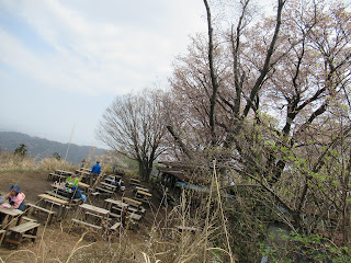
Lots of seating space for café

The café is under the canopy of cherry trees.
I think if you start cooking here,
the proprietor of the café comes to warn you …

Mmmmmmmmmmmmmmmmmmm

To return to the soft ridgeway walk, we briefly climbing down a steep slope. In our itinerary, the area around the peak of Mt. Kagenobu is the most remote area from towns. Inevitably, the trekking path here can resemble more for deep Tanzawa mountains 丹沢, rather than that for the area around the peak of Mt. Takao. People you meet here could be more regulars for mountaineering. Having said that, it won’t take more than 40 minutes for us to reach to Kobotoke Pass 小仏峠 from Mt. Kagenobu. It seems to me people who manage Meiji Forest Takao Quasi-national Park 明治の森高尾国定公園 are now engaging cleaning up Kobotoke Pass area. Compared with my adventure in 2017 around Kobotoke Pass, the picnic benches are cleaner. The vegetation around Kobotoke Pass is mainly afforested conifers. But once we proceed up to the direction of Mt. Shiroyama 城山, and start looking down Lake Sagami 相模湖 to the west, the broad-leaved trees regain the dominance of the scene. My expectation for cherry blossoms were once again growing. In about 30 minutes from Kobotoke Pass, after 10 minutes or so climb, we reach to the top of Mt. Shiroyama.

Going down to Kobotoke Pass

I’ve met a lizard, Plestiodon finitimus.
Coming out from hibernation!

Flower field for violets continues.
This is Viola eizanensis.

Kobotoke Pass.
Cherry blossoms and wild azalea say hello to us.
😊

Beyond Kobotoke Pass,
we come to a viewing point for Lake Sagami.

Pink smoke in a forest, before Mt. Shiroyama

To the peak of Mt. Shiroyama

The top of Mt. Shiroyama, ASL 670.4m, also has a café and lots of picnic benches. Here, provided we behave politely as we’ve done at Mt. Kagenobu, we can use our stove for cooking. It is also thanks to the kindness of café owner. You may brew your coffee here and enjoy the view not only to the east but also to the west of our ridge way. To the east is again for the downtown Tokyo. To the west is Tanzawa mountains and Mt. Fuji 富士山. Moreover, from here big cherry trees start showing off their pink flowers just next to us, not as pink clouds within thick forest. You may be welcomed by slow showers of pink petals while enjoying aroma of hot coffee and cookies … er, if you have enough time left before dusk, I mean. Anyway, from here to the cable car station, there are lots of cherry trees standing along the hiking course which is THE main street for Mt. Takao Hiking. Keeping in mind the time for the last cable car service (at 18:00), let’s proceed this “cherry tree-lined avenue” to the top of Mt. Takao, ASL 599.3m. Depending on your way of enjoying cherry blossoms, it may take more than one hour from Mt. Shiroyama to Mt. Takao. Again, the last 10 or so minutes to the paved top of Mt. Takao is steep slope (and steps). If you’re not accustomed to mountain walk, the last “attack” here could be demanding especially after 6 or so hours of hiking. Please persevere. From the top of Mt. Takao where the Visitor Center locates, we go down to the cable car station via Yakuoin Temple 薬王院 (; my post on December 15, 2017) the scenery is more of a city park where large cherry trees stand at strategically chosen points. You may see high-heeled ladies in skirts strolling. Phew. Congratulations! You’ve completed your Mt. Takao ridge hike, with secretly famous cherry blossoms!

The café for Mt. Shiroyama.
Lots of seating space with flowers!

To Mt. Takao, cherry blossoms lined main street.


Going up to the top of the mountain …
er, well, slightly fed up with pink?

to be continued … come to think of it,
all of these cherry trees are not planted, but wild.
This is something, don’t you think?


Nearly there …
and I think these cherry trees were planted.

The cherry blossoms at Yakuoin Temple

p.s. Mt. Takao Cable Car service runs over the slope of 31’18”, the steepest for cable cars in Japan. FYI.


The contact address for the office in charge of Meiji Forest Takao Quasi-national Park 明治の森高尾国定公園 is

Bureau of Environment, Tokyo Metropolitan Government 東京都環境局
2-8-1 Nishi-Shinjuku, Shinjuku-ku, Tokyo, 163-8001
Phone: 03-5388-3539, 
FAX: 03-5388-1379 
S0000618@section.metro.tokyo.jp

Friday, March 4, 2022

Spring up and thrive like a wildflower: walking along the ridge of Mt. Takao, Part 2


First, yeah, you can start this ridge walk from Mt. Takao 高尾山. But, I have to tell you this. If you take Mt. Takao as your starting point, you’ll complete your hike descending from Mt. Jimba 陣馬山. The communities at the foot of Mt. Jimba have quite limited commuter bus service to the nearby train stations (all are for JR Chuo-honsen Line 中央本線). It is quite likely you complete your hike at dusk when you enjoy cherry blossoms. Say, from Wada bus stop 和田 (pls. see my post for Mt. Jimba) to JR Fujino Station 藤野, the last service is at 18:20. If you miss it, you have to either pay for taxi or walk to the station, for about 6km, on a mainly mountainous, street-light-shy winding car road. I don’t think it’s a fun itinerary after 8 hours’ ridge walk. In contrast, from Mt. Takao, although the last cable car departs at 18:00, even if you miss it the road to Takaosanguchi Station 高尾山口 of Keio Line 京王線 is more relaxed well-lit main approach to Yakuoin Temple 薬王院, which is roughly 1 hour walk from the cable car station. Of course, you can choose the short-cut of steep descend for Mt. Takao hiking course without any light. I don’t recommend it unless you’re an expert of the area ... The number of train service from Takaosanguchi to downtown Tokyo is far more than that for JR Fujino. It’s definitely a safer plan to end the hiking at Mt. Takao Ridge Way … Mmmmmmmmm … hotel-wise, if you don’t mind using taxi (with cost for about 100 USD or more), it may not be much different ending the hike at Mt. Takao or Mt. Jimba … There are lots of resort hotels around Lake Sagami 相模湖. Takaosanguchi Station has two hotels within 5 minutes walking distance. Hotels near Mt. Jimba has free pick up service from Fujino Station, RSVP of course. If you plan to spend 2 or more days in this area and you’re confident enough for your stamina to reach to a train station before sun set, ending your hike at Mt. Jimba could be an option, I guess. In any case, I tell you my adventure starting from Mt. Jimba side.


The beginning of today is from Takao Station either for JR or Keio Line. Please leave the station from the North Exit and find the Bus Stop #1 for Nishi-tokyo Bus 西東京バス. Ride a service to Jimbakogen-shita 陣馬高原下 to the terminal stop, Jimbakogen-shita (; time table is here). It’s about 40 minutes ride to ASL 300m. From there proceed along the road to the west. If you’re in doubt, find a sign around the bus stop saying “Mt. Jimba, this way.” There is a similar kind of road near the bus stop to the south along Okinatsurushi Stream オキナツルシ沢. If you take this road, you will go straight to Sokozawa Pass 底沢峠, economizing 30 minutes or so of your itinerary … but it’s a pity to take such short cut for this trekking fun, I think. Anyway, the paved road to the west is an old road called Jimba-kaido Avenue 陣馬街道 going around Mt. Jimba to Wada 和田 community we’ve visited before. As such, there are some car traffic, but it is a quiet forestry road. Actually, I liked a lot this road along Ange River 案下川, because it’s a wonderful humid way full of many kinds of moss, including several endangered ones! If you’re interested in these species, you can spend your whole day without climbing up to the ridge, I bet. About 20 minutes or so of walk from the bus stop, we’ll find a signpost telling us this is an entrance to the hiking road to Mt. Jimba.

Takao Station, North Exit
I tell you even it’s a weekday morning,
the cue waiting for the bus to Takao Ridge Way can be
LONG.

Jimbakogen-shita, the terminal stop

To Mt. Jimba, please go to the direction of a cherry tree.

In today’s itinerary, we also meet lots of wild azaleas.
This is Rhododendron dilatatum,
endemic species of Japan,
which flowers before their leaves come out
just like cherry blossoms.
These days, they are suffering theft.
Please protect them if you find their flowers.

I think it is Brotherella henonii

The climb from this starting point to Mt. Jimba is the steepest ascend for today. The entrance to the trail is about ASL 540m, and Mt. Jimba is ASL 855m. The estimated time for standard hiker to reach to Mt. Jimba is within 1 hour. Gaining 300m in one hour … You’ve got an idea, hah? Please endure here: the rest of today’s itinerary is not this much tough. You can spend your time at the top of Mt. Jimba for toilet and morning snacks, but this is just the beginning of a long trail. Staying here not long may be a wiser move. Follow the sign telling us “Myo-oh Pass 明王峠, this way.” It’s the direction for the ridge way of Mt. Takao. Once you enter this route, it’s almost one way running along the prefectural border between Tokyo and Kanagawa. Simply keep on going the ridge. After 1 hour or so from Mt. Jimba, we reach to Myo-oh Pass.

The entrance to the trail to Mt. Jimba

The beginning is relatively flat …

The road then climbs up for about an hour …

White paint and ropes indicate the route.

Nearly, to Mt. Jimba

The road coming down from the top of Mt. Jimba

When we are from the peak,
there are lots of signpost like this
showing the way to Myo-oh Pass.

Here! Cherry blossoms!

The hiking road of the ridge is like this:
wide and well-maintained.

Myo-oh Pass

The ridge way is really a well-maintained trekking route. Also, even during weekdays, you’ll find yourself with lots of companies. In this regard, this is a safe hiking course. The road goes with slight ups and downs in afforested conifers and broadleaved deciduous trees. Although today’s main attraction is cherry blossoms, you’ll be greeted by several kinds of spring wildflowers. For example, the area of Mt. Takao is famous for many kinds of violets. Please do not deviate from the hiking course. Those pretty violets can be stumped down easily by us without notice. + They are vulnerable for theft. Let’s protect rich biodiversity here … From Myo-oh Pass to Mt. Dodokoro 堂所山 ASL 731m, it’s about half an hour walk via Sokozawa Pass 底沢峠. There is a small detour around the peak of Mt. Dodokoro for proceeding the ridge way. Either you check the peak (but there is not much to see there), or go ahead straightforwardly the ridge, please follow the sign directing to Mt. Kagenobu 景信山.

This is a very well-behaved Viola grypoceras.

Sokozawa Pass. Please go to the direction of Mt. Kagenobu


When we approach to the peak of Mt. Kagenobu ASL 727.3m, we started to see pink smokes within trees here and there along the ridge and beyond. They are Cerasusu jamasakura, the endemic wild cherry trees of Japan, and THE grandma of Japanese cultivated cherries. Although cherry trees in Ueno 上野 or Meguro River 目黒川 have less than 100 years of lifespan, these wild cherries in Takao can be hundreds of years old. Real grandmas. They are tall and big. And so, we can admire them from afar. On the ridge way, I recalled somebody’s advice: “Naomi, if you want to enjoy cherry blossoms, don’t go near a tree. View the entire slope of a hill. That’s the proper way of doing cherry blossoms party.” Yeah, we can enjoy such fun on this ridge way. Soon, we reach to the peak of Mt. Kagenobu. Next week, I tell you my adventure with more cherry blossoms. Please stay tuned!

High above us is pink clouds of cherry blossoms …
I think I was late last year.
Probably just few days earlier, they were more splendid …

Before the peak of Mt. Kagenobu,
there also is a large bush of Lidera praecox
with pretty yellow flowers.

This is Potentilla freyniana.

Viola phalacrocarpa


The contact address for the office in charge of Meiji Forest Takao Quasi-national Park 明治の森高尾国定公園 is

Bureau of Environment, Tokyo Metropolitan Government 東京都環境局
2-8-1 Nishi-Shinjuku, Shinjuku-ku, Tokyo, 163-8001
Phone: 03-5388-3539, 
FAX: 03-5388-1379 
S0000618@section.metro.tokyo.jp