This week I tell you
another spot to enjoy autumn leaves in Kanagawa Prefecture. It’s popular
destination among locals of Hadano City 秦野, but
not known as “congested” like temples in Kamakura 鎌倉. Bonus: you can enjoy fishing there. The place is Shinsei Lake 震生湖, the youngest natural lake of Japan, surrounded by a forest. Last year,
a vender who rented boats and fishing pier there went out of business so that,
it seems to me, you can simply go there and try your luck. For enthusiasts, the
lake is well-known to catch 1 feet or more long Japanese crucian carp (Carassius
cuvieri) and Black bass (Micropterus). If you cast a line, please be
friendly with your fellow anglers. 😀
 |
| Go fishing |
The place has two free
parking lots. When you go fishing, driving would be the best option. Please set
your car navigation system to Shinsei Lake of Hadano City. It’s about 10
minutes’ drive from Hadano-Nakai IC of Tomei Express Way. It may be congested
to park there during weekends … Having said that, to experience the uniqueness
of this lake, it would be better to use public transportation, and do a little
hiking. Please get off Odakyu Odawara Line at Hadano and leave the station from
the south exit. Go straight the wide road in front of the exit and turn right
at a T-crossing. There will be the next T-crossing 50m ahead. Turn left there
and keep going along a narrow and winding community road. Soon we’ll meet
Imaizumi Meisui Sakura Park 今泉名水桜公園 on our left. Passing by the park, the road ends with the third
T-crossing of today. Turn right, then left at the first corner. Go straight to
find Imaizumi Shrine 今泉神社 on our
right at a relatively large crossing. Turn left and in front of us is Hadano Minai Elementary School 秦野市立南小学校, the
school that has a meaning for our itinerary today.
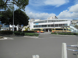 |
| The south exit of Hadano
Station |
 |
Tourism Info next to the
ticket gate of Hadano Station has
a good collection of free tourism guide in
English,
Chinese, Vietnamese, and Hindu. |
 |
| The straight road in
front of the south exit |
 |
| A narrow community road
from the station |
 |
An entrance to Imaizumi
Meisui Sakura Park.
The park was designed by an architect
Tadao Ando 安藤忠雄 in 2005.
The place is not big so that you can visit
here
in your itinerary for today if you have time. |
 |
| Signposts to Shinsei
Lake appear along the road |
 |
| Crossing at Imaizumi
Shrine |
 |
| Hadano Minai Elementary
School over there |
At the T-crossing of
Minami Elementary, please go right, and then turn left at the next T-crossing. Go
straight to cross Muro River 室川 and meet
with a large Torii structure on your left. It’s an entrance to
Shirasasainari Shrine 白笹稲荷神社 where
they have an antique fair regularly (; their schedule can be found here). Passing
by the shrine, go along the community road, and reach to a wider road at Shirasasainari
Traffic Light. Cross the road to enter straight the road in front of you. The
way returns to a narrow community route … Now you may think “Ah ha. This is an
old village road.” Yap. From the station to this point, roughly 20-30 minutes’ walk,
we are welcomed by houses, shrines, vegetable fields and orchards in both
sides. Hadano is an old place where Lord of Hatano 波多野氏 governed the area between the 11th -13th
century. House of Hatano became the founder of several samurai Lords’ family
who appeared as supporting characters of Japanese history. Their historical
base was here, and people had their village life for millennium. Now we carry
on a bit to find a signpost saying “Shinsei Lake this way.” Please ignore this:
the route is to a parking lot next to the Lake (; er, well, if you drive,
please take this direction). After the sign, we’ll find even narrower community
way on our left which seems ending at a private residence. Let’s take this
road. Surely, the pavement ends in front of a house, but it continues as a
trekking route on a side of a vegetable field. It’s a relaxing strolling path going
up. We’ll meet an interesting scenery ahead this way, which says why we have a
lake here.
 |
| Muro River |
 |
| An entrance to
Shirasasainari Shrine |
 |
Shirasasainari Traffic
Light.
Please go straight from here. |
 |
Please ignore this signpost,
“Shinsei Lake this way,” and take the right road. |
 |
| This is our way for
today. |
This country path climbs
up a slope which has a shape like a pudding scooped its side by a spoon. It is
a typical structure created by a large landslide. In the middle of the route,
after crossing a semi-paved way for utility vehicle, we find a fault scarp on
the right that tells geological story of the area. It shows volcanic activity
of Mt. Hakone, and large earthquakes that caused a huge slip of land. Mt.
Hakone started its last gigantic and consecutive eruption about 130,000 years
ago. It spewed out humongous amount of pyroclastic flow of deposits named Tokyo
Pumice. Volcanic debris reached thickly even to present-day Yokohama. Hadano is
far nearer to Hakone, and so the area has deep layers of Tokyo Pumice. Oh, just
a reminder: pumice strata is fragile. On the other hand, the area locates
almost above a sticky point between Philippines and North American Plates.
Tectonic movement pushes down Philippines Plate slowly below North American
Plate, but these gigantic crusts of the planet cannot slide smoothly.
Philippines Plate is somehow gummed to the bottom of North American Plate below
Sagami Bay 相模湾 to Tanzawa Mountains 丹沢.
Consequently, the force to push down the plate accumulates its pressure and
pulls down North American Plate with Philippines Plate. When it reaches to a
breaking point, North American Plate springs back which is a gigantic
earthquake. The fault line we can find here shows such thing happened some
66,000 years ago. It shows disrupted strata of Tokyo Pumice. We meet a fault scarp
facing a geographical feature of large landslide. Could you see my point?
 |
| First, it’s a trekking
road with a view, |
 |
| then the route is paved
for utility cars. |
 |
The paved way will
depart to narrower un-paved path here.
Take the un-paved one. |
 |
| Peaceful veggie field on
a typical landslide |
 |
The fissure created by
the fault was covered by pyroclastic flow,
and hence looks smooth from above.
Once a landslide reveals the structure,
we could recognize a drama of the
planet here. |
Proceeding 50 or so more
meters, we reach to a ridge which is another community road. From here to the
north, we can admire mountains of Tanzawa starting from Mt. Oyama 大山 (ASL 1252m) on our right, then Mt. San’no-Toh 三ノ塔 (ASL 1204.7m), Nabewari 鍋割山 (ASL 1272.4m), et al to the left. When in 1923 the Great Kanto Earthquake hit, those mountains of Tanzawa collapsed. The epicenter
of the quake is still in debate among academics, and somewhere near Hadano City
is one of the candidates. From the photos taken in autumn 1923 at the point we
are standing today, the scholars have identified more than 50% of mountain
slopes of Tanzawa with deep-seated landslides. Inevitably, the place we are visiting
this week suffered enormous calamity here and there. We go right and meet with
a wide car road where a larger parking lot for Shinsei Lake situates. In a
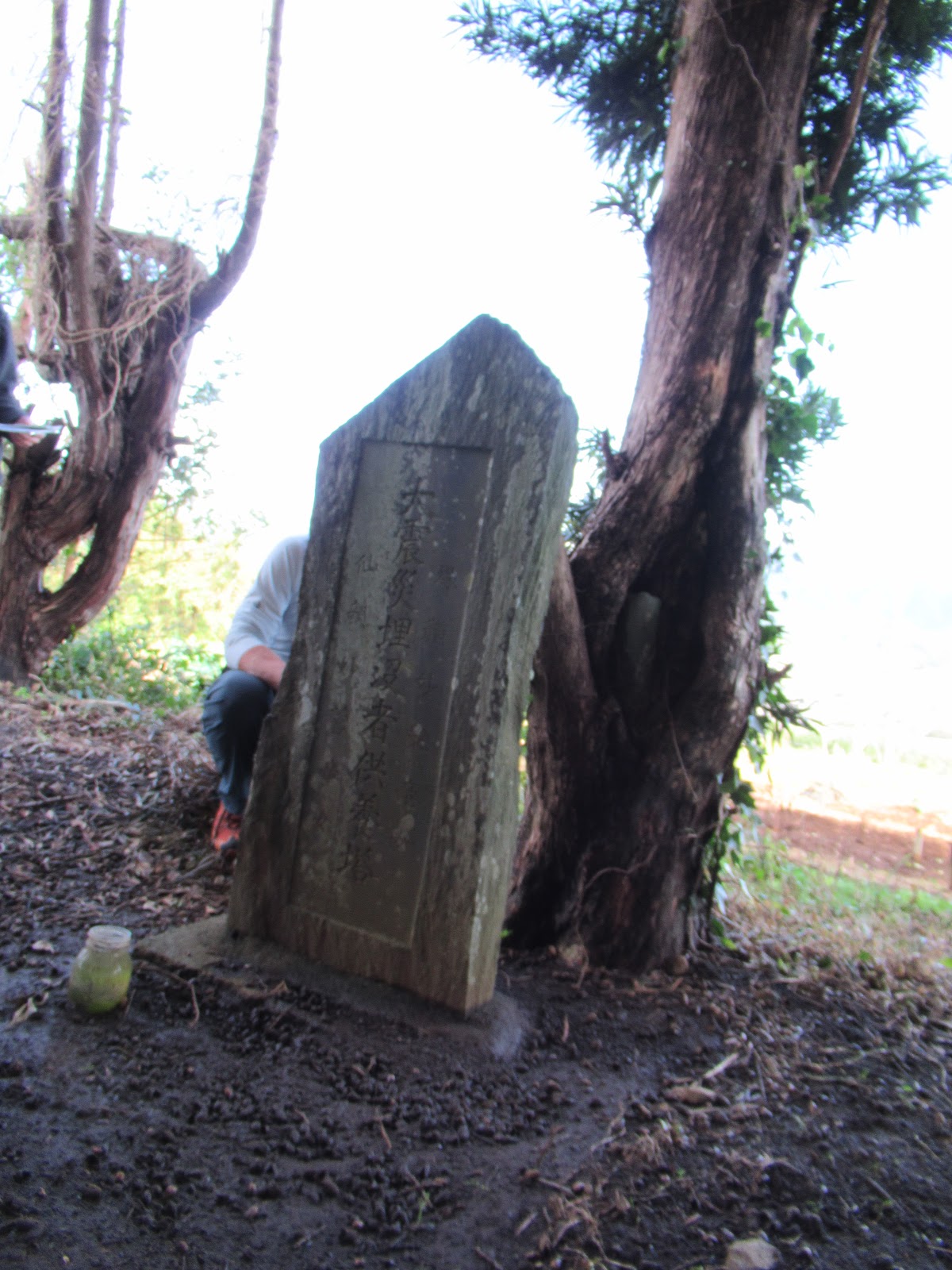
small hill opposite to the parking there is a stone monument, the Memorial
Tower of Buried Girls by the Great Kanto Earthquake. It was at 11:58:32, September
1st, 1923, the first day after a long summer recess. 2 girls of Hadano
Mimami Elementary hurried home for lunch. They were swallowed by monstrous
landslide, perhaps, and buried deep. Adults searched for them frantically, but could
never recover their remains. So, villagers built a monument there to mourn their
girls. The collapsed hills not only engulfed the girls, but also intercepted Ishikisawa
Stream 石木沢 that ran in the south of the ridge way we stand now.
It created Shinsei Lake, a natural dam.
 |
| We’ve reached the ridge
way. Let’s turn right here. |
 |
The view from the ridge
way to Tanzawa mountains.
I just imagined half the slope of these turned brown
at
once in a fine September noon of 1923. |
 |
| A parking lot for
Shinsei Lake Park |
 |
| The monument of lost
girls |
From the point where the
memorial stands, let’s go back a bit and find a signpost on our right saying “Entrance
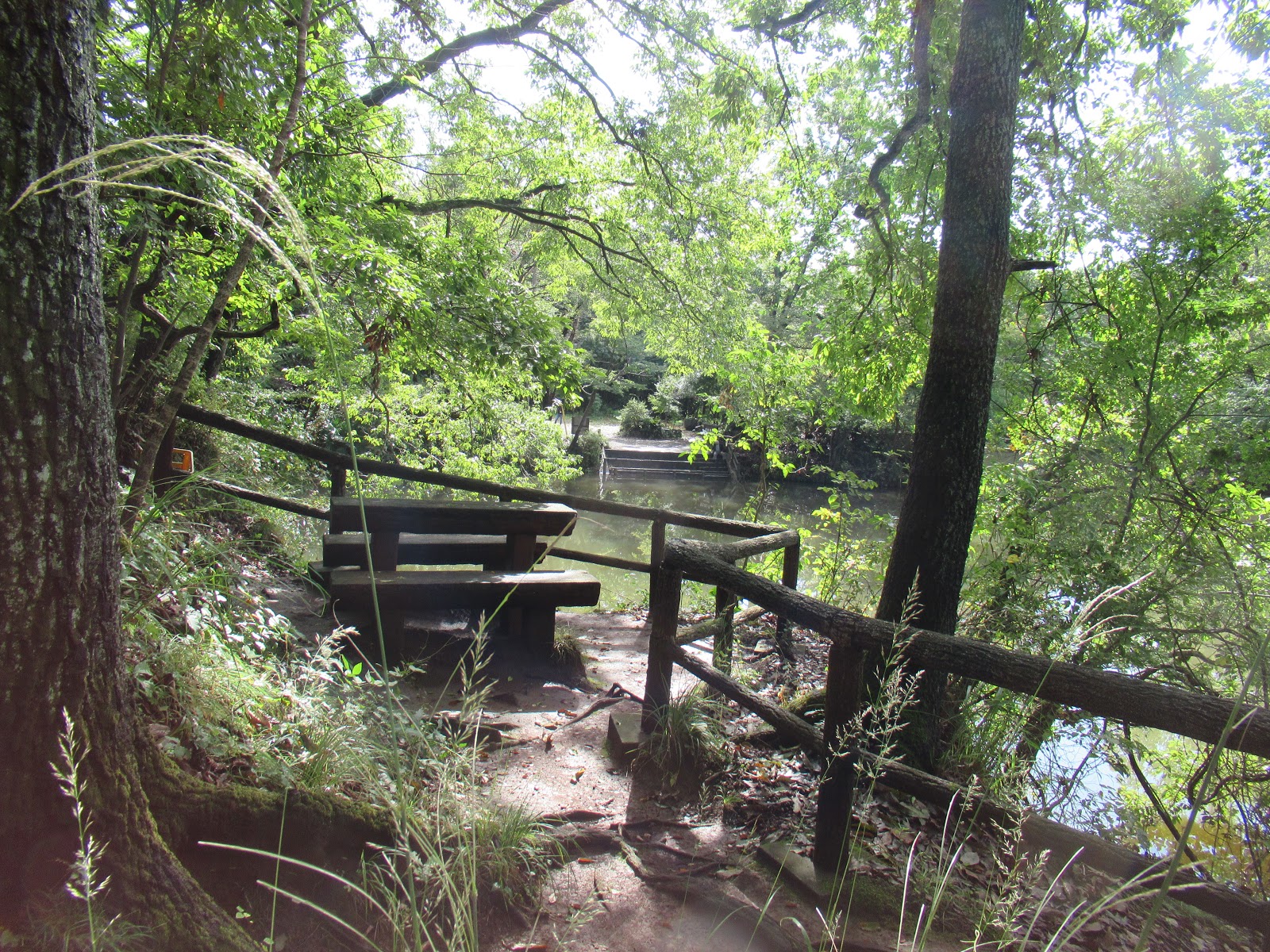
to Shinsei Lake Park 震生湖公園入口.” Steps starts here down to the shore of the lake. It’s a steep slope,
just like slopes surrounding a man-made dam lake. In less than 10 minutes, we
reach to the lake side. It’s the north-west corner of Shinsei Lake whose average
altitude at its water surface is ASL 152.7m. When I’ve been there recently, it
was after the consecutive torrential rains starting from Typhoon Faxai. The
water level of the lake was high. Moreover, in the north-west corner of Shinsei
Lake there was swamp like streams pouring water into the lake. Actually, it was
a water source of Ishikisawa Stream. The slope surrounding northwest corner of
Shinsei Lake has a shape of scooped pudding. The place must have had numerous
landslides before. It also means the catchment area of Ishikisawa Stream / Shinsei
Lake is contained within such terrain of spoon scoops. According to Mr. Kimio
Inoue of Sabo Frontier Foundation 砂防フロンティア整備機構, water for Shinsei Lake gathers from the surrounding 15ha forest without
gushing river. As the soil of the area is mainly of porous volcanic debris from
Hakone and Mt. Fuji, water seeps in/out the lake slowly underground. Such
natural water system works nicely for Shinsei Lake to survive.
 |
| The signpost to the
shore |
 |
| The road goes down to |
 |
the water source for Ishikisawa
Stream.
When dry, there is no surface flow here,
and we can walk easily to the
other side.
Mighty super typhoons … |
Basically, natural dam
is born due to a fragile soil structure of a valley. If a river is dammed by collapsed
slopes, aftershocks and rain can quickly destroy the unstable blockade and
release stopped water flow. Almost always a collapse of such natural banks brings
massive avalanche of earth and rocks with muddy water, which will annihilate
several human settlements downstream instantaneously. In Hadano area, there were
several villages wiped out in this way when a large typhoon hit two weeks after
the Great Kanto Earthquake. It did not happen for Shinsei Lake. Mr. Inoue said
the blocked Ishikisawa Stream was tiny and its catchment area did not provide
water to the river in volume. The way Shinsei Lake receives water is slow
penetration that did not create a force to destroy the natural embankment from the
earthquake. Having said that, the mass of soil shut in the water for Shinsei
Lake must be large enough to sustain the structure for almost 100 years. We can
check it in the southeast corner of the lake.
 |
| Lots of people walking
around the lake |
On average, the lake has
1.6ha of water, roughly 60,000m3, with the deepest point of 9m. The lake shore has a trekking road going
around. We can complete it in one hour with a relaxed walk. The water is
contained at the southeast corner by a land mass from a collapsed hill which was
5m high before the earthquake. The
estimated amount of mudslide was 200,000m3 which is now 500m wide
bank. We can observe remnants of a former hill along a road coming to the lakeside
parking lot. A slightly higher point from the parking, there is a field for
solar panel farm that too has a shape of scooped pudding. Mr. Inoue speculates at
the time of Great Kanto Earthquake the “scooped” soil was first levitated en
masse, and then slid down at once to the Ishikisawa Stream. “For this amount of
soil, the scenario is possible when an acceleration of gravity is more than one.
This place could be the epicenter of Great Kanto Earthquake so that such thing
might have happened.” WOOOOOOOOW! Present-day remains of mudslide that created
Shinsei Lake looks like an ordinary countryside in Kanagawa prefecture, aka a rolling
hill of forest, veggie patches and orchards. This hill may have once flied and touched
down there. It’s … supernatural.

 |
Next to the parking lot,
there is Hadano Fukuju Benzaiten Shrine 秦野福寿弁財天.
We
came out of Torii of the shrine
to reach to the southeast corner of the lake,
where the parking space is.
Oh, toilet here is clean, FYI. |
 |
| The detail of the lake
is explained here. |
 |
| This side of the lake has
more feel of “Park.” |
 |
The place also locates a
monument of Haiku
written by Torahiko Terada 寺田寅彦
who was a physics professor and
well-known Haiku poet at Tokyo
University.
Hearing new lake was created
after the Great Tokyo Earthquake,
he
visited here in 1930 for scientific survey.
He did not forget to
create a poem for the occasion:
Mountains collapsed, A pond is born, Water is pure
山さけて 成しける池や 水すまし.
He is a person who created a Haiku-like aphorism:
Disasters befall us
when we least expect them
天災は忘れたころにやってくる.
Indeed. |
 |
The solar panel farm.
Imagine this flat valley was once a hill.
The entire earth was moved to |
 |
dam the stream here.
Yeah.
By the beginning of December,
this place must have beautiful autumn color
… |
 |
| The remnant of the
destroyed hill |
Hadano City has a plan
to register the lake and the surrounding area as a National Remain of
Earthquake, and to invite more tourists. Mr. Inoue said “For that, the City and
the Prefecture must reinforce water outlets from the lake coming out from the underground
system. There are several of these we have confirmed, but the lake might have
more. Proper research and civil engineering works are necessary. You see?
Natural dam is possible when the soil is fragile. Very luckily Shinsei Lake
lasts this long. But it could suddenly fail before it reaches to the maximum
capacity. Say if it rains 500mm consecutively in a short period of time, the
water depth of the lake will be 2-3m higher than normal, but not full. Our
simulation says it could push the structural limit of the lake over the edge. Catastrophe
may happen in Hadano City, neighboring Nakai Town 中井町, and more to the downstream. There are many works to be done for this
place to be a National monument.” I was surprised to know the lake does not have Automated Meteorological Data Acquisition System (AMEDAS). By watching the depth of water covering rudimentary fisherman’s piers poking out from the shore, people are wondering how much rain the lake received from super typhoons and rains this fall. Hmmmmmmmmmmmmm. Hadano City must begin quickly from the very basics.
 |
From the Haiku monument
there is a pedestrian bridge
to go to the opposite shore.
The road quickly departs
in two ways:
one goes to a circular road around the lake and |
 |
| another climbs up to the
communities of Nakai Town. |
 |
I think this is a part
of 500m wide bank
created by the Great Earthquake.
Now we’re in Nakai Town
side.
The underground of this land has
complicated natural water system. |
The forest covering the
slope to Shinsei Lake consists of familiar village vegetation of Kanagawa.
Anglers were surrounded by Quercus acutissima, serrata, myrsinifolia, Hydrangea
macrophylla, maples, Japanese laurel, lily turf … Surely, when many of them
change their leave color and reflect color to the water, it must provide us beautiful
vistas for weekend lunch. Large thistles (Cirsium nipponicum var incomptum)
are here and there. Thistles are pioneer plants in Japan. Many thistles around
Shinsei Lake indicates this is the place where the land collapsed recently. There
are 4 old communities surrounding the lake with names with “Kubo 窪:” Ikekubo 池窪, Nakanokubo 中之窪, Kubononiwa 窪之庭, and Shinokubo 篠窪. “Kubo” in Japanese means something hollowed. People of this old
community have known their place. I hope Hadano City will start working soon to
stabilize the structure … or climate change may bring another series of monstrous
typhoons and destroy the lake sooner. As of today, the lake is still welcoming
fishing enthusiasts and family picnic for autumn. The place is also known by
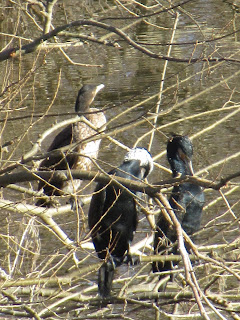
aficionados for bird watching during winter. Please enjoy the place while it
lasts. Honestly.
 |
| This is a baby thistle.
Cute. |
 |
| Adults |
 |
| Ushirokubo Bus Stop we
can easily find in Nakai Town side |
 |
| In three weeks, it will
be beautiful … |
If you find
environmental issues in Kanagawa Prefecture, please make a contact with Kanagawa
Natural Environment Conservation Center 神奈川県自然環境保全センター
657 Nanasawa, Atsugi City, 243-0121
〒243-0121 厚木市七沢657
Phone: 046-248-0323