Showing posts with label Hiking. Show all posts

Friday, March 5, 2021

Going Down the Slippery Slope: Stone-pavement via Hatajuku on the 8 Miles Road of Hakone 箱根八里


Say, you ride a commuter bus around 9:00 from Odawara Station 小田原駅 to Onshi-koen Park 恩賜公園, start walking from there, and reach to Amasake Chaya Café 甘酒茶屋. Probably, it is around 11:30-12:00, lunch time at a nice historical Café with healthy menu, and lots of toilets. Many people decide their hiking is done here and ride a bus to Hakone Yumoto Station 箱根湯本駅 of Hakone Tozan Railway 箱根登山鉄道. Now! Let’s hike from Amasake Chaya to Hakone Yumoto with 8 Miles Road. The number of tourists ahead is smaller, if not “rare”, I tell you. Anyway, the stone paved route from now is relatively less trodden. This makes maneuvering on the road becomes trickier. You may think “?” I tell you why.

From Amasake Chaya,
we go down Prefectural Road 732 a bit to find
a signpost to return to the old pavement.
 The ancient road beyond these steps runs along #732.

Basically, Hakone is the area receiving more rainfall compared with the other places in Kanagawa Prefecture. When we check the up-to-date precipitation data online, Hakone stays in the top 3 spots regularly. The forests of Hakone are the mixture of afforested coniferous ever-greens and broadleaved trees. As we descend, we move to climate warmer and kinder to evergreen hardwoods. Inevitably, the stone-paved route in the forest receives less sun light and humid. If you’re interested in mosses and mushrooms, it’s an exciting place. But, when we plan to pick up the pace of walking, the condition is hazardous for hikers with uneven stones covered with mosses and continuously falling leaves. (Do you know evergreens shed their old leaves year-round?) I tell you, especially from Amasake Chaya, 8 Miles Road of Hakone is very SLIPPERY!

The paved way in a forest

Worse. The road is paved with hard-stone and runs on the precipitous slope of Hakone. If we fail to secure safe landing when we fall, there is a high possibility of suffering severe injury, like broken bones or concussion. Do you remember the photo last week, even before reaching to Amasake Chaya we avoided walk on the center of the paved road? That’s because we felt our knees tired and wanted to lessen the impact of hopping from one stone to another that looked safer. The sides of the paved route keep some ground soil so that it was gentler for foot of long-distance hikers … and the trekking road will be destroyed further because of our stamping … We know the environmental impact of our deeds. So, sorry, but our instinct for self-preservation wins. Now from Amasake Chaya, the number of hikers is smaller, and the space the side of the paved road, created by hikers, is narrower. And we’ve already descended along the stone-tiled route for about 3 hours. We continue 2-3 hours more of this, but harsher condition with hazardous moss-covered stones. You see my point? That’s why it’s so important to choose your shoes for this paved hiking course! I’ve witnessed many hikers before me over there slipped and had hard time to recover from the ground to proceed.

Please don’t get fooled by its “flat” surface …

8 Miles Road itself goes along the Prefectural Road #732. #732 winds quickly for cars to proceed steep slopes of Hakone. Compared to this, 8 Miles Road is for walkers continuing (relatively) straight. We often have to cross #732 and search for petit entrances in another side for 8 Miles Road to proceed. The Prefectural Road is a commuter road used frequently, if not congested, by cars. In this regard, we don’t have to worry too much getting lost. Occasionally we enjoy open mountain scenery of Hakone, of ancient and new volcanos, and Sagami Bay. During autumn, it’s so beautiful with colored slopes over there in yellow, red and green with blue Pacific Ocean ... Although we can here cars are coming next to us, the route is calm and serene in general. The atmosphere compensates our concentration on the moss-covered perilous stones …

Another side after crossing #732 could be some steps like this.
 Just keep on going,
 and soon we return to the 17th century pavement.

Old and new remnants of massive volcanic eruptions in Hakone,
 seen from the 8 Miles Road.

From Amasake Chaya, the local community called Hatajuku 畑宿 built houses here and there along #732. This is a historical community existing along 8 Miles Road of Hakone. At the beginning of Tokugawa Shogunate 徳川幕府 of the 17th century, theirs was a village of deep mountain where exhausted travelers asked some rest (and toilets!). 100 or so years later, they had cafés where the procession of feudal lords took rest and enjoyed elaborated mountain gardens. They even had (unofficial) brothels. According to one popular TV travelogue named “Bra-Tamori ブラタモリ” aired in October 2018, the Shogunate treated the villagers of Hatajuku well as they were informants watching for suspicious movement in and out of Edo (Tokyo) via Hakone. A-ha. The community of spies, then. In the 21st Century the place is famous as a hamlet of artisans for Hakone Yosegi-zaiku 箱根寄せ木細工.

Ichiri-zuka 一里塚 in Hatajuku.
 “Ichiri-zuka” is a signpost = “Zuka”
 built by Tokugawa Shogunate
 to mark “Ichi-ri” = 3.9km from the previous “Zuka.”
 This is the 23rd Ichiri-zuka from
   the beginning of Tokaido
東海道,
  Nihonbashi Bridge of Edo (Tokyo)
江戸日本橋
 (the bridge in front of the BOJ).
 This Ichiri-zuka was rebuilt in 2012
 after archeological study of the place.
 Once, such facility was used for travelers
 having a short break under the shade of big tree.

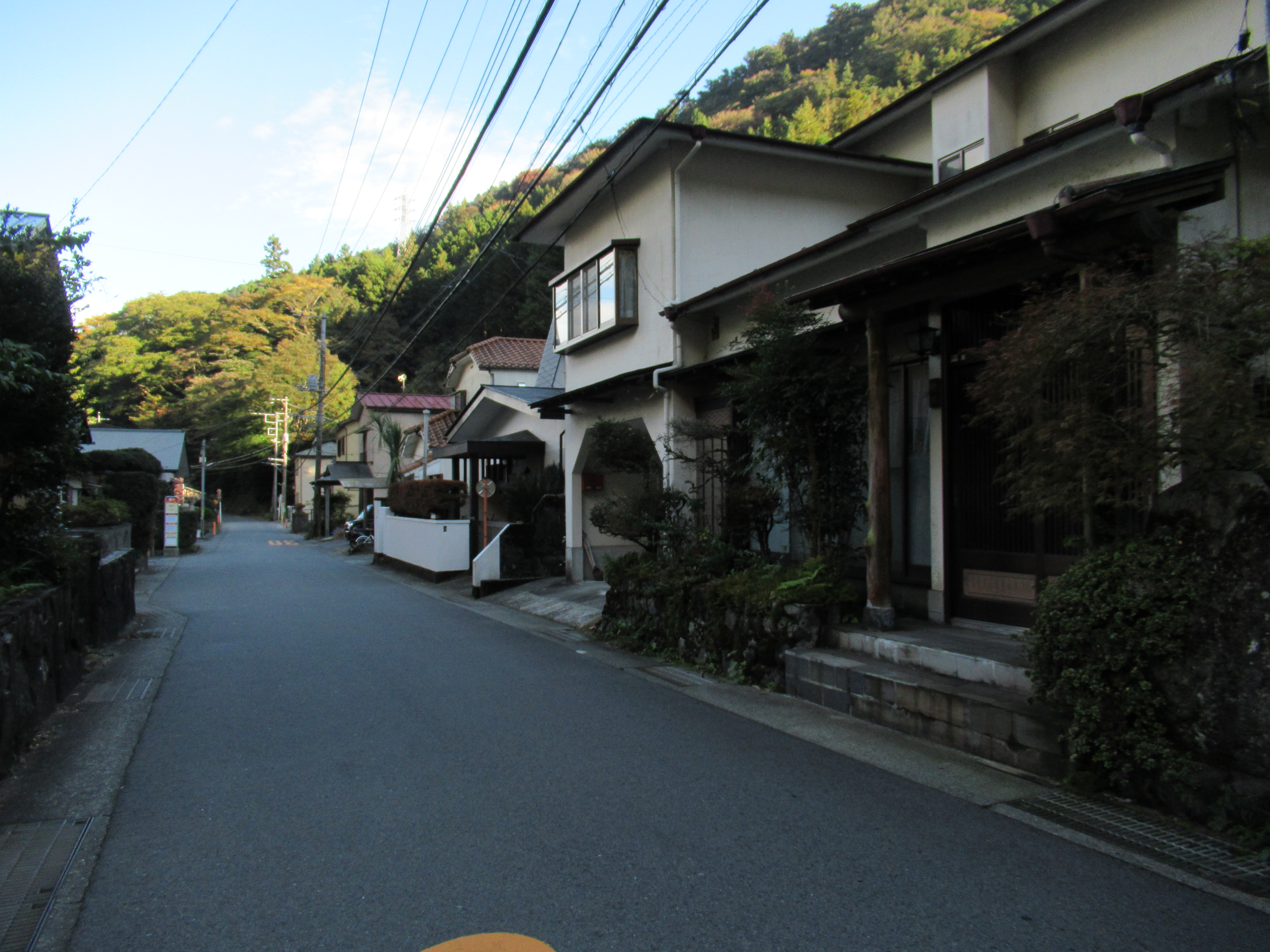
Hatajuku community in 2020

They have public toilets.

It was in the late 18th century when an artisan of Hatajuku named Ishikawa Jin’bei 石川仁兵衛 developed the technique to create craft objects, like jewelry boxes, plates, etc. using the ubiquitous trees in Hakone. I think it now becomes standard souvenirs for tourists to Hakone from all over the world. Many crafters of Yosegi-zaiku resides in Hatajuku community still. Hatajuku has museums and ateliers where we can learn the traditional crafts on hand and find souvenirs. You can decide to spend the rest of your day here and take bus to Hakone Yumoto for returning downtown Megalopolis (; the last bus will be at 20:41. Time table, here).

My Yosegi-zaiku box.
 I have it since I was a kindergartener …
 Maybe somebody gave it to me …

One of such shops to experience Yosegi woodcraft in Hatajuku
The ancient road continues between gardens probably of 200-300 years old …

From Hatajuku Bus Stop, the paved-road goes along with not only Prefectural Road #732, but also National Route 1. The historical road runs also with Sukumo-gawa River 須雲川. The level of slipperiness goes on strong. It continues for about half an hour, and the stone pavement finally unites with Prefectural Road 732 at Sukumo-gawa Bridge. From here to Hakone Yumoto Station, we walk #732, so please be careful of cars. Many hot spring inns start to appear. Area-wise, this is already the tourists’ spot of Hakone Yumoto 箱根湯本. Some spas allow day-trippers to enjoy short time stay. Some requires reservation in advance. To choose one, please refer here. Spa could be a nice conclusion for historical hiking in Hakone. Hakone Yumoto community has its own parks and forests, like I’ve visited for mushroom the other day. In future, I’ll report my another adventure in Hakone Yumoto. 😀

The paved road goes along Sukumo-gawa River.

The toilet near Sukumo-gawa Bridge.
 This is the end of the ancient road.
 From here we, walk #732.

And in no time,
 we enter the present-day housing area of Hakone Yumoto.

Hakone Yumoto Station seen from near Hakone Town Hall.
 The end of our hiking today!

Oh, by the way, for 8 Miles Road of Hakone = Hakone Hachi-ri, “Hachi-ri 八里 = 8-ri” is supposed to be “1-ri * 8 = 3.9 km * 8 = about 32 km,” if we convert the unit in Shogunate official metrics. Our 8 Miles Road is not at all 32km. In classic Japanese language, “ri” often used for “long distance.” The historical road nowadays is about 8 miles that I found very convenient to translate “Hakone Hachi-ri 箱根八里” into English “8 Miles Road.” It seems to me, there are several explanation about the moniker “Hakone Hachi-ri.” The most legal one says the start of the road is Hakone Yumoto, and the end is Mishima 三島 in Shizuoka Prefecture 静岡県, whose distance is about 32km. The ancient route from Hakone Checking Station (箱根関所 roughly, our starting point for this hiking) to Mishima is none other than present day National Route 1, remodeled by modern civil engineering and always busy with lots of cars. Please pick your choice of the beginning / the end of the historical “Hakone Hachi-ri.” Cars? On foot?

Cute Himalayan spindles (Enonymus hamiltonianus) in Hakone.
 This makes white parts of Hakone Yosegi-zaiku …


If you find environmental issues in Hakone, please make a contact with Hakone Visitor Center, Ministry of Environment of Japan.

164 Motohakone, Hakone-machi, Ashigarashimo-gun, Kanagawa 250-0522
Phone: +81-460-84-9981
FAX: +81-460-84-5721
Email: hakone-vc@kanagawa.email.ne.jp
http://hakonevc.sunnyday.jp/shizenjyouhou/gazou/englishindex.html

Friday, February 5, 2021

The Most Precipitous in Japan: introduction for hiking “8 Miles Road of Hakone 箱根八里”


Hakone 箱根, one of the best-known tourists’ destinations in Japan, is a historical place. It has reputation such as “the most precipitous in Japan” … I doubt this claim, though … Anyway! still now, when people travel between the West, i.e. Nara 奈良, Kyoto 京都, and Osaka 大阪, and the East, i.e. Kamakura 鎌倉 and Edo 江戸 (Tokyo), Hakone is THE choking point for land route. The area is made of steep cliffs and torrents. The passable routes are limited. Until 802 AD, it even had a popular detour which went around Hakone. The bypass was roughly the same road of present-day Route 246 from Gotemba City 御殿場市 to Matsuda Town 松田町 (the gateway to Yadoriki Forest やどりき水源林) via Ashigara Pass 足柄峠 (; my post on August 4, 2017). Then in the first week of 802, Mt. Fuji erupted and closed the Ashigara Pass. People were forced to use mountainous Hakone Route.


The locational composition of Hakone and Mt. Fuji is like this.
 It’s not at all near …
 This photo was taken on the peak of Mt. Yagura
矢倉岳, near Ashigara Pass.


Since then, there were many records depicting how hard to cross Hakone area (for example, this one). When Tokugawa Ieyasu 徳川家康, the founder of Tokugawa Shogunate Government 江戸幕府, decided in 1600 to make Edo the center of Japanese political system, Hakone offered a clever strategic option to build Fortress Tokyo. As the place is so precipitous, there were very few people ventured alternative routes in Hakone. i.e. The government could control almost perfectly the traffic between the East and the West of Japan at Hakone. It was the main gate to Edo. To defend Tokyo from western enemy attacks via the main route, the idea is perfect, isn’t it? Tokugawa Ieyasu constructed a well-crafted road through the mountainous Hakone suitable for large entourages of delegations sent by the Emperor in Kyoto, or by the King of Joseon Dynasty from Korean Peninsula. This mountain road was named “Hakone 8 Ri 箱根八里” aka “8 Miles Road of Hakone” starting from Hakone Yumoto 箱根湯本 to Lake Ashinoko 芦ノ湖. Ieyasu then located a huge check point called Hakone Checking Station 箱根関所 on the south shore of Lake Ashinoko where 8 Miles Road ends and departs to the next region which was the area for modern Shizuoka Prefecture 静岡県.

The map of 8 Miles Road of Hakone, shown near Lake Ashinoko

Today, Hakone Checking Station is a huge tourist attraction that is an amalgam of history museum and a theme park. Introducing the place will be saved for another occasion … Today, and in the next 2 posts, I tell you my adventure along the 8 Miles Road of Hakone. Yes. The road Tokugawa Ieyasu prepared has largely preserved although it is cut in numerous times by Prefectural Road 732 for cars. The marvel of civil engineering for the 17th century Japan. The ancient route becomes a popular hiking road for the 21st century. Exactly speaking, 8 Miles Road starts from Hakone Yumoto (; my post on ), proceeds through the forest almost in parallel to Route 1 until old Hatajuku Town 畑宿, then crisscrosses with Road 732 to historical Amazake-Jaya Café 甘酒茶屋, and finally goes down to Lake Ashinoko via Kampher-Barney Monument. From there to the Checking Station the road runs along the popular circle road of Lake Ashinoko.


When the 8 Miles Road meets with Lake Ashinoko,
 at the First Torii
一の鳥居 of Hakone Shrine 箱根神社,
 we find these tiny stupas and statues of Buddha
 on both sides of the Circle Lake Road.
 The place is called Sai-no-Kawara
賽の河原
where numerous travelers to Hakone some 1000 to 150 years ago
 built these objects of worship for their peace of mind.
 It had once far more stupas,
 but economic development destroyed so many.
 The place is now designated as a Historic Site by Hakone Town.

When you walk the route in this way, it is almost “one way up” … Hmmmmm, it would be an educational experience to know how hard it was to pass Hakone until some 150 years ago … But, in this age of the 21st Century, let’s use a modern tool called “commuter bus services.” We go Lake Ashinoko first, then follow the path from there to Hakone Yumoto. Yeah, it’s almost “one way down.” Even though, it’s really a day hike. I found going-down is enough to know the difficulty in Hakone on foot or horse-ride if you’re skilled enough perhaps at the level of professional jockey or Olympians … Next week, I start from how to reach Lake Ashinoko by commuter bus. Please stay tuned. 😄 Oh, just one reminder. Hakone is a National Park of Japan. Environmental restrictions are harder than for the other parts of Kanagawa Prefecture. We must behave there. Wow.


If you find environmental issues in Hakone, please make a contact with Hakone Visitor Center, Ministry of Environment of Japan.

164 Motohakone, Hakone-machi, Ashigarashimo-gun, Kanagawa 250-0522
Phone: +81-460-84-9981
FAX: +81-460-84-5721
Email: hakone-vc@kanagawa.email.ne.jp
http://hakonevc.sunnyday.jp/shizenjyouhou/gazou/englishindex.html

Friday, May 5, 2017

Hello Ghosts! I’m going up to Mt. Oyama: Kotakuji Temple Route


The third route to climb up Mt. Oyama I tried is from Kotakuji Temple 広沢寺. Distance wise, it’s the longest walk to the peak (6.5K) compared to the routes from Hinata Yakushi Temple 日向薬師 (6K), Yabitsu Pass ヤビツ峠 (2K), or from the Oyama Cable Bus Stop via Lower Afuri Shrine 阿夫利神社下社 (3K). Though, I felt gaining altitude in Kotakuji Temple route is similar to the route from Yabitsu Pass, i.e. gentler, and we can enjoy a pleasant ridge walk along a well-maintained trekking road. When your objective in Mt. Oyama is to have a nice hiking weekend rather than experiencing historical pilgrimage, starting the day from Yabitsu Pass and going down to Kotakuji Temple could be the best option. The bonus of this itinerary is Gyokusui-Roh Spa 玉翠楼 next to the Kotakuji Temple. We can conclude our Oyama hiking in a quiet spa in forest. 😇


A view to Kanto Plain from the ridge way of Kotakuji Route


Even though, I repeat the thing I told you last week. Never try off-road, but keep the route clearly marked by the park rangers. Also, think the season and equipment when you go there. Checking the weather of your scheduled date should always be the starting point of your itinerary. If you plan to go there during cold spells, crampons are the MUST. It is definitely advisable to carry a good map of Tanzawa before your walk. For the most popular and reliable map, the info is here. The site of Japan Mountaineering Association aggregates the information of the mountains in Japan. Though they are mainly for the peaks of higher altitude, if something serious happens in Tanzawa they can cover. Consider leaving your plan in a written form at the entrance of the route; for this week’s schedule, a free parking space at the beginning of the route has a drop-in box. Tanzawa is the place where Japanese alpinists for Mt. Everest train themselves. Never underestimate the place.


The drop box for reporting your itinerary today.
The road beyond, especially around the tunnel we’ll go soon,
has ghost stories of lost souls ...
better be prepared anyway.


The commuter station we start for Kotakuji Temple route is Honatsugi station 本厚木駅 of Odakyu Odawara Line. We leave from the north exit of Honatsugi, and walk 5 minutes to the Atsugi Bus Center 厚木バスセンター next to the Atsugi City Central Library. Kanachu Bus connects Kotakuji Temple with downtown Atsugi City from #9 stop of the Bus Center by Atsu-38 (38) service (to Kotakuji Temple Spa stop 広沢寺温泉). As we can find the timetables to and from Kotakuji Temple, there are fairly limited services between the downtown and Kotakuji Temple. If you don’t mind prolonging hiking distance for about quarter an hour along the bus route, using Atsu-33, 34, or 39 (33, 34, 39) to/from Kotakuji Temple Spa Entrance stop 広沢寺温泉入口 could be an alternative. (Time Table from the Bus Center for them is here.) The bus runs through Nanasawa Hot Spring town 七沢温泉郷 via the campus of Kanagawa Nature Conservation Center 神奈川県自然環境保全センター, and Kanagawa Rehabilitation Hospital 神奈川リハビリテーション病院. The hospital is specialized for the people who suffer serious stroke, heart attack, etc. From the window of the bus, we understand why the Rehab Center for severe medical problem is there. We proceed through a peaceful countryside equipped with hot springs. When cherry blossoms are in full-bloom, the Nanasawa hills surrounding Mt. Oyama were so beautiful with various hues of green and polka dots of pale pink. I wish very good luck for those who are busy in their rehab schedule …


Atsugi Bus Center.
# 9 stop is in the middle of this photo where people gather.


Kotakuji Temple Spa is a part of Nanasawa Hot Spring which is clear and cold (23°C) mineral springs with ph9-10, i.e., strong alkaline. Bathing in strong alkaline spring yields smooth skin, and hence the springs in Nanasawa have a nickname, “Springs for Beauties.” 😍 The discovery of a spring next to Kotakuji Temple is in the 1930s. There is now a Japanese Inn, Gyokusui-Roh Spa. They have day-spa menus (usage of spa only, spa + soft drinks, spa + alcohol and tapas, spa + wild boar dishes, spa + …), or overnights options. Kotakuji Temple was a private temple for Uesugi clan 上杉氏, the lord of Nanasawa Castle that in the 15th century stood on the place where the current Rehab Hospital is. The clan was never be a major league player in Japanese history … I don’t think they wanted to be anyway. If you live in such a pastoral place, rat race of any kind could be nonsense ... Kotakuji Temple Spa bus stop is in front of the Gyokusui-Roh Spa and the steps going up to Kotakuji. To the route for Mt. Oyama, we go back 50m or so the bus route from the terminal stop. If you want to skip Gyokusui-roh and Kotakuji Temple, you can ask the bus driver beforehand to stop at the junction immediately before the road to Gyokusui-roh. Actually, between Kotakuji Temple Spa Entrance stop and Kotakuji Temple Spa stop we can get off the bus wherever we like, provided we ask the driver beforehand.


Gyokusui-roh Inn.
For a day-spa, they allow us to use open-air spas
(; male and female are separated).
Private spa is for overnight stay only.
Kotakuji Temple
Kotakuji Temple Spa Stop
We can get off the bus here without going to Kotakuji.
This is a free parking space with toilet.
The facility has western style toilets with wash basins,
and a drop box for reporting your itinerary today.


The Tanzawa-Oyama Quasi- National Park starts from the point where the free parking space is. Beyond, there is a paved 3.5K road proceeding further into the mountain. It’s a community road for local farmers and forestry. Especially at the beginning, the south side of the road is sealed off with electric wires that are to stop wild animals wondering into the ag land. (More to this in my later post.) Corollary: if you try to enter the mountain off road here, you’ll be electrocuted. A steep climb eventually begins after the last house on the way. Roughly 1.5K from the parking there is a gate that allows only the cars with official permit to enter. The road now runs along Yamano-kami Stream 山の神沢 (“Mountain God Stream”). 300m more walk from the gate, we reach to the mouth of a tunnel, Yamagami Zuido 山神隧道 (“Mountain God Tunnel”). Yamagami Zuido is something for “urban legend” as several TV stars insisted they have seen a male ghost inside. When I walked there … I could not feel any mysterious thing. It’s a long and narrow tunnel without light. The only light we can see is the other side. Rather than ghost, I found the road very good for walking meditation … I love the place, I tell you.


The road ahead from the parking
Please keep off from the fence.
Getting altitude …
This soil erosion controller became functional just last year.
Yamano-kami Stream.
We’ve entered forestry area …
From there no car without permit can enter.
Oh, by the way, before the gate,
there on the right is a small detour
that allows us to get a bit nearer to the watercourse.
At this point, we find an even smaller spurt
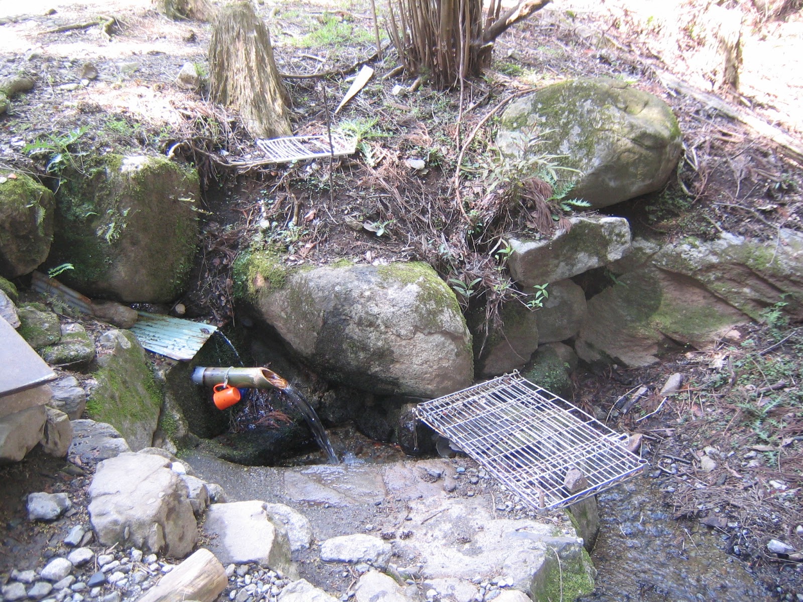
pouring to Yamano-kami Stream, with a plastic cup provided.
It seems to me locals come here to gather water for their tea.
I haven’t tried it, but could be sweet, as Gomayashiki Spring.
Beyond the gate is more and more a forestry road.
And over there is Yamagami Zuido, approx. 250m long.
The toilet on the left is the second from the last facility
we can use for today’s itinerary before the peak.
Oh so symbolic!


A paved road still continues beyond the tunnel. We find lots of small streams running down from the left slope of the road to Yamano-kami Stream. It’s an area with abundant water. “Nanasawa” means “7 streams” in Japanese. The name of the town must have logic. Thanks to these water-flows, we are able to observe the soil of Tanzawa mountain directly … very shallow top soil and the rocks underneath. About 20 min. walk from the tunnel, we reach to the end of the vehicle road. Beyond is a bridge crossing the Yamano-kami Stream. At the other side, there is the final toilet we can use for today’s itinerary. Please do not miss the opportunity! A paved road continues for a while after the toilet, but the surface is covered with screes and fallen trees. We have a feeling we are really entering deep into the mountain … Soon we meet a derelict concrete bridge without parapet crossing once again the Yamano-kami Stream. At the mouth of the bridge, there is a warning the structure is too fragile so that any wheeled device should avoid crossing it. Beyond the bridge is an open space, called Fudohjiri 不動尻 (453m ASL) that was once a camping site. This place also contains the legend of ghosts, this time a necrophilia eating roasted meat of baby girls … I could not feel any gruesome atmosphere there. Rather, I was welcomed by late blooming of Edgeworthia chrysantha adoring the beginning of the trekking road to the peak. If you don’t mind the legend, it’s a fairly good place to have a break and prep for a steep climb. 😜


The other side of the tunnel continues like this.
Along the way on the left there is a road leading us
to Kanegatake
鐘ヶ嶽 (an elevation of 561m) and then
to Kotakuji Temple Spa Entrance bus stop.
It’ll be 2 hours walk from here to the bus stop.
A huge rock along the route.
It looks like raised in a slanted way.
This feature is the key why the main pilgrimage
routes to the peak of Mt. Oyama,
Omotesando
表参道 and Urasando 裏参道,
are scree-covered.
I’ll tell you what they are when we go there.
One of the waterfalls
we can meet along the road.
The end of the paved road
Toilets!
The road beyond toilet
It will be beautiful in May here.
A bridge with a warning
A former camp, or crime, site
Edgeworthia chrysantha.
Now, let’s climb!


Almost immediately after Fudojiri, we meet a junction of 3 roads. To the left is to the peak of Mt. Oyama, and to the right is for about 5 hours hiking to Mt.Mitsumine 三峰山 (934.6m ASL) and Miyagase Lake 宮ケ瀬湖. (I hope you click the link to Mt. Mitsumine before you plan to go there. The route is not for uninitiated.) Today, we take Oyama direction. The road is sharply going up through the afforested area of Japanese cedars and cypresses. As we gain the altitude huge wild Pinus densifora start to appear as in Hinata-yakushi Route. It seems to me the City of Atsugi is doing the maintenance work for the forest, and there are lots of cordoned road with a notice “This route is not to the peak of Mt. Oyama, but for forest maintenance.” It’s a bit confusing arrangement, but as long as you follow the direction, signposts appears several times before we reach to the ridge. Please be patient. Climbing up further we begin to see the forest of Fagus crenata beyond the afforested area on the right. i.e., We are going beyond 800m above sea level. About an hour climb from Fudojiri, we reach to a small peak (844m ASL) with a sign post. Here we are already surrounded by natural beeches, Comus kousa, and Abies firma. I’ve come back to Mt. Oyama!


To the right is for Mt. Mitsumine.
To the left is for Mt. Oyama.
Gaining the altitude …
3.3K to go
This direction is off-limit for hikers.
In mid-April, the forest of Fagus crenata had so pale green of new leaves that
was a palpable contrast with dark green cypresses ...
By the way, have you noticed the trunk
of afforested trees wrapped by plastic mesh?
I’ll return the topic in my later post.
The sign post at 844m above the sea level


From here for about 1K, the route becomes fairly pleasant ridge road. We go down for 10 min. or so to Karasawa Pass 唐沢峠 where there is a pergola and picnic benches. There would be a strong temptation to have lunch now … but often the place is occupied by earlier visitors. If your stomach can accept 20 more minutes’ walk, there will be another good place ahead … After Karasawa Pass, the ridge way shows the feature of seriously precipitous rim of the mountain typical in Tanzawa. As this route is well-maintained, the route is clear with lots of wood decks and chains. So long as we are careful it would be OK. Though, I simply imagine the other routes that are assigned for “good walkers of Tanzawa.” The bushes cover the way, and there won’t be any help to pass rocks … No wonder many incidences occur in Tanzawa mountains. 0.5K from the Karasawa Pass, the ridge becomes somehow wider, and then suddenly the both sides of the road open up. On the left is the vast Kanto plain, and on the right are the North Ridge and the Peak of Mt. Oyama. You’ll soon find a picnic bench ahead. Some say this spot is better than Karasawa Pass for lunch.😋


A view from the ridge way to Oyama North Ridge.
Over there is a pro-only route.
Hello, dear firs!
Yellow cute flowers are Lidera praecox.
Karasawa Pass picnic place
A part of ridge way is like this,
or like this …
Very obvious ridge
The view ahead becomes wider …
This bench (908m ASL) is better for Picnic!


Soon after the bench with views, the road once again starts to gain altitude rapidly. The route is a continuation of steps of logs. It lasts for about 30 min. till Fudojiri-Bunki (不動尻分岐, Fudojiri Junction; 1148m ASL) where the Kotakuji Route meets with the end of Kaminari-no-mine O’ne (雷ノ峰尾根 The Ridgeway of Thunder-Peak) for the Hinata-yakushi Route. You may notice the vegetation around you is a bit limited …  natural beeches, ancient Abies firma, a bit of Acuba japonica, trimmed Boehmeria spicata, and large bushes of Pieris japonica. Admitted the flowers of Japanese andromeda are pretty, and they were in full-bloom in mid-April. But… they are poisonous. Why can they grow this vigorous here near the peak of Oyama? A hint appears at the next picnic bench situated before Fudojiri-Bunki. When you take a rest on it, to the west is a high-voltage power line going near the peak of Oyama. To the east is wire-fenced space where inside are baby trees covered by mesh. They are protected from being eaten ... I a sort of felt a pain. The situation is not yet settled in Mt. Oyama … I’ll return the issue next month … Any way! After a heart-pumping climb of 30 minutes, we meet the hikers who came from Hinata Yakushi at Fudojiri-Bunki. The top of the mountain is within 30 minutes’ walk now!


The long and winding and steep road
There is another picnic bench along the way.
Could you see the wired fence over there?
And next to us is a very 21-st century structure.
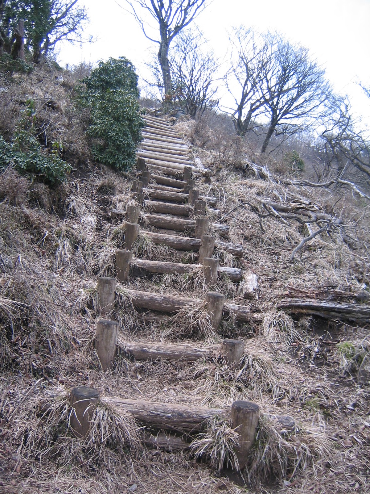
The way becomes more and more like this.
Yep, Japanese Andromeda are cuties, but …
Nearly there …
Fudojiri-Bunki


If you find environmental problems in Oyama, please make a contact to
 
Kanagawa Nature Conservation Center 神奈川県自然環境保全センター
657 Nanasawa, Atsugi City, 243-0121 2430121 厚木市七沢657
Phone: 046-248-0323

You can send an enquiry to them by clicking the bottom line of their homepage at http://www.pref.kanagawa.jp/div/1644/