
Say, you ride a commuter bus around 9:00 from Odawara Station 小田原駅 to Onshi-koen Park 恩賜公園, start walking from there, and reach to Amasake Chaya Café 甘酒茶屋. Probably, it is around 11:30-12:00, lunch time at a nice historical Café with healthy menu, and lots of toilets. Many people decide their hiking is done here and ride a bus to Hakone Yumoto Station 箱根湯本駅 of Hakone Tozan Railway 箱根登山鉄道. Now! Let’s hike from Amasake Chaya to Hakone Yumoto with 8 Miles Road. The number of tourists ahead is smaller, if not “rare”, I tell you. Anyway, the stone paved route from now is relatively less trodden. This makes maneuvering on the road becomes trickier. You may think “?” I tell you why.
 |
| From
Amasake Chaya, we go down Prefectural Road 732 a bit to find |
 |
| a signpost
to return to the old pavement. The ancient road beyond these steps runs along #732. |
Basically, Hakone is the area receiving more rainfall compared with the other places in Kanagawa Prefecture. When we check the up-to-date precipitation data online, Hakone stays in the top 3 spots regularly. The forests of Hakone are the mixture of afforested coniferous ever-greens and broadleaved trees. As we descend, we move to climate warmer and kinder to evergreen hardwoods. Inevitably, the stone-paved route in the forest receives less sun light and humid. If you’re interested in mosses and mushrooms, it’s an exciting place. But, when we plan to pick up the pace of walking, the condition is hazardous for hikers with uneven stones covered with mosses and continuously falling leaves. (Do you know evergreens shed their old leaves year-round?) I tell you, especially from Amasake Chaya, 8 Miles Road of Hakone is very SLIPPERY!
 |
| The paved way in a forest |
Worse. The road is paved with hard-stone and runs on the precipitous slope of Hakone. If we fail to secure safe landing when we fall, there is a high possibility of suffering severe injury, like broken bones or concussion. Do you remember the photo last week, even before reaching to Amasake Chaya we avoided walk on the center of the paved road? That’s because we felt our knees tired and wanted to lessen the impact of hopping from one stone to another that looked safer. The sides of the paved route keep some ground soil so that it was gentler for foot of long-distance hikers … and the trekking road will be destroyed further because of our stamping … We know the environmental impact of our deeds. So, sorry, but our instinct for self-preservation wins. Now from Amasake Chaya, the number of hikers is smaller, and the space the side of the paved road, created by hikers, is narrower. And we’ve already descended along the stone-tiled route for about 3 hours. We continue 2-3 hours more of this, but harsher condition with hazardous moss-covered stones. You see my point? That’s why it’s so important to choose your shoes for this paved hiking course! I’ve witnessed many hikers before me over there slipped and had hard time to recover from the ground to proceed.
 |
| Please don’t get fooled by its “flat” surface … |
8 Miles Road itself goes along the Prefectural Road #732. #732 winds quickly for cars to proceed steep slopes of Hakone. Compared to this, 8 Miles Road is for walkers continuing (relatively) straight. We often have to cross #732 and search for petit entrances in another side for 8 Miles Road to proceed. The Prefectural Road is a commuter road used frequently, if not congested, by cars. In this regard, we don’t have to worry too much getting lost. Occasionally we enjoy open mountain scenery of Hakone, of ancient and new volcanos, and Sagami Bay. During autumn, it’s so beautiful with colored slopes over there in yellow, red and green with blue Pacific Ocean ... Although we can here cars are coming next to us, the route is calm and serene in general. The atmosphere compensates our concentration on the moss-covered perilous stones …
 |
| Another
side after crossing #732 could be some steps like this. Just keep on going, and soon we return to the 17th century pavement. |
 |
| Old
and new remnants of massive volcanic eruptions in Hakone, seen from the 8 Miles Road. |
From Amasake Chaya, the local community called Hatajuku 畑宿 built houses here and there along #732. This is a historical community existing along 8 Miles Road of Hakone. At the beginning of Tokugawa Shogunate 徳川幕府 of the 17th century, theirs was a village of deep mountain where exhausted travelers asked some rest (and toilets!). 100 or so years later, they had cafés where the procession of feudal lords took rest and enjoyed elaborated mountain gardens. They even had (unofficial) brothels. According to one popular TV travelogue named “Bra-Tamori ブラタモリ” aired in October 2018, the Shogunate treated the villagers of Hatajuku well as they were informants watching for suspicious movement in and out of Edo (Tokyo) via Hakone. A-ha. The community of spies, then. In the 21st Century the place is famous as a hamlet of artisans for Hakone Yosegi-zaiku 箱根寄せ木細工.
 |
| Ichiri-zuka
一里塚 in Hatajuku. “Ichiri-zuka” is a signpost = “Zuka” built by Tokugawa Shogunate to mark “Ichi-ri” = 3.9km from the previous “Zuka.” This is the 23rd Ichiri-zuka from the beginning of Tokaido 東海道, Nihonbashi Bridge of Edo (Tokyo) 江戸日本橋 (the bridge in front of the BOJ). This Ichiri-zuka was rebuilt in 2012 after archeological study of the place. Once, such facility was used for travelers having a short break under the shade of big tree. |
 |
| Hatajuku community in 2020 |
 |
| They have public toilets. |
It was in the late 18th century when an artisan of Hatajuku named Ishikawa Jin’bei 石川仁兵衛 developed the technique to create craft objects, like jewelry boxes, plates, etc. using the ubiquitous trees in Hakone. I think it now becomes standard souvenirs for tourists to Hakone from all over the world. Many crafters of Yosegi-zaiku resides in Hatajuku community still. Hatajuku has museums and ateliers where we can learn the traditional crafts on hand and find souvenirs. You can decide to spend the rest of your day here and take bus to Hakone Yumoto for returning downtown Megalopolis (; the last bus will be at 20:41. Time table, here).
 |
| My
Yosegi-zaiku box. I have it since I was a kindergartener … Maybe somebody gave it to me … |
 |
| One of such shops to experience Yosegi woodcraft in Hatajuku |
 |
| The ancient road continues between gardens probably of 200-300 years old … |
From Hatajuku Bus Stop, the paved-road goes along with not only Prefectural Road #732, but also National Route 1. The historical road runs also with Sukumo-gawa River 須雲川. The level of slipperiness goes on strong. It continues for about half an hour, and the stone pavement finally unites with Prefectural Road 732 at Sukumo-gawa Bridge. From here to Hakone Yumoto Station, we walk #732, so please be careful of cars. Many hot spring inns start to appear. Area-wise, this is already the tourists’ spot of Hakone Yumoto 箱根湯本. Some spas allow day-trippers to enjoy short time stay. Some requires reservation in advance. To choose one, please refer here. Spa could be a nice conclusion for historical hiking in Hakone. Hakone Yumoto community has its own parks and forests, like I’ve visited for mushroom the other day. In future, I’ll report my another adventure in Hakone Yumoto. 😀
 |
| The paved road goes along Sukumo-gawa River. |
 |
| The
toilet near Sukumo-gawa Bridge. This is the end of the ancient road. From here we, walk #732. |
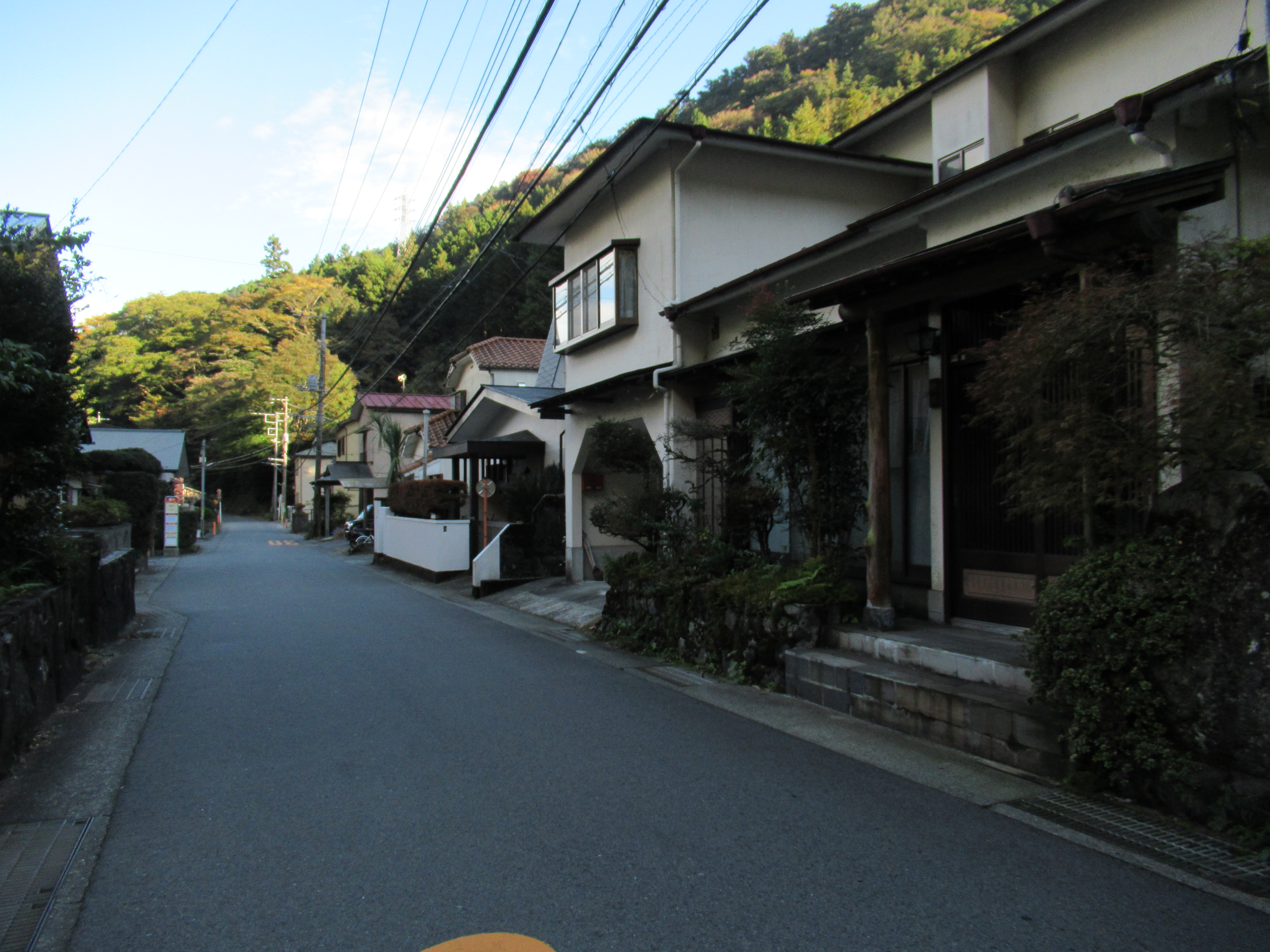 |
| And in
no time, we enter the present-day housing area of Hakone Yumoto. |
 |
| Hakone
Yumoto Station seen from near Hakone Town Hall. The end of our hiking today! |
Oh, by the way, for 8 Miles Road of Hakone = Hakone Hachi-ri, “Hachi-ri 八里 = 8-ri” is supposed to be “1-ri * 8 = 3.9 km * 8 = about 32 km,” if we convert the unit in Shogunate official metrics. Our 8 Miles Road is not at all 32km. In classic Japanese language, “ri” often used for “long distance.” The historical road nowadays is about 8 miles that I found very convenient to translate “Hakone Hachi-ri 箱根八里” into English “8 Miles Road.” It seems to me, there are several explanation about the moniker “Hakone Hachi-ri.” The most legal one says the start of the road is Hakone Yumoto, and the end is Mishima 三島 in Shizuoka Prefecture 静岡県, whose distance is about 32km. The ancient route from Hakone Checking Station (箱根関所 roughly, our starting point for this hiking) to Mishima is none other than present day National Route 1, remodeled by modern civil engineering and always busy with lots of cars. Please pick your choice of the beginning / the end of the historical “Hakone Hachi-ri.” Cars? On foot?
 |
| Cute Himalayan
spindles (Enonymus hamiltonianus) in Hakone. This makes white parts of Hakone Yosegi-zaiku … |
If you find environmental issues in Hakone, please make a contact with Hakone Visitor Center, Ministry of Environment of Japan.
164 Motohakone, Hakone-machi, Ashigarashimo-gun, Kanagawa 250-0522
Phone: +81-460-84-9981
FAX: +81-460-84-5721
Email: hakone-vc@kanagawa.email.ne.jp
http://hakonevc.sunnyday.jp/shizenjyouhou/gazou/englishindex.html


