Showing posts with label National Park. Show all posts

Friday, November 5, 2021

Lord, are you going to wash my feet? Hakone Sengokubara, Japanese Natural National Treasure 箱根仙石原


I won’t tell you exactly where the entrance to off-limits part of Sengokubara 仙石原 is. In the end, it’s to a restricted National Treasure. Anyway, we went to the controlled wetland from Hakone Botanical Garden of Wetlands 箱根湿生花園, donning our rubber boots. The entry point had a small stream coming from the National Treasure area pouring to the ponds of Botanical Garden. Mr. Katsuyama said, “Please wash your boots here before moving into the protected area.” So far people have not found a Sengokubara-only endemic species. Though, the place has many endangered Japanese indigenous creatures. On the other hand, researchers found invasive species in the restricted area. “You see? Birds and animals may bring non-endemic types. Winds can carry seeds of Taraxacum officinale. We cannot control such things completely. At least we homo sapience can be careful not contributing to such disturbance for our wetland.” Mr. Katsuyama said. Indeed. Sengokubara is not so special as a Japanese wetland, but it is the only marshland in Kanagawa Prefecture. Maybe it would be difficult for Sengokubara to be a Ramsar site. But if we can preserve the swamp surrounded by resort facilities, it would tell something for cohabitation of nature and us, wouldn’t it?

The stream is man-made to control the water in the area.

So, we all washed our boots, then started to walk. For a while we walked along the stream that runs through forest of large Japanese Alder (Alunus Japonica). They are pioneer species for wetland naturally transiting to more dry and fertile land. The outer layer of National Treasure is at the final stage for the lifecycle of marshland. Even though, the forest floor is still swampy. The rim of this forest is next to a busy commuter road and the other side of the road is resort housing areas … It’s like alders protecting the way to the least disturbed fairly land of natural wetland. Soon, we encounter the field of Chinese silver grass (Miscanthus sinensis) and Common reed (Phragmites australis). The scenery became suddenly bright. Blue sky is high above us, but we are surrounded very high greensward.

Alders in Sengokubara

We’ve found Japanese gentians
(Gentiana Scabra Bunge var. buergeri (Miq.) Maxim)
along the stream.

Here we are!

I simply wondered how Mr. Katsuyama could find the way where our sight is completely blocked by well-grown grasses. Interestingly, the road had many small ups and downs. “It’s the remnants of rice paddies cultivated some 80 years ago.” Mr. Katsuyama said. Water from Mt. Daigatake 台ヶ岳 manages to pass through such artificial structure. Unless we’re careful, a sudden water hole can appear unexpectedly on our way. “Please be careful.” Silver grass and Common reed looked like competing each other. For the transition of wetland, the field of silver grass is one step before the forest of alders. In Sengokubara the vegetation hesitates to dominate the place. Actually, people intervene to stop the wetland changing to the dry land. Volunteers from Hakone Town set controlled fire every early spring on grasses and reeds. Those tall vegetations turns ash to be nutrients for the wetland, and more flora for marshland can receive sunshine in spring. At the same time, Silver grass and Common reed cannot establish strong holds for the burned area. The swamp stops its transition to dryland. The section that received the recent fire has shorter grasses and reeds. We could identify irises with seed pods. They could find sunshine to flower!

Sometimes, our way had rudimentary wood “decks.”

Researchers enter this area in order to study
fauna, flora, and underground water.
This is the point they measure the water level.

Grass and reed are competing each other.

Thistles in Sengokubara are Cirsium sieboldii.

Mr. Katsuyama said if we could combine fire and weeding, the management of wetland would be better. But for these 2 years COVID prevented volunteers from gathering to do the task. Not only that. “You see? Weeding always have problem of how-to carry out the cleared grass. If we left the cut reeds on the ground, it’s the same as naturally dead vegetation decaying on the ground and drying the marsh. We really have to take out the cut grass after weeding. We could weed only very small area in Sengokubara where this garbage collection problem is solved. How to do it in the entire Sengokubara where the trekking passes are limited?”

Could you see the difference in grass height
between the front and the back?
The lower part was burnt 2 years ago.

Hmmmmm. the sky was blue, the wind was sweet in early October. The place was only for us at that time. We took deep breath that was often difficult when places were congested and COVID-19 was just around the corner … The feeling of liberation was enormous in Sengokubara. To enjoy such things more, we have to solve the problem to protect the environment. Difficult … I personally recited the Bible. Water stream is Jesus, and we were just mere mortals …

John 13: 5 
After that, he poured water into a basin and began to wash his disciples’ feet, drying them with the towel that was wrapped around him.


Hakone Botanical Garden of Wetlands
817 Sengokubara, Hakone Town, Kanagawa, 250-0631
Phone: 0460-84-7293 
https://hakone-shisseikaen.com/

Friday, October 29, 2021

Once there was a lake … Hakone Sengokubara, Part 1 箱根仙石原1


Hakone 箱根, one of the most popular National Parks in Japan, has two National Natural Treasures. One is Giant Salamander (Andrias japonicus). It is a Special National Natural Treasure designated in 1952 and lives only in Hakone-en Aquarium. Another is Sengokubara Wetland 仙石原, designated in 1934. Sengokubara is a very famous tourist destination. Especially in autumn, it turns a golden field of pampas grass whose fluffy tufts elegantly swings with chilly winds. To admire it, visitors can walk along Prefectural Road #75, a busy commuter road connecting resort communities spreading around Mt. Hakone. It’s rather difficult to experience ‘wetland’ through Road 75. As the place is National Natural Treasure, real wetland part of Sengokubara is off-limits for tourists. Early October this year, I had a chance to enter wetland of Sengokubara chaperoned by Mr. Teruo Katsuyama 勝山輝男, the Researcher Emeritus for Kanagawa PrefecturalMuseum of Natural History, and the Chairperson for Flora Kanagawa Association. It was a wonderful adventure!

Having said that, we can enjoy wild flowers
 along Road #75 wherever it runs.
 Hey, we’re in National Park!

First, the history of Sengokubara Wetland. The place is spreading on the northeast slope of Mt. Daigatake 台ヶ岳. To its north, there is Hayakawa River 早川 that pours into Sagami Bay 相模湾. The wetland was once a large lake created by active volcanic activity of Hakone. It collected water from rains on the surrounding mountains. Sediments were carried by water flow from the higher altitude and gradually deposited at the bottom of the lake. By roughly 5000 years ago, the former lake became Lake Ashinoko 芦ノ湖, wetlands and a river. River is Hayakawa, and Sengokubara was one of the marshes dotted the zone between Lake Ashinoko and Sengokubara area. During the first half of the 20th century, the entire Hakone was for the craze of resort development. Many marshes were reclaimed to build nice vacation houses. The present-day Sengokubara happened to be difficult to build anything, including rice paddies. But it had lots of Japanese Water Iris (Iris ensata). The Sengokubara village chief in 1933, Mr. Kobayashi, thought it would be nice to make it National Nature Treasure for conservation and tourism economy. As Hakone was already famous for rich Tokyoites, he did not have difficulty to find Dr. Miyoshi Manabu 三好学 who spent his summer in Sengokuhara. Dr. Miyoshi was a person in 1919 to establish the Law of Preservation of Historic Sites and Natural Monuments and an expert for Iris. Dr. Miyoshi pushed Sengokubara to the government for a National Natural Monument. At the beginning only 0.7ha of Sengokubara was designated as a Treasure. Later after 1945, farmers who came back from Manchuria were given the surrounding wetlands by the government to try rice cultivation. They all failed and chose to engage in tourism industry instead. The wetland was returned to the national and regional authorities. The space around the original 0.7ha becomes prefectural or otherwise public land and gradually annexed to the Natural Monument.

In October, all irises were gone to seeds.

So, the preset-day beautiful field of pampas grass is a patchwork of different kinds of public lands. Anyway, people try to maintain and invigorate the place as a meaningful size of ecosystem as a wetland. Recently, Kanagawa Prefecture acquired surrounding forest of Sengokubara that shields the wetland from urbanization by resort development. Next to the forest is Hakone Botanical Garden of Wetlands 箱根湿生花園 that is owned by Hakone Town. People take care of Garden’s wetland to be a model for restoration of the entire Sengokubara Wetland. We entered the restricted part of Sengokubara from the Botanical Garden. It is a really nice garden worthy of your visit even if only for the area open to the public. The place has well-tended native and otherwise vegetations for temperate mountainous area. The majority of the road inside the Garden is barrier-free so that wheelchair users are able to experience nature of National Treasure. If you have a chance to visit Hakone, please check the place.

The entrance to Botanical Garden

Immediately after the gate,
there is this large map and exhibit what to look inside.

This is one of the ponds inside the Garden.
The town maintains the waterflow to keep this place as a pond.
More to this, next week.

Wood decks are provided for visitors
 to stroll the restored wetlands in the Garden.

Wild-looking flowers some of which were actually brought in.
More to it, again next week.

Strolling paths are wide and barrier-free.

The access to Botanical Garden is either by car from Gotemba 御殿場 IC of Tomei Expressway, or by bus from Shinjuku (with Odakyu Hakone Expressway Bus 小田急高速バス) or from Odawara (with Hakone-tozan Bus 箱根登山バス, commuter bus services to Kojiri/Togendai 湖尻/桃源台 Terminal; time-table here). You get off your bus at Sengoku An’naijo-mae Stop 仙谷案内所前, walk 20m or so to the north and turn left at the corner of Lalique Museum. From there its one way stroll of less than 10 minutes to the entrance of Botanical Garden. Next week, I tell you my experience at the wetland itself. Please stay tuned. 😉

The Garden has an ample parking space.
 
Hayakawa River near Sengoku An’naijo-mae Stop

The way from Lalique Museum to the Garden is like this.


Hakone Botanical Garden of Wetlands
817 Sengokubara, Hakone Town, Kanagawa, 250-0631
Phone: 0460-84-7293 
https://hakone-shisseikaen.com/

Friday, March 5, 2021

Going Down the Slippery Slope: Stone-pavement via Hatajuku on the 8 Miles Road of Hakone 箱根八里


Say, you ride a commuter bus around 9:00 from Odawara Station 小田原駅 to Onshi-koen Park 恩賜公園, start walking from there, and reach to Amasake Chaya Café 甘酒茶屋. Probably, it is around 11:30-12:00, lunch time at a nice historical Café with healthy menu, and lots of toilets. Many people decide their hiking is done here and ride a bus to Hakone Yumoto Station 箱根湯本駅 of Hakone Tozan Railway 箱根登山鉄道. Now! Let’s hike from Amasake Chaya to Hakone Yumoto with 8 Miles Road. The number of tourists ahead is smaller, if not “rare”, I tell you. Anyway, the stone paved route from now is relatively less trodden. This makes maneuvering on the road becomes trickier. You may think “?” I tell you why.

From Amasake Chaya,
we go down Prefectural Road 732 a bit to find
a signpost to return to the old pavement.
 The ancient road beyond these steps runs along #732.

Basically, Hakone is the area receiving more rainfall compared with the other places in Kanagawa Prefecture. When we check the up-to-date precipitation data online, Hakone stays in the top 3 spots regularly. The forests of Hakone are the mixture of afforested coniferous ever-greens and broadleaved trees. As we descend, we move to climate warmer and kinder to evergreen hardwoods. Inevitably, the stone-paved route in the forest receives less sun light and humid. If you’re interested in mosses and mushrooms, it’s an exciting place. But, when we plan to pick up the pace of walking, the condition is hazardous for hikers with uneven stones covered with mosses and continuously falling leaves. (Do you know evergreens shed their old leaves year-round?) I tell you, especially from Amasake Chaya, 8 Miles Road of Hakone is very SLIPPERY!

The paved way in a forest

Worse. The road is paved with hard-stone and runs on the precipitous slope of Hakone. If we fail to secure safe landing when we fall, there is a high possibility of suffering severe injury, like broken bones or concussion. Do you remember the photo last week, even before reaching to Amasake Chaya we avoided walk on the center of the paved road? That’s because we felt our knees tired and wanted to lessen the impact of hopping from one stone to another that looked safer. The sides of the paved route keep some ground soil so that it was gentler for foot of long-distance hikers … and the trekking road will be destroyed further because of our stamping … We know the environmental impact of our deeds. So, sorry, but our instinct for self-preservation wins. Now from Amasake Chaya, the number of hikers is smaller, and the space the side of the paved road, created by hikers, is narrower. And we’ve already descended along the stone-tiled route for about 3 hours. We continue 2-3 hours more of this, but harsher condition with hazardous moss-covered stones. You see my point? That’s why it’s so important to choose your shoes for this paved hiking course! I’ve witnessed many hikers before me over there slipped and had hard time to recover from the ground to proceed.

Please don’t get fooled by its “flat” surface …

8 Miles Road itself goes along the Prefectural Road #732. #732 winds quickly for cars to proceed steep slopes of Hakone. Compared to this, 8 Miles Road is for walkers continuing (relatively) straight. We often have to cross #732 and search for petit entrances in another side for 8 Miles Road to proceed. The Prefectural Road is a commuter road used frequently, if not congested, by cars. In this regard, we don’t have to worry too much getting lost. Occasionally we enjoy open mountain scenery of Hakone, of ancient and new volcanos, and Sagami Bay. During autumn, it’s so beautiful with colored slopes over there in yellow, red and green with blue Pacific Ocean ... Although we can here cars are coming next to us, the route is calm and serene in general. The atmosphere compensates our concentration on the moss-covered perilous stones …

Another side after crossing #732 could be some steps like this.
 Just keep on going,
 and soon we return to the 17th century pavement.

Old and new remnants of massive volcanic eruptions in Hakone,
 seen from the 8 Miles Road.

From Amasake Chaya, the local community called Hatajuku 畑宿 built houses here and there along #732. This is a historical community existing along 8 Miles Road of Hakone. At the beginning of Tokugawa Shogunate 徳川幕府 of the 17th century, theirs was a village of deep mountain where exhausted travelers asked some rest (and toilets!). 100 or so years later, they had cafés where the procession of feudal lords took rest and enjoyed elaborated mountain gardens. They even had (unofficial) brothels. According to one popular TV travelogue named “Bra-Tamori ブラタモリ” aired in October 2018, the Shogunate treated the villagers of Hatajuku well as they were informants watching for suspicious movement in and out of Edo (Tokyo) via Hakone. A-ha. The community of spies, then. In the 21st Century the place is famous as a hamlet of artisans for Hakone Yosegi-zaiku 箱根寄せ木細工.

Ichiri-zuka 一里塚 in Hatajuku.
 “Ichiri-zuka” is a signpost = “Zuka”
 built by Tokugawa Shogunate
 to mark “Ichi-ri” = 3.9km from the previous “Zuka.”
 This is the 23rd Ichiri-zuka from
   the beginning of Tokaido
東海道,
  Nihonbashi Bridge of Edo (Tokyo)
江戸日本橋
 (the bridge in front of the BOJ).
 This Ichiri-zuka was rebuilt in 2012
 after archeological study of the place.
 Once, such facility was used for travelers
 having a short break under the shade of big tree.

Hatajuku community in 2020

They have public toilets.

It was in the late 18th century when an artisan of Hatajuku named Ishikawa Jin’bei 石川仁兵衛 developed the technique to create craft objects, like jewelry boxes, plates, etc. using the ubiquitous trees in Hakone. I think it now becomes standard souvenirs for tourists to Hakone from all over the world. Many crafters of Yosegi-zaiku resides in Hatajuku community still. Hatajuku has museums and ateliers where we can learn the traditional crafts on hand and find souvenirs. You can decide to spend the rest of your day here and take bus to Hakone Yumoto for returning downtown Megalopolis (; the last bus will be at 20:41. Time table, here).

My Yosegi-zaiku box.
 I have it since I was a kindergartener …
 Maybe somebody gave it to me …

One of such shops to experience Yosegi woodcraft in Hatajuku
The ancient road continues between gardens probably of 200-300 years old …

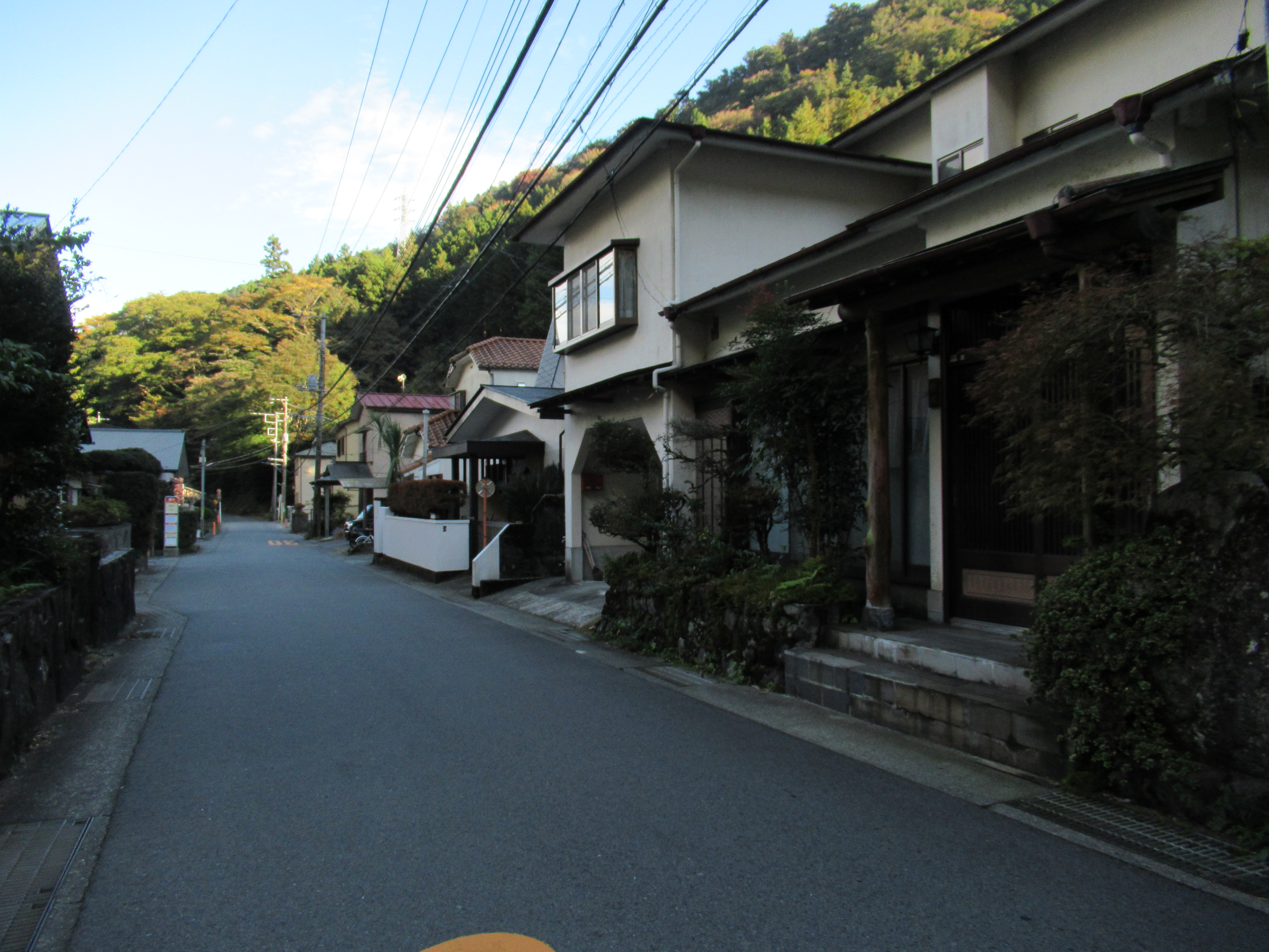
From Hatajuku Bus Stop, the paved-road goes along with not only Prefectural Road #732, but also National Route 1. The historical road runs also with Sukumo-gawa River 須雲川. The level of slipperiness goes on strong. It continues for about half an hour, and the stone pavement finally unites with Prefectural Road 732 at Sukumo-gawa Bridge. From here to Hakone Yumoto Station, we walk #732, so please be careful of cars. Many hot spring inns start to appear. Area-wise, this is already the tourists’ spot of Hakone Yumoto 箱根湯本. Some spas allow day-trippers to enjoy short time stay. Some requires reservation in advance. To choose one, please refer here. Spa could be a nice conclusion for historical hiking in Hakone. Hakone Yumoto community has its own parks and forests, like I’ve visited for mushroom the other day. In future, I’ll report my another adventure in Hakone Yumoto. 😀

The paved road goes along Sukumo-gawa River.

The toilet near Sukumo-gawa Bridge.
 This is the end of the ancient road.
 From here we, walk #732.

And in no time,
 we enter the present-day housing area of Hakone Yumoto.

Hakone Yumoto Station seen from near Hakone Town Hall.
 The end of our hiking today!

Oh, by the way, for 8 Miles Road of Hakone = Hakone Hachi-ri, “Hachi-ri 八里 = 8-ri” is supposed to be “1-ri * 8 = 3.9 km * 8 = about 32 km,” if we convert the unit in Shogunate official metrics. Our 8 Miles Road is not at all 32km. In classic Japanese language, “ri” often used for “long distance.” The historical road nowadays is about 8 miles that I found very convenient to translate “Hakone Hachi-ri 箱根八里” into English “8 Miles Road.” It seems to me, there are several explanation about the moniker “Hakone Hachi-ri.” The most legal one says the start of the road is Hakone Yumoto, and the end is Mishima 三島 in Shizuoka Prefecture 静岡県, whose distance is about 32km. The ancient route from Hakone Checking Station (箱根関所 roughly, our starting point for this hiking) to Mishima is none other than present day National Route 1, remodeled by modern civil engineering and always busy with lots of cars. Please pick your choice of the beginning / the end of the historical “Hakone Hachi-ri.” Cars? On foot?

Cute Himalayan spindles (Enonymus hamiltonianus) in Hakone.
 This makes white parts of Hakone Yosegi-zaiku …


If you find environmental issues in Hakone, please make a contact with Hakone Visitor Center, Ministry of Environment of Japan.

164 Motohakone, Hakone-machi, Ashigarashimo-gun, Kanagawa 250-0522
Phone: +81-460-84-9981
FAX: +81-460-84-5721
Email: hakone-vc@kanagawa.email.ne.jp
http://hakonevc.sunnyday.jp/shizenjyouhou/gazou/englishindex.html

Friday, February 26, 2021

Sweet drink for Exhausted Princess: Stone-pavement and historic Amasake Chaya Café on the 8 Miles Road of Hakone 箱根八里


Now, please check your shoes. No slippery sole? Ready to take the historical 8 Miles Road of Hakone? OK, let’s go! From Kaempfer-Barney Memorial, a nice walking road leads us to the east. In no time, we cross a petit flyover which crosses a community road busy with cars. In November, from the bridge we can admire beautiful autumn color of tall Japanese orixa (Orixa japonica) at the same level of our eyes. Bonus. 😄 The end of the overpass is the beginning of Japanese civil engineering for the 17th Century, i.e., the stone paved road of the 8 Miles Road of Hakone 箱根八里. It’s a sharp climbing, called “Gongen-zaka (Gongen Slope 権現坂). Come to think of it, Lake Ashinoko 芦ノ湖 is a crater lake made by the volcanic eruption 3000 years ago. The slope surrounding the Lake must be very steep. Accept it …

We walk on the overpass from Kaempfer-Barney Memorial.
The pavement begins.

The paved road sometimes runs with stone steps where we encounter little monuments of yesteryear travelers, such as a community Shintoism shrine. After passing the memorial stone for the song of packhorse drivers 箱根馬子唄碑, we reach to the highest altitude point, ASL 800m, of the entire old Tokaido 東海道. When people traveled Tokaido between Osaka / Kyoto and Edo (Tokyo) on foot or horseback, that was the “top of the world.” Actually, Hakone still has the highest altitude point of Route 1, at ASL 874m near Ashino-yu Hotspring 芦之湯. Hmmmmm … the mechanized power certainly makes human voyage easier … In today’s hiking course, up to this point is the only sheer climbing. The rest is mainly going down, with occasional small ascends. Especially this part of 8 Miles Road is busy hiking route so that the pavement is well-treaded and clean. Enjoy your walk of short breath!

Gongen slope

Along the way, there are several educational boards explaining the 8 Miles Road. (Hey, we’re in the National Park!) According to one of them, until 1680 Tokugawa Shogunate Government covered the 8 Miles Road with Pleioblastus chino f. vaginatus, a variant of ubiquitous sasa-bamboo, Pleioblastus chino Makino var chino. F. vaginatus is smaller in size compared with their cousins in lower altitude such as in Yokohama. Sure enough, we find lots of f. vaginatus in both sides of the 8 Miles Road that was constructed by cutting through the hill. The Shogunate soon realized it was extremely expensive to maintain the road that way. Hiring laborers to mow the road, collecting sasa-bamboos, cutting the harvested sasa in proper size, then spreading them for 8 miles so often … Phew. So, they changed their method, and paved all the route of about 3.6m wide with volcanic stones readily available in the area. When Kaempfer came to Hakone in 1691 and 1692, the pavement of the 8 Miles Road was relatively new. No wonder he was so impressed by the shiny artery road of Japan.


Hakone’s sasa bamboos are smaller than those in lower places.
The ancient civil engineering.
 By the way, have you noticed
 people in this photo avoiding the center of the way?
 I tell you why next week.

Both sides of the road beyond the slopes with sasa-bamboos are afforested forests of Japanese cedar (Cryptomeria japonica) and Hinoki cypress (Chamaecyparis obtuse). Even though, compared with the other parts of Kanagawa Prefecture, in terms of volume the % of afforested conifers is smaller here. It’s because Hakone was registered as a National Park early. Japanese National Park system started in 1934, and Hakone became the one in 1936 before the World War II. So, next to the patches of coniferous afforestation we can frequently meet deciduous broad-leaved trees spared from deforestation, such as large Wedding cake trees (Cornus controversa), Himalayan spindles (Enonymus hamiltonianus), and many others. They were spared from deforestation. It is a particular joy to hike in an old forest of biodiversity. Many deciduous trees have also been important cultural and economic thing for the traditional community we eventually reach. Wait for the next week’s post. 😊

Mixture of conifers and broad-leaved trees
Beautiful Botrychium ternatum

The last time this road underwent an overhaul was in 1863 when Princess Kazu 和宮親子内親王, the 8th daughter of Emperor Ninkoh 仁孝天皇, moved to Edo from Kyoto to be the First Wife of the 14th Tokugawa Shogun, Iemochi 徳川家茂. Later, she played a crucial role to save Edo (Tokyo) from destruction by modern military forces of Meiji Restoration Government 明治維新政府. I imagine how the teenager Princess moved through Hakone in a palanquin … The mountains were deep and precipitous. She must have clung for hours to the supporting rope from ceiling, in order to stay in the wagon. Her palms could have been grazed, possibly blooding … Did she walk? Nah. She was a pure court girl lived her entire life so far only in and around Emperor’s palace in Kyoto. Hiking was not in her resume. Yet, the 8 Miles Road of Hakone is very wide mountain trekking road with pavement, remaining in the 21st Century. Before trains and cars, it had several cafés along the route for travelers to have some rest. The only one remains now.


From the highest altitude point for the 8 Miles Road, after about an hour descend, we cross a pedestrian crossing over the modern prefectural road Route 732. The ancient road still continues to another side for about 5 or so minutes. Then, on our right we meet an old, thatched wooden structure. It’s Amasake Chaya Café 甘酒茶屋, established around the same time for Hakone Checking Point 箱根関所 in the early 17th century. The current owner of the premise is the 13th Master of Amasake Chaya, Mr. Satoshi Yamamoto 山本聡. The café is famous for centuries with its special recipe for Amasake drink. Amasake is sweet drink made of steamed rice fermented by malted rice. Amasake Chaya’s recipe does not add any sugar. Yet, its sweetness is easy for tired body to replenish depleted energy, thanks to lots of natural amino acid, glucose, vitamins, oligosaccharide, and dietary fiber. i.e. The café acted as a water station for long-distance trail walkers/runners for more than 400 years. Today, they serve, in a reasonable price, their almighty Amasake and traditional Japanese snacks which are basically vegan (; the menu is here). Aaaaaaaaaand, they are always open, 7:00-17:30, rain or shine. Their café is standing on this historical artery road of Japan on which lots of travelers come and go. There is no excuse to close the water station for such exhausted passengers, isn’t there?

Amasake Chaya on our right
Amasake Chaya

Their famous Amasake

Now you reach here from Lake Ashinoko. Please enjoy famous Amasake, and light meals as lots of people have done for centuries. Oh, in English Wikipedia, they say Amazake is alcohol drink. WRONG. If we make it as Amasake Chaya does, it does not contain alcohol. Their fermentation method is same for soy source or miso paste, i.e. non-alcoholic, and safe for Muslims to drink. Even a 0-year-old baby can have it when their mom has problem of breast-feeding. Additional info: when you try their rice cake (Mochi) menu in Amasake Chaya, you can combine the flavoring of your choice. They serve a Mochi plate for two pieces of rice cakes. The choice of flavoring is soy source with seaweed (named ‘Isobe いそべ’), sweet kinako topping (called ‘Uguisu うぐいす’), and slightly salty kinako with coarsely ground toasted black sesame (‘Kurogoma 黒ごま‘). You can choose any of these for your two rice cakes, like “One with soy source, and another with sweet kinako.” Please tell your preference at the time of ordering. Their serving system is, you tell your choice at the cashier first, find your place to sit, and wait for the servers to bring your meal. As this is a very old wooden house, air circulation can be perfect, in addition to lots of open-air seats outside. We can enjoy café even under the threat of COVID-19 (+ they provide sanitizing alcohols, wipes et al here and there). And finally, the place is in the middle of municipal garden that has independent structure for lots of toilets! You can catch a commuter bus service (time table here) from here to Hakone-yumoto Station 箱根湯本駅 of Hakone Tozan Railway 箱根登山鉄道, or keep on walking the 8 Miles Road. Actually, to experience the historical 8 Miles Road of Hakone as the yesteryear people did, you ain’t heard nothin’ yet, mate. Please stay tuned for the next week. 😉

I ordered Isobe and Kurogoma for my lunch.
In front of the Café is Amasake Chaya Stop.

Toilets

If you find environmental issues in Hakone, please make a contact with Hakone Visitor Center, Ministry of Environment of Japan.

164 Motohakone, Hakone-machi, Ashigarashimo-gun, Kanagawa 250-0522
Phone: +81-460-84-9981
FAX: +81-460-84-5721
Email: hakone-vc@kanagawa.email.ne.jp
http://hakonevc.sunnyday.jp/shizenjyouhou/gazou/englishindex.html