Showing posts with label Yadoriki. Show all posts

Sunday, July 19, 2026

Aroma from forest: extracting essential oil from Lindera praecox in Yadoriki


Last winter, when I had a chance to meet Prof. Kuramoto for Meiji University (; my post for March 29, 2026), he said for the sustainable management of forests it is crucial to find out ways to milk products from forest in a balanced manner. i.e. Nature-based solution. Rummaging our ancestral approach, using trees for artistic daily necessities could be a starting point. But, say, in the case of Kamakurabori, the traditional supply chain for supporting these beautiful wares is in a critical condition (; my post last week). Never mind. We are searching. Today is my adventure with another people who is experimenting with a different approach to creating product from material harvested from forests. They are in Yadoriki. What they are trying is extracting essential oils from trees in Yadoriki.

Kamakurabori products,
getting difficult to meet these days …

Essential oil is from European tradition. Having said that, identifying aromas from forests is not at all new for Japan. Traditionally, Japanese have manufacture incense from materials of forests. We have ways to wear scents by smoking clothes with incense. But this approach is very cumbersome, and difficult to take for this busy 21st century life, i.e. marketing such aroma is technical difficult. In contrast, European essential oil is easy to incorporate for modern living. These days, lavender oil is famous from Hokkaido. Hinokitior (beta-thujaplicin) already has boutiques in Tokyo. There are many other candidate trees as materials for fragrant oils. In Yadoriki, members of NPO Rok are searching for marketable essential oils extracted from trees found in Yadoriki. The other day, I had a chance to help their effort to extract oil from Lindera praecox.


The entrance for the warehouse of Rok

Lindera praecox is middle-sized shrubby deciduous tree in the family of Lauraceae, found in Japan and China. As in a family member of laurel, its entire body has woody and slightly sweet scent. It has round fruits which become dark brown (seemingly) hard nuts in autumn. I once tried to make it scented beads for neckless. Actually, its husk is very fragile. When I applied my hand drill to make a hole, the nut collapsed completely at once. My ambition was terminated easily … Traditionally, people used the Lindera praecox for lamp. The plant contains enough oil. Nuts were used for lanterns, and the bush was used for torch. In other words, we would be able to extract essential oil from it. Right? Several Japanese mountainous communities are experimenting to make the product from Lindera praecox (; one of the famous examples can be found here), if not taken off widely yet. Yadoriki too is trying.

We harvested this Linderae praecox
from a forest in Yadoriki.

Here

First, mince them in shredder.
Long stems are thrown in the machine.

The way to extricate the oil from Lindera praecox is the same for many other scented plants. We heat up harvested bush, a lot, with steam, and catch the oil from distillation. Rok has received a grant from the Prefectural Office and purchased a distillation system from a company in Kyoto for 600 thousand yen. So far they have tried several woods, hinoki cypress and the others, and provided floral water to Sento run by Matsuda Town. If the trial with Lindera praecox is successful enough for stable supply, it would be a new product from Yadoriki community. I had a chance to help them, a bit, for the cooking process of essential oil from the bush.

The leaves are also added.

The materials are packed
in this stock pot with double bottom.

First, the chips.

Then, the leaves.

And the chips are added, and the leaves, in layers.
The pot is literally “packed.”

The packed stockpot weighed 11.65kg.

The pot is ready to be steamed.

This is the distillation system.
The water is boiled in a brick kiln heated
by firewood which is another product from Rok.

Filling lower pot with water,

And pilling up the pot
with minced Lindera praecox.

Lastly, putting on a lid with pipes
to catch distilled fragrant water.

The fragrant water is
separated from essential oil here.

I was surprised in less than one hour, lots of fragrant water dripped from the system and rapidly filled up the tank to catch the water after extracting essential oil. I guess the necessary time to extract oil from the system depends on the plant we try to harvest the oil, and the condition of the plant and the weather of the day. As Lindera praecox is famous for its easiness to catch fire, the process started very soon and we observed the result quickly. Having said that, the amount of essential oil taken from 11.65Kg of the shrub was less than 5cc. Rok people said after the fire of the kiln died away, they left the system as such for at least one day and squeezed out the water with essential oil as much as possible. Finally, the oil in flask is separated from the water and the product is ready. i.e. the process takes at least 24 hours to be completed. No wonder true organic essential oil of any kind is expensive. But fragrant water, the by-product of the process, is useful to use as a room fragrance or bath scent. It’s not bad. As a product I think essential oil making is promising if the way to harvest the oil is on the track.

The floral water goes to the tank below.

About 4 hours later from the start of cooking.
The bubbly part inside the flask is
essential oil. How much will it go next day?


NPO Rok
特定非営利活動法人 仂

Yadoriki, Matsuda Town, Ashigara-kami Gun, Kanagawa
https://www.yadrok.com/

If you want to contact with Rok please send message from here

https://www.yadrok.com/%E3%81%8A%E5%95%8F%E3%81%84%E5%90%88%E3%82%8F%E3%81%9B

Sunday, January 11, 2026

Every New Beginning Comes from Other Beginning's End: Kanagawa’s forests and aging society


And so, Yokohama’s problem of aging population for environmental management is tackled in this way (; my post last week). In numbers as of January 1, 2026, Yokohama has 3,769,748 population which has been increasing in this post-COVID era. Especially, younger generations have moved into our city. They are nullifying the decrease from elderly passing-away. In addition, our city will host International Horticultural Expo in 2027, “Green×Expo” held near Citizen Forests of Northan Yokohama, i.e. Seya, Oiwake, Yasashi, Kamikawai, Miho, and Niiharu (; my posts during 2015). The momentum is building up in our neighborhood greenery. Yokohama can, at least for now, think a way to deal with the greying population as a public relation matter. It should be fortunate. Kanagawa Prefecture has a different problem.

A neighborhood stroll path in Yokohama

Yokohama has 437.4km2, roughly 18% of Kanagawa Prefecture with 2416.55km2. In this limited area we have approx. 41% of Kanagawa’s population with 9,217,647 (as of September 1, 2025). People live in Yokohama is relatively young and increasing. In contrast, for some time Kanagawa Prefecture in total is observing the decrease in population and rapid aging especially in rural areas. Even before the greying problem became obvious, a guy for financial affairs of the Prefectural Office once told me money-wise Kanagawa Prefecture was depending heavily on taxpayers of Yokohama. Well, we Yokohama people are generous. We’re paying 3 different taxes for environmental issues. One is the national tax, Forest Environment Tax. Another is the prefectural tax, Water Source Environmental Protection Tax. And finally Green Tax for the City of Yokohama. Among these three, national tax is returned to the city as a subsidy for “Using Japanese forestry products among citizens.” E.g. Building your home in Yokohama with Japanese timbers will receive municipal support pecuniary. Green tax is for maintaining and expanding your neighborhoods forests of Yokohama. Your family can enjoy your Saturday lunch there easily. Then, Water Source Tax? Er …

This fall, we’ve enjoyed beautiful autumn leaves
in Yokohama’s forests.

Water source forests for Kanagawa Prefecture are in the eastern slopes of Hakone National Park, Tanzawa Mountains and Takao Mountains which are Quasi-national Parks. When the tax was introduced in 2007, the forests of the area were indeed suffering neglect due to already aging and decreasing population of mountain villages. But thanks to the nature of forestry, once the maintenance jobs are done with the tax base, the next job-cycle for such areas begins 20 or more years later. This means, taxing 2026 people for 30-years-later-jobs has a little persuasive power. In addition, for the majority of city rats, i.e. we the people of Yokohama, National Parks are recreational areas, i.e. luxury, and do not have much familiarity with our daily lives. Paying tax for this now? No way.

In Tanzawa, autumn leaves were also splendid this fall.

Of course, the people living in mountain villages must have different opinions. The public works using the income from Water Source Tax has been VERY important income for rural areas. But, that’s that. For example, Yadoriki Community is observing rapidly decreasing population, and the remaining people are more and more aging. Since last year, there is no commercial farmer in Yadoriki Community. Yes, people are tending their veggie fields for home consumption, but no more tea or citrus growing for business. Reason? Ag works on steep slopes are too much for grandpas and grandmas. Younger people have taken city jobs for better pay, commuting to nearby cities which is really near in Kanagawa Prefecture. A familiar story for all over the world, I guess. The issue of Water Source Tax is now not for environment, but for welfare of aging populations. It’s difficult for the Prefectural Office to sustain the argument for the scheme now. Water Source Tax will be abolished in 2027. Soon.

Er … this openness was really something.
But once we realize this is a commuter road
 within Yadoriki community which is
 half an hour car ride from Odakyu Shin-Matsuda Station,
can we simply praise the atmosphere?
Isn’t it desolation?

Last fall, a new honcho has been assigned to the Prefectural division that is in charge of the matters of rural areas in the west of Kanagawa. That person may have been given the mission from the HDQ in Yokohama to rationalize prefectural works for the area. The closure of the visitors’ service for Yadoriki Water Source Forest was announced last month. The deadline was not clarified but the Forest Instructors’ Association was notified to evacuate the buildings rather sooner. The demolition of the admin house at the entrance is said to be started within months. Yeah. Since last summer, those facilities could not have electricity. The Prefecture surveyed the wiring and found several points where the connection was directly eroded by wet soil (; this is water source!). Moreover, the foundations of the log houses are more and more fragile thanks to the decays from high moisture (; this is water source!). For restoration of such structures the Office needs money of certain amount. When there is no solid reasoning to maintain the service and financial arrangement, closure shall be inevitable.

Yadoriki’s toilets are closed.

Instead, portable toilets are situated.
We don’t know how long this service is provided.

It is said that the offices for the Forest of the 21st Century (; my post for July 28, 2017) will also be closed, or the service there will be reduced to the minimum. For both Yadoriki and the 21st C Forests, I know the number of visitors is really small. The rationalization in fiscal expenditure for them is unavoidable. But I think the real difficult part will start after closure. OK. Stop taking care of the places perhaps would not cause serious problems for now to the environment. The thinning and mowing have been completed in the area thanks to these 20 years of the tax base. But, then, is there a reliable prospect for another policy when the time comes and the forests need help again? I don’t say there is nothing in store for the policies of the Prefectural government … I’m now collecting information which includes interesting projects with top-notch technologies. I’m also hearing the stories when the frozen approach to the forests causes problems. I’ll tell you these when they are ready. Meanwhile, in 2026 we’re starting the new era for our neighborhood forests.


If you find environmental issues in Kanagawa Prefecture, please make a contact with

Kanagawa Natural Environment Conservation Center
神奈川県自然環境保全センター

657 Nanasawa, Atsugi City, 243-0121
〒243-0121 厚木市七沢657
 
Phone: 046-248-0323

You can send an enquiry to them by clicking the bottom line of their homepage at 

http://www.pref.kanagawa.jp/div/1644/

Friday, August 18, 2023

Stroll in a Mountainous Community: from Mt. Jitango to Yadoriki Community 寄ジタンゴ山 ・宮地山


Actually, returning to Yadoriki Community 寄 from Mt. Jitango ジタンゴ山 in today’s itinerary has (mainly) two routes. One is via Mt. Miyachi (ASL 512m) 宮地山, and another is skipping the peak of Mt. Miyachi by turning left 100m before the summit. We took the latter plan last month and concluded it may not be a good idea especially for non-locals … The road of our July hiking was sometimes covered by bush + scree on steep slopes. Many fallen oaks blocked the road due to Oak Tree Wilt. It would be easy to lose the way ... So, in today’s post, I introduce you the safer route via the top of Mt. Miyachi with photos I’ve taken last January. Please allow me to post some photos taken July, and another taken during the dead-winter. In our hiking coming December would have a scenery a bit closer to the January photo … Anyway! From the departing point of last week from the forestry road, we first pass a transmission tower. The ground for the tower is covered with dwarf lilyturf. I guess they were artificially brought here when the tower was constructed. They had pretty flowers in July. Cute.

Here! Flowers of dwarf lilyturf

From there, we slowly go up again a trekking road in the afforested coniferous forest. Then, the forest becomes broadleaved trees like giant dogwood, Lindera praecox, or Quercus serrata. It’s a quiet walk in a many faces of forest. Soon we’ll meet a signpost showing the direction to Mt. Miyachi. Please simply follow this advice. The hiking road here is wide and well-taken care of. I don’t think there is much difficulty to find a way. After less than an hour leisurely walk from the paved forestry road, we arrive at the top of Mt. Miyachi with oak trees and deer fences. In January, all the leaves of oaks had fallen, and we could observe the ridge of Mt. Sengen (ASL 567.7m; it does not have a hiking road) 浅間山 around which Mikurube Forestry Road 三廻部林道 runs (my posts on November 26 and December 3, 2021). During summer, I guess the view from the peak of Mt. Miyachi is completely covered by greens and the place would have less sunshine. Perhaps, Mt. Miyachi is a place for winter hiking.

We first walk through the coniferous forest.

Eventually, the trees become broadleaved.

A tunnel with giant dogwoods

It’s a big Lindera praecox.

There’s not much steep climbing from the forestry road.
The majority part of the trekking road
to the peak of Mt. Miyachi is like this.

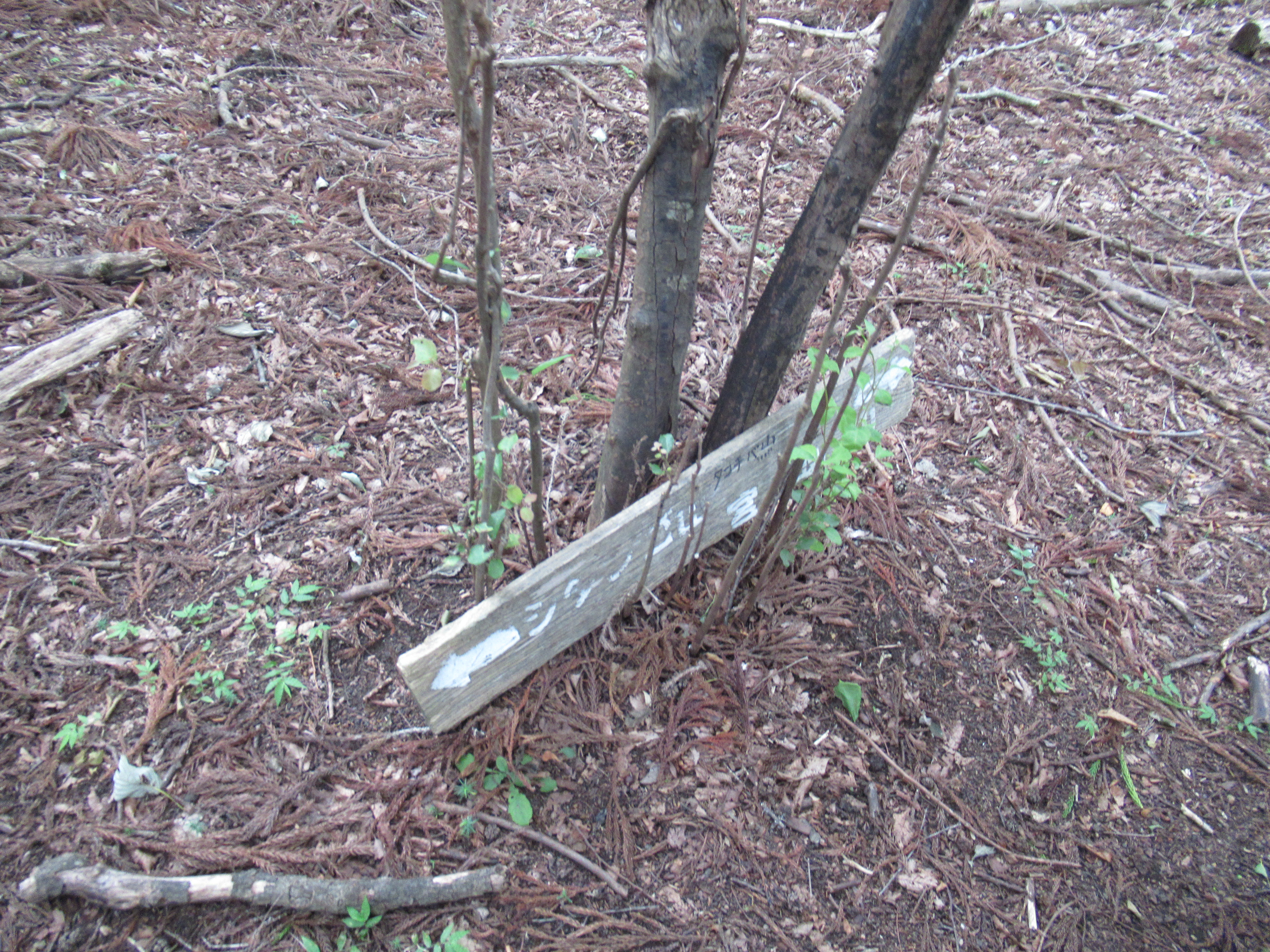
Hmmmm … it’s a signpost.
We take the road in the direction of right arrow.

The scenery near the top of Mt. Miyachi is like this in winter.
Lots of
Quercus serrata and sawtooth oaks.
I think this itself has its own serene beauty ...

The top of Mt. Miyachi

The peak of Mt. Miyachi is like a hilly open space. Simply proceed trekking road going to southwest direction. The route becomes a gently going down with steps made of logs. In about 15 minutes or so, we arrive at a junction where we meet again Miyachi Forestry Road. The place also has a guide map for a hiking course to Mt. Jitango via Mt. Miyachi (i.e. the reverse itinerary for this post). The course from here gives us a nice strolling in a mountain community … Both sides of Miyachi Forestry Road show vegetation typical for Japanese agricultural village. Observing and admiring them in a slow hiking is a fun. The Forestry Road eventually brings us to Miyachi Community 宮地 of Yadoriki. This is another one of 7 villages that in 1876 joined in one administrative unit of Yadoriki.

In winter the peak is a very open space.

The trekking course gently descends from the peak.

And the steps with log stoppers begin,

to meet Miyachi Forestry Road again.
 At this junction, there is a map of hiking courses.

A plant we met along the forestry road near the housing.
 We discussed if they were capsules for
  Dioscorea tokoro Makino
or Japanese yam.
 The latter is delicious, and the former is only for bitter
diuretic.
 We concluded regrettably it’s for diuretic
 as the capsules have opening facing the sky.

This old statue of Buddhist figure has
 the inscription dated September 1882.

That’s said, to return Shin-Matsuda Station 小田急新松田駅, we have to catch the bus whose service is rather limited. Going down, we meet Tashiro Bridge over Nakatsu River. Cross it and go straight. We find the bus route and a bus stop. The name of the stop is Tashiro Mukai 田代向 (the timetable to Shin-Matsuda Station is here). The service next to 14:45 (Sat and Sun) is 15:45. If you need to use the bathroom before riding bus, please find it one at the foot of the Bridge in Miyachi Community. Oh, these days, when we cross the Tashiro Bridge to the bus stop, a kitchen car is open during weekend at foot of the Bridge (; I mean, at the opposite side of the river from the toilet). I haven’t tried the premise yet … but soon I will. Banana juice looks appetizing. 😋

We come down here.
The small structure below the arrow is toilet.

Tashiro Bridge.
 Please cross it and go straight.
 There will be a bus stop in front of you.

The place we can find a kitchen car these days is
 here with the yellow arrow.
 Oh, could you figure out a blue house left to the arrow place?
 It’s a
secretly famous studio for serigraphy
 where famous and grand Japanese artists ask work
 when they create opus for
important exhibition domestic and overseas.

If you find environmental issues in Kanagawa Prefecture, please make a contact with Kanagawa Natural Environment Conservation Center 神奈川県自然環境保全センター

657 Nanasawa, Atsugi City, 243-0121
〒243-0121 厚木市七沢657
Phone: 046-248-0323

You can send an enquiry to them by clicking the bottom line of their homepage at http://www.pref.kanagawa.jp/div/1644/

Saturday, August 12, 2023

Let’s Visit a Neighbourhood Peak: To Mt. Jitango 寄ジタンゴ山 2


There are several routes to the peak of Mt. Jitango ジタンゴ山. Come to think of it, the place was in community use. Several routes would have been developed naturally. Among them, the longest is a kind of shortcut connecting Yadoriki Community to Hadano Pass 秦野峠 and to Lake Tanzawa 丹沢湖. It’s about 10 hours walk in total for us … it would be a route shorter for yester-century’s mountain community. Let’s take the other itinerary for our leisurely day-hiking. It goes like this for a very slow walk:

0:00 Yadoriki Ohtera-bashi Bridge 大寺橋

1:00 The end of a paved forestry road

1:20 The peak of Mt. Jitango (ASL 757.9m)

1:50 Meeting paved Miyachi Forestry Road 宮地林道

2:20 Entering the trekking road to Mt. Miyachi 宮地山

2:50 The peak of Mt. Miyachi (ASL 512m)

3:50 Tashiro Mukai Bus Stop 田代向

When we include short rests and lunch time, it would be about 5-5:30 walk. Not bad for a day hike. Another good thing about this course is there is no cliff or place needing chains or ropes. Of course, steep climbs/descends are there as we’re in Tanzawa 丹沢, but the route would be OK as long as you’re prepared enough water, food, and equipment for emergency (for rain, etc.), in addition to, needless to say, good shoes. 😉


The start is a bridge next to Yadoriki Bus Stop 寄. The commuter bus service to the terminal stop at Yadoriki is from Odakyu Shin-Matsuda Station 小田急新松田駅 (: timetable for the bus services is here). After about half an hour bus ride, we’re at the terminal Yadoriki Stop. When you arrive there, you’ll find a bridge over Nakatsu River 中津川 almost in front of you. That’s Ohtera-bashi Bridge. Please cross it and go straight into Ohtera Community 大寺 of Yadoriki. “Yadoriki” was established in 1876 as one administrative unit made of formerly independent 7 villages of the area. Ohtera Community was one of such villages. Thinking of the location, I guess the village had a large say in management of the field of sedges at the top of Mt. Jitango. Just follow the meandering paved commuter road going through the housings, tea plantations and veggie fields. Here and there you’ll find a smaller paved way, but don’t deviate. Always choose (relatively) wider paved road which is a community forestry road. After both sides of the road becoming simply a forest, there will be a signpost saying, “This way: hiking road to Mt. Jitango.” Er, yeah, you can choose that route which will in the end join our route today. I recommend not entering it but proceeding on the paved road. Reason? Yeah, the route suggested by the post is a standard hiking road, but both sides of this direction are artificially created coniferous forests which could be … boring.

Bridge and Bus Stop

Beyond the bridge is slightly going up.

This way to Mt. Jitango through tea plantations.

You see? Don’t turn right here, but go straight!

The condition of the road eventually becomes like this.
Never mind!

Interestingly, the paved forestry road runs in the mixed forest of afforested conifers and more natural broad-leaved trees. Especially when you’re interested in admiring the variety of broad-leaved vegetation with more diversity in forest floors, this is the way you will choose. Besides, it’s a paved road with very low car traffic, albeit the maintenance of it might be almost forgotten. It could be easier for casual hikers to enjoy Tanzawa’s forest, just like via Mikurube Forestry Road 三廻部林道 (; my posts on November 26 and December 3, 2021). The end of the paved road is an open space where the road from the first signpost “to Mt. Jitango” joins with the forestry road. A laminated direction is pasted on one of the trees, saying “Mt. Jitango, this way.” Simply follow the direction for a narrower unpaved trekking road. Soon our itinerary becomes a real climb where you may feel out of breath. The environment around the route is a mixed forest with afforested confers and natural broad-leaved trees. After less than 30 minutes ascend, we’ll see a ridge before us and in no time the garden of Enkianthus perulatus begins. Welcome to the peak of Mt. Jitango!

Spotted Bellflowers we meet along this route is
Campanula punctata Lam. var. hondoensis (Kitam.) Ohwi,
 an endemic variant of
Campanula punctata.
Just like straight hairs of ladies in ancient pictures of Japan,
they have straight calyx lobes without curly appendage
as their cousins of Campanula punctata in more lower altitudes.

We found fallen hairs of deer on the road.

I guess in autumn, the leaves here have
beautiful red and yellow colors that would make
a good contrast with the evergreen of conifers background.

The trekking road departed from our forestry road will join …

here in the end of paved road with a wider space.
The bottom of the picture is the direction we take.

The laminated paper says “Mt. Jitango this way.”

The road becomes like this.

Mixtures of conifers and broad-leaved trees

Almost there …

Welcome to the garden of Enkianthus perulatus!

From the peak to the south, we can see the spread of Odawara City 小田原市, Enoshima Island 江の島, Miura Peninsula 三浦半島, and if weather permits Boso Peninsula 房総半島 beyond Sagmi Bay 相模湾. The island floating in the middle of the Pacific Ocean is Ohshima Island 大島. To the west, we can identify the towns and cities on the slope of Mt. Fuji including Gotemba City 御殿場市. If it’s fine weather Mt. Fuji 富士山 is over there. The peak of Mt. Jitango is a relaxing open space that is good for a long coffee break or lunch. In July, we started our walk at 9:00 from Yadoriki Bust terminal and arrived there before 10:30, a bit early for lunch. So, we had a long tea break in a misty rain but open sky. From there in today’s itinerary, we proceed following the signpost saying “To Hadano Pass.” Don’t be intimidated by this sign. Follow this direction. After about 20 minutes of rapid descending, we’ll meet another forestry road named Miyachi Forestry Road. This is the junction to Hadano Pass or to Mt. Miyachi. Today, we take the descending direction of Mt. Miyachi. Oh, if you’re interested in Hadano Pass, it’s about 2 hours climb from here with a point after the paved road where we had to ask chains to go over a rocky cliff. You need stamina and proper preparation, I tell you.

The peak of Mt. Jitango

Sagami Bay from Mt. Jitango.
Could you figure out Enoshima Island over there?

To the direction of Gotemba City

The top of Mt. Jitango is surrounded by the garden like this.

Take the route pointed to “Forestry Road / Ameyama Pass.”

It’s really a rapid down.

Here we meet another forestry road. The junction.

This is to Hadano Pass, but

Today, we take this opposite descending direction.

As of July 2023, the Miyachi Forestry Road looked like a recently renovated road. It could be a relatively easy route. Both sides are afforested conifers, but the forest floor here could have interesting features including the species from orchid family. Let’s enjoy the environment nature can provide, which is a luxury available only for an itinerary with time to spare! Eventually we’ll come to a place with a space on our left where the paved forestry road makes a big curve to the right. At the end of an open space there is another trekking road descending. It’s the beginning to the way to Mt. Miyachi. Let’s dive in. Oh, we had lunch there. It’s a matter of preference, but the peak of Mt. Miyachi does not have a view. Here in the open space, we can enjoy the view to Mt. Takamatsu 高松山 (; my posts on January 7 and 14, 2022). Next week, I continue from here to returning to Yadoriki Community.

The road is well maintained this time.

Large broad-leaved trees
also adorned the forestry road.

An open space and
the beginning of a trekking road to Mt. Miyachi

A view where we had lunch.
It’s the slope of Mt. Takamatsu in front of us.

Cyrtosia septentrionalis

If you find environmental issues in Kanagawa Prefecture, please make a contact with Kanagawa Natural Environment Conservation Center 神奈川県自然環境保全センター

657 Nanasawa, Atsugi City, 243-0121
〒243-0121 厚木市七沢657
Phone: 046-248-0323

You can send an enquiry to them by clicking the bottom line of their homepage at http://www.pref.kanagawa.jp/div/1644/