Showing posts with label Tsurumi River. Show all posts

Sunday, December 8, 2024

Great Divide: Haruhino-Kurokawa Forest 1


This year, Japanese map app YAMAP has rolled out a new product showing basins of rivers, large AND small, in Japan. The accuracy of the info shown there sometimes needs more refinement. (Example: why has Takigo Stream for Yadoriki Water Source Forest been cut into 2 in the middle?) But the creator of the app, Mr. Yoshihiko Haruyama, said the project is in its infancy. They welcome suggestions and new ideas from users with their new service. I found the app is very interesting. It’s often the case forests in our area spread along ridgs of hills and mountains. This means sometimes a forest which is considered as one unit can be divided into one or several areas when its valleys supply rainwater to different rivers. Unexpected borderlines can be found in YAMAP Basin Map. That’s what I found in Haruhino-Kurokawa Forest はるひ野-黒川の森.

We’re going up to the ridge of Haruhino-Kurokawa Forest.

Last month, Haruhino-Kurokawa Forest in Kawasaki City held an autumnal art show, their 9th. My impression from the recent show was not much different from the murmur in my previous post (on December 2, 2022). I’ve been there during its opening days and met several artists who installed their work. In sum, many of them found the wide-open space they could use attractive, and decided participating the project. OK. That’s that. May I mention they might not have thought much about communication with the multilayered ecosystem of the forest? … The artists approach would be similar to the newcomers to Western Nakagawa of Kohoku New Town (; my post on November 24, 2024). That’s unfortunate. The forest clearly shows the existence of people who care about the forest itself and engage in the maintenance works, not-so-flashy-as-art, continuously. Great Divide between two kinds of people, maybe …

Having said that,
this installation by Toshiyuki Tanaka
tries to capture mutual communication with the forest:
 "TANAKA Toshiyuki, Eyes in the woods."
“ISHIZAKI Kouji, Hope”

“TAKEMOTO Suguya, Floating Object in the Valley.”
This installation would be
from the same idea of Tanaka’s installment above.
But I was horrified to see this plastic seats floating
above the abandoned rice paddy.
Reason? Please wait till my next week’s post.

“SATO Hideyuki, Dinosaur Egg.”
Ditto for this fiber-reinforced plastic.

“LYU Dian, Fountain.” Ditto for this.

“TACHIKAWA Mariko, Surrounded by Delicious Sunlight.”

“HARADA Riito, Convey my heart.” This I like.

“MURATA Yuta, Place of Soil.”
His continuous work from the previous show.
I’d like to see how he develops
his way of communicating with the land.

“MACHI Kiiko, No!”
She emphasized she was strongly against all the wars of the planet,
and said NO in a large voice …
but why in this forest, I wonder.

“TSUKASA Kana, Scene.”

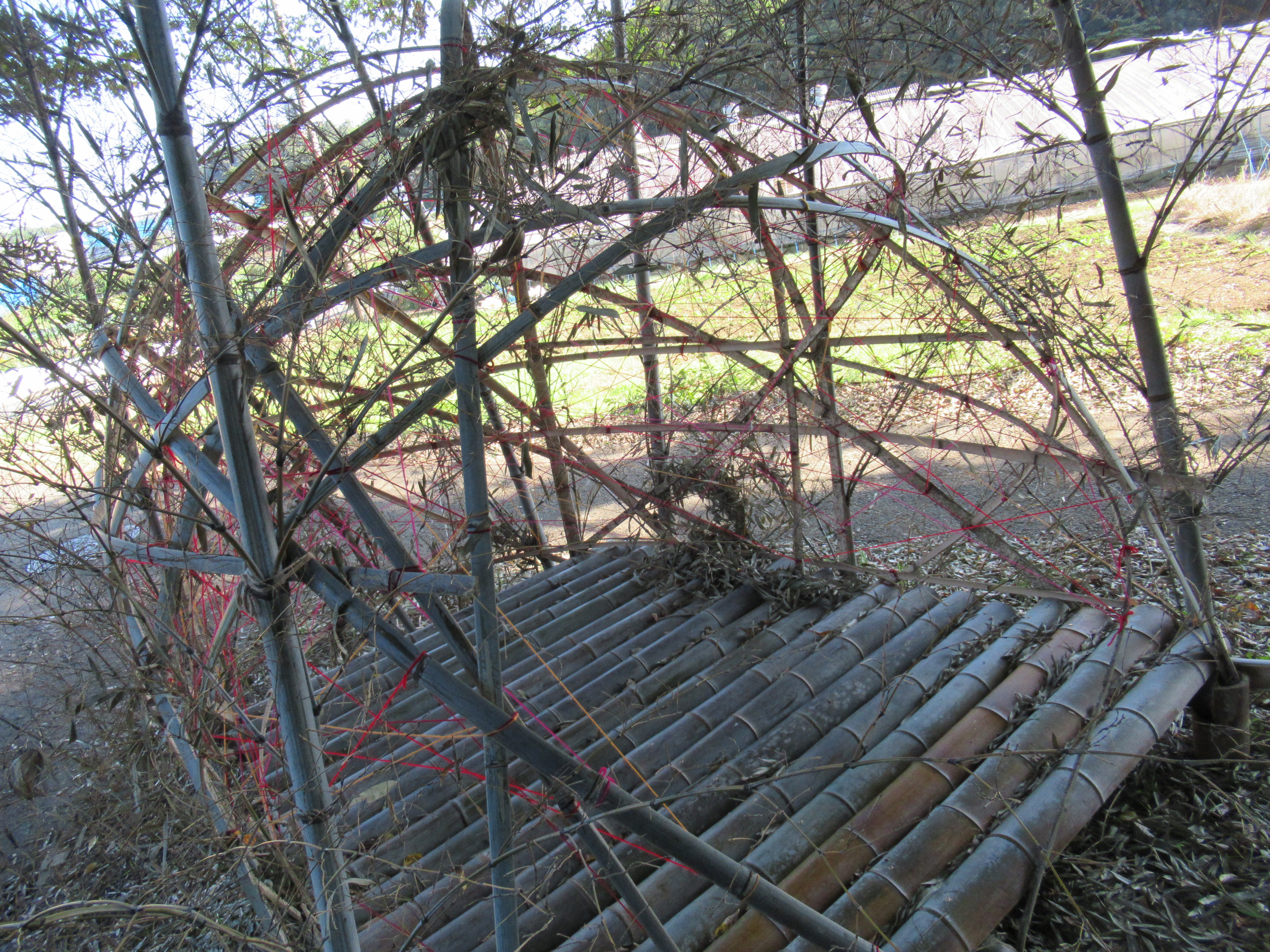
“UTSUMI Hitoshi, Secret Base.”
This one is also I like.
He tries to have a fun with the forest as a kid.

“ABE Yasumichi, Loop.”
He’s not the only artist of this show
who presented a sculpture made of stone.
In a sense, it’s a traditional way of humans in the relationship with nature.
What does it mean, I wonder.
Is it the beginning of gigantic stone palace of Versailles
with completely geometrical garden?
I suspend my opinion about this …

I have not yet met people from groups who engage in regular maintenance work for the forest. But according to this page, the area has lively communities, some of which do forestry works for the Forest. Moreover, they’re proud of their dirt-work beyond the desk theory. I had a feeling they are clearly succeeding in it. When I’ve been there last month, it was still a bit early for trees shedding leaves. Yet, the general impression Haruhino-Kurokawa Forest showed was bright with rustling sounds of leaves. The paths inside were well maintained for strollers to enjoy. People are controlling the undergrowth of the forest nicely and treating the damage by oak tree wilt. That’s something. As long as I know, the tenure of the land for Haruhino-Kurokawa Forest is a mixture of governmental, private and corporate entities. The teamwork of volunteers from many corners of Kawasaki and some help from pros hired by the City has done a really good job. Their endeavor in the end created the wide space the artists installed their work. Moreover, the success of such handiworks was scientifically measured in terms of basins.


When we check Yamap Basin Map, the ridgeway of Haruniho-Kurokawa Forest is the watershed between Tama River and Tsurumi River. The streams go down the north slope to the direction to Haruhino Station provides water for Tama River. The water from the south slope including an experimental farm of Meiji University goes to Tsurumi River. From 2015 this water to southward was checked by the group of researchers from Tokyo University of Science. The result was amazing. I tell you this next week. Please stay tuned!


If you find environmental issues in Kanagawa Prefecture, please make a contact with Kanagawa Natural Environment Conservation Center 神奈川県自然環境保全センター

657 Nanasawa, Atsugi City, 243-0121
〒243-0121 厚木市七沢657
Phone: 046-248-0323 

You can send an enquiry to them by clicking the bottom line of their homepage at http://www.pref.kanagawa.jp/div/1644/

Thursday, September 17, 2020

Improving: Nature in Shinyokohama Park along Tsurumi River 鶴見川多目的遊水地


Last year, we had several monster typhoons which caused floods and landslides in Metropolitan Tokyo area. One of such was Typhoon Hagibis that let Japanese government to decide flood the sports park surrounding the Nissan Stadium, aka Shinyokohama Park 新横浜公園, for October 13th Rugby World Cup match between Scotland and Japan. The access to the anti-flood facility of Shinyokohama Park called Tsurumi River Multipurpose Retarding Basin 鶴見川多目的遊水地 is, of course, off-limit for non-permit holders. This summer, I had a chance to enter the restricted area and to join a nature observation session there. It was damned hot and humid day. We donned face asks. But the flood control area was only for us, i.e., no congestion at all, winds over Tsurumi River 鶴見川 was comfortable, and water creatures were cute. Today, I report you my adventure with nature thriving on the man-made flood control system in Shinyokohama Park.


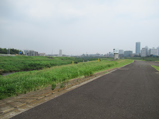
The entire scenery of this photo was flooded last October.


As I mentioned in my post on February 21 this year, the flood control mechanism in Shinyokohama Park is one of the bests (and the most expensives) in Japan. Since its opening in 2003, Shinyokohama Park was operated as a flood buffer 21 times, or in total of 240 hours. People from Tsurumi River Watershed Center 鶴見川流域センター explained us the flood control is by the Ministry of Land, Infrastructure and Transport of Japan, and the management of sports park is done by the City. After the place was used as a flood pond, the cleaning of the area to restore the facility is by the City of Yokohama. “Last year when the Rugby World Cup was held, the City spent 60 million yen (USD 600 thousand) to clean up the place after the flood.” As Tsurumi River meanders from a small hill in Machida City (ASL 170m) to Tokyo Bay, it wears Tama Hills made of sand and mud. Its water is always muddy, unlike the neighboring Tama River. When it floods it carries tons of mud to the basin. So, “The cost of cleaning up depends on the amount of mud remained on the park. Last year’s amount was for 60-million-yen expenditure. In the City of Yokohama, this was the last remaining flat public land of this size. The municipality accepted the deal.” I see.


Maintaining this scenery costs money.


Aside from its local coordination mechanisms and the overall design as an anti-flood reservoir, it was interesting to see on site the detail of Tsurumi River Multipurpose Retarding Basin. The off-limit area of Shinyokohama Park starts from an elongated pond in the north that acts as a stilling basin when the flood happens. In summer it is covered by Trapa japonica. “We cleaned the pond few years ago, then the plant came out naturally.” The person from the Center said. That’s interesting. Although the Park is surrounded completely by commercial, industrial, and housing buildings, if preparation is OK, nature comes back almost automatically. The north of the pond is 400m overflow dyke, strictly off-limit for non-permit holders. The levee of Tsurumi River for Shinyokohama Park is Prefectural Road #13 that has bus stops for Nissan Stadium. The overflow dyke is 3m lower than the levee so that when Tsurumi River is flooding, 400m wide overflow naturally occurs here. In normal times, the overflow dyke is very wide-open strolling place for occasional visitors like us, or for a helicopter to land. It’s an artificial structure whose slope is constructed with many gabions of wire cage. Each unit of gabion is staffed with natural stones so that when the area is inundated the water can seep in the cage. In this way, the power of flow is dampened, and the sports park can be opened just by cleaning up the mud. Moreover, the cage becomes home for many kinds of creatures, animal and vegetable. In mid-summer, walking on the overflow dyke is like strolling a wide paved road sandwiched by natural gentle slopes with lots of grass and insects. “We mow the area once or so a year.” I guess it also helps for the area to increase the biodiversity as it allows the floor to receive enough sunshine. Nature can grow in the middle of city on such artificial arrangement.


The pond in the north of the sports park.
 It is shielded by the wire fence.
 We can go without permit near to the fence.
The pond in summer is covered by Trapa japonica. Grey helons make the place home. It means, the pond has lots of foods for the birds.
The entrance to the overflow dyke is locked securely.
From the entrance on the levee,
 it is going down 3m to the dyke.
The 400m long overflow dyke of
 Tsurumi River Multipurpose Retarding Basin
Both east and west ends of the dyke have
 this water gage pole that send real time info
 24/7 to the control center of the river.
 It can measure the amount and speed of
 water flow with various electromagnetic waves.
 “Please do not enter the zebra zone, NEVER.
 It interprets your height as the water depth,
 and your movement as the speed of the overflow.
 The emergency scramble will be issued.”
The entire slope of the dyke is constructed with such gabions.
The northside of the dyke to Tsurumi River was
 received mowing when we’ve been there in August.
And the place has a family toilet for wild racoon dogs.
 It seems to me the restricted area is a safe place for wild animals.
 The poop was fresh.
The large sign on the dyke visible
 from helicopters when they need it.
After flood,
 water in the park is returned to the river from this gate.


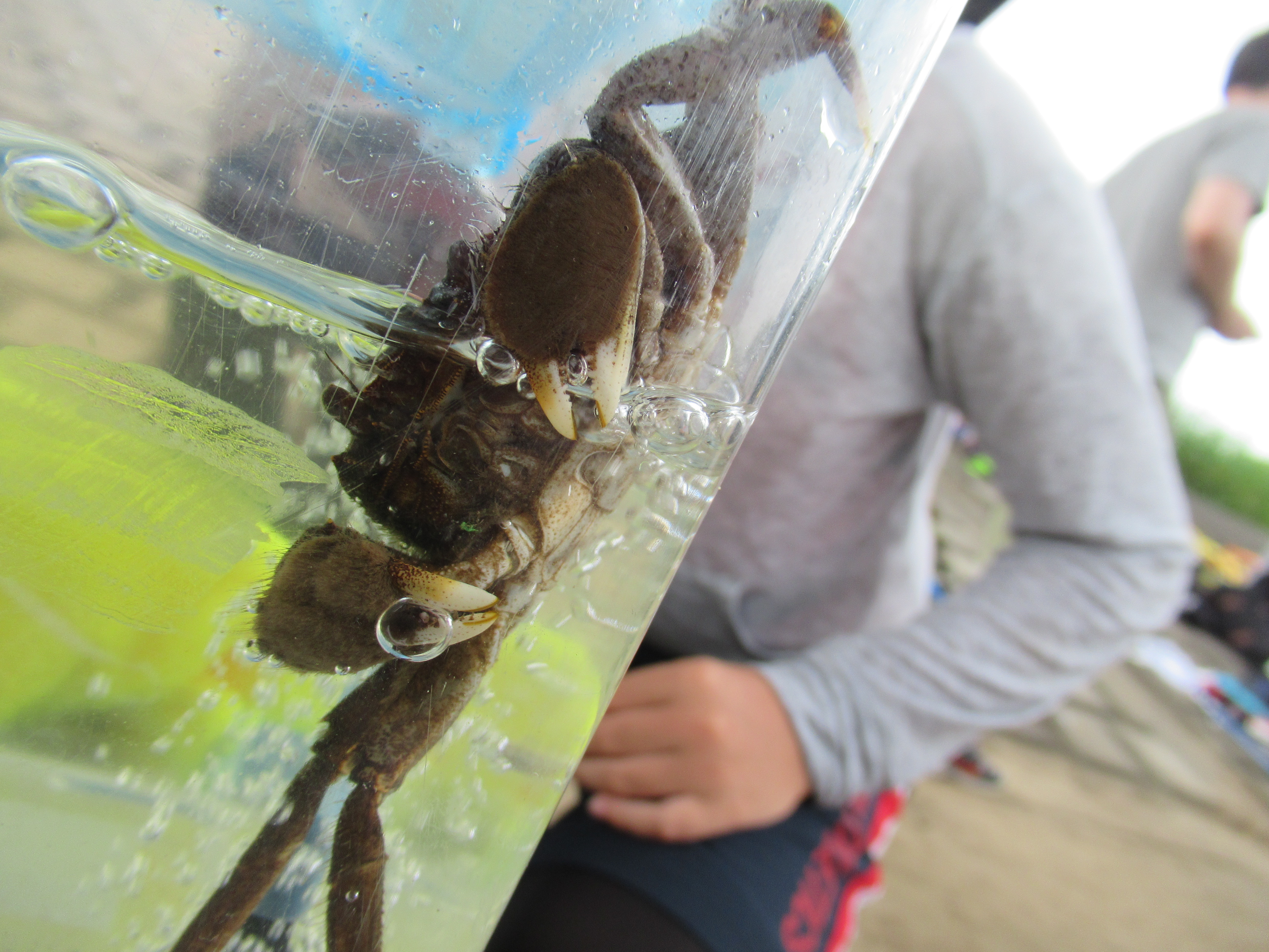
In Tsurumi River at the corner of Shinyokohama Park, there is a small weir named Kozukue-Seki 小机堰. It is a mobile weir that was to flood rice paddies before. Now its main function is completely retired, but it acts as a small waterfall for the River that runs relatively flat plane. The bubbling caused by the cascade incorporates oxygen from the air in the water. Especially during summer, it creates an ideal condition for water creatures to ride over heatwave. Tsurumi River separated from Shinyokohama Park by an artificial dyke covered by growing natural environment has many kinds of fishes. Just for 15 minutes playing with small fishing nets on the riverbank, we could capture several kinds of aquatic lives. Thanks to Kozukue-Seki, the fishes of brackish water can come up to this point from Tokyo Bay. Some decided to stay here. Flathead grey mullets are making the area their home. Crabs are more mobile, the people from the Tsurumi River Watershed Center told us. According to them, Japanese mitten crabs are identified in almost entire Tsurumi River, although they are not as large as we can find in Chinese restaurants. Yet fishes in Shinyokohama Park were far larger than those we can find in Yadoriki Stream 寄沢. I realized that’s the difference between river basin and mountainous valley. Yeah, Shinyokohama Park is a typical urban sports park. As Tsurumi River gathers sewage of millions of people although they undergo intensive advanced treatment, the river’s BOD has still rooms of improvement. But Tsurumi River secretly becomes home for so many living creatures that have voluntarily immigrated to this artificial place. That’s something.


Kozukue-seki
A flathead grey mullet easily captured
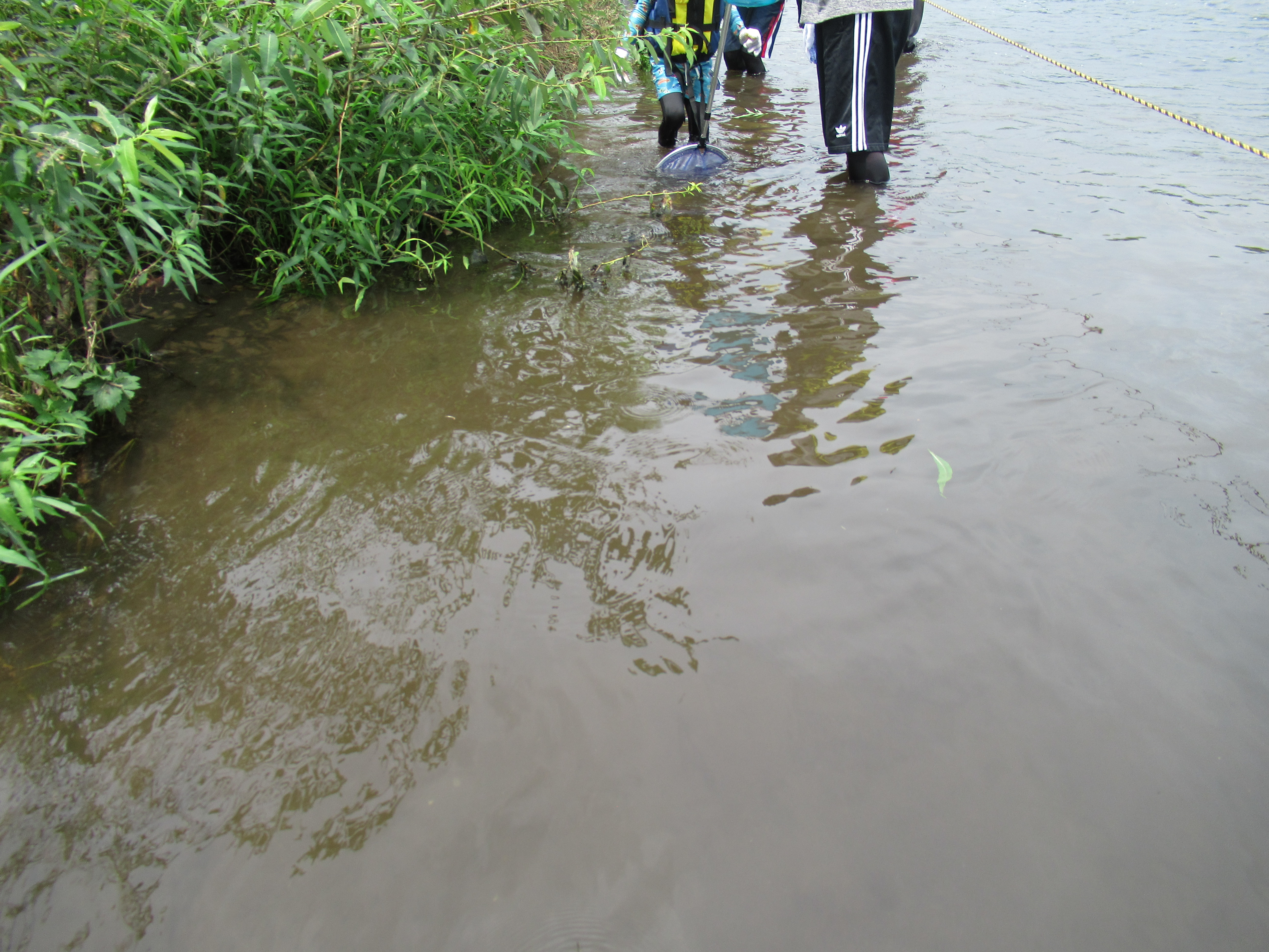
We did a bit of fishing …
Dragonfly nymphs of three kinds: of Melligomphus viridicostus, Sieboldius albardae, and Boyeria maclachlani.
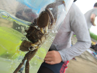
Hairly Japanese mitten crab
Pacific redfin and pale chub. Looked from front, they look very cute. 😊
Tsurumi River has many kinds of
  Gobiodei as well.


So, now in Japan the time of typhoons has come again, and we may see another inundation of Shinyokohama Park. Let’s prepare for the emergency. This year, as we’re with COVID-19, Japanese DRR offices recommend to pack additional things for your emergency backpack: face masks, medical thermometer, personal alcohol wipes, soaps, paper towels, disposable plastic gloves, garbage bags, water, comfy shoes, and portable toilet. For general info to prepare for natural disasters, please check my blog on February 28, 2020. Recently, Government of Japan decided to merge Hinankankoku 避難勧告 “Recommendation to evacuate” and Hinanshiji (Kinkyu) 避難指示(緊急)”Immediate evacuation order” as “Evacuation order.” They also say when you can find the place to evacuate without being in a crowded, say, school gym, please choose that place instead of mechanically go to the designated evacuation center. Your friend’s home may be safer when we consider the risk of COVID, isn’t it?


X-band radar the Ministry deploys
 next to the Tsurumi River Watershed Center.
 It is capable of spotting rapid beginning
 of small local rain cloud.
 The Ministry is expanding
 the nation-wide coverage of such towers.
 The rapid warning issued from the radar
 can be found from here 24/7.
 From this site,
 we can also download
 the smartphone app to receive the info.


When you find issues in Tsurumi River, please make a contact with

Tsurumi River Watershed Center 鶴見川流域センター

Phone: 045-475-1998

FAX: 045-475-1999

https://www.ktr.mlit.go.jp/keihin/keihin00490.html


Keihin River Office, Kanto Development Bureau

Ministry of Land, Infrastructure and Transport of Japan

国土交通省 関東地方整備局 京浜河川事務所

2-18-1 Tsurumi-chuoh, Tsurumi Ward, Yokohama, 230-0051

230-0051 神奈川県横浜市鶴見区鶴見中央2-18-1

Phone: 045-503-4000


Friday, February 21, 2020

How to Train Your Dragon: Tsurumi River and a pond near Niiharu Citizen Forest


On the eastside of Niiharu Citizen Forest, there is a man-made pond, connected to Umeda River that is a second tributary for Tsurumi River 鶴見川 via On’daRiver 恩田川. The existence of it has been always a mystery for me. The pool is made of concrete walls, although now it is full of aquatic life with muds flown in from the forests. The size of Niiharu Forest gives us a feeling we are standing in a traditional agricultural area. It is not at all true. Just 5 minutes’ walk from the pond, we are surrounded by ordinary suburbia of Megalopolis Tokyo. There is no agriculture needing water reservoir for their business. Then, what’s for that pond? It must have costed lots of money to build such structure. I know it’s not a private property, but of the City. So, that pool is made of taxpayers’ money. There must be a good reason for the existence of the pond. Recently, I learned the raison d’être of it. It has a VERY serious duty to perform, I realized.


This is the pond.
 The forest over there is the eastside of Niiharu Forest.


If you’re familiar to ordinary towns of Yokohama, you may notice there are lots of signs like this:


The panel says, “Below this building, there is a storm water reservoir.” It is a way of controlling flood often caused by small rivers running in our city. You see? Yokohama is a port town, i.e. we have many small but steep hills falling down to Tokyo Bay. Such geological feature makes the place good for port. At the same time, in Yokohama very tiny water streams go down the ubiquitous small valleys between the steep hills. They may be pequeños, but for a densely populated city can be troublesome enough with torrential rains. As they are small, they can quickly reach to the capacity, and cause floods in downtown. How to control such incidents is always the important issue for ages in Japan.


Small Umeda River


The other day, Prof. Yuji Kishi of Keio University explained to us Kanagawa Forest Instructors the basic method of controlling such flood. Before, when our society was mainly for agriculture, the flat places where water entered easily was used for rice paddies. The sites were good for staple cultivation, and acted as an important buffer for overflow caused by rains and rivers. Many traditional rice cultivars in Japan were resilient for floods so that their quality was not affected much, even after several weeks of inundation in late summer and fall. Those were the days. Now, especially Yokohama and Kawasaki in Metropolitan Tokyo area, the places prone to flood are developed for factories, offices, housings, shopping centers … with millions of people. Meanwhile, rivers won’t change their course when we build our sweet home on their way. When a storm comes, nature wins, and humans face devastation with deluge.


The mouth of KatabiraRiver 帷子川 at the Port of Yokohama.
 Here, we have brackish water, but not yet of sea.
 You see?
 Global HDQ of Nissan stands at the lovely waterfront,
 but if flood occurs,
 the building does not stand at the pole position.


The professor pointed out, especially for Tsurumi River (my post on August 2, 2019), its geological condition presents THE serious threats. It’s a very short river; 42.5km in total starts from a spring at ASL170m in Machida City of Tokyo. Direct distance between the origin to its mouth is less than 20km, whereas the river creates 235km2 of catchment area. i.e., The flow is meandering the relatively flat flood plain before ending at Tokyo Bay. No wonder it overflows very often when strong typhoon comes. The flood plain of Tsurumi River is home of huge population larger than the City of Osaka. During the high growth era of the 1960s, regularly 20000 households of Yokohama and Kawasaki suffered a lot with the flood of Tsurumi River. I imagine the situation could be similar to the current problem of people in Dhaka, Bangladesh … In the early 1970s, the mandarins of Japanese government reached the conclusion they could not contain Tsurumi River with a “standard way.” In terms of civil engineering, Professor Kishi continues, the easiest way to avoid inundation in Yokohama and Kawasaki area by Tsurumi River is to cut all the trees in upstream hills, including Niiharu Forest, concrete every slopes for rain water to pass smoothly, and widen the river by removing all the human activities from the flood plain. In this way, rainwater would smoothly flow into the sea. BUT, of course, we cannot take this method in Megalopolis Tokyo.


Recent Tsurumi River near Kamoi Ohashi Bridge 鴨居大橋.
 People are busy restoring the bank
 destroyed by Typhoon Hagibis
 (; my post on January 17, 2020).


Even though, if we can control the amount of water flowing into the river at least to some extent, we can protect our life. People living along Tsurumi River including municipal governments + the central government gathered their brain to come up with a plan. In 1980, the Integrated Flood Management Policy for Tsurumi River went into the effect. 2020 is its 40th anniversary. The measure is unique in Japan as this is a cross-municipal arrangement where the central government and civil society organizations act as a mediator, or connector, of sorts among 3 regional governments; Machida, Kawasaki, and Yokohama along the river. Prof. Kishi presides TRnet 鶴見川流域ネットワーキング which is a civic organization covering the Tsurmi River itself and sits at the Inter-municipality + National Office Council regarding Tsurumi River Basin 鶴見川流域水協議会.


Despite of a substantial flood last fall,
 water birds are surviving ...


The Ministry of Land, Infrastructure, and Transport is executing civil engineering projects to fortify banks, smoothing out the river flow with various measures (including underground aqueducts) to lessen the impact of flood water running down the sea. It also created the huge multipurpose anti-flood pond which is the New YokohamaSports Park with Nissan Stadium for 2002 FIFA World Cup and 2019 Rugby World Cup. (More to this next week.) The inter-municipal arrangement is also engaging in the measures to improve the quality of forests along the river in order to advance forests’ ability to retain rainwater before washing down to Tsurumi River. Each municipality supports civil society activities to maintain the health of forests along Tsurumi River. Yokohama has 12 Citizen Forests in Tsurumi River Basin. Each has Lovers Organization of volunteers that receive financial and technical assistance from the City with Green Tax funding. Lovers of Niiharu Citizen Forest is the largest. We are busy with maintaining our forest to keeping its ability of retaining water. For Niiharu Forest, also the Council for Fun Learning along Umeda River 梅田川水辺の楽校協議会, a member for Niiharu Council together with the Lovers (; my post on April 22, 2016), works closely with TRnet. Machida and Kawasaki too have their own scheme to promote civic activity for the health of forests in Tsurumi River Basin. In addition, municipal governments constructed numerous storm water ponds not only for Tsurumi River but also for the other rivers under their territory. The pond next to Niiharu Forest is one of them.


The New Yokohama Sports Park with Nissan Stadium
Umeda River becomes maddeningly beautiful
 with
Spiraea thunbergii in Spring.
 Please come in late March to early April
 for your relaxed walk along the river, next to Niiharu Forest.
 The Council for Fun Learning along Umeda River is
 in charge of picking up garbage and mowing in the riverbed.


I was a little taken aback to the map shown by the professor which showed the location of flood reservoirs along the river. The shape of the basin for Tsurumi River looks like a cute tapir. Then, the dots representing ponds were like polka dots decorating the entire body of the animal, like some object created by Yayoi Kusama. In total there are more than 4900 ponds for flood control of Tsurumi River. Woooooooooow. The professor told us this arrangement was possible because it is for Tsurumi River that runs the richest municipalities in Japan, very near to the offices of the central government. The place has money to mobilize all the relevant actors, national and local governments + civil society, to control the flood. “I think the only place possible to replicate Tsurumi River model would be in Osaka whose budgetary scale could support such project. However, the local governments of Osaka are at odds with the national offices in Tokyo so that mandarins in Tokyo do not like to touch it …” Prof. Kishi told us. That’s sounds depressing. If such coordination is rare even for tiny rivers, what would happen for those rivers flowing internationally? How can people manage natural (or otherwise) disasters caused by their river when your neighbor speaks completely different “language”? 


A tapir wearing a coat of polka dots


Prof. Kishi added more in his seminar; with such ferocious downpouring these days, the era we can count on the ability of forests to retain rainwater is over. Yes, healthy forest with enough mulch absorbs droplets from heaven, up to a point. If an extreme shower occurs in a very short period of time like that of Typhoon Hagibis last year, or, if substantial raining continues for unusual period of time like we had last October and November, any forest cannot keep water beneath the system of roots and soils. Once the ground reaches to the max capacity, it gives in to the law of gravity, and causes landslide. Any landslip with lots of living trees causes the max devastation. Debris flow contains not only earth and rocks, but also logs, huge roots, and anything that was once a part of a forest. The impact of such avalanche is far worse. Say, if they reach to the river, mixture of logs and earth destroys bridges far rapidly than the slide only with tumbling rocks. “The arrangement for Tsurumi River is not yet at all adequate to tackle frequent ‘once in 100 years’ typhoons. Considering its extremely urban circumstances, we may have hit the technical limit already.” Hmmmmmmmmm … At least last year, the reservoir attached to Niiharu Forest retained water while Umeda River next to the forest run maddeningly to On’da River. How long it can go that way? At least, we Lovers of Niiharu Citizen Forest are every weekend busy maintaining our forest with its mulch, hoping it retains rain …


The collapse


By the way, this Sunday, February 24th, from 13:30 at Tsurumi River Watershed Center  鶴見川流域センター next to Yokohama Sports Center, Prof. Kishi will have a workshop about Tsurumi River and the New Yokohama Sports Park with Nissan Stadium. RSVP at

Tsurumi River Watershed Center
Phone: 045-475-1998
FAX: 045-475-1999

The participation fee is 100 yen for a cup of coffee served there. Anyway, when you find issues in Tsurumi River, please make a contact with

Keihin River Office, Kanto Development Bureau
Ministry of Land, Infrastructure and Transport of Japan
国土交通省 関東地方整備局 京浜河川事務所
2-18-1 Tsurumi-chuoh, Tsurumi Ward, Yokohama, 230-0051
230-0051 神奈川県横浜市鶴見区鶴見中央2-18-1
Phone: 045-503-4000

Friday, August 2, 2019

Floodplain: invasive species along Tsurumi River


City of Yokohama has three main rivers, Tsurumi 鶴見川, Katabira 帷子川, and Ohoka 大岡川, pouring into Tokyo Bay. Tsurumi River is the longest, with the largest basin. Its source is in Machida City of Tokyo. From there, it runs through northern Wards of Yokohama, i.e., Aoba 青葉区, Tsuzuki 都筑区, Midori 緑区, Ko’hoku 港北区, and Tsurumi 鶴見区. The river basin of Tsurumi has a good size. A large part of Tsurumi Ward is made of it. It created the space in Ko’hoku Ward for Shin-Yokohama Park with the Nissan Stadium where 2002 FIFA World Cup Final was held (and will be the main venue for football / soccer in 2020 Tokyo Olympics). Nowadays, especially its middle basin maintains “natural” riverbeds which are enough to have petit forests. From Shin-Yokohama Park to upstream, the river side has lots of wild Japanese walnut trees (Juglans ailantifolia) that I guess are the survivors of rampant urbanization of Tama Hill 多摩丘陵 during the last 150 years (; my post on October 28, 2016). This area is a pleasant place. Many enjoy relaxed walking, jogging, or cycling with refreshing winds from the river. In summer, kids play riverside laughing. In a very urban environment, the floodplain of Tsurumi River is a precious breathing space for us, residents of Yokohama.


Japanese walnuts in Yokohama as of July 2019


Floodplain environment receives frequent floods that wash over the previous living things and brings some other ones from upstream. It’s a peculiar, fast moving place. Japanese archipelago is destined to have lots of natural disasters, such as storms. Our fathers have spent huge amount of money and energy to lessen the impact of force majeure. Japanese hydrologically engineered our rivers for hundreds of years in order to control floods. This has made riverbeds very “artificial” place, especially in Kanto Region 関東地方. It is rare to find rivers in Megalopolis Tokyo area without undergoing concreted riverbeds or heavy dredging. Yeah. Thanks to that, we has not have yearly flooding of, say, Tsurumi River that was once seasonal things some 70 years ago. There is a price to pay. In Kanagawa Prefecture, we have Aster cantoensis kitam, which is Japanese endemic and endangered species (IB category). The reason why the chrysanthemum it has reached thus far is, we concreted the riverbeds for controlling the flow. It drastically reduced its habitat of sufficiently gravelly sand in floodplain. OK, that’s what I’ve heard. I’ve never seen Aster cantoensis kitam. The discussion has been something of abstraction. Then, one day while I strolled along Tsurumi River, I had a kind of Eureka! moment.


Although it looks natural, I noticed the vegetation in the riverbed for Tsurumi River has lots of invasive species. Their presence is definitely larger than, say, in Niiharu Citizen Forest which situates near the middle basin as one of the water sources for Tsurumi River. Disclaimer: in Niiharu, we Lovers are sentinels to spot and stop the invasion of non-endemic species that can run over precious endemic flora. Thanks to that, I’ve become somehow watchful about the existence of invasive ones. Yap, the floodplain of Tsurumi River is often undergoing drastic treatments. Of course, several times during typhoon season every year, the place is inundated with muddy river water, probably containing polluted materials from upstream cities of Tokyo. In addition to concreted banks here and there, once in a year or so, the municipality controls the growth of its vegetation with extensive mowing and chemical weed killers. Perhaps thanks to global warming, the frequency the plain receives such extreme is, it seems to me, increasing. No matter, the grasses and trees come back every time and cover the riverbed quickly. That’s itself impressive. And the survivors of the harsh condition are truly tough ones, I presume. And in the list of stayers, the species which come to Japan not long ago stand out with their energy.


Invasive species 1:
 English plantain (Plantago Lanceolata)
Invasive species 2:
 A colony of Wandering jew (Tradescantia fluminensis) …
 I’ve just noticed its English name suggests something …
I’m not sure if we can call this invasive …
 Orange Daylily (Hemerocallis fulva var. kwanso)
 originating from China,
 and came here in prehistoric time.
 (We have 8th century poems describing this flower.)
 What is non-endemic, then?


That’s telling something. Those that can remain in an environment different from their home town are … strong. Can we really manage and preserve our endemic species with such formidable new comers that try to expand its territory no matter what? To begin with, the reason of their thriving along Tsurumi River is our city development, excavating old forest floor, pouring concrete over it, building factories and houses, bringing in foreign species from somewhere, etc. etc. Nature conservation … what does it mean?


If you find an environmental issues in Kanagawa Prefecture, please make a contact with Kanagawa Natural Environment Conservation Center 神奈川県自然環境保全センター
657 Nanasawa, Atsugi City, 243-0121 〒243-0121 厚木市七沢657
Phone: 046-248-0323


You can send an enquiry to them by clicking the bottom line of their homepage at http://www.pref.kanagawa.jp/div/1644/