Showing posts with label Dams. Show all posts

Friday, January 17, 2020

Survival Game: Lives and the Lingering Effects of Flood Threats from Rivers in Kanagawa Prefecture


Last fall, we live in Metropolitan Tokyo area were hit twice by Super Typhoons, Faxai and Hagibis. In Kanagawa Prefecture, several were killed by landslides and flood. Tama River, marking the border between Tokyo and Kanagawa, flooded to kill a person in Kawasaki. Very fortunately, though, the banks of large rivers flowing in Kanagawa Prefecture did not collapse. It kept the damage from the typhoons somehow lesser in our towns compared with the other places like in Chiba or Nagano. In any case, it was a terrible experience. (For the photos about the disaster by Hagibis in Kanagawa, you can find them here, the site by Kanagawa Shinbun Newspaper Co.) 


A scenery showing how close it was for Sakawa River.


One of my seniors of Kanagawa Forest Instructors lives in Hiratsuka City 平塚市 along Sagami River 相模川. The bank of the river has been for her relaxed strolling. Then on 12th of October, the city issued an evacuation order to her neighborhood because of the torrential rain, and the warnings from 4 dams, Doshi Dam 道志ダム, Miyagase Dam 宮ケ瀬ダム, Sagami Dam 相模ダム, and Shiroyama Dam 城山ダム, for imminent release of water to Sagami River. “You see, our 50-inch TV was brand-new, and it was on the first floor. So my husband and I brought it first to the second floor. Then, my son came home. We all three frantically moved our furniture to the second floor. Gosh, how heavy our microwave was! Finally, only the refrige remained. We discussed if we can carry it to the second floor. It was impossible. We decided to let go the machine and the food if the flood comes …” Then, they got into the car with few items of their belongings and headed for the designated shelter that was a nearby elementary school. “We found the place was damned full. No room was left for our family. In any case, the school was also near the river so that we moved on to another school that was in higher elevation. It was full again. We drove around for some time to find a safer place, and ended up in a school not in a walking distance from our home, but on a hill safely away from the river.” Her family stayed in the gymnasium of that elementary for the night of October 12th. They were distributed 2 blankets per person to sleep on a hard wood floor. “You see? I don’t know why but I grabbed my yoga mat when we evacuated our home. It turned out to be a jackpot-move. At least I could lay on the floor more easily. It was hard to sleep at that night. Many kids started to cry, and lots of elderly people had hard time to get up to go to toilet …” Thank God. Sagami River held up even with the discharge from four dams.


A goal post for soccer turned into a jumble of scraps
 thanks to the inundation from Sagami River last fall.


One of my pals as Forest Instructor is an officer working for Kanagawa Water Supply Authority 神奈川県内広域水道企業団. They are in charge of Doshi Dam, Sagami Dam, Shiroyama Dam, Miho Dam and water intake weirs in Sagami and Sakai Rivers. On that night they were on an emergency night shift. “You see? We did not want to discharge water but the speed of rising water level was abnormal. In the end, the gate of Shiroyama Dam was opened 5 minutes before the final warning was issued by the Prefecture. It was a close call. Thank God, Sagami River did not overflow … That was a super night.” Well, even though, the water of rivers in Kanagawa, Sagami, Sakawa, Tsurumi, et al rose quite close to the limit. My instructor senior went to the river bank several days later. “You see? Only the top 10cm of tall reeds kept its green, and the rest was covered by mud. In addition, quite many of them were completely beaten down to the same direction. The power of flood water was horrible …”


Could you see in this photo at least
 the water reached to that level from Sagami River?
The phot was taken on the bank of Sagami River early January.
 The vegetation was recovering to green,
 but those flatten muddy reeds tell the power of water.


It could be indeed miraculous the only death by flood of rivers in Kanagawa Prefecture was on the border with Tokyo. I’ve heard several communities received substantial damage in their rice paddies and tangerine orchards in the west of the Prefecture. Water of the rivers kept muddy for more than a month after Hagibis. Humans are still struggling to recover from the weather incidents. Having said that, to some extent, it would be an evidence the Prefecture does well to control rivers in the territory. Yeah, on October 13th, a Rugby World Cup match between Scotland and Japan was held in Nissan Stadium even though the flood basin of Tsurumi River inundated the sports park surrounding the Stadium. It was thanks to a very good civil engineering design for flood control. Still, the power of Tsurumi River from 12th of October was shocking. It extirpated many forests that existed along the Tsurumi River before Hagibis.


Sakawa River in the middle of November 2019.
 The water was still raging.
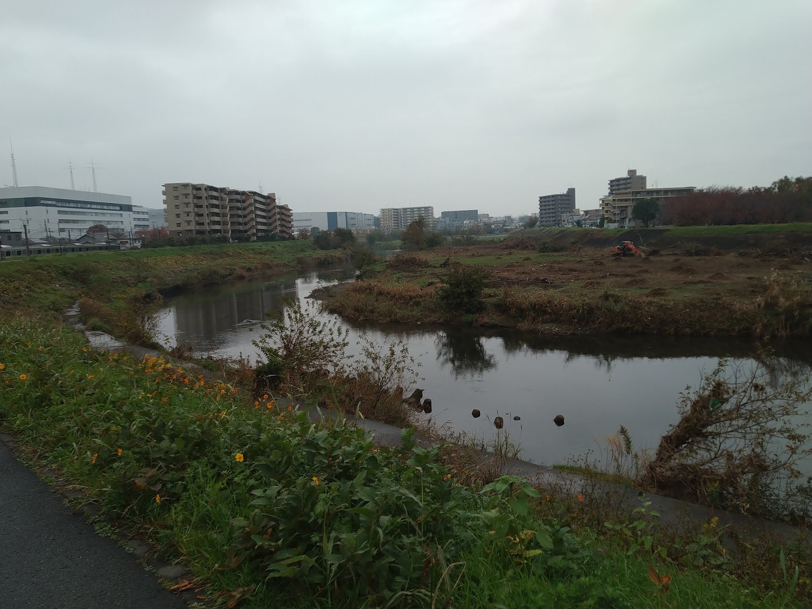
This photo of Tsurumi River was taken last August
 before super typhoons came.
This is for the same place as above
 after the typhoons in November.
 Frankly, I was shocked.


Then, what happened for wildlife along the river? In January, the waters of rivers have finally returned non-muddy. But the effect is still lingering. I knew there was a large Japanese walnut tree on a bank of Tsurumi River that was a home for lots of pacific reef herons. Then, the flood uprooted the tree, and these days I cannot find black herons there … The birds have received the damage too. Still, the place near Sagami-Ozeki Weir 相模大堰 on Sagami River has welcomed many migratory water birds as usual this winter. In the area, we have found accumulation of poops by Japanese raccoon dog family, and feces of wild Japanese hare. A peregrine falcon perched high-up on the power transmission tower near railroad bridge for Odakyu Line. Aster kantoensis, which is an endangered species (CR+EN in Kanagawa) were survived … Whatever happens by super typhoons, they are resilient at least for now. Is there anything we can do to ride on this strange series of weather with them together in 2020?


102140: This is also the photo of last August
in the bank of Tsurumi River where
 pacific reef herons returned before sunset.
Immediately after the typhoons,
 the tree itself stood with herons.
 But could you figure out
 the back of their nest is in a mess with uprooted trees
 and garbage from the river?
The city cleared the space for further riparian maintenance.
 No tree in January 2020. No herons.
 But could you see a Eurasian coot in the middle?
 Life goes on after the storm …
Poops of Japanese raccoon dogs
 on the dusty bank of Sagmi River this month.
Humans are busy to restore the bank for Sagami River.
I was a sort of impressed with these
 as hare was so resilient to leave their dropping here
 on the riverbed after the flood.
Sagami-Ozeki Weir in early January 2020.
 It withstood with the flood water
 which left such muddy vegetation and sandbags around.
But goose came to the Weir as usual this winter.
A nice couple of Eurasian teal,
 regulars for winter at Sagami-Ozeki Weir.
Somewhere in this photo,
 there must be a peregrine falcon …


If you find environmental issues in Kanagawa Prefecture, please make a contact with Kanagawa Natural Environment Conservation Center 神奈川県自然環境保全センター

657 Nanasawa, Atsugi City, 243-0121
〒243-0121 厚木市七沢657
Phone: 046-248-0323


You can send an enquiry to them by clicking the bottom line of their homepage at http://www.pref.kanagawa.jp/div/1644/

Friday, January 10, 2020

A Hidden World; From Ameyama Pass to Yushin Valley 雨山峠からユーシン渓谷へ


Although Kanagwa Prefecture is a part of Metropolitan Tokyo, we have one of the most secluded places in Kanto Region. It has a legendary beauty. The place is called Yushin Valley ユーシン渓谷. The valley is the narrow middle to downstream of Kurokura River 玄倉川 that starts from the east point of Lake Tanzawa 丹沢湖, at Kurokura 玄倉 community. Kurokura River runs to the east for about 12km. The scenery of Yushin Valley from the forestry road was/is gorgeous. In addition to seasonally changing vista of mountains, the water of Kurokura River is so pure. As it runs on the bedrock of white granite typical for deep Tanzawa mountains, Yushin Valley looks like a stream of sapphire blue in fine days. It is named Yushin Blue. People who saw the place told me, “You don’t have to go to Capri for Blue Grotto!” Wooooow. Unfortunately, the area is not possible to enter now.


At least on map, there goes a forestry road, named Kurokura Forestry Road 玄倉林道, along the Kurokura River up to the point where the valley diverts to Hohkisugi Stream 箒杉沢 and Nabewari Stream 鍋割沢. The access to Kurokura River by public transportation is from Odakyu Shinmatsuda Station 小田急新松田駅. We have to catch a bus to Kurokura operated by Fujikyu-Shonan Bus 富士急湘南バス. It’s about an hour bus-ride. From the bus stop we walk a forestry road, called Nakanosawa Forestry Road 中ノ沢林道, to the north for about 1 km to meet with Kurokura Power Plant #1 玄倉第一発電所. The beginning of Kurokura Forestry Road is about 2km north from the Power Plant #1, diverting to the east from Nakanosawa Forestry Road. Moving along Kurokura Forestry road itself was an adventure. It has 9 tunnels all of which do not have any lamp. Several of them have even cranks inside. The forestry road climbs up only slowly for about 300m with 12km. It may be long, but walking surrounded by gorgeous nature, Yushin Blue inclusive, was not so demanding for casual visitors. Say, if you’re a guy who wants to show how macho you are to your city-girlfriend in a stunningly beautiful scenery, the setting was perfect, with a series of pitch black tunnels … There was Yushin Lodge ユーシン・ロッジ at about 8km point from the beginning of Kurokura Road (; er, “there is,” actually, as the building is standing still). The Lodge was managed by the Prefecture. The Office used to allow people who reserved nights’ stay at the hut to drive to Yushin Lodge. The premise was popular among mountaineers as a base camp to the main peaks of Tanzawa, such as Mt. Hirugatake 蛭ヶ岳 (ASL 1672.6m), Mt. Hinokiboramaru 檜洞丸 (ASL 1601m) or Mt. Tanzawasan 丹沢山 (ASL 1567m).


There is a reason why the Prefecture constructed a forestry road in such a deep mountain. Before the diversion point of Hohkisugi and Nabewari Streams, there is a hydroelectric dam, named Kumaki Dam 熊木ダム. Kumaki Dam drops the water via underground aqueduct to another dam, Kurokura Dam 玄倉ダム / Kurokura Power Plant #2, which is in the middle of Kurokura River. At the Kurokura Dam, the water from the catchment area of Kurokura River is gathered. A part is used for electric generation at Kurokura Power Plant #2, and the rest is sent into another underground canal for electric generation at Kurokura Power Plant #1. The electricity produced in these two plants is sold to Tokyo Electric Power Company (TEPCO) and fed into the electric grid of Metropolitan Tokyo. So if you’re in Kanagwa, or Tokyo, you may use the power generated there now. It’s the thing of dam in Japan, and so, we can collect dam cards by visiting these places. (About dam cards, my post on April 19, 2019.) In addition, the place has legendary beauty! If you collect the dam cards, please take your selfie with the Kurokura Power Plant #1, and bring it to the Admin Office of Lake Tanzawa at Miho Dam 三保ダム (my post on April 19, 2019). Officers there will give you 4 cards at once: one for Power Plant #1, then for #2, Kurokura Dam, and Kumaki Dam. i.e. You don’t have to visit the power plant #2 and the dams. Why is this short cut? Because Kurokura Forestry Road is closed at the moment. There is no reason for human side to close Kurokukra Forestry Road, right? Mother nature thinks differently, perhaps.


Basically, the area of Kurokura River is a tricky place. Do you remember I told you a famous 1999 drowning accident of 13 people near Kurokura Dam? (My post on August 24, 2018.) It’s a really remote place. In 2006, the Prefecture checked the safety of the Forestry Road, and found large cracks in the third tunnel, named Aozare Tunnel 青崩隧道. The bonus treatment for the customers to Yushin Lodge was terminated, and the Lodge was closed in April 2007. New tunnel was excavated and opened in 2011 as New Aozare Tunnel, but the car usage of Kurokura Forestry Road was strictly limited for the holders of governmental permission … I think it made the legend of sleeping beauty Yushin Valley definitive … Then, on 17 January 2018, a troop of hunters who engaged in prefectural tasks of culling wild deer found another large fractures in the slopes along the route between tunnel #3 and #6. (I know this date, as one of the hunters is my Forest Instructor pal.) It snowed heavily next week. When people returned there after snow, huge landslides happened here and there, and the forestry road was completely blocked. The collapsed soil poured into the river so that, according to a person who went there, the Yushin Valley was not blue, but of whitish mud. As of January 2020, Kanagawa Prefecture sets up locked wire fences at the mouths of tunnels between New Aozare Tunnel and Tunnel #6. The beauty of Yushin Blue is off-limit for us …


Although currently we cannot approach to the middle to downstream of Kurokura River, we are able to enter, a sort of, the upstream of Kurokura River. How? Here comes Ameyama Pass 雨山峠 I reported the devastation last week. At least till the autumn of 2017, from Ameyama Pass to Kurokura Forestry Road, there was a relatively well-organized hiking road which ran from Ameyama Pass along Ameyama Stream 雨山沢 pouring in Kurokura River. We’ve been there last month to find almost all the hiking road is washed away up until the last few hundred meters of a metal plank path secured by bolts and nuts to the bedrock of Tanzawa. Below are the photos I’ve taken there.


Basically, the route from Ameyama Pass to Kurokura Forestry Road is
 on the riverbed of Ameyama Stream.
 We guessed the right-hand side of this photo was the trace
 where once a hiking road ran.
So, there are lots of “ruins” like this, dangling from the steep slope.
Still some installments are still working. Thank God.
The scenery tells why there is no route anymore here …
Smaller dry valleys tell us eloquently what happened.
Hmmmmmmmmm.
 Debris flow will happen again, and again, don’t you think?
This precarious red ribbon shows we’re on the right track.
This section of the route has a better condition.
 I was amazed water runs over the huge white granite.
 The bedrock remains, really.
Almost suddenly, a metal plank path appears. Strange …
Kurokura River is over there.


The route from Ameyama Pass joins with Kurokura Forestry Road at Ameyama Bridge 雨山橋. We proceeded further on Kurokura Forestry Road to Yushin Lodge … I think there have not been many people entered there. The Forestry Road has lots of collapses so that we did a bit of rock climbing in order to progress. Although the remnants of the road are paved, they were buried by thick piles of fallen leaves. Many dry valleys along the road were filled with large debris flow covering the forestry road. We glimpsed the entrance to Yushin Lodge across Kurokura River, and returned to Ameyama Pass due to time constraint. (Remember? Walking the route via Ameyama Pass after dark is suicidal.) The upstream of Kurokura River has a wide riverbed owing to frequent and massive debris flows. It gives us a feeling of “wide open space,” which is actually not at all safe. Large bridges and weirs were standing. I found them a sort of fruitless human struggle … It was the end of autumn. We met many large mosses that can be seen only in deep mountains. The whole landscape was so serene and beautiful …


At the crossing of
 the route from Ameyama Path and Kurokura Forestry Road
Ameyama Bridge is over there.
We recognized lots of footsteps of deer and large mammals on the road.
 It was paved route, but the sandy debris covers the road.
To Yushin Lodge
The collapsed Kurokura Forestry Road
Another collapsed part.
 Huh, it takes an effort to make this route passable again for cars.
The debris flow is covering …
Hmmmmmmm
The bridge to the entrance to Yushin Lodge.
 The weir over there is standing.
Don’t you think it’s beautiful?
 The forest over there is designated as
 one of the best 50 forests in Kanagawa Prefecture.


Kanagawa Prefecture is having a hard time for managing Kurokura and Kumaki Dams both of which are now beyond the locked-off area from Kurokura community. The only way for the officers to go there is on foot via Ameyama Pass. The Office has asked Kanagawa Forest Instructors to give them any information about the access to the area. The senior Instructors are presuming the Prefecture could not leave Kurokura Forestry Road as such because of hydroelectric power generation. At the moment, the prefectural government plans to start repair works this spring, and to open the entire Kurokura Forestry Road by the end of March 2023. Until then Yushin Valley remains as an inaccessible secluded place in our neighborhood. I’m just waiting for the time we can go there more easily. But, if such days come, those lovely large mosses would be gone by lots of tourists. Sad. Which is better in the end?


Climacium dendroides


If you find environmental issues in Kanagawa Prefecture, please make a contact with Kanagawa Natural Environment Conservation Center 神奈川県自然環境保全センター

657 Nanasawa, Atsugi City, 243-0121
〒243-0121 厚木市七沢657
Phone: 046-248-0323

You can send an enquiry to them by clicking the bottom line of their homepage at http://www.pref.kanagawa.jp/div/1644/

Friday, August 24, 2018

A Quick Introduction to Outing to the Riverside in Japan: Play It Safe 101


It’s HOT! Basically Japanese summer is very humid, e.g. 80% or above humidity, always. This year, the dampness often dances with extremely high temperature, like 38 or 40C. I’ve heard a conversation, “Well Jakarta is far cooler now than in Tokyo, honestly.” OK, OK, OK. So, we in Megalopolis Tokyo are devising remedial measures to cope with the reality. Let’s go to riverside! Japanese culture has lots of traditional ways to summer with river. You may know tourists’ attractions like shows of fishing with cormorants 鵜飼 (for example, here or here), having banquets on houseboat (for example in Tokyo Bay, here or here), or watching fireworks on the riverside. Er, well, it would be nice to feel a breeze from a river during those shows, but they are (A) expensive, and/or (B) for you to cram yourself in a limited space of a city. Take Sumida River Fireworks Festival 隅田川花火大会; it attracts more than 1 million people within 2.5km2 along Sumida River 隅田川. Looking up to see fireworks with 1 million people situating shoulder-to-shoulder in humidity 80% at 35C◦ would be … not for cool breeze, I guess. There is another up-to-date kind of summering with Japanese rivers. That is BBQ or picnic on the riverside in forests.


Having said that, strolling and having lunch on riverbed
 can be relaxing during spring.
 It’s a scenery along Arakawa River
荒川 in March.
But during mid-summer,
 rivers in the city cannot offer much retrieve
 compared with the streams in the mountain
 … It’s Tsurumi River
鶴見川 this august.
 The banks are deserted, aren’t they?


Kanagawa Prefecture 神奈川県 has many rivers with dry riverbed when weather is nice. So people go there with cooler boxes staffed with foods and drinks. We set up a tent for shade, and prep for a riverside party. Nice, isn’t it? Yeah, but before that, a basic info: Japanese rivers and riverbeds are the property of the government. The biggest or the nationally important ones are owned by the national office. For smaller ones, prefectural or municipal governments take the ownership. In any case, the national government delegates day-to-day management of the rivers to local governments so that local offices have actual jurisdiction over the usage of Japanese rivers. They are responsible for flood control and environmental conditions of the rivers. Inevitably, there are several protocols for picnic with rivers. Let me list them.


The riverbank of Sagami River 相模川 near Samukawa Water Intake Facility 寒川取水堰.
 Sagami River and its riverbeds are owned by the national office,
 and Kanagawa
神奈川県 and Yamanashi Prefectures 山梨県 are
 commissioned to manage it within each border.
 The Kanagawa Prefectural Office has built
 an athletic field-cum-retarding basin here.


1.     Not all riverbeds are safe.

It would be a common sense. Especially in Japan, many rivers are short and rapid with upstream dams for flood control. May be due to global warming, these several years we are having sudden and unexpectedly heavy downpours in deep mountains around such dams. A short and small river can quickly turn into a wide muddy stream and running down to the downstream riverbed within 10 minutes. The place you think is safe enough for picnic can abruptly be swallowed up by Tsunami-like river water, even under sunny blue sky. So,

A) Please check locals beforehand if it is safe for pitching a tent for your BBQ or picnic at your chosen riverbed. If they recommend not to, just follow their local knowledge.


B) During the consultation, locals can tell you if there would be emergency sirens or the notices issued by the authority when the imminent danger is coming. Please do take this information seriously and follow the local instruction if you unfortunately are facing such calamity. Where is the megaphone for the sirens? Where can the officers come to let you know the time to escape? Which direction is safe if the muddy water chases you? You must make it sure at least these points, and be ready for such contingencies.


One day, we’ve found trashes
 beneath Yadoriki-ohashi Bridge
寄大橋 in Tanzawa 丹沢.
 Disgusting … who did it?
And a week later,
 the riverbed beneath the Bridge was almost cleared …
We found only a chair at 10m below of the weir.
 The thing is,
 during that week no substantial rain came in Yokohama,
 and it was difficult for us to imagine
 Yadoriki River
寄沢 had such a massive flow
 to push down the garbage.
 Hmmmmmmmmmm.


2.     Don’t underestimate Japanese river.


A) Yeah, ours are tiny, but often rapid, or hiding swift stream underneath. These days, lots of city folks come to a riverside, having a beer party, jumping into a river laughing, and drawn dead due to the ferocious torrent. This newspaper article is one of the recent ones calling our attention to the issue. Be very prudent, please.

B) Tiny rivers in Japanese mountains are almost always surrounded by forests. In order to stop forest fires, unless the place is designated, fire is prohibited in all the riverbeds in Japan. You’d better check if you can BBQ over there, first. Otherwise, you’ll be charged by criminal offense.


A riverbed of Ushiro-zawa Stream ウシロ沢 running on the south-west slope of
 Mt. Nabewari
鍋割山 (ASL 1272m) of Tanzawa.
 Yeah, when it’s a fine day, the river width is not much
 but the water runs very rapidly.
 Moreover, tiny but high water falls
 join with the stream here and there,
 and we find lots of large rocks with sharp edges along the river.
 i.e. When it rains,
 this refreshing small flow becomes destructive torrent
 gouging out the porous soil of Tanzawa.
On the riverbed Yadoriki-sawa River 寄沢,
 any fire usage is prohibited.
 Instead, people can come for sun-bathing
 and have sandwiches.


3.     Often a nice picnic riverbed is attached to a business right.


A) The most obvious one is fishing rights. It’s safe to think all the attractive rivers in Japan are covered by fishing rights of some fisheries cooperatives. Do you know even the estuary of Tama River 多摩川 of Tokyo-Kanagawa is divided by the rights of several cooperatives who fish for Conger-eel, aka Anago あなご, for sushi? So, if you go fishing in Japanese river, please check first where to buy an appropriate fishing license. Otherwise, your deed can be a theft punishable by a jail-time.

B) OK, you plan to have a BBQ party on that riverbed. But is it allowed to do so? You see, if no one looks, weekend revelers can trash the place with garbage, play loud music without thinking the residents nearby, leave poops et al anywhere, and, for the worst case, invite crimes. So, municipalities often request local business to watch for the manner of visitors by giving them business rights on the riverbed. The nicer the riverbed, the more lucrative for business. Almost all the nice-looking BBQ places in Japan are covered by local BBQ proprietary these days. Before start a fire with your charcoal, you’d better know if it is OK to bring your BBQ gear to that riverbed. The place could be only for the customers who borrow such things from the vender situated nearby. Making trouble with them would be charged by an obstruction of business. 


A sign of selling fishing license
 for Hinata River
日向川 on the foot of Mt. Oyama 大山 (ASL 1252m).
Doshi River 道志川 is famous
 for its large choices of camping and BBQ sites.
 (For Doshi River, pls see my previous posts in last January and February.)
 It’s Lower Doshi area,
 Aone community
青根 of Kanagawa Prefecture,
 where we can recognize the camping business
 down there along the river.


Huh, you may think these are all the cumbersome rules for your summer ... er, well, it’s your choice to think so … One anecdote. On August 13, 1999, there were lots of campers who used the informal riverbed of Kurokura River 玄倉川 pouring into Lake Tanzawa 丹沢湖. There suddenly came typhoon rain around 15:00, and the water level of the river got rapidly higher. Upstream is KurokuraDam 玄倉ダム as an intake weir that protects Miho Dam 三保ダム of Lake Tanzawa, one of the main water sources for 9 million people in Kanagawa Prefecture. The authority saw the danger of an outburst in Kurokura Dam and decided to open the gate if the time comes. From 15:20, the dam officers ran around the area calling for evacuation, but 21 people from Yokohama poo-pooed the warning and stayed on the riverbed. At 20:06, the dam asked local police to enforce the evacuation of those “remained,” and at 20:20 Kurokura Dam reached the limit to open the gate. At 21:10, their camping site became a sandbank within a violently muddy stream that prevented the police, firefighters etc. from reaching to their place. After midnight, the main mass of the typhoon clouds hit the area, and August 14 was the day of rescue and search by the emergency rangers of the Japanese Defense Force in the storm and the angry river. 13 dead bodies of them, including a 1-year old baby girl, was found in Lake Tanzawa. The authority even opened the gate of Miho Dam to find them, which was criticized because it could cause water shortage among 9 million people if the weather condition was worsened. Not much sympathy for those campers was found in the public.


… so they tried to drain the Lake Tanzawa
 for finding a body of a baby …
 Looking Kurokura River joining with the Lake Tanzawa,
 at the bottom of this photo.
In Yamakita Town 山北町,
 there are wide riverbeds
 in the downstream for Miho Dam in Sakawa River
酒匂川.
 No locals stay there for a long time.
 They know it.


Happy summering with Japanese rivers! Take care, and be prudent. Oh, yes, please don’t leave any garbage after your picnic or BBQ. 😉


The office of Kanagawa Prefecture which deals with the issues of rivers is

Division of Rivers, Prefectural Land Development Bureau 
神奈川県土整備局河川下水道部河川課
1 Nihon-Ohdori, Naka-ku, Yokohama, 231-8588
Phone: 045-210-1111
Fax: 045-210-8897
http://www.pref.kanagawa.jp/docs/f4i/index.html