Showing posts with label JR Yokohama Line. Show all posts

Friday, July 3, 2015

Ancient Sanurais’ Dreams: Kozukue-johshi Citizen Forest 小机城址市民の森


夏草や兵どもが夢の跡(なつくさやつわものどもがゆめのあと)
Natsu-kusa ya / tsuwamono-domo ga / yume no ato

The summer grass-
It is all that's left
of ancient warriors dreams

Matsuo Bajoh 松尾芭蕉

JR Yokohama Line Kozukue Station 小机駅 is the nearest station for NissanYokohama Stadium, the home for Yokohama Marinos FC, and the place where the championship match was held for 2002 FIFA World Cup. Not far from the Stadium, there is another old battle ground, Kozukue-johshi 小机城址 that is now a Yokohama Citizen Forest.

When we leave the station, we find a large notice board for Nissan Stadium. Opposite to this board, take a small road to the west along the railway. After observing a railroad crossing on the left, go ahead a way to a half-residential / half-agricultural area.  Soon, you will find a familiar map board for the Citizen Forest system, for Kozukue Forest, in a residential area, not in the forest. It means the place is loved by the locals. Actually, every April, they have a festival to celebrate the history of the Forest. (The photos of Festival Parade 2015 are here.) After finding the Map, keep going to the flyover of Daisan-keihin Toll Road 第三京浜 that in1965 divided the original Kozukue Forest in half. Turn right before the under-flyover. Eventually, we are welcomed by the Forest. (Map here and here.) Right after entering into the forest, there is a toilet and a potable water faucet for Kozukue Forest.

Near the railroad crossing
 
When I’ve been there,
on the right from the station was a field for green onions.

The map of the Forest,
already shown in the residential area,
and a sign post for the Forest.
The Forest over there
Toilet

Once upon a time, Japan was divided by numerous warlords. Sometime in early 15th century, a chieftain (we do not know exactly who) found the area near current Nissan Stadium strategically important, and built a fortress that later became a castle called Kozukue. Then in 1478, there was a battle for the domination of the area among warlords one of whom was the first unifying conqueror of Edo (i.e. Tokyo) area, Ohta Dohkan 太田道灌. His soldiers massacred the samurais who were besieged in Kozukue Caslte, and made the nearby rice paddy a blood bath. (The place is now called Akata Yato 赤田谷戸, i.e. Red Rice Paddy.) Later in the middle of the 16th century, another warlord rebuilt the castle to strengthen the line of defense for their master (Gohohjoh clan 後北条 ) in Odawara Castle 小田原城. When in 1590 Odawara Castle was taken by Toyotomi Hideyoshi 豊臣秀吉, and Tokugawa Ieyasu 徳川家康 made Edo and surrounding area (Yokohama inclusive) his home, Kozukue Castle was demolished for good. (The history of the area, in Japanese, is explained in this Wiki.) So this Citizen Forest is the remains of a medieval castle for war.

More flashy sort of Japanese castles preserved now (e.g., Odawara Castle) are the architecture constructed after the 17th century. Ieyasu was the champion of warlords so that he and his descendants never allowed the other families to build anything suitable for a battle of medieval kind. The castles permitted to exist after 1600 still keeps mort and other functions for war, but they are more appropriate for offices where samurais commuted daily to govern their territory. Kozukue Castle was different. The entire Forest is one of the best kept remains for the structure of medieval war castle in Japan.

Dry mort
ditto

When you walk inside Kozukue Forest, you know why the Castle was ordered to be demolished by the ultimate warlord. In a rather limited area (4.6 ha), the ground was like a maze. According to the educational board in Honmaru Hiroba (The Inner Citadel Open Space本丸広場), the 15th century warlords first situated defense structures according to war-games they mentally played based on the geography of surrounding area; the north of the castle is Tsurumi River 鶴見川, and the south is small but steep hills. They then dug deep / piled-up high the ground to construct the system of dry mort (which is more difficult to cross than the watery kind) and lookouts. The road (about 1 km in total) within the Forest is to connect each facility in an efficient manner, but not to allow outsiders to navigate easily. There are 4 entrances, 3 of which face to the hilly, i.e. allied (the direction to Odawara Castle), side.

To the Inner Citadel
The remains of lookout.
The base is stone with holes for wooden pillars.
The Inner Citadel entrance.
All the roads within the Forest repeat steep up and down.
The way connecting the Inner Citadel
and Ninomaru (the Outer Citadel
二の丸).

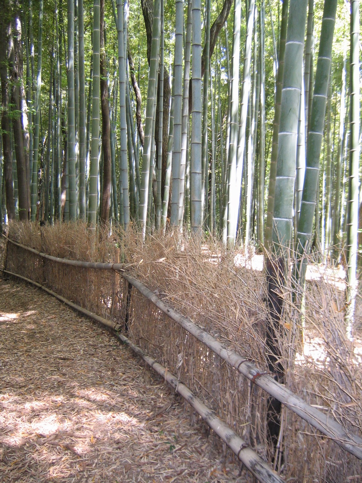
I don’t know if the vegetation of the Forest was strategically chosen for war. The outer layer of the forest is broad leaf trees, and inside especially along the road linking the facilities is beautiful bamboos. The bamboo part is tended by Japan Bamboo Fun Club ( 日本竹ファンクラブ for volunteering information with them, click here) who, I think, do a wonderful job to keep the atmosphere of ancient war castle. The mort is mainly with broad leaf trees. Both Inner and Outer Citadel Open spaces have picnic benches.

Honmaru Hiroba
Ninomaru Hiroba

To go to the divided part of the remains, we first have to return to the residential area, cross the Daisan Keihin under the flyover, then turn right immediately. Ahead is another side of the Forest. This part has only one road along the Daisan Keihin (; a road in the map to the other way was impassable as of June 2015). This is the road which permits us to go to the river (i.e. enemy) side of the Forest. It would have been like this for 500 years … 

The another sign for the Forest
The steps
leading to the remaining part of the Forest
Beyond the fence is the Freeway.

If you like, from the river side exit, we can go to the pedestrian bank of Tsurumi River where cherry blossoms are heavenly in early spring. The nearest bridge to cross Tsurumi River from here is the bridge leading us to IKEA. Before IKEA, there is a dim-sum factory of Kiyoken 崎陽軒 on the right. They are making pork dumplings for Train Station Lunches (“Ekiben” 駅弁 ) of Yokohama Station. Their daily output of lunches is more than 20,000 units which makes them the most popular Station Lunch in Japan.  The plant tour of this factory is always fully-booked for 3 months (for reservation, click here for phone number). This factory has a small kiosk where we can enjoy freshly made pork dumplings between 10:00-16:00.

Kiyoken Factory
Petit Pork buns (100 yen)

If you find a problem in the Park, please make a contact with

Office for the Park Greeneries in the North 北部公園緑地事務所
Yokohama Municipal Government Creative Environment Policy Bureau 横浜市環境創造局
Phone: 045-311-2016 (I guess in Japanese only)
FAX: 045-316-8420 (I hope there is somebody who can read English …)


Saturday, May 2, 2015

Thank you for allowing us to visit your forest: inside of Niiharu Citizen Forest 新治市民の森

Niiharu Citizen Forest viewed from Miho Nenjuzaka Park 三保念珠坂公園
The north of Yokohama has two main rivers. One of them, Katabiragawa 帷子川 starts in the south of Miho Citizen Forest 三保市民の森. Another is Tsurumigawa 鶴見川 whose tributary, Umedagawa 梅田川, has its source in Miho Forest. The hills go down from Miho Forest in both direction. Miho Forest is in the south west of Niiharu Forest. So, roughly speaking, the west of Niiharu Forest has higher altitude than the east, and the south is higher than the north. It means, if we enter the Niiharu Forest from Satoyama Exchange Center (aka Okutsu House 旧奥津邸), we must be ready to climb up the hills. (Map, here.)


oh, yes.
In any case, the route of Niiharu Forest is very well-prepared, thanks to the collaboration of landlords and volunteers. Let’s take it easy.


Some routes are closed due to maintenance. Beyond is an afforestation site by volunteers and kids from local elementary schools.
The forest we can see directly from Okutsu House is called Mukaiyama 向山. Mukaiyama means “The hill on the other side.” I guess the name comes from the fact that the area spreads over the opposite side of houses standing next to Okutsu House. Those are the residence of people who actually work in the field of Asahi-Yato 旭谷戸 which we’ve visited in the previous post, “Spring in Satoyama.” Mukaiyama has magnificent Japanese cedars, Japanese cypress, and bamboos.


i.e., Basically Mukaiyama is a cultivated forest for generations. Coniferous forest is for traditional construction materials in Japan, and bamboos are for tools of daily activities, such as baskets and utensils. And hence, Satoyama Center has a regular bamboo basket weaving class. Especially in spring, bamboos provide seasonal delicacy of bamboo shoots, takenoko たけのこ.


If you find bamboo shoots this large, it is too hard to eat already. Let it shoot into the sky.
Normally, people harvest bamboo shoots in early morning. An expert walks in a bamboo forest in soft-sole flip-flops to feel the tip of the shoots still beneath the surface. Finding it, s/he digs it out of the ground, then as soon as possible boils it to get rid of astringent taste. After this procedure, the shoot is ready to be cooked for stew, salad, tempura, etc. It is a typical spring dish in Japan, and hence many people, including thieves, want to dig them. In a beautiful bamboo forest of Niiharu,


there is a warning sign saying “This land is a private property. Digging out bamboo shoots without permission is a crime.”


Aside from culinary and artisanal usage, bamboos were used for flooring at least in Kanagawa Prefecture until the middle of the 19th century. Before Meiji restoration, Niiharu area was a part of land directly controlled by Tokugawa Shogunate in Tokyo. The regulation over the way of living for ordinary people was harsh and strict as Sagami-no-kuni 相模国 (the ancient name for the major part of Kanagawa Prefecture) and Musashi-no-kuni 武蔵国 (the past name of now Tokyo, Kawasaki, and a part of Yokohama) were so near to the castle of Shogun (which is now the Imperial Palace).Ordinary people who lived in the current northern part of Yokohama had to ask special permission from Shogun to construct a house with wooden or tatami-mat floor, as they were more expensive than fast-growing bamboos. Bamboos are easy to be bristled so that it requires frequent changes of floors, i.e. a greater demand for bamboos if they are for floors. The local seniors of Niiharu say in a-matter-of-fact way that any farmers with land (i.e., the ancestors of current landlords of Niiharu) had to have a well-cared bamboo forest. The large bamboo forest in Mukaiyama is the remnant from the time of Shogun. Mukaiyama also maintains the bushes of Sasa veitchii which was once ubiquitous in Yokohama, but now in near extinction.


Sasa veitchii is thriving beneath the canopy.
If you choose to enter from D-1, next to A-1, a small route along the orchard soon brings you to a farm land.


D-1 entrance
I think they are plums.
Mukebara

It is Mukebara 向ヶ原, aka “Niiharu Megumi-no-Sato (Niiharu with blessings) 新治恵みの里,” that is used for educational farming activities operated by local landlords. The harvest from here appears in Farmers’ Market every Saturday.

Between Ikebuchi Hiroba 池ぶち広場 and Miharashi Hiroba みはらし広場, the route is wide enough for a small truck to carry necessary supplies for the maintenance of the Forest. If you are with babies in buggies, you can take the Ikebuchi Route (from A-1 to A-8) for picnic. Ikebuchi Hiroba has faucets for potable water and several picnic benches some of which is under a magnificent canopy of wisteria in full-bloom early May.


Ikebuchi Hiroba also has toilets, with paper, but no soap.


Local mums bring their kids by bikes to Ikebuchi Hiroba for picnic.
The south of Ikebuchi Hiroba and beyond Mukebara is, really, a forest. According to the Revival and Re-energizing Plan for Niiharu Forest, the area is defined as the habitat for (almost) natural fauna and flora of Niiharu. A large group of people (e.g. 100 or more) is positively discouraged to visit the area. A group of 2 or 3 people would be the maximum. (If you plan to have a school excursion, please make a contact with the Office listed below.)


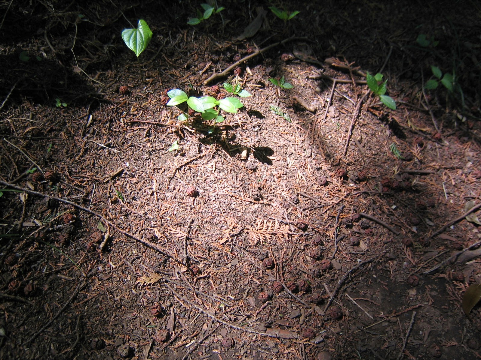
It’s not artificial spot light. I just took a photo of the ground near E-5, one fine day.
Around D-10. The route is really well-kept.
A scenery near D-8. Can you figure out a parking for Yokohama Zoorasia in the middle? 
And suddenly we find logs for Shiitake Mushrooms in the Forest!
The eastern area between Route E and Route D is called Yaman’me Yama やまんめ山. Before, this was the point where people could find many wild silk warm cocoons. (“Yaman’me” means “cocoons of wild silk worm.”) Wild silk cocoons produce the best quality silk so that this hill was really a wealth factory. Now it is the area for regular summer news for wasp and mamushi attacks.


A warning for wasp attack!
The entire experience in the southern part of Niiharu Forest is meditative and really refreshing. Let’s just be modest, as we humans are intruders of family life for wasps and snakes. Don’t be greedy for silks …

If you find a problem in the Park, please make a contact with

Office for the Park Greeneries in the North北部公園緑地事務所
Yokohama Municipal Government Creative Environment Policy Bureau横浜市環境創造局
Phone: 045-311-2016 (I guess in Japanese only)
FAX: 045-316-8420 (I hope there is somebody who can read English …)

Niiharu Administrative Office / Satoyama Exchange Center新治管理事務所・里山交流センター
Phone: 045-931-4947
Fax: 045-937-0898
http://www.niiharu.jp/